

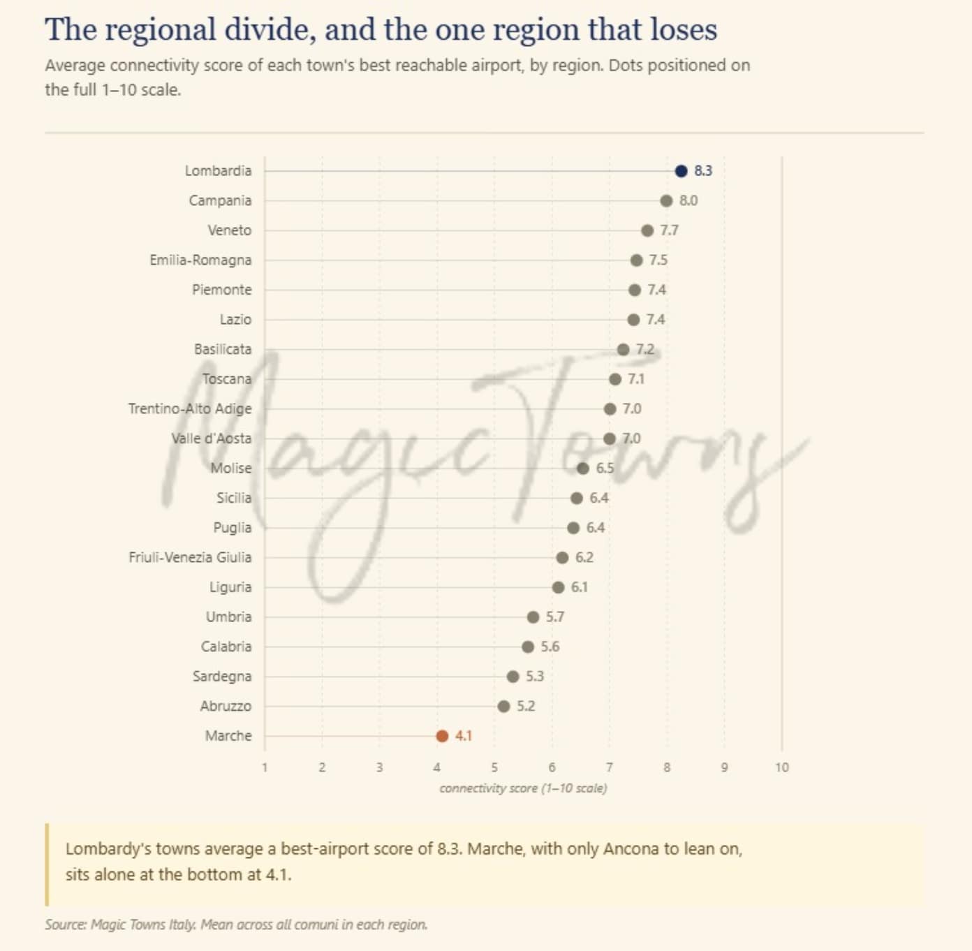
Most Italy relocation guides treat airports as a footnote. There is a list somewhere of the “nearest international airport,” usually measured in kilometres, and that is the end of it. The problem is that distance to an airport tells you almost nothing useful. A town forty minutes from a runway can be worse connected to the rest of the world than a town two hours away, and the data makes the gap clear. To build Italy’s airport map, we scored all 42 of Italy’s commercial airports on a 1-to-10 scale, based on this: how many passengers they move how many places you can reach without changing planes whether those connections are seasonal or year-round, and whether any of them cross an ocean (crucial for American / Aussie / Canadian expats, among others). Then we calculated, for every one of Italy’s 7,895 towns, which airports are realistically within reach by car and how good they are. The result is the airport filter in the Town Explorer and, like the rail analysis before it, it rearranges the map in ways that should change how you think about a few regions. FIND OUT WHICH ITALIAN CITY IS RIGHT FOR YOU The whole country…
Create an account to explore more
This content is for Members only | Already a Member? Sign in









 English
 French
 German
 Italian
 Danish