
Elevation
[?]
Elevation of a city refers to the height above sea level at which the city is located, measured in meters.
505
Population
[?]
This is a town's official population, measured each year by the national statistics authority.
9500
Real Population (5km)
[?]
Our "Real Population" metric reflects more accurately a town's real size by including inhabitants in the immediate vicinity of the town's official borders.
24000
Air Quality Rating
[?]
Based on PM10, PM2.5, NO2, SO2, and ozone levels. Higher scores indicate cleaner air.
86
Region
Toscana
Walkability
Walker’s Paradise
Housing availability
[?]
Based on total number of properties (sale and rent) classifies housing availability into five categories: low, relativel ylow, medium, relatively high and high.
Medium
Avg Download Speed (Mbps) / Avg Upload Speed (Mbps)
43
/ 10
Climate Description
Mild winters, warm summers, year-round sun, even rain, brief snow, comfortable living.
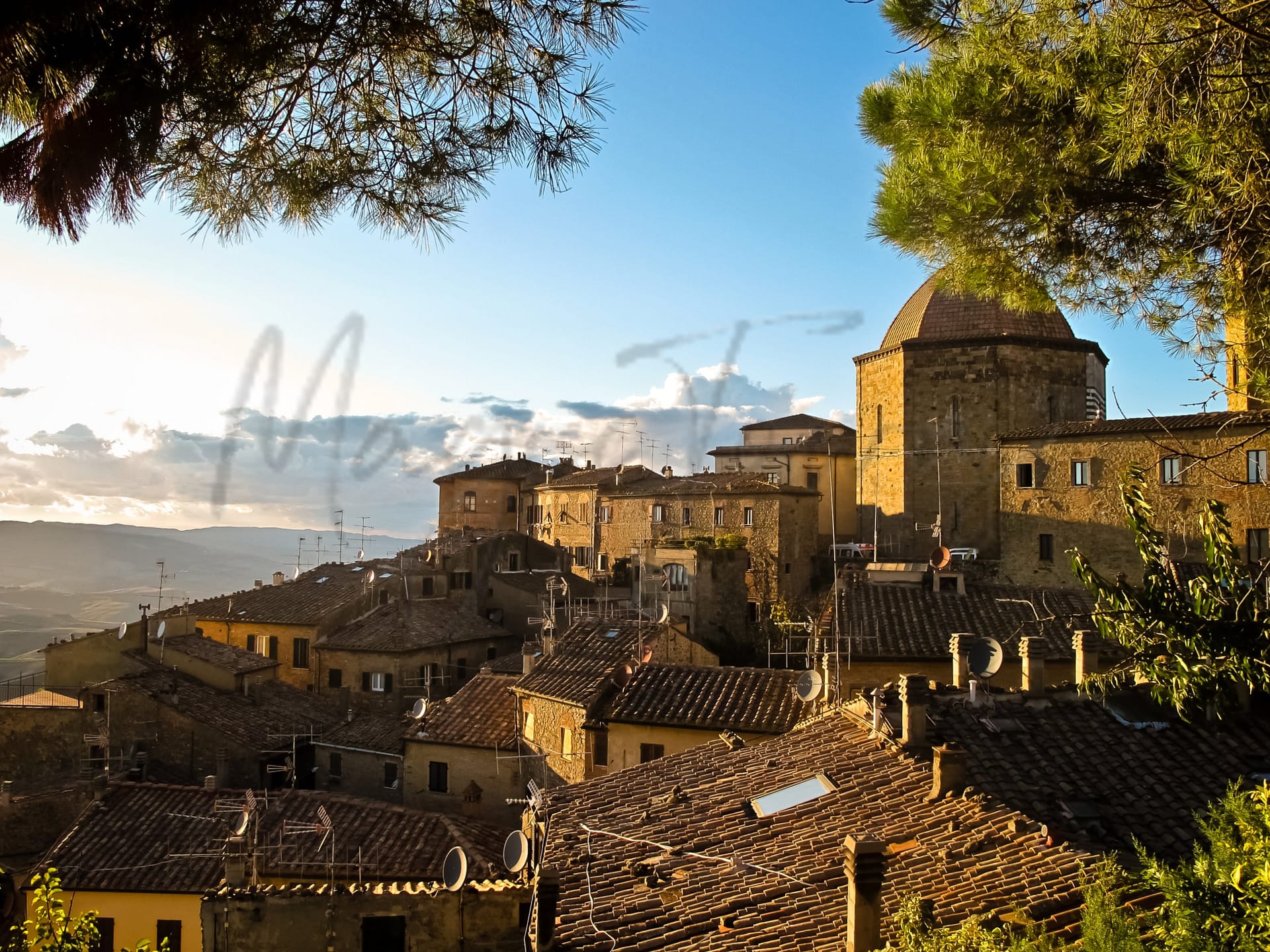
Volterra
Toscana
Historic hilltop town with Etruscan roots, archaeological sites, and a vibrant expat community.
Quality of Life Score
[?]Factors in air quality, amenities, walkability, population, and environmental risks. Higher scores suggest better living conditions.
73
Quality of Infrastructure
[?]Measures internet speed, healthcare access, airports, rail, and walkability. Higher scores mean better connectivity and essential services.
49
Quality of Economy
[?]Based on income, property prices, job availability, and population density. Higher scores indicate stronger economic conditions.
73
Volterra Demographics
Population
[?]
This is a town's official population, measured each year by the national statistics authority.
9500
Real Population (5km band)
[?]
Our "Real Population" metric reflects more accurately a town's real size by including inhabitants in the immediate vicinity of the town's official borders.
24000
Births Per 100 Deaths
30.0
Population Data Source
ISTAT,2023
Estimated Unemployment Rate
Touristy Index
[?]
Calculation of tourist density index for the city, comparing its total tourist number to the overall average tourist number of the region
relative to its own population.The index indicates how a location’s tourist density compares to the average, with values above
100 representing higher-than-average density and values below 100 representing lower-than-average density.
Moderate Tourism
Income per capita (2023)
[?]
This is an estimation of average income per resident for this town, based on 2023 data from the Italian Ministry of Finance.
22300
Income rank in Italy (2023)
[?]
This is a ranking of the town's average income per resident, against the full list of townships in Italy.
2354 out of 7901
Infrastructure and Connectivity
Create an account to explore more
This content is for Members only | Already a Member? Sign in
Infrastructure & Amenities
Create an account to explore more
This content is for Members only | Already a Member? Sign in
Healthcare
Create an account to explore more
This content is for Members only | Already a Member? Sign in
Housing & Property Market
Create an account to explore more
This content is for Members only | Already a Member? Sign in
Connectivity & Digital Access
Create an account to explore more
This content is for Members only | Already a Member? Sign in
Education
Create an account to explore more
This content is for Members only | Already a Member? Sign in
Climate & Weather
Create an account to explore more
This content is for Members only | Already a Member? Sign in
Precipitation
[?] Based on daily climate data for precipitation from OPEN-METEO this parameter indicates how a city's annual precipitation compares to others in terms of percentage, with values ranging from 0 (lowest) to 1 (highest). For example, a percentile rank of 0.75 means the city's total precipitation is higher than 75% of other cities.
Somewhat Low (21st-30th percentile)
Sunshine
Somewhat High (61st-70th percentile)
Snowfall
Somewhat Low (21st-30th percentile)
Min Annual Temperature (°C)
[?] This parameter represents the monthly average of daily minimum temperatures for January, based on data from OPEN-METEO.
0.7
Max Annual Temperature (°C)
[?] This parameter represents the monthly average of daily minimum temperatures for January, based on data from OPEN-METEO.
28.5
Climate Description
Volterra enjoys a temperate climate, characterized by mild winters and warm, sun-drenched summers. Residents and visitors can expect generous sunshine throughout the year, enhancing the town's appeal and fostering outdoor activities. Precipitation is evenly spread, ensuring lush landscapes without excessive rainfall. Winter brings a brief period of snow that typically blankets the town’s medieval architecture, adding to its enchanting allure. The range of temperatures from the coolest to the warmest months allows for comfortable living year-round, suiting retirees and expats looking for a stable and mild climate away from harsh weather extremes.
Annual Temperature Chart (Min)
Error
There was a problem with your SQL connection - Please contact the administrator
There was a problem with your SQL connection - Please contact the administrator
Annual Temperature Chart (Max)
Error
There was a problem with your SQL connection - Please contact the administrator
There was a problem with your SQL connection - Please contact the administrator
Sunny Days By Month
Error
There was a problem with your SQL connection - Please contact the administrator
There was a problem with your SQL connection - Please contact the administrator
Environmental & Air Quality
Create an account to explore more
This content is for Members only | Already a Member? Sign in
Classifications
PM10
[?]
PM10 levels indicate Good air quality at 0–20 µg/m³, Fair at 20–40 µg/m³, Moderate at 40–50 µg/m³, Poor at 50–100 µg/m³, Very Poor at 100–150 µg/m³, and Extremely Poor at 150–1200 µg/m³.
Good
PM2.5
[?]
PM2.5 is Good if PM2.5 levels are between 0–10 µg/m³, Fair between 10–20 µg/m³, Moderate between 20–25 µg/m³, Poor between 25–50 µg/m³, Very Poor between 50–75 µg/m³, and Extremely Poor between 75–800 µg/m³.
Fair
NO2
[?]
NO₂ levels are considered Good at 0–40 µg/m³, Fair at 40–90 µg/m³, Moderate at 90–120 µg/m³, Poor at 120–230 µg/m³, Very Poor at 230–340 µg/m³, and Extremely Poor at 340–1000 µg/m³.
Good
SO2
[?]
SO₂ levels indicate Good air quality at 0–100 µg/m³, Fair at 100–200 µg/m³, Moderate at 200–350 µg/m³, Poor at 350–500 µg/m³, Very Poor at 500–750 µg/m³, and Extremely Poor at 750–1250 µg/m³.
Good
O₃
[?]
For O₃, the air is Good at 0–50 µg/m³, Fair at 50–100 µg/m³, Moderate at 100–130 µg/m³, Poor at 130–240 µg/m³, Very Poor at 240–380 µg/m³, and Extremely Poor at 380–800 µg/m³.
Fair
Air Quality Rating
[?]
Based on PM10, PM2.5, NO2, SO2, and ozone levels. Higher scores indicate cleaner air.
86
Air Quality Description
Volterra, Italy, presents an inviting setting for expats and retirees seeking a place with commendable air quality. The town generally enjoys good levels of particulate matter (PM10) and nitrogen dioxide, reflecting the area’s minimal industrial activity and lower traffic volumes. While levels of PM2.5 and ozone are rated fair, they rarely detract from the overall pleasant environment. This balance offers a fresh breath of air compared to more urbanized locations, making Volterra an appealing choice for those prioritizing a healthier lifestyle in a historic Italian setting.
Volterra, Italy, presents an inviting setting for expats and retirees seeking a place with commendable air quality. The town generally enjoys good levels of particulate matter (PM10) and nitrogen dioxide, reflecting the area’s minimal industrial activity and lower traffic volumes. While levels of PM2.5 and ozone are rated fair, they rarely detract from the overall pleasant environment. This balance offers a fresh breath of air compared to more urbanized locations, making Volterra an appealing choice for those prioritizing a healthier lifestyle in a historic Italian setting.
Town Descriptions
Create an account to explore more
This content is for Members only | Already a Member? Sign in
Getting There
Volterra is accessible via significant road connections, including SS68 and SP12, linking it to nearby towns. The closest airport is Ampugnano, approximately 55 minutes away, with another airport, Galileo Galilei in Pisa, slightly further. Train services are available at stations within a 43-minute radius, providing moderate connectivity.
Getting Around
Local Cuisine
Volterra’s culinary scene is deeply rooted in its rich agricultural heritage, emphasizing local ingredients such as Cinta Senese pork, truffles, cheeses, and high-quality extra virgin olive oil. Traditional dishes include handmade pastas like pici served with robust ragù, often featuring wild game such as boar. The region also boasts a unique salt known as the ‘purest in Italy,’ enhancing the flavor profiles of local cuisine. The town offers a variety of dining options, ranging from rustic trattorias serving authentic Tuscan fare to modern eateries incorporating international influences. Prominent culinary events, such as Volterragusto, celebrate the local truffle harvest. Notably, Volterra is home to at least one Michelin-starred restaurant that exemplifies the quality and innovation within the region’s dining scene.
Shopping Overview
The shopping landscape offers a diverse array, catering to both daily needs and specialty items. Supermarkets provide essential groceries, while weekly markets display fresh produce and local delicacies, fostering community engagement. Small boutiques feature handcrafted goods, including regional specialties, particularly alabaster products. Additionally, a variety of art galleries contribute to cultural shopping experiences. Overall, the city blends modern convenience with traditional charm, making it suitable for expats and retirees seeking a fulfilling shopping environment.
Neighborhoods
Green Areas and Parks
Volterra offers an array of outdoor activities and hiking trails suitable for various interests and skill levels. The “Volterra – Prato d’Era” trail provides a moderate 6.8-mile trek, while the “Saline di Volterra” presents a more challenging 5.2-mile route. For nature enthusiasts, the Riserva Naturale di Berignone features diverse wildlife and lush trails. History and archaeology can be explored at Parco Archeologico Enrico Fiumi, encompassing green spaces and ancient ruins. The Montenero Nature Reserve presents evergreen forests and the picturesque Strolla stream, ideal for leisurely walks and birdwatching, enhancing the region’s natural appeal.
✅ Pros
– Rich cultural and historical heritage to explore and enjoy.
– Mild climate with beautiful Tuscan landscapes year-round.
– Strong community support for expats and integration opportunities.
– Moderate tourism provides a lively yet peaceful atmosphere.
– Good air quality for a healthy living environment.
– Low unemployment rate indicates a stable local economy.
– Access to quality healthcare services in the region.
– Scenic transportation options enhance travel within Tuscany.
– Close proximity to major cities for additional amenities.
– Sufficient internet connectivity for remote work and communication.
❌ Cons
– Limited healthcare quality may require travel for specialized services.
– Infrastructure challenges can complicate daily commuting and transportation.
– Internet speed may hinder high-demand remote work activities.
– Local education facilities may not meet all international standards.
– Mild climate can lead to hot summers and chilly winters.
– Moderate tourism can overcrowd popular sites during peak seasons.
– Limited shopping options may require trips to larger cities.
– Cultural events may not cater to all expat interests.
– Language barrier could complicate integration for non-Italian speakers.
– Smaller community might feel isolating for some newcomers.
FAQs
Summary
Volterra, a historic hilltop town in Tuscany, appeals to foreign expats with its stunning archaeological heritage and vibrant community life. Known for its Etruscan roots, visitors can explore ancient sites like the Acropolis, well-preserved Roman theater, and the striking medieval architecture that defines its charming landscape. The town boasts vibrant squares, such as Piazza dei Priori, and numerous museums showcasing local art, including alabaster creations, a craft for which Volterra is renowned. With a walkable layout and a robust expat community, residents enjoy a high quality of life, complemented by a rich culinary scene featuring local wines and food festivals.
However, Volterra’s remoteness poses challenges, such as limited access to major airports, with the nearest one located over an hour’s drive away. The town’s healthcare quality rate is average, which may be a consideration for retirees. Nevertheless, its serene ambiance and cultural depth continue to attract those seeking a tranquil lifestyle in Italy.
✅ Pros
– Rich cultural and historical heritage to explore and enjoy.
– Mild climate with beautiful Tuscan landscapes year-round.
– Strong community support for expats and integration opportunities.
– Moderate tourism provides a lively yet peaceful atmosphere.
– Good air quality for a healthy living environment.
– Low unemployment rate indicates a stable local economy.
– Access to quality healthcare services in the region.
– Scenic transportation options enhance travel within Tuscany.
– Close proximity to major cities for additional amenities.
– Sufficient internet connectivity for remote work and communication.
❌ Cons
– Limited healthcare quality may require travel for specialized services.
– Infrastructure challenges can complicate daily commuting and transportation.
– Internet speed may hinder high-demand remote work activities.
– Local education facilities may not meet all international standards.
– Mild climate can lead to hot summers and chilly winters.
– Moderate tourism can overcrowd popular sites during peak seasons.
– Limited shopping options may require trips to larger cities.
– Cultural events may not cater to all expat interests.
– Language barrier could complicate integration for non-Italian speakers.
– Smaller community might feel isolating for some newcomers.
Related Posts
No posts found for the town.
More questions about Volterra ? Ask Magic AI.
Our innovative AI assistant is eager to help. Try it out for free here: