
Elevation
[?]
Elevation of a city refers to the height above sea level at which the city is located, measured in meters.
223
Population
[?]
This is a town's official population, measured each year by the national statistics authority.
45000
Real Population (5km)
[?]
Our "Real Population" metric reflects more accurately a town's real size by including inhabitants in the immediate vicinity of the town's official borders.
410600
Air Quality Rating
[?]
Based on PM10, PM2.5, NO2, SO2, and ozone levels. Higher scores indicate cleaner air.
82
Region
Lombardia
Walkability
Walker’s Paradise
Housing availability
[?]
Based on total number of properties (sale and rent) classifies housing availability into five categories: low, relativel ylow, medium, relatively high and high.
Medium
Avg Download Speed (Mbps) / Avg Upload Speed (Mbps)
165
/ 104
Climate Description
Moderate seasons; mild winters, warm summers, ample sun, balanced precipitation, lush flora.
Seregno
Lombardia
Historical charm, modern amenities, strong craftsmanship, community-focused, near Milan, adequate transport, high living costs.
Quality of Life Score
[?]Factors in air quality, amenities, walkability, population, and environmental risks. Higher scores suggest better living conditions.
78
Quality of Infrastructure
[?]Measures internet speed, healthcare access, airports, rail, and walkability. Higher scores mean better connectivity and essential services.
77
Quality of Economy
[?]Based on income, property prices, job availability, and population density. Higher scores indicate stronger economic conditions.
89
Seregno Demographics
Population
[?]
This is a town's official population, measured each year by the national statistics authority.
45000
Real Population (5km band)
[?]
Our "Real Population" metric reflects more accurately a town's real size by including inhabitants in the immediate vicinity of the town's official borders.
410600
Births Per 100 Deaths
60.0
Population Data Source
ISTAT,2023
Estimated Unemployment Rate
Touristy Index
[?]
Calculation of tourist density index for the city, comparing its total tourist number to the overall average tourist number of the region
relative to its own population.The index indicates how a location’s tourist density compares to the average, with values above
100 representing higher-than-average density and values below 100 representing lower-than-average density.
Not Touristic
Income per capita (2023)
[?]
This is an estimation of average income per resident for this town, based on 2023 data from the Italian Ministry of Finance.
25500
Income rank in Italy (2023)
[?]
This is a ranking of the town's average income per resident, against the full list of townships in Italy.
311 out of 7901
Infrastructure and Connectivity
Create an account to explore more
This content is for Members only | Already a Member? Sign in
Infrastructure & Amenities
Create an account to explore more
This content is for Members only | Already a Member? Sign in
Healthcare
Create an account to explore more
This content is for Members only | Already a Member? Sign in
Housing & Property Market
Create an account to explore more
This content is for Members only | Already a Member? Sign in
Connectivity & Digital Access
Create an account to explore more
This content is for Members only | Already a Member? Sign in
Education
Create an account to explore more
This content is for Members only | Already a Member? Sign in
Climate & Weather
Create an account to explore more
This content is for Members only | Already a Member? Sign in
Precipitation
[?] Based on daily climate data for precipitation from OPEN-METEO this parameter indicates how a city's annual precipitation compares to others in terms of percentage, with values ranging from 0 (lowest) to 1 (highest). For example, a percentile rank of 0.75 means the city's total precipitation is higher than 75% of other cities.
Very High (81st-90th percentile)
Sunshine
Somewhat Low (21st-30th percentile)
Snowfall
Above Average (51st-60th percentile)
Min Annual Temperature (°C)
[?] This parameter represents the monthly average of daily minimum temperatures for January, based on data from OPEN-METEO.
-0.5
Max Annual Temperature (°C)
[?] This parameter represents the monthly average of daily minimum temperatures for January, based on data from OPEN-METEO.
27.9
Climate Description
Seregno, Italy, endures a climate that lends itself well to those accustomed to moderate seasons. Winters gently drape the town in a light blanket of snow, creating a picturesque scene that can be rarely found elsewhere. Summers bring warmth without the extremes, making them ideal for enjoying the local landscapes and open-air markets. Sunlight is generous, ensuring ample opportunities to explore the outdoors comfortably throughout the year. The balance of precipitation ensures that the natural flora thrives, keeping the surrounding countryside lush and vibrant. Seregno's weather patterns create an inviting environment for magic towns readers, expats, and retirees seeking a serene yet engaging lifestyle.
Annual Temperature Chart (Min)
Error
There was a problem with your SQL connection - Please contact the administrator
There was a problem with your SQL connection - Please contact the administrator
Annual Temperature Chart (Max)
Error
There was a problem with your SQL connection - Please contact the administrator
There was a problem with your SQL connection - Please contact the administrator
Sunny Days By Month
Error
There was a problem with your SQL connection - Please contact the administrator
There was a problem with your SQL connection - Please contact the administrator
Environmental & Air Quality
Create an account to explore more
This content is for Members only | Already a Member? Sign in
Classifications
PM10
[?]
PM10 levels indicate Good air quality at 0–20 µg/m³, Fair at 20–40 µg/m³, Moderate at 40–50 µg/m³, Poor at 50–100 µg/m³, Very Poor at 100–150 µg/m³, and Extremely Poor at 150–1200 µg/m³.
Fair
PM2.5
[?]
PM2.5 is Good if PM2.5 levels are between 0–10 µg/m³, Fair between 10–20 µg/m³, Moderate between 20–25 µg/m³, Poor between 25–50 µg/m³, Very Poor between 50–75 µg/m³, and Extremely Poor between 75–800 µg/m³.
Moderate
NO2
[?]
NO₂ levels are considered Good at 0–40 µg/m³, Fair at 40–90 µg/m³, Moderate at 90–120 µg/m³, Poor at 120–230 µg/m³, Very Poor at 230–340 µg/m³, and Extremely Poor at 340–1000 µg/m³.
Good
SO2
[?]
SO₂ levels indicate Good air quality at 0–100 µg/m³, Fair at 100–200 µg/m³, Moderate at 200–350 µg/m³, Poor at 350–500 µg/m³, Very Poor at 500–750 µg/m³, and Extremely Poor at 750–1250 µg/m³.
Good
O₃
[?]
For O₃, the air is Good at 0–50 µg/m³, Fair at 50–100 µg/m³, Moderate at 100–130 µg/m³, Poor at 130–240 µg/m³, Very Poor at 240–380 µg/m³, and Extremely Poor at 380–800 µg/m³.
Fair
Air Quality Rating
[?]
Based on PM10, PM2.5, NO2, SO2, and ozone levels. Higher scores indicate cleaner air.
82
Air Quality Description
In Seregno, a town in Italy celebrated for its scenic beauty and historic charm, the air quality presents a mixed but generally satisfactory landscape for prospective expats and retirees. Particulates smaller than 10 micrometers (PM10) and ozone levels are deemed to be fair, indicating periods when outdoor activities might be less enjoyable. Meanwhile, finer particulate matter (PM2.5) holds a moderate rating, urging caution particularly for those with respiratory concerns. Nitrogen and sulfur dioxide levels are classified as good, contributing positively to the region’s overall livability by supporting cleaner air, essential for healthful day-to-day living in this picturesque locale.
In Seregno, a town in Italy celebrated for its scenic beauty and historic charm, the air quality presents a mixed but generally satisfactory landscape for prospective expats and retirees. Particulates smaller than 10 micrometers (PM10) and ozone levels are deemed to be fair, indicating periods when outdoor activities might be less enjoyable. Meanwhile, finer particulate matter (PM2.5) holds a moderate rating, urging caution particularly for those with respiratory concerns. Nitrogen and sulfur dioxide levels are classified as good, contributing positively to the region’s overall livability by supporting cleaner air, essential for healthful day-to-day living in this picturesque locale.
Town Descriptions
Create an account to explore more
This content is for Members only | Already a Member? Sign in
Getting There
Seregno boasts good connectivity, with proximity to key transport links. The nearest airport, Linate, is accessible while Malpensa also serves the area. Local train stations provide regular services and are well-rated for connectivity, enhancing the town’s accessibility within Lombardia and beyond.
Getting Around
Local Cuisine
The culinary scene in Seregno, located in the Lombardia region, is characterized by a rich blend of traditional local dishes and diverse international offerings. Traditional Lombard cuisine is well represented with iconic dishes such as risotto, cotoletta alla Milanese (breaded cutlet), cassoeula (a cabbage and pork stew), and panettone for dessert. The town features a variety of dining options, ranging from rustic trattorias serving authentic local fare to more contemporary eateries that explore international cuisines, reflecting a cosmopolitan atmosphere. Notably, Seregno boasts Michelin-starred restaurants, which highlight the region’s culinary excellence and elevate its gastronomic reputation. The dining scene is thus a mix of traditional Italian hospitality infused with modern culinary trends, providing an enticing experience for both locals and visitors.
Shopping Overview
The shopping landscape offers a variety of options catering to diverse needs. Major supermarket chains are present, supplemented by local grocery shops providing fresh produce and Italian specialties. Retail experiences range from independent boutiques to larger department stores, ensuring both artisanal goods and popular brands are accessible. Noteworthy shopping centres and malls house numerous retail outlets, creating a convenient shopping environment. Additionally, regular flea markets and artisanal craft fairs feature prominently, showcasing local products and providing a traditional shopping experience.
Neighborhoods
Green Areas and Parks
Seregno, Lombardia, offers a mix of outdoor activities suitable for both active lifestyle enthusiasts and retirees. The region features notable trails such as the Renate-Como-Valmadrera, a challenging 74-mile route suitable for biking. Additionally, the Parco Brianza-Ceredo provides a 3.3-mile easy trail for hiking and running, making it accessible for a range of fitness levels. For shorter outings, the Central Brianza Park, also known as Area 2 June at the Porada, offers a scenic 1.3-mile walk. These outdoor options highlight Seregno’s appeal for those seeking green spaces and physical activity.
✅ Pros
– High-quality healthcare services available in the region.
– Excellent transportation links to Milan and surrounding areas.
– Pleasant climate with warm summers and mild winters.
– Rich cultural and historical backdrop to explore and enjoy.
– Low unemployment rate, promoting economic stability and opportunities.
– Good infrastructure supporting daily living and connectivity.
– Non-touristic atmosphere fostering local community integration.
– Diverse educational facilities catering to various learning needs.
– Reliable internet connectivity for remote work and leisure.
– Vibrant local markets offering fresh produce and artisanal products.
❌ Cons
– Limited healthcare facilities directly within Seregno itself.
– Air quality occasionally dips below optimal levels for comfort.
– Local dining options may lack international variety and flair.
– Seregno’s charm may not satisfy all cultural enthusiasts.
– Limited nightlife and entertainment options for younger residents.
– Nearby cities overshadow Seregno’s local attractions and events.
– Weather can be humid during peak summer months.
– Commuting to Milan can be time-consuming during peak hours.
– Non-touristic may feel too quiet for some expats.
– Local dialect may pose communication challenges for newcomers.
FAQs
Summary
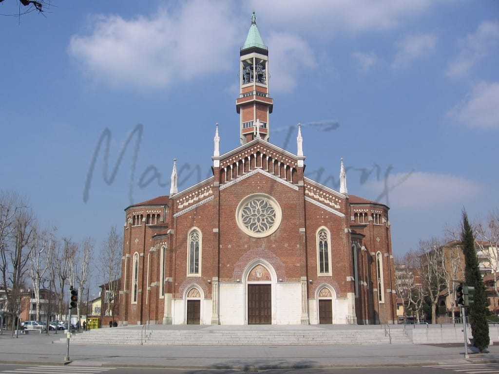
Seregno, located in Lombardy’s Monza e Brianza province, offers an appealing lifestyle for expats and retirees seeking a blend of historical charm and modern amenities. Renowned for its craftsmanship and vibrant service sector, Seregno features attractions such as the medieval Barbarossa Tower and the Basilica of San Giuseppe, which boasts stunning frescoes. The town’s rich cultural scene is reflected in its numerous churches and the Central Brianza Park, ideal for outdoor activities.
Living in Seregno comes with benefits, including excellent air quality and a strong sense of community. However, challenges such as a high cost of living and limited nightlife options may be notable. Public transport is adequate, yet car dependency is common. With its proximity to Milan—just a short drive to the airport—Seregno strikes a balance between serene suburban life and urban accessibility, making it a compelling choice for those relocating to Italy.
✅ Pros
– High-quality healthcare services available in the region.
– Excellent transportation links to Milan and surrounding areas.
– Pleasant climate with warm summers and mild winters.
– Rich cultural and historical backdrop to explore and enjoy.
– Low unemployment rate, promoting economic stability and opportunities.
– Good infrastructure supporting daily living and connectivity.
– Non-touristic atmosphere fostering local community integration.
– Diverse educational facilities catering to various learning needs.
– Reliable internet connectivity for remote work and leisure.
– Vibrant local markets offering fresh produce and artisanal products.
❌ Cons
– Limited healthcare facilities directly within Seregno itself.
– Air quality occasionally dips below optimal levels for comfort.
– Local dining options may lack international variety and flair.
– Seregno’s charm may not satisfy all cultural enthusiasts.
– Limited nightlife and entertainment options for younger residents.
– Nearby cities overshadow Seregno’s local attractions and events.
– Weather can be humid during peak summer months.
– Commuting to Milan can be time-consuming during peak hours.
– Non-touristic may feel too quiet for some expats.
– Local dialect may pose communication challenges for newcomers.
Related Posts
More questions about Seregno ? Ask Magic AI.
Our innovative AI assistant is eager to help. Try it out for free here: