
Elevation
[?]
Elevation of a city refers to the height above sea level at which the city is located, measured in meters.
17
Population
[?]
This is a town's official population, measured each year by the national statistics authority.
206700
Real Population (5km)
[?]
Our "Real Population" metric reflects more accurately a town's real size by including inhabitants in the immediate vicinity of the town's official borders.
409200
Air Quality Rating
[?]
Based on PM10, PM2.5, NO2, SO2, and ozone levels. Higher scores indicate cleaner air.
82
Region
Veneto
Walkability
Walker’s Paradise
Housing availability
[?]
Based on total number of properties (sale and rent) classifies housing availability into five categories: low, relativel ylow, medium, relatively high and high.
High
Avg Download Speed (Mbps) / Avg Upload Speed (Mbps)
320
/ 199
Climate Description
Mild conditions prevail, with frequent sunshine and light snowfall, balanced by temperate annual warmth.
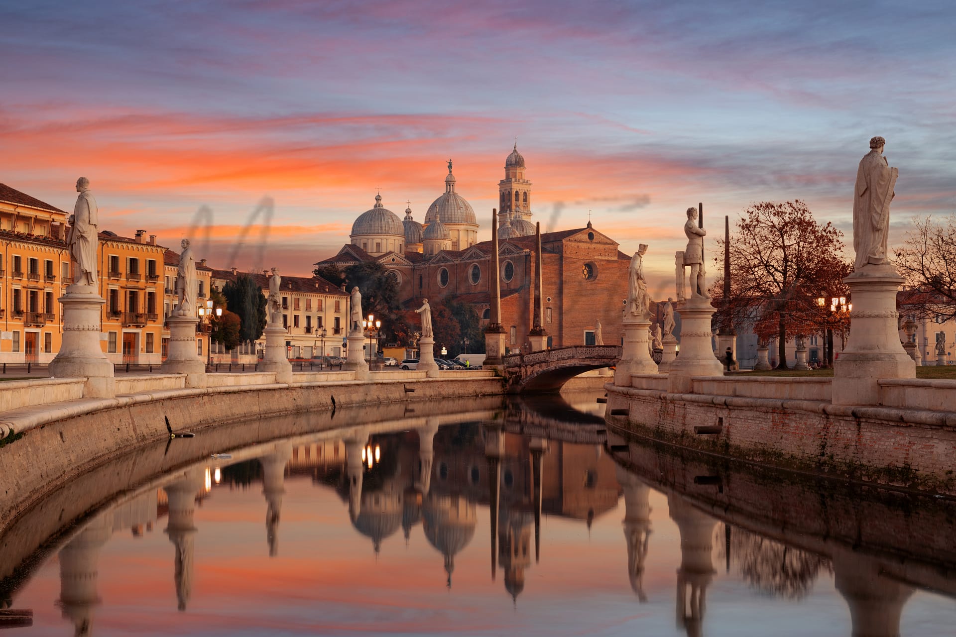
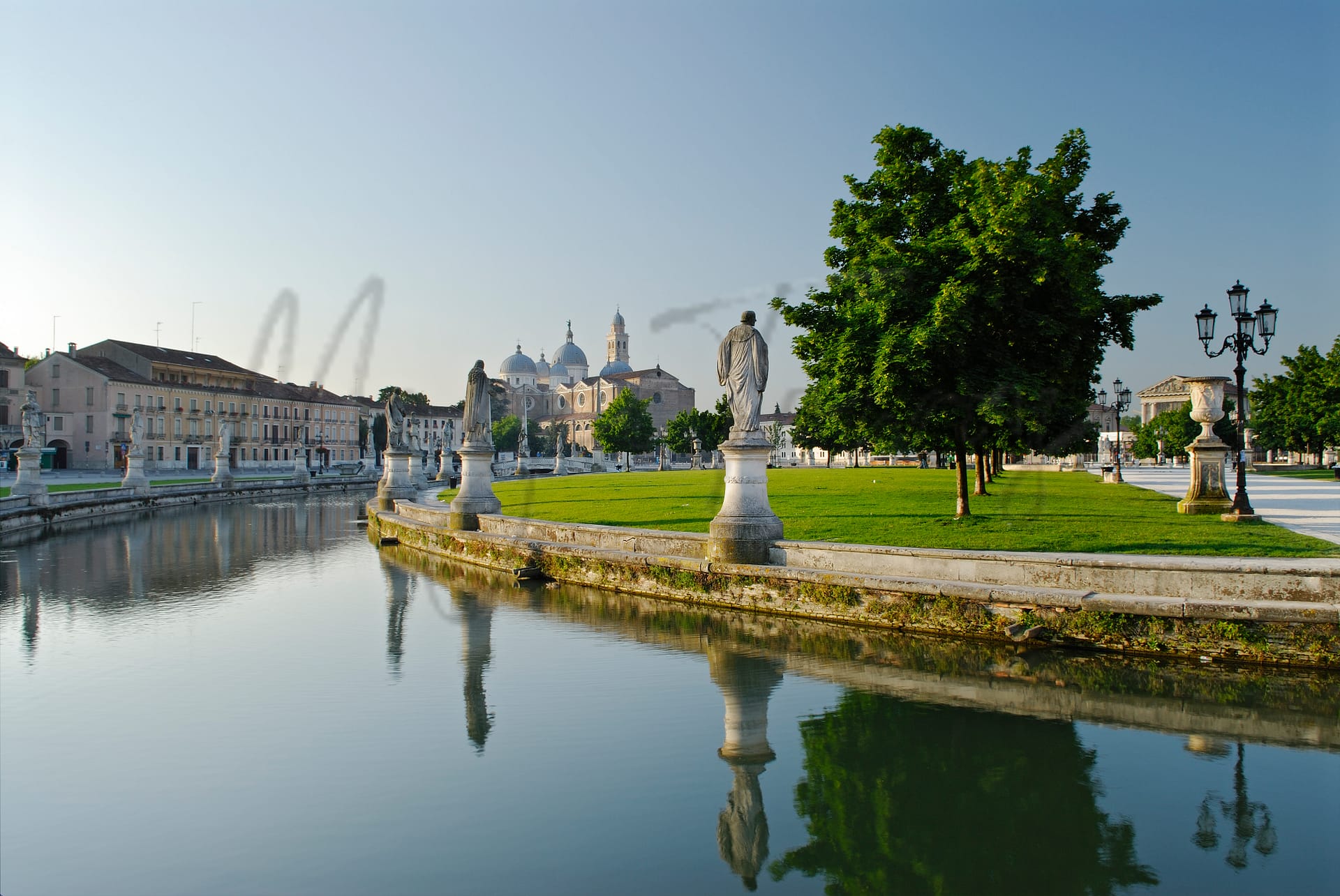
Padova
Veneto
Historic yet modern, this city thrives culturally and economically, known for its ancient university, vibrant marketplaces, and excellent transport links. Ideal for expats valuing education and history.
Quality of Life Score
[?]Factors in air quality, amenities, walkability, population, and environmental risks. Higher scores suggest better living conditions.
85
Quality of Infrastructure
[?]Measures internet speed, healthcare access, airports, rail, and walkability. Higher scores mean better connectivity and essential services.
100
Quality of Economy
[?]Based on income, property prices, job availability, and population density. Higher scores indicate stronger economic conditions.
84
Padova Demographics
Population
[?]
This is a town's official population, measured each year by the national statistics authority.
206700
Real Population (5km band)
[?]
Our "Real Population" metric reflects more accurately a town's real size by including inhabitants in the immediate vicinity of the town's official borders.
409200
Births Per 100 Deaths
50.0
Population Data Source
ISTAT,2023
Estimated Unemployment Rate
Touristy Index
[?]
Calculation of tourist density index for the city, comparing its total tourist number to the overall average tourist number of the region
relative to its own population.The index indicates how a location’s tourist density compares to the average, with values above
100 representing higher-than-average density and values below 100 representing lower-than-average density.
Some Tourism
Income per capita (2023)
[?]
This is an estimation of average income per resident for this town, based on 2023 data from the Italian Ministry of Finance.
26100
Income rank in Italy (2023)
[?]
This is a ranking of the town's average income per resident, against the full list of townships in Italy.
182 out of 7901
Infrastructure and Connectivity
Create an account to explore more
This content is for Members only | Already a Member? Sign in
Infrastructure & Amenities
Create an account to explore more
This content is for Members only | Already a Member? Sign in
Within 10km
Auto Repair Shops
519
Bars
346
Cafes
185
Cinemas
18
Dentists
121
Golf Courses
3
Gyms
195
Health Clinics
64
Hiking Trails
17
Historical Sites
194
Libraries
32
Museums
50
Parks
100
Pharmacies
102
Restaurants
299
Shopping Centres
30
Supermarkets
220
Spas
287
Beach
Name
Sottomarina 3800 Metri Sud Inizio Diga San Felice
Driving Distance
52mins
Water Quality Rating
1 - Excellent
Mountain Resort
Name
Belmonte - Treschè Conca
Driving Distance
70.0mins
Healthcare
Create an account to explore more
This content is for Members only | Already a Member? Sign in
Healthcare Score
[?]
Evaluates hospital/clinic access, drive time to care, and regional quality rankings. Higher scores mean better healthcare.
98.0
Nearest Hospital Name
Ospedale Pediatrico
Drive Time to Nearest Hospital
3 minutes
Hospitals and Clinics Within 10km
5
Healthcare Quality Description
In this area of Veneto, the local healthcare quality is notably efficient, exceeding the national average across many indicators. Hospital care remains reliable, though there’s room for improvement in some clinical outcomes. The treatment of bone fractures is notably timely, and post-operative stays are generally brief. Urgent cardiac care often meets optimal intervention times, although readmission rates for heart conditions suggest some challenges. Breast cancer surgeries frequently employ minimally invasive techniques. Overall, healthcare services are commendable, providing a reassuring option for those considering relocation.
Local Public Healthcare Provider
AZIENDA ULSS N. 6 EUGANEA
Safety
Seismic Zone (risk of earthquakes)
[?]
Official seismic zones classify areas based on earthquake risk.
Moderate to Low Earthquake Risk
Road Accidents Rate per 10k Inhabitants
[?]
Calculation of road accidents per 10,000 people based on the number of deaths and injuries registered in roads for year 2022 for the city.
67
Percentage of Population at Landslide Risk
[?] Percentage of the population in high or moderate landslide risk zones. Higher values indicate greater environmental risk.
Percentage of Population at Flood Risk
[?] Percentage of the population in high or moderate flood risk zones. Higher values indicate greater environmental risk.
Car Insurance Price Index
[?]
The car insurance price index is a measure of how a city's average car insurance premium compares to the national average,
expressed as a percentage. A value of 100 indicates that the city's premium is equal to the national average.
Values above 100 show higher premiums, while values below 100 show lower premiums.
102.925
Housing & Property Market
Create an account to explore more
This content is for Members only | Already a Member? Sign in
Housing availability
[?]
Based on total number of properties (sale and rent) classifies housing availability into five categories: low, relativel ylow, medium, relatively high and high.
High
Property Prices per m²
[?]
Calculation of property sale prices per square meter for apartments, houses in the city.
Median (50th Percentile): The midpoint price, where half the values are above and half below.
First Quartile (25th Percentile): The price below which 25% of properties fall.
Third Quartile (75th Percentile): The price below which 75% of properties fall.
First Quartile
1667
Median
2397
Third Quartile
3046
Connectivity & Digital Access
Create an account to explore more
This content is for Members only | Already a Member? Sign in
Walkability Description
Walker's Paradise
Avg Download Speed (Mbps)
320
Fast Download Speed (Mbps)
401
Slow Download Speed (Mbps)
249
Education
Create an account to explore more
This content is for Members only | Already a Member? Sign in
Avg Schools Ranking (All Criteria)
[?]
This ranking shows in which decile the town's public schools fall while looking at all the indicators provided by the Italian Ministry of Education for the most recent available year. Note that figures are only provided by the ministry at the school catchment area level, and therefore several schools may be grouped together.
Top 50%
Avg Schools Ranking (Standardised Tests)
[?]
This ranking shows in which decile the town's public schools fall while looking the students' results in national standardised tests. The data is provided by the Italian Ministry of Education for the most recent available year.
Top 50%
Counts of School
Error
There was a problem with your SQL connection - Please contact the administrator
There was a problem with your SQL connection - Please contact the administrator
Climate & Weather
Create an account to explore more
This content is for Members only | Already a Member? Sign in
Precipitation
[?] Based on daily climate data for precipitation from OPEN-METEO this parameter indicates how a city's annual precipitation compares to others in terms of percentage, with values ranging from 0 (lowest) to 1 (highest). For example, a percentile rank of 0.75 means the city's total precipitation is higher than 75% of other cities.
Average (41st-50th percentile)
Sunshine
Above Average (51st-60th percentile)
Snowfall
Somewhat Low (21st-30th percentile)
Min Annual Temperature (°C)
[?] This parameter represents the monthly average of daily minimum temperatures for January, based on data from OPEN-METEO.
-0.3
Max Annual Temperature (°C)
[?] This parameter represents the monthly average of daily minimum temperatures for January, based on data from OPEN-METEO.
29.3
Climate Description
Padova has a mild climate with warm summers that are comfortable, without the extreme heat of southern Italy. Winters are generally mild, with occasional light snow that rarely causes disruptions. Rainfall is spread evenly throughout the year, keeping the area green without long periods of rain. The pleasant weather makes it easy to enjoy outdoor activities and explore local culture all year round.
Annual Temperature Chart (Min)
Error
There was a problem with your SQL connection - Please contact the administrator
There was a problem with your SQL connection - Please contact the administrator
Annual Temperature Chart (Max)
Error
There was a problem with your SQL connection - Please contact the administrator
There was a problem with your SQL connection - Please contact the administrator
Sunny Days By Month
Error
There was a problem with your SQL connection - Please contact the administrator
There was a problem with your SQL connection - Please contact the administrator
Environmental & Air Quality
Create an account to explore more
This content is for Members only | Already a Member? Sign in
Classifications
PM10
[?]
PM10 levels indicate Good air quality at 0–20 µg/m³, Fair at 20–40 µg/m³, Moderate at 40–50 µg/m³, Poor at 50–100 µg/m³, Very Poor at 100–150 µg/m³, and Extremely Poor at 150–1200 µg/m³.
Fair
PM2.5
[?]
PM2.5 is Good if PM2.5 levels are between 0–10 µg/m³, Fair between 10–20 µg/m³, Moderate between 20–25 µg/m³, Poor between 25–50 µg/m³, Very Poor between 50–75 µg/m³, and Extremely Poor between 75–800 µg/m³.
Moderate
NO2
[?]
NO₂ levels are considered Good at 0–40 µg/m³, Fair at 40–90 µg/m³, Moderate at 90–120 µg/m³, Poor at 120–230 µg/m³, Very Poor at 230–340 µg/m³, and Extremely Poor at 340–1000 µg/m³.
Good
SO2
[?]
SO₂ levels indicate Good air quality at 0–100 µg/m³, Fair at 100–200 µg/m³, Moderate at 200–350 µg/m³, Poor at 350–500 µg/m³, Very Poor at 500–750 µg/m³, and Extremely Poor at 750–1250 µg/m³.
Good
O₃
[?]
For O₃, the air is Good at 0–50 µg/m³, Fair at 50–100 µg/m³, Moderate at 100–130 µg/m³, Poor at 130–240 µg/m³, Very Poor at 240–380 µg/m³, and Extremely Poor at 380–800 µg/m³.
Fair
Air Quality Rating
[?]
Based on PM10, PM2.5, NO2, SO2, and ozone levels. Higher scores indicate cleaner air.
82
Air Quality Description
In Padova, Italy, the air quality reflects a mix of both modern exigencies and natural conditions. Particulate matter (PM2.5 and PM10) levels are moderate to fair, likely impacted by both vehicular emissions and regional industrial activities. While slight concerns might arise regarding particulate concentrations, nitrogen dioxide and sulphur dioxide levels are commendatively maintained at good standards, indicative of effective local environmental regulations and the successful application of green technologies. Ozone levels are moderately maintained, signaling typical urban exposure but remaining within a range tolerable for daily activities. Potential residents can expect an atmosphere that supports outdoor lifestyles with minimal respiratory discomfort.
In Padova, Italy, the air quality reflects a mix of both modern exigencies and natural conditions. Particulate matter (PM2.5 and PM10) levels are moderate to fair, likely impacted by both vehicular emissions and regional industrial activities. While slight concerns might arise regarding particulate concentrations, nitrogen dioxide and sulphur dioxide levels are commendatively maintained at good standards, indicative of effective local environmental regulations and the successful application of green technologies. Ozone levels are moderately maintained, signaling typical urban exposure but remaining within a range tolerable for daily activities. Potential residents can expect an atmosphere that supports outdoor lifestyles with minimal respiratory discomfort.
Town Descriptions
Create an account to explore more
This content is for Members only | Already a Member? Sign in
Getting There
Padova enjoys strong transportation links, situated near significant roads such as the A13 and A4 motorways, facilitating access to major cities. The nearest major airport is Venice’s Marco Polo, while Treviso’s Antonio Canova airport serves as a secondary option. With excellent train connectivity, travel to surrounding regions is efficient.
Getting Around
Within Padua, trams and buses provide frequent services to various parts of the city, and cycling is a popular option with many bike lanes. The train connections also make day trips to nearby Venice simple and convenient.
Local Cuisine
The culinary scene in Padova is characterized by its rich traditional dishes, including Baccalà alla Cappuccina, Gallina Padovana, Gran Bollito alla Padovana, Oca in Onto, Sfilacci di Cavallo, and Torta Pazientina. The city boasts a variety of dining options, from rustic, family-run establishments serving local cuisine to more contemporary venues influenced by international trends. Michelin-starred dining is also represented, with notable excellence found at Le Calandre, a three Michelin-star restaurant renowned for its experimental and innovative approach to Veneto cuisine. Le Calandre provides an intimate dining experience, focusing on high-quality ingredients and a holistic sensory experience.
Shopping Overview
Shopping options in the area are diverse, featuring large supermarkets and smaller grocery stores, known locally as “supermercati” and “alimentari,” respectively. Open-air markets sell fresh produce and local specialities, often complemented by stalls offering clothing and household goods. Boutique shopping is present, providing a range of artisanal and fashion items. Malls offer a mixture of shopping, dining, and entertainment, catering to various consumer preferences. This variety ensures convenience and access to essential and leisurely shopping needs.
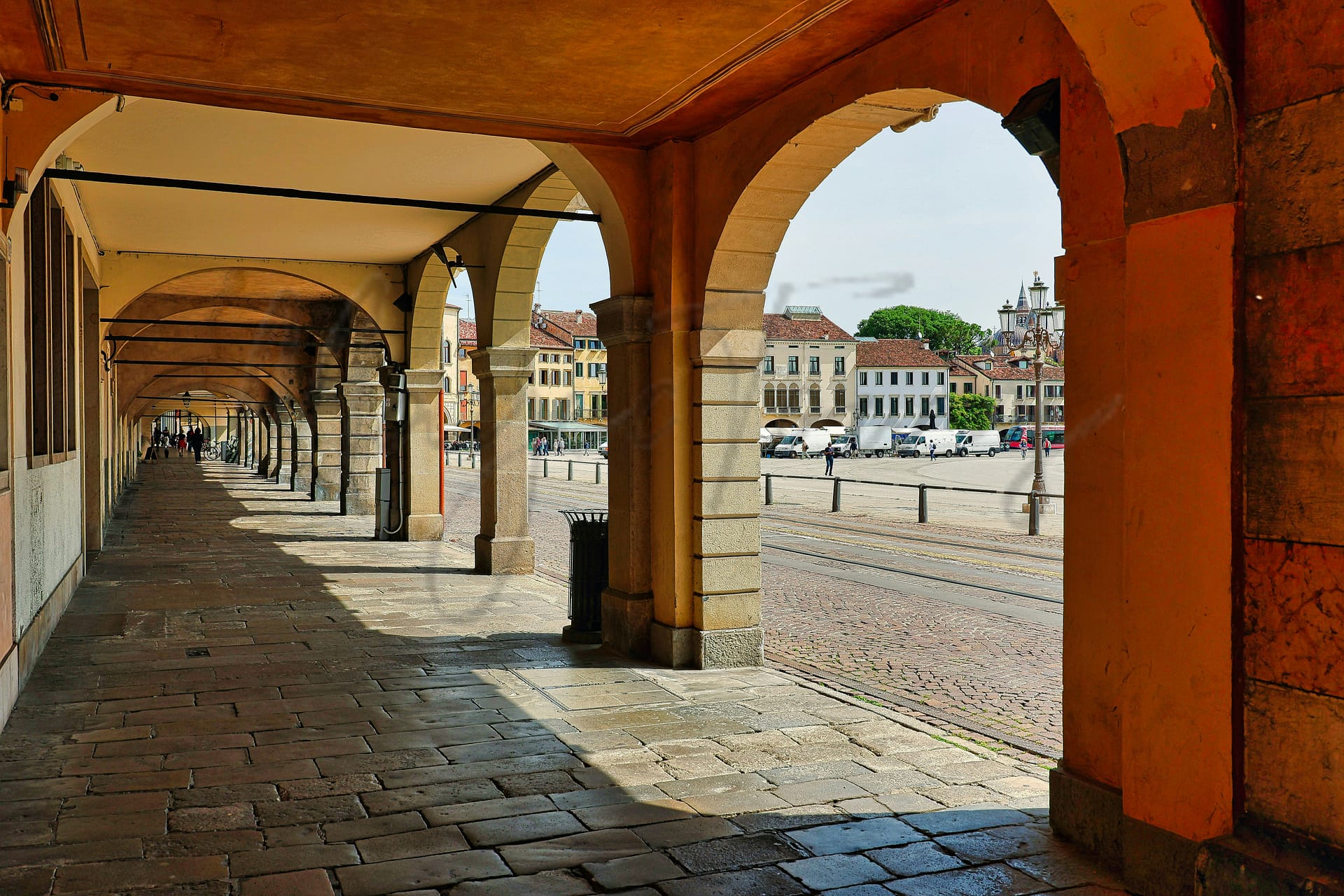
Neighborhoods
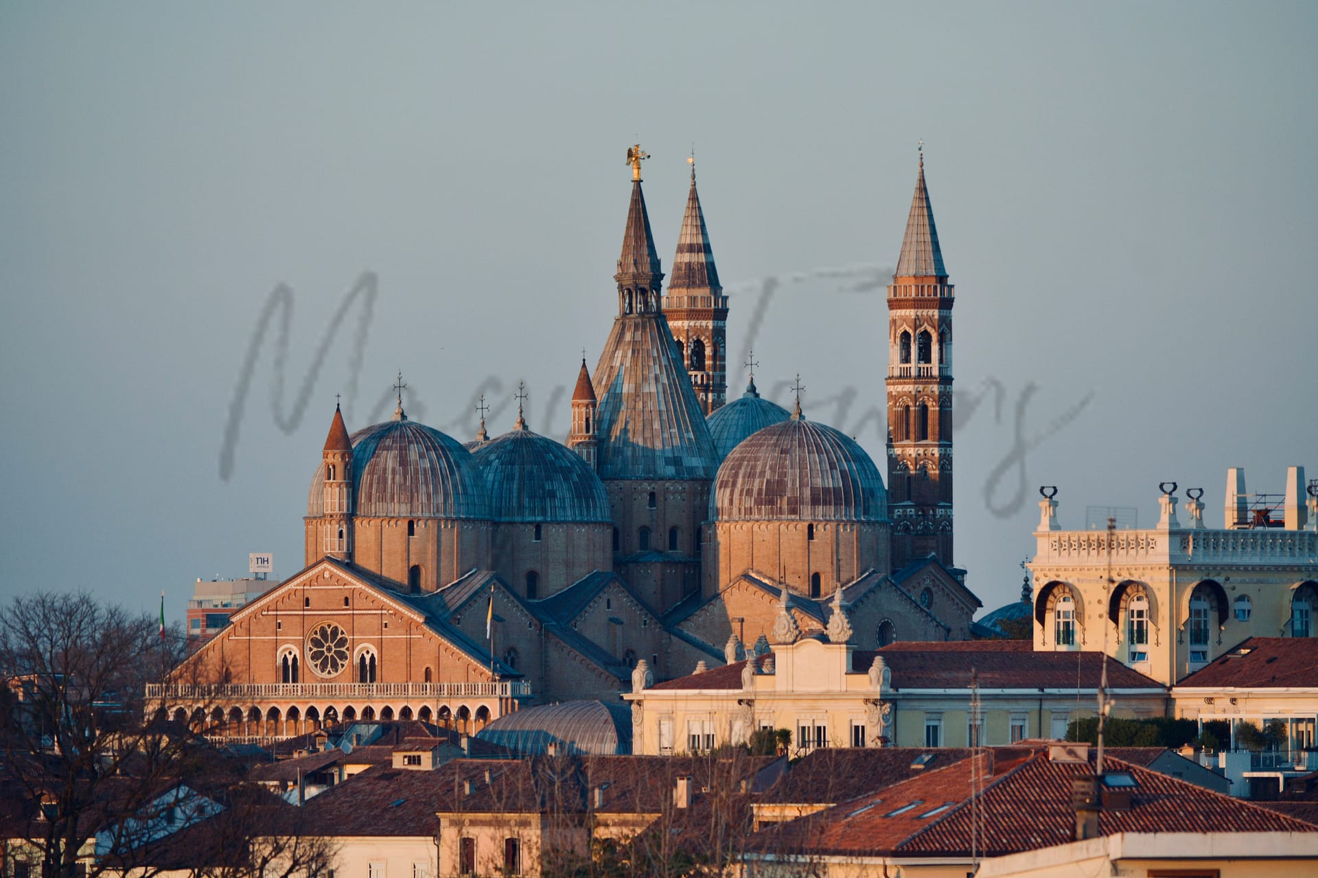
– **Centro Storico**: This area forms the heart of the city, encompassing the University of Padua and the famous Scrovegni Chapel, both integral to cultural and historical identity.
– **Arcella**: A diverse neighbourhood in the north, known for its strong community vibe and proximity to the train station facilitating regional access.
– **Forcellini**: Located in the east, this residential area combines suburban amenities with easy access to major university departments.
– **Voltabarozzo**: Situated in the south-east, it offers residential options further away from the city bustle while maintaining essential services.
– **Santa Croce**: Within the south-west are heritage sites and proximity to the Prato della Valle, enabling vibrant living close to green spaces.
– **Chiesanuova**: Positioned in the west, it serves as a link between the city and the industrial areas, providing strong transport connections.
Green Areas and Parks
Padua offers a variety of outdoor activities and green spaces suitable for expats and retirees. The Orto Botanico, established in 1545, is a significant historical garden. The Euganean Hills Nature Park provides numerous trails, notably the “River Cycling Circular,” a 29-mile moderate trail, and Padova: Stanga – Giardini dell’Arena – Parco Treves de’ Bonfili, an easy 5.2-mile trail. Engage in leisurely walks or cycling activities at Parco Urbano Termale or the Fenice Green Energy Park, Italy’s first dedicated to environmental sustainability. These locations provide ample opportunity for outdoor recreation in tranquil settings.
✅ Pros
– Excellent healthcare quality with highly rated facilities available.
– Efficient transportation network connecting to major cities and regions.
– Rich cultural and historical heritage for exploration and appreciation.
– Pleasant climate, enhancing outdoor activities and lifestyle enjoyment.
– Strong educational institutions offering diverse learning opportunities.
– Low unemployment rate fostering a stable economy and job market.
– Integrative community with welcoming locals and expat networks.
– High-quality infrastructure supporting modern living needs.
– Moderate tourism ensuring a vibrant yet tranquil atmosphere.
– Good internet connectivity for remote work and communication.
❌ Cons
– Limited nightlife options for those seeking vibrant entertainment.
– Occasional language barrier for non-Italian speakers.
– Air quality can fluctuate, impacting those with sensitivities.
– Some bureaucratic hurdles in settling and paperwork processes.
– Public services may experience occasional delays or inefficiencies.
– Limited shopping variety compared to larger cities.
– Housing prices can be high in desirable areas.
– Seasonal tourist influx may disrupt local tranquility.
– Weather can be quite humid in summer months.
– Cultural events may not always cater to expat interests.
FAQs
Summary
Padua, or Padova as the locals call it, is a city and comune in Veneto, northern Italy, rich in academic and artistic heritage. It is home to Italy’s second-oldest university, founded in 1222, and a cultural hotspot with ancient architecture and important artworks. These include the famous Giotto’s frescoes in the Scrovegni Chapel.
Padua’s importance is not limited to culture and history only. The city maintains an important role in the industrial and agricultural sectors of the Veneto region. Its well-preserved marketplaces and piazzas offer the best of both worlds: a glimpse into history without compromising that modern touch expats love.
Conveniently located in Northern Italy, Padua has excellent transport connections to major cities like Venice. For this and many other reasons, this city is favoured by expats who want to enjoy a calm atmosphere, top-notch educational institutions, history, and contemporary amenities.
✅ Pros
– Excellent healthcare quality with highly rated facilities available.
– Efficient transportation network connecting to major cities and regions.
– Rich cultural and historical heritage for exploration and appreciation.
– Pleasant climate, enhancing outdoor activities and lifestyle enjoyment.
– Strong educational institutions offering diverse learning opportunities.
– Low unemployment rate fostering a stable economy and job market.
– Integrative community with welcoming locals and expat networks.
– High-quality infrastructure supporting modern living needs.
– Moderate tourism ensuring a vibrant yet tranquil atmosphere.
– Good internet connectivity for remote work and communication.
❌ Cons
– Limited nightlife options for those seeking vibrant entertainment.
– Occasional language barrier for non-Italian speakers.
– Air quality can fluctuate, impacting those with sensitivities.
– Some bureaucratic hurdles in settling and paperwork processes.
– Public services may experience occasional delays or inefficiencies.
– Limited shopping variety compared to larger cities.
– Housing prices can be high in desirable areas.
– Seasonal tourist influx may disrupt local tranquility.
– Weather can be quite humid in summer months.
– Cultural events may not always cater to expat interests.
Related Posts
More questions about Padova ? Ask Magic AI.
Our innovative AI assistant is eager to help. Try it out here: