Elevation
Population
Real Population (5km)
Air Quality Rating
Region
Walkability
Housing availability
Avg Download Speed (Mbps) / Avg Upload Speed (Mbps)
Climate Description
Veneto
Quality of Life Score
81
Quality of Infrastructure
44
Quality of Economy
76
– High-quality healthcare services available in the area.
– Efficient local transportation options for easy mobility.
– Mild climate with pleasant weather year-round.
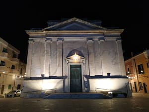
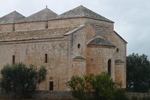
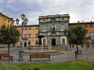
– Rich cultural and historical heritage to explore.
– Low unemployment rate fosters economic stability.
– Non-touristic environment for peaceful living experience.
– Opportunities for social integration with local communities.
– Clean air quality contributing to overall wellbeing.
– Access to educational facilities for lifelong learning.
– Internet connectivity suitable for remote work and communication.
– Limited entertainment options may lead to boredom for some.
– Infrastructure improvements needed for a more comfortable lifestyle.
– Internet speed might frustrate avid streamers and gamers.
– Non-touristic means fewer social activities for newcomers.
– Mild climate could be too humid during summer months.
– Local shops may have limited variety and hours.
– Cultural events may lack the vibrancy of larger cities.
– Transport connections to bigger cities can be infrequent.
– Healthcare score indicates room for improvement in services.
– Social integration can be challenging for non-Italian speakers.
Population
5500
Real Population (5km band)
76900
Births Per 100 Deaths
60.0
Population Data Source
ISTAT,2023
Estimated Unemployment Rate
Touristy Index
Not Touristic
Income per capita (2023)
23500
Income rank in Italy (2023)
1278 out of 7901
Closest Airport
Name
Connectivity Score
Driving Time
2nd Closest Airport
Name
Connectivity Score
Driving Time
3rd Closest Airport
Name
Connectivity Score
Driving Time
Closest Rail
Name
Stazione di Lerino
Connectivity Score
7
Driving Time
10min(s)
Train service at Stazione di Lerino includes the following features:
– **Rail Lines**: Trenitalia operates services connecting Lerino with several key destinations through regional and intercity lines.
– **Key Destinations**: Direct train routes from Lerino connect to Venice, Verona Porta Nuova, Vicenza, Padova, Milan, and Rome.
– **Train Operators**: The primary operator is Trenitalia, which runs regional services and intercity trains.
– **Frequency of Departures**: The frequency varies by destination, with up to 74 trains per day to Venice, 47 to Verona Porta Nuova, 35 to Vicenza, 31 to Padova, 30 to Milan, and 45 to Rome. Typically, trains depart every 30 minutes to hourly, depending on the city.
– **Type of Trains**: Lerino has a mix of regional and intercity trains, but high-speed services are not specifically mentioned for this station.
Overall, Lerino offers robust connections through regional lines, with good frequency to major cities in the region.
2nd Closest Rail
Name
Stazione di Grisignano di Zocco
Connectivity Score
7
Driving Time
14min(s)
Train service at Stazione di Grisignano di Zocco offers regular connectivity across several key aspects:
– **Rail Lines**: The station primarily serves regional train lines that connect the area to major cities and regions.
– **Key Destinations**: Direct trains from Grisignano di Zocco provide access to several important destinations, including Vicenza and Venice, with approximately 21 trains per day to Venice, taking about 1 hour and 4 minutes.
– **Train Operators**: The main operator for train services is Trenitalia, focusing on regional travel.
– **Frequency of Departures**: Trains generally run frequently, with services available approximately every 30 minutes to major nearby cities.
– **Types of Trains**: The station accommodates primarily regional trains, with no high-speed services available.
Overall, the station serves as a vital link in the regional rail network.
3rd Closest Rail
Name
Stazione di Vicenza
Connectivity Score
9
Driving Time
17min(s)
Train service at Stazione di Vicenza covers multiple rail lines, primarily serving the Milan – Venice main line. Key destinations accessible via direct trains include Venice, Milan, Verona, and Treviso. The station is served by Trenitalia and Italo, providing a mix of high-speed and regional train services. Frequency of departures varies; trains to major cities like Venice may run every 30 minutes to hourly, while regional connections might be less frequent. The station accommodates both high-speed and regional trains, catering to a wide range of passenger needs.
Within 10km
Auto Repair Shops
212
Bars
145
Cafes
117
Cinemas
11
Dentists
41
Golf Courses
0
Gyms
40
Health Clinics
10
Hiking Trails
22
Historical Sites
231
Libraries
10
Museums
20
Parks
11
Pharmacies
38
Restaurants
183
Shopping Centres
3
Supermarkets
65
Spas
131
Beach
Name
Driving Distance
Water Quality Rating
Mountain Resort
Name
Belmonte - Treschè Conca
Driving Distance
52.0mins
Healthcare Score
57.0
Nearest Hospital Name
Ospedale San Bortolo-P. Soccor
Drive Time to Nearest Hospital
18 minutes
Hospitals and Clinics Within 10km
3
Local Public Healthcare Provider
AZIENDA ULSS N. 8 BERICA
Healthcare Quality Description
In this area of Veneto, the local healthcare system demonstrates a commendable performance, ranking high in national evaluations. Local hospital care services are particularly noted for their quality. Patients experience effective short recovery periods following surgery and timely interventions for severe heart conditions. While the management of bone fractures is efficient, room for improvement exists in handling post-heart attack scenarios and certain surgical procedures, especially breast cancer surgeries. Overall, the healthcare provision combines notable strengths with some areas requiring enhancement, offering a promising option for expats and retirees seeking reliable medical services.
Seismic Zone (risk of earthquakes)
Moderate to Low Earthquake Risk
Road Accidents Rate per 10k Inhabitants
57
Percentage of Population at Landslide Risk
Percentage of Population at Flood Risk
Car Insurance Price Index
100.226
Housing availability
Relatively Low
Property Prices per m²
First Quartile
611
Median
1084
Third Quartile
1358
Walkability Description
Car-Dependent
Avg Download Speed (Mbps)
40
Fast Download Speed (Mbps)
47
Slow Download Speed (Mbps)
26
Avg Schools Ranking (All Criteria)
Bottom 10%
Avg Schools Ranking (Standardised Tests)
Bottom 30%
Counts of School
| Town/City | Primary Schools | Kindergartens | Comprehensive Schools | Medium High Schools | Scientific High Schools | Technical Commercial Schools | Classical High Schools | Industrial Technical Schools | Higher Education Institutes |
|---|---|---|---|---|---|---|---|---|---|
| Longare | 2 | 0 | 1 | 1 | N/A | N/A | N/A | N/A | N/A |
Precipitation
Above Average (51st-60th percentile)
Sunshine
Somewhat High (61st-70th percentile)
Snowfall
Below Average (31st-40th percentile)
Min Annual Temperature (°C)
-0.7
Max Annual Temperature (°C)
29
Climate Description
Longare presents a climate that fosters both expansive sunny days and a balanced level of precipitation. The town experiences a range of temperatures that sees mild winters gently moving into warm summers. Occasional snowfall adds a brief, picturesque winter cloak, without imposing severe cold. The overall temperate climate supports diverse living requirements – ideal for retirees and expats seeking solace from more extreme weather variations. The ample sunshine further enriches life here, offering plenty of opportunities for outdoor activities throughout the year in this tranquil Italian setting. This consistent yet varied climate underpins Longare’s appeal as a welcoming community for its residents.
Annual Temperature Chart (Min)
Climate data provided by Open Meteo, based on 2010–2022 averages.
| Town | Min Temp Jan | Min Temp Feb | Min Temp Mar | Min Temp Apr | Min Temp May | Min Temp Jun | Min Temp Jul | Min Temp Aug | Min Temp Sep | Min Temp Oct | Min Temp Nov | Min Temp Dec |
|---|---|---|---|---|---|---|---|---|---|---|---|---|
| Longare | -0,70 | 0,90 | 3,70 | 7,90 | 11,50 | 16,40 | 19,00 | 18,50 | 14,70 | 10,30 | 5,80 | 0,10 |
Annual Temperature Chart (Max)
Climate data provided by Open Meteo, based on 2010–2022 averages.
| Town | Max Temp Jan | Max Temp Feb | Max Temp Mar | Max Temp Apr | Max Temp May | Max Temp Jun | Max Temp Jul | Max Temp Aug | Max Temp Sep | Max Temp Oct | Max Temp Nov | Max Temp Dec |
|---|---|---|---|---|---|---|---|---|---|---|---|---|
| Longare | 7,4 | 9,20 | 14,20 | 18,10 | 21,30 | 26,40 | 29,00 | 28,70 | 23,70 | 18,60 | 13,10 | 8,40 |
Sunny Days By Month
Climate data provided by Open Meteo, based on 2010–2022 averages.
| Town | Sunny Days % Jan | Sunny Days % Feb | Sunny Days % Mar | Sunny Days % Apr | Sunny Days % May | Sunny Days % Jun | Sunny Days % Jul | Sunny Days % Aug | Sunny Days % Sep | Sunny Days % Oct | Sunny Days % Nov | Sunny Days % Dec |
|---|---|---|---|---|---|---|---|---|---|---|---|---|
| Longare | 46 | 40 | 55 | 54 | 59 | 65 | 69 | 70 | 56 | 41 | 35 | 49 |
Classifications
PM10
Fair
PM2.5
Fair
NO2
Good
SO2
Good
O₃
Fair
Air Quality Rating
82
Air Quality Description
In Longare, Italy, the air quality maintains a relatively balanced profile, fostering a comfortable environment for both expats and retirees. The particulate matter, both fine and coarse, remains at levels described as fair, indicating a moderate presence that doesn’t often impede daily activities or outdoor enjoyment. Nitrogen dioxide and sulphur dioxide levels are commendably low, classified as good, reflecting a lesser degree of industrial pollution and higher air purity, which contributes to the serene setting of the town. Ozone levels, while also marked as fair, bolster the air’s freshness, particularly beneficial for those with respiratory concerns looking to relax in this quaint setting.
In Longare, Italy, the air quality maintains a relatively balanced profile, fostering a comfortable environment for both expats and retirees. The particulate matter, both fine and coarse, remains at levels described as fair, indicating a moderate presence that doesn’t often impede daily activities or outdoor enjoyment. Nitrogen dioxide and sulphur dioxide levels are commendably low, classified as good, reflecting a lesser degree of industrial pollution and higher air purity, which contributes to the serene setting of the town. Ozone levels, while also marked as fair, bolster the air’s freshness, particularly beneficial for those with respiratory concerns looking to relax in this quaint setting.
Getting There
Getting Around
Local Cuisine
Longare, nestled in the Veneto region of Italy, offers a diverse culinary scene that prominently features traditional dishes such as Baccalà alla Vicentina—rehydrated stockfish cooked in milk served with polenta—and the local specialty Soppressa Vicentina, a sweet and peppery cold cut. Seasonal ingredients such as peas, asparagus, radicchio, and various fruits define the region’s cuisine, enriched by a focus on local agricultural practices. The dining landscape includes options from casual eateries to more sophisticated establishments. There is at least one notable Michelin-starred restaurant, enhancing the town’s appeal to gastronomy enthusiasts. Dining venues incorporate both traditional Venetian cuisine and international influences, thereby broadening the culinary experience to cater to a variety of tastes.
Shopping Overview
Neighborhoods
Green Areas and Parks
✅ Pros
– High-quality healthcare services available in the area.
– Efficient local transportation options for easy mobility.
– Mild climate with pleasant weather year-round.
– Rich cultural and historical heritage to explore.
– Low unemployment rate fosters economic stability.
– Non-touristic environment for peaceful living experience.
– Opportunities for social integration with local communities.
– Clean air quality contributing to overall wellbeing.
– Access to educational facilities for lifelong learning.
– Internet connectivity suitable for remote work and communication.
❌ Cons
– Limited entertainment options may lead to boredom for some.
– Infrastructure improvements needed for a more comfortable lifestyle.
– Internet speed might frustrate avid streamers and gamers.
– Non-touristic means fewer social activities for newcomers.
– Mild climate could be too humid during summer months.
– Local shops may have limited variety and hours.
– Cultural events may lack the vibrancy of larger cities.
– Transport connections to bigger cities can be infrequent.
– Healthcare score indicates room for improvement in services.
– Social integration can be challenging for non-Italian speakers.
FAQs
No posts found for the town.
Our innovative AI assistant is eager to help. Try it out for free here: