Elevation
[?]
Elevation of a city refers to the height above sea level at which the city is located, measured in meters.
546
Population
[?]
This is a town's official population, measured each year by the national statistics authority.
100
Real Population (5km)
[?]
Our "Real Population" metric reflects more accurately a town's real size by including inhabitants in the immediate vicinity of the town's official borders.
7400
Air Quality Rating
[?]
Based on PM10, PM2.5, NO2, SO2, and ozone levels. Higher scores indicate cleaner air.
86
Region
Veneto
Walkability
Car-Dependent
Housing availability
[?]
Based on total number of properties (sale and rent) classifies housing availability into five categories: low, relativel ylow, medium, relatively high and high.
Low
Avg Download Speed (Mbps) / Avg Upload Speed (Mbps)
50
/ 11
Climate Description
Winters are cool, summers temperate; occasional snow, abundant sunshine. Rainfall is fairly consistent.
Laghi
Veneto
Quality of Life Score
[?]Factors in air quality, amenities, walkability, population, and environmental risks. Higher scores suggest better living conditions.
71
Quality of Infrastructure
[?]Measures internet speed, healthcare access, airports, rail, and walkability. Higher scores mean better connectivity and essential services.
32
Quality of Economy
[?]Based on income, property prices, job availability, and population density. Higher scores indicate stronger economic conditions.
53
Laghi Demographics
Population
[?]
This is a town's official population, measured each year by the national statistics authority.
100
Real Population (5km band)
[?]
Our "Real Population" metric reflects more accurately a town's real size by including inhabitants in the immediate vicinity of the town's official borders.
7400
Births Per 100 Deaths
100.0
Population Data Source
ISTAT,2023
Estimated Unemployment Rate
Touristy Index
[?]
Calculation of tourist density index for the city, comparing its total tourist number to the overall average tourist number of the region
relative to its own population.The index indicates how a location’s tourist density compares to the average, with values above
100 representing higher-than-average density and values below 100 representing lower-than-average density.
No Data
Income per capita (2023)
[?]
This is an estimation of average income per resident for this town, based on 2023 data from the Italian Ministry of Finance.
19100
Income rank in Italy (2023)
[?]
This is a ranking of the town's average income per resident, against the full list of townships in Italy.
4797 out of 7901
Expat population by town trend
| Year | US | UK | DE | FR | NL | CH | SE | DK | AT | IE | BE | ES | PT | CA | AU | Western Total | Anglophone Total |
|---|---|---|---|---|---|---|---|---|---|---|---|---|---|---|---|---|---|
| 01/01/2019 | 0 | 0 | 0 | 1 | 0 | 0 | 0 | 0 | 0 | 0 | 0 | 0 | 0 | 0 | 0 | 1 | 0 |
| 01/01/2020 | 0 | 0 | 0 | 1 | 0 | 0 | 0 | 0 | 0 | 0 | 0 | 0 | 0 | 0 | 0 | 1 | 0 |
| 01/01/2021 | 0 | 0 | 0 | 1 | 0 | 0 | 0 | 0 | 0 | 0 | 0 | 0 | 0 | 0 | 0 | 1 | 0 |
| 01/01/2022 | 0 | 0 | 0 | 1 | 0 | 0 | 0 | 0 | 0 | 0 | 0 | 0 | 0 | 0 | 0 | 1 | 0 |
| 01/01/2023 | 0 | 0 | 0 | 1 | 0 | 0 | 0 | 0 | 0 | 0 | 0 | 0 | 0 | 0 | 0 | 1 | 0 |
| 01/01/2024 | 0 | 0 | 0 | 1 | 0 | 0 | 0 | 0 | 0 | 0 | 0 | 0 | 0 | 0 | 0 | 1 | 0 |
| 01/01/2025 | 0 | 0 | 0 | 0 | 0 | 0 | 0 | 0 | 0 | 0 | 0 | 0 | 0 | 0 | 0 | 0 | 0 |
Infrastructure and Connectivity
Create an account to explore more
This content is for Members only | Already a Member? Sign in
Infrastructure & Amenities
Create an account to explore more
This content is for Members only | Already a Member? Sign in
Within 10km
Auto Repair Shops
14
Bars
17
Cafes
14
Cinemas
1
Dentists
1
Golf Courses
0
Gyms
3
Health Clinics
0
Hiking Trails
21
Historical Sites
61
Libraries
0
Museums
5
Parks
2
Pharmacies
2
Restaurants
33
Shopping Centres
0
Supermarkets
21
Spas
7
Beach
Name
Driving Distance
Water Quality Rating
Mountain Resort
Name
Belmonte - Treschè Conca
Driving Distance
40.0mins
Healthcare
Create an account to explore more
This content is for Members only | Already a Member? Sign in
Healthcare Score
[?]
Evaluates hospital/clinic access, drive time to care, and regional quality rankings. Higher scores mean better healthcare.
71.0
Nearest Hospital Name
Alto Vicentino-Pronto Socc
Drive Time to Nearest Hospital
37 minutes
Hospitals and Clinics Within 10km
0
Healthcare Quality Description
ULSS 7 Pedemontana covers the foothill belt of northern Vicenza province — Bassano del Grappa, Marostica, Thiene, Schio, and the Asiago plateau. Composite of 61/100, top decile nationally. Emergency response is exceptional (77); the relative weak spot is post-COPD readmission rates. A strong catchment that combines Veneto’s general quality with a particularly well-organised acute-transfer network.
Local Public Healthcare Provider
AZIENDA ULSS N. 7 PEDEMONTANA
Safety
Seismic Zone (risk of earthquakes)
[?]
Official seismic zones classify areas based on earthquake risk.
Moderate to Low Earthquake Risk
Road Accidents Rate per 10k Inhabitants
[?]
Calculation of road accidents per 10,000 people based on the number of deaths and injuries registered in roads for year 2022 for the city.
0
Percentage of Population at Landslide Risk
[?] Percentage of the population in high or moderate landslide risk zones. Higher values indicate greater environmental risk.
Percentage of Population at Flood Risk
[?] Percentage of the population in high or moderate flood risk zones. Higher values indicate greater environmental risk.
Car Insurance Price Index
[?]
The car insurance price index is a measure of how a city's average car insurance premium compares to the national average,
expressed as a percentage. A value of 100 indicates that the city's premium is equal to the national average.
Values above 100 show higher premiums, while values below 100 show lower premiums.
100.226
Housing & Property Market
Create an account to explore more
This content is for Members only | Already a Member? Sign in
Housing availability
[?]
Based on total number of properties (sale and rent) classifies housing availability into five categories: low, relativel ylow, medium, relatively high and high.
Low
Property Prices per m²
[?]
Calculation of property sale prices per square meter for apartments, houses in the city.
Median (50th Percentile): The midpoint price, where half the values are above and half below.
First Quartile (25th Percentile): The price below which 25% of properties fall.
Third Quartile (75th Percentile): The price below which 75% of properties fall.
First Quartile
Median
Third Quartile
Connectivity & Digital Access
Create an account to explore more
This content is for Members only | Already a Member? Sign in
Walkability Description
Car-Dependent
Avg Download Speed (Mbps)
50
Fast Download Speed (Mbps)
61
Slow Download Speed (Mbps)
13
Education
Create an account to explore more
This content is for Members only | Already a Member? Sign in
Avg Schools Ranking (All Criteria)
[?]
This ranking shows in which decile the town's public schools fall while looking at all the indicators provided by the Italian Ministry of Education for the most recent available year. Note that figures are only provided by the ministry at the school catchment area level, and therefore several schools may be grouped together.
Avg Schools Ranking (Standardised Tests)
[?]
This ranking shows in which decile the town's public schools fall while looking the students' results in national standardised tests. The data is provided by the Italian Ministry of Education for the most recent available year.
Counts of School
| Town/City | Primary Schools | Kindergartens | Comprehensive Schools | Medium High Schools | Scientific High Schools | Technical Commercial Schools | Classical High Schools | Industrial Technical Schools | Higher Education Institutes |
|---|
Climate & Weather
Create an account to explore more
This content is for Members only | Already a Member? Sign in
Precipitation
[?] Based on daily climate data for precipitation from OPEN-METEO this parameter indicates how a city's annual precipitation compares to others in terms of percentage, with values ranging from 0 (lowest) to 1 (highest). For example, a percentile rank of 0.75 means the city's total precipitation is higher than 75% of other cities.
Exceptional (Top 10%)
Sunshine
Very Low (Bottom 10%)
Snowfall
Very High (81st-90th percentile)
Min Annual Temperature (°C)
[?] This parameter represents the monthly average of daily minimum temperatures for January, based on data from OPEN-METEO.
-1.6
Max Annual Temperature (°C)
[?] This parameter represents the monthly average of daily minimum temperatures for January, based on data from OPEN-METEO.
24.7
Climate Description
Laghi, nestled in Italy, offers a climate marked by distinct seasonal variations suitable for retirees and expats seeking the charm of Europe. Winters are moderately cold with periodic snowfall, creating picturesque scenes reminiscent of classic European winters without severe temperatures. Summers provide warmth conducive to outdoor activities and exploration, without the extremes found in more southern locales. The region enjoys ample sunlight through the year, ensuring that even shorter winter days feel brighter. Precipitation is well-spread over the year, supporting the lush local vegetation that makes Laghi appealing for those enchanted by nature’s beauty. This balanced climate makes Laghi an ideal spot for year-round living.
Annual Temperature Chart (Min)
Climate data provided by Open Meteo, based on 2010–2022 averages.
| Town | Min Temp Jan | Min Temp Feb | Min Temp Mar | Min Temp Apr | Min Temp May | Min Temp Jun | Min Temp Jul | Min Temp Aug | Min Temp Sep | Min Temp Oct | Min Temp Nov | Min Temp Dec |
|---|
Annual Temperature Chart (Max)
Climate data provided by Open Meteo, based on 2010–2022 averages.
| Town | Max Temp Jan | Max Temp Feb | Max Temp Mar | Max Temp Apr | Max Temp May | Max Temp Jun | Max Temp Jul | Max Temp Aug | Max Temp Sep | Max Temp Oct | Max Temp Nov | Max Temp Dec |
|---|
Sunny Days By Month
Climate data provided by Open Meteo, based on 2010–2022 averages.
| Town | Sunny Days % Jan | Sunny Days % Feb | Sunny Days % Mar | Sunny Days % Apr | Sunny Days % May | Sunny Days % Jun | Sunny Days % Jul | Sunny Days % Aug | Sunny Days % Sep | Sunny Days % Oct | Sunny Days % Nov | Sunny Days % Dec |
|---|
Environmental & Air Quality
Create an account to explore more
This content is for Members only | Already a Member? Sign in
Classifications
PM10
[?]
PM10 levels indicate Good air quality at 0–20 µg/m³, Fair at 20–40 µg/m³, Moderate at 40–50 µg/m³, Poor at 50–100 µg/m³, Very Poor at 100–150 µg/m³, and Extremely Poor at 150–1200 µg/m³.
Good
PM2.5
[?]
PM2.5 is Good if PM2.5 levels are between 0–10 µg/m³, Fair between 10–20 µg/m³, Moderate between 20–25 µg/m³, Poor between 25–50 µg/m³, Very Poor between 50–75 µg/m³, and Extremely Poor between 75–800 µg/m³.
Fair
NO2
[?]
NO₂ levels are considered Good at 0–40 µg/m³, Fair at 40–90 µg/m³, Moderate at 90–120 µg/m³, Poor at 120–230 µg/m³, Very Poor at 230–340 µg/m³, and Extremely Poor at 340–1000 µg/m³.
Good
SO2
[?]
SO₂ levels indicate Good air quality at 0–100 µg/m³, Fair at 100–200 µg/m³, Moderate at 200–350 µg/m³, Poor at 350–500 µg/m³, Very Poor at 500–750 µg/m³, and Extremely Poor at 750–1250 µg/m³.
Good
O₃
[?]
For O₃, the air is Good at 0–50 µg/m³, Fair at 50–100 µg/m³, Moderate at 100–130 µg/m³, Poor at 130–240 µg/m³, Very Poor at 240–380 µg/m³, and Extremely Poor at 380–800 µg/m³.
Fair
Air Quality Rating
[?]
Based on PM10, PM2.5, NO2, SO2, and ozone levels. Higher scores indicate cleaner air.
86
Air Quality Description
Laghi’s air quality stands commendably clean, primarily bolstered by its low levels of nitrogen dioxide and sulphur dioxide, marking it as a promising choice for those concerned with respiratory health. While particulate matter readings show variability, with PM10 at a good level and PM2.5 presenting moderate concern, the overall air freshness contributes positively to daily living. Ozone levels, hovering at fair ratings, may warrant attention on selected days but generally maintain a balance without tipping into problematic zones. This serene Italian town offers a breathable environment that supports outdoor activities and relaxation—a significant plus for retirees and expats settling here.
Laghi’s air quality stands commendably clean, primarily bolstered by its low levels of nitrogen dioxide and sulphur dioxide, marking it as a promising choice for those concerned with respiratory health. While particulate matter readings show variability, with PM10 at a good level and PM2.5 presenting moderate concern, the overall air freshness contributes positively to daily living. Ozone levels, hovering at fair ratings, may warrant attention on selected days but generally maintain a balance without tipping into problematic zones. This serene Italian town offers a breathable environment that supports outdoor activities and relaxation—a significant plus for retirees and expats settling here.
Town Descriptions
Create an account to explore more
This content is for Members only | Already a Member? Sign in
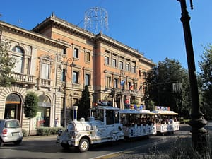
Getting There
Getting Around
Local Cuisine
Laghi, located in the Veneto region of Italy, thrives within a culinary framework characterized by a rich tapestry of traditional dishes that reflect the local agricultural and maritime heritage. Signature plates include ‘Bigoli in salsa,’ a distinctive pasta served with an anchovy and onion sauce; ‘Risotto al nero di seppia,’ a creamy risotto infused with cuttlefish ink; and ‘Sarde in saor,’ marinated sardines prepared with a sweet and sour mix. The region is also renowned for its polenta, served in various forms, and ‘Baccalà mantecato,’ a creamy dried fish pâté. Local dining venues favor fresh, seasonal ingredients, often showcasing seafood due to the town’s proximity to Lake Garda.
The dining scene in Laghi benefits from a diversity of restaurant offerings, ranging from quaint, family-run trattorias to contemporary establishments exploring international flavors. While the town’s gastronomic options appear varied, notable Michelin-starred restaurants elevate the culinary prestige within the region. The Michelin Guide has recognized at least one such establishment in the vicinity, indicating the presence of high-quality culinary experiences.
Shopping Overview
Neighborhoods
Green Areas and Parks
✅ Pros
– High-quality healthcare services available in the town.
– Pleasant climate conducive to year-round outdoor activities.
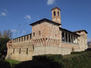
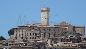
– Rich cultural and historical backdrop to explore and enjoy.
– Low unemployment rate fosters a stable community atmosphere.
– Opportunities for integration with friendly local residents.
– Clean air quality enhances overall living experience.
– Access to nearby natural parks for recreation and relaxation.
– Peaceful environment ideal for retirees seeking tranquility.
– Close-knit community offers a supportive living atmosphere.
– Growing interest in local events and cultural activities.
❌ Cons
– Limited transportation options make travel challenging and inconvenient.
– Slow internet speeds can frustrate modern connectivity needs.
– Low income rank might limit local business opportunities.
– Infrastructure issues can detract from overall living experience.
– Limited educational facilities may not meet all family needs.
– Cultural activities may feel repetitive over time for some.
– Weather extremes can occasionally disrupt outdoor plans.
– Lack of tourist presence might feel isolating for newcomers.
– Fewer dining and shopping options compared to larger towns.
FAQs
Summary
✅ Pros
– High-quality healthcare services available in the town.
– Pleasant climate conducive to year-round outdoor activities.
– Rich cultural and historical backdrop to explore and enjoy.
– Low unemployment rate fosters a stable community atmosphere.
– Opportunities for integration with friendly local residents.
– Clean air quality enhances overall living experience.
– Access to nearby natural parks for recreation and relaxation.
– Peaceful environment ideal for retirees seeking tranquility.
– Close-knit community offers a supportive living atmosphere.
– Growing interest in local events and cultural activities.
❌ Cons
– Limited transportation options make travel challenging and inconvenient.
– Slow internet speeds can frustrate modern connectivity needs.
– Low income rank might limit local business opportunities.
– Infrastructure issues can detract from overall living experience.
– Limited educational facilities may not meet all family needs.
– Cultural activities may feel repetitive over time for some.
– Weather extremes can occasionally disrupt outdoor plans.
– Lack of tourist presence might feel isolating for newcomers.
– Fewer dining and shopping options compared to larger towns.
Related Posts
No posts found for the town.
More questions about Laghi ? Ask Magic AI.
Our innovative AI assistant is eager to help. Try it out here: