
Elevation
[?]
Elevation of a city refers to the height above sea level at which the city is located, measured in meters.
179
Population
[?]
This is a town's official population, measured each year by the national statistics authority.
26900
Real Population (5km)
[?]
Our "Real Population" metric reflects more accurately a town's real size by including inhabitants in the immediate vicinity of the town's official borders.
398200
Air Quality Rating
[?]
Based on PM10, PM2.5, NO2, SO2, and ozone levels. Higher scores indicate cleaner air.
82
Region
Lombardia
Walkability
Walker’s Paradise
Housing availability
[?]
Based on total number of properties (sale and rent) classifies housing availability into five categories: low, relativel ylow, medium, relatively high and high.
Low
Avg Download Speed (Mbps) / Avg Upload Speed (Mbps)
133
/ 64
Climate Description
Crisp winters, warm summers, abundant sunshine, light snowfall, and moderate temperatures.
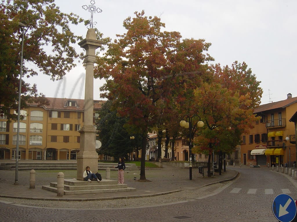
Garbagnate Milanese
Lombardia
Small Lombardy town near Milan offers residential comfort, cultural attractions, and diverse dining options.
Quality of Life Score
[?]Factors in air quality, amenities, walkability, population, and environmental risks. Higher scores suggest better living conditions.
78
Quality of Infrastructure
[?]Measures internet speed, healthcare access, airports, rail, and walkability. Higher scores mean better connectivity and essential services.
79
Quality of Economy
[?]Based on income, property prices, job availability, and population density. Higher scores indicate stronger economic conditions.
72
Garbagnate Milanese Demographics
Population
[?]
This is a town's official population, measured each year by the national statistics authority.
26900
Real Population (5km band)
[?]
Our "Real Population" metric reflects more accurately a town's real size by including inhabitants in the immediate vicinity of the town's official borders.
398200
Births Per 100 Deaths
60.0
Population Data Source
ISTAT,2023
Estimated Unemployment Rate
Touristy Index
[?]
Calculation of tourist density index for the city, comparing its total tourist number to the overall average tourist number of the region
relative to its own population.The index indicates how a location’s tourist density compares to the average, with values above
100 representing higher-than-average density and values below 100 representing lower-than-average density.
Not Touristic
Income per capita (2023)
[?]
This is an estimation of average income per resident for this town, based on 2023 data from the Italian Ministry of Finance.
24600
Income rank in Italy (2023)
[?]
This is a ranking of the town's average income per resident, against the full list of townships in Italy.
641 out of 7901
Infrastructure and Connectivity
Create an account to explore more
This content is for Members only | Already a Member? Sign in
Closest Airport
Name
Malpensa (Milan)
Connectivity Score
[?]
Measures travel time and service quality of nearby airport stations. Higher scores mean better transport access.
10
Driving Time
26min(s)
Milan Malpensa Airport (MXP) is located near Milan, Italy, and is the second largest and busiest airport in the country. Handling 28.5 million passengers, the airport connects to around 195 destinations worldwide, serving as a major hub for EasyJet. Key routes include flights to New York, London, Dubai, and Istanbul, making it a significant international gateway. Notable for its effective connectivity with Milan’s city centre via the Malpensa Express, the airport caters extensively to travellers heading to diverse European, American, and Asian destinations.
2nd Closest Airport
Name
Linate (Milan)
Connectivity Score
[?]
Measures travel time and service quality of nearby airport stations. Higher scores mean better transport access.
7
Driving Time
28min(s)
Milan Linate Airport (LIN), situated in Segrate and Peschiera Borromeo in Lombardy, Italy, serves around 10.6 million passengers annually. It focuses on flights within Europe and the United Kingdom, serving as a hub for ITA Airways. The airport offers convenient connections to popular destinations such as Rome, Cagliari, and Paris, making it an accessible choice for travellers seeking direct European flights.
3rd Closest Airport
Name
Orio al Serio (Bergamo)
Connectivity Score
[?]
Measures travel time and service quality of nearby airport stations. Higher scores mean better transport access.
7
Driving Time
37min(s)
Orio al Serio International Airport, also known as Milan Bergamo Airport, is located just 5 km from Bergamo and about 45 km from Milan in Lombardy, Italy. It is the third busiest airport in Italy, serving over 13 million passengers annually and acting as a major hub for Ryanair. The airport connects to numerous European destinations including Copenhagen, Düsseldorf, as well as farther routes like Dubai and Cairo. Known for its budget-friendly flights primarily operated by Ryanair, Milan Bergamo Airport is a popular choice for travellers looking for affordable options to various international destinations.
Closest Rail
Name
Stazione di Garbagnate Milanese
Connectivity Score
[?]
Measures travel time and service quality of nearby rail stations. Higher scores mean better transport access.
6
Driving Time
4min(s)
Train service at Stazione di Garbagnate Milanese provides a range of connections:
– **Rail Lines**: The station is served by lines S1, S3, and S13 of the Milan suburban railway network.
– **Key Destinations**: Direct connections include Milan, Saronno, and other locations within Lombardy.
– **Train Operators**: Services are primarily operated by Trenord.
– **Frequency of Departures**: Trains typically run every 30 minutes, although frequency may vary during peak and off-peak hours.
– **Train Types**: Garbagnate Milanese station mainly offers regional services, with no high-speed trains available.
Overall, the station provides essential regional connectivity within the Lombard area, linking smaller towns to major urban centres.
2nd Closest Rail
Name
Garbagnate Parco delle Groane railway station
Connectivity Score
[?]
Measures travel time and service quality of nearby rail stations. Higher scores mean better transport access.
6
Driving Time
4min(s)
Train service at Garbagnate Parco delle Groane railway station includes the following details:
– **Rail Lines That Stop Here**: The station is served by the S1, S3, and S13 lines of the Milan suburban railway network.
– **Key Destinations Connected by Direct Trains**: Key destinations include Milan, particularly Milano Cadorna, which is approximately 13.5 km away, along with connections to other suburban areas.
– **Train Operators**: The station is operated by Trenord.
– **Frequency of Departures**: Departures are frequent, with services typically every 15 to 30 minutes, depending on the line and time of day.
– **Types of Trains**: The station primarily offers regional services, focusing on local and suburban connections rather than high-speed trains.
3rd Closest Rail
Name
Stazione di Cesate
Connectivity Score
[?]
Measures travel time and service quality of nearby rail stations. Higher scores mean better transport access.
6
Driving Time
6min(s)
Train service at Stazione di Cesate includes the following features:
– **Rail Lines:** The station is served by the S1 and S3 lines of the Milan suburban railway network.
– **Key Destinations:** Direct trains connect Cesate to key destinations including Milan Centrale and other locations within the Lombardy region.
– **Train Operators:** The service is primarily operated by Trenord, a regional transport company that manages suburban trains in Lombardy.
– **Frequency of Departures:** Trains depart approximately every 30 minutes during peak hours, with reduced frequency during off-peak times.
– **Train Types:** The station primarily offers regional services, with no high-speed train services available.
Infrastructure & Amenities
Create an account to explore more
This content is for Members only | Already a Member? Sign in
Healthcare
Create an account to explore more
This content is for Members only | Already a Member? Sign in
Housing & Property Market
Create an account to explore more
This content is for Members only | Already a Member? Sign in
Connectivity & Digital Access
Create an account to explore more
This content is for Members only | Already a Member? Sign in
Education
Create an account to explore more
This content is for Members only | Already a Member? Sign in
Climate & Weather
Create an account to explore more
This content is for Members only | Already a Member? Sign in
Precipitation
[?] Based on daily climate data for precipitation from OPEN-METEO this parameter indicates how a city's annual precipitation compares to others in terms of percentage, with values ranging from 0 (lowest) to 1 (highest). For example, a percentile rank of 0.75 means the city's total precipitation is higher than 75% of other cities.
Very High (81st-90th percentile)
Sunshine
Somewhat Low (21st-30th percentile)
Snowfall
Above Average (51st-60th percentile)
Min Annual Temperature (°C)
[?] This parameter represents the monthly average of daily minimum temperatures for January, based on data from OPEN-METEO.
-0.7
Max Annual Temperature (°C)
[?] This parameter represents the monthly average of daily minimum temperatures for January, based on data from OPEN-METEO.
28.5
Climate Description
In Garbagnate Milanese, the winters have a crisp chill, while summers boast welcoming warmth, making it an attractive setting throughout the year. The region enjoys plenty of sunny days, which greatly outnumber the days with rainfall, ensuring ample opportunities for outdoor activities. While there is occasional snowfall, it's generally light and doesn't disrupt daily life. Temperatures are moderate, rarely hitting severe lows in winter or sweltering highs in the summer. This balanced climate appeals especially to retirees and expats looking for a comfortable place to reside without the extremities of weather to contend with.
Annual Temperature Chart (Min)
Error
There was a problem with your SQL connection - Please contact the administrator
There was a problem with your SQL connection - Please contact the administrator
Annual Temperature Chart (Max)
Error
There was a problem with your SQL connection - Please contact the administrator
There was a problem with your SQL connection - Please contact the administrator
Sunny Days By Month
Error
There was a problem with your SQL connection - Please contact the administrator
There was a problem with your SQL connection - Please contact the administrator
Environmental & Air Quality
Create an account to explore more
This content is for Members only | Already a Member? Sign in
Classifications
PM10
[?]
PM10 levels indicate Good air quality at 0–20 µg/m³, Fair at 20–40 µg/m³, Moderate at 40–50 µg/m³, Poor at 50–100 µg/m³, Very Poor at 100–150 µg/m³, and Extremely Poor at 150–1200 µg/m³.
Fair
PM2.5
[?]
PM2.5 is Good if PM2.5 levels are between 0–10 µg/m³, Fair between 10–20 µg/m³, Moderate between 20–25 µg/m³, Poor between 25–50 µg/m³, Very Poor between 50–75 µg/m³, and Extremely Poor between 75–800 µg/m³.
Moderate
NO2
[?]
NO₂ levels are considered Good at 0–40 µg/m³, Fair at 40–90 µg/m³, Moderate at 90–120 µg/m³, Poor at 120–230 µg/m³, Very Poor at 230–340 µg/m³, and Extremely Poor at 340–1000 µg/m³.
Good
SO2
[?]
SO₂ levels indicate Good air quality at 0–100 µg/m³, Fair at 100–200 µg/m³, Moderate at 200–350 µg/m³, Poor at 350–500 µg/m³, Very Poor at 500–750 µg/m³, and Extremely Poor at 750–1250 µg/m³.
Good
O₃
[?]
For O₃, the air is Good at 0–50 µg/m³, Fair at 50–100 µg/m³, Moderate at 100–130 µg/m³, Poor at 130–240 µg/m³, Very Poor at 240–380 µg/m³, and Extremely Poor at 380–800 µg/m³.
Fair
Air Quality Rating
[?]
Based on PM10, PM2.5, NO2, SO2, and ozone levels. Higher scores indicate cleaner air.
82
Air Quality Description
In Garbagnate Milanese, nestled within Italy’s industrious Lombardy region, the air quality presents a mixed but generally favorable report for residents and newcomers alike. Particulate matter pertinent to both PM10 and PM2.5 registers at levels denoting fair and moderate conditions respectively—indicative of urban areas but within a moderate threshold that suggests balance. In contrast, nitrogen and sulphur dioxide levels are commendably low, suggesting effective management of these typical pollutants. For ozone, the levels are average, aligning with expectations for suburban settlements near a major metropolis. Overall, the atmospheric conditions here support a moderately pleasant living environment.
In Garbagnate Milanese, nestled within Italy’s industrious Lombardy region, the air quality presents a mixed but generally favorable report for residents and newcomers alike. Particulate matter pertinent to both PM10 and PM2.5 registers at levels denoting fair and moderate conditions respectively—indicative of urban areas but within a moderate threshold that suggests balance. In contrast, nitrogen and sulphur dioxide levels are commendably low, suggesting effective management of these typical pollutants. For ozone, the levels are average, aligning with expectations for suburban settlements near a major metropolis. Overall, the atmospheric conditions here support a moderately pleasant living environment.
Town Descriptions
Create an account to explore more
This content is for Members only | Already a Member? Sign in
Getting There
Garbagnate Milanese is well-connected, located near key roadways such as the A52 and A4 motorways, facilitating access to Milan and beyond. The town benefits from nearby train stations, enhancing public transport options, while its proximity to Malpensa and Linate airports supports international travel.
Getting Around
Local Cuisine
Garbagnate Milanese boasts a diverse culinary scene deeply rooted in the traditional Italian cuisine of Lombardy. The region is renowned for dishes such as Costoletta alla Milanese, a breaded veal cutlet; Risotto alla Milanese, characterized by its saffron coloring; and Ossobuco, a braised veal shank typically served with gremolata. Local culinary traditions are complemented by a range of international dining options, reflecting broader culinary influences. The town hosts a mix of casual eateries and more upscale dining venues, demonstrating a balance between traditional Italian fare and innovative cuisine. Notably, Garbagnate Milanese features Michelin-starred restaurants, signaling the quality and sophistication of its dining offerings.
Shopping Overview
The shopping landscape features diverse options, including several supermarkets and a variety of boutiques. Notably, a major shopping mall nearby hosts over 200 stores across categories such as fashion, beauty, electronics, and groceries. Dining options are plentiful, encompassing various cuisines. Smaller retail venues offer local goods, while markets provide fresh produce. This multiplicity caters well to both expats and retirees seeking convenience and variety in their shopping experience.
Neighborhoods
Green Areas and Parks
Garbagnate Milanese offers several outdoor activities, notably within the Parco delle Groane. The region features trails around the Villoresi Canal and the Lombra, suitable for walking or cycling. Additionally, the Il Bosco di Cesate and Laghetto del Manuè provide natural vistas in the same park. The loop trails extend through the Rosa Camuna Park and along the Nirone stream. These pathways are accessible and structured, presenting various excursion opportunities for enthusiasts. The area effectively merges urban proximity with natural landscapes, making it favorable for retirees seeking active leisure pursuits.
✅ Pros
– High-quality healthcare services available in the region.
– Efficient public transportation connecting to Milan and surrounding areas.
– Favorable job market with low unemployment rates.
– Pleasant climate with mild winters and warm summers.
– Rich cultural heritage and historical landmarks throughout the town.
– Opportunities for community integration and social activities.
– Good air quality for a healthier lifestyle.
– Robust infrastructure supporting daily living needs.
– Access to quality educational facilities for residents.
– Non-touristic environment offering a peaceful living experience.
❌ Cons
– Healthcare services may be limited compared to larger cities.
– Public transportation can be overcrowded during peak hours.
– Job opportunities may not cater to all professional backgrounds.
– Mild winters might still feel chilly for some newcomers.
– Cultural activities may not be as vibrant as larger cities.
– Limited dining options; culinary adventures might be scarce.
– Internet speeds may not satisfy heavy streaming needs.
– Community events may lack the buzz found in tourist spots.
– Limited nightlife options for younger expats and retirees.
– Local dialects can complicate integration for non-Italian speakers.
FAQs
Summary
Garbagnate Milanese, located in the Lombardy region, is a small town offering a mix of residential comfort and cultural richness, well-suited for expats and retirees. Just a short drive from Milan and the nearest airport, it boasts a walkable environment, with high scores for pedestrian friendliness. The town is home to notable attractions, including the Santuario della Beata Vergine del Rosario and the Chiesa dei SS. Eusebio e Maccabei, both reflecting its rich historical tapestry. Culinary diversity thrives with local restaurants serving everything from traditional Italian to Mediterranean and Asian cuisines, fostering a vibrant dining scene. However, like many small towns, it faces challenges such as limited healthcare facilities, which may concern some newcomers. Notably, while scenic and culturally engaging, residents may find social activities somewhat limited compared to larger urban centers. Overall, Garbagnate Milanese presents a serene lifestyle alternative with unique local charm.
✅ Pros
– High-quality healthcare services available in the region.
– Efficient public transportation connecting to Milan and surrounding areas.
– Favorable job market with low unemployment rates.
– Pleasant climate with mild winters and warm summers.
– Rich cultural heritage and historical landmarks throughout the town.
– Opportunities for community integration and social activities.
– Good air quality for a healthier lifestyle.
– Robust infrastructure supporting daily living needs.
– Access to quality educational facilities for residents.
– Non-touristic environment offering a peaceful living experience.
❌ Cons
– Healthcare services may be limited compared to larger cities.
– Public transportation can be overcrowded during peak hours.
– Job opportunities may not cater to all professional backgrounds.
– Mild winters might still feel chilly for some newcomers.
– Cultural activities may not be as vibrant as larger cities.
– Limited dining options; culinary adventures might be scarce.
– Internet speeds may not satisfy heavy streaming needs.
– Community events may lack the buzz found in tourist spots.
– Limited nightlife options for younger expats and retirees.
– Local dialects can complicate integration for non-Italian speakers.
Related Posts
No posts found for the town.
More questions about Garbagnate Milanese ? Ask Magic AI.
Our innovative AI assistant is eager to help. Try it out for free here: