
Elevation
[?]
Elevation of a city refers to the height above sea level at which the city is located, measured in meters.
122
Population
[?]
This is a town's official population, measured each year by the national statistics authority.
57100
Real Population (5km)
[?]
Our "Real Population" metric reflects more accurately a town's real size by including inhabitants in the immediate vicinity of the town's official borders.
116700
Air Quality Rating
[?]
Based on PM10, PM2.5, NO2, SO2, and ozone levels. Higher scores indicate cleaner air.
96
Region
Puglia
Walkability
Walker’s Paradise
Housing availability
[?]
Based on total number of properties (sale and rent) classifies housing availability into five categories: low, relativel ylow, medium, relatively high and high.
Medium
Avg Download Speed (Mbps) / Avg Upload Speed (Mbps)
145
/ 71
Climate Description
Mild winters, warm summers, ample sunlight, moderate year-round rainfall.
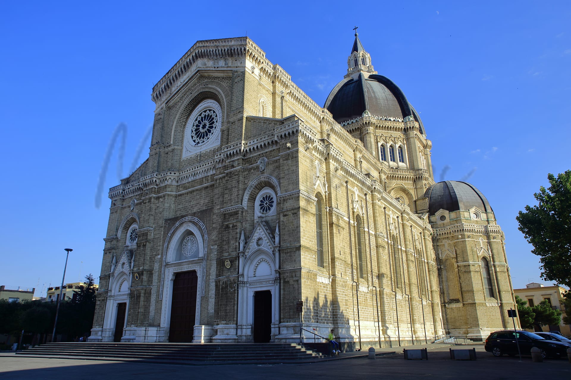
Cerignola
Puglia
Vibrant town in Puglia known for olive oil production, pedestrian-friendly, rich cultural heritage, healthcare challenges.
Quality of Life Score
[?]Factors in air quality, amenities, walkability, population, and environmental risks. Higher scores suggest better living conditions.
78
Quality of Infrastructure
[?]Measures internet speed, healthcare access, airports, rail, and walkability. Higher scores mean better connectivity and essential services.
65
Quality of Economy
[?]Based on income, property prices, job availability, and population density. Higher scores indicate stronger economic conditions.
66
Cerignola Demographics
Population
[?]
This is a town's official population, measured each year by the national statistics authority.
57100
Real Population (5km band)
[?]
Our "Real Population" metric reflects more accurately a town's real size by including inhabitants in the immediate vicinity of the town's official borders.
116700
Births Per 100 Deaths
110.0
Population Data Source
ISTAT,2023
Estimated Unemployment Rate
Touristy Index
[?]
Calculation of tourist density index for the city, comparing its total tourist number to the overall average tourist number of the region
relative to its own population.The index indicates how a location’s tourist density compares to the average, with values above
100 representing higher-than-average density and values below 100 representing lower-than-average density.
Not Touristic
Income per capita (2023)
[?]
This is an estimation of average income per resident for this town, based on 2023 data from the Italian Ministry of Finance.
14100
Income rank in Italy (2023)
[?]
This is a ranking of the town's average income per resident, against the full list of townships in Italy.
7424 out of 7901
Infrastructure and Connectivity
Create an account to explore more
This content is for Members only | Already a Member? Sign in
Infrastructure & Amenities
Create an account to explore more
This content is for Members only | Already a Member? Sign in
Healthcare
Create an account to explore more
This content is for Members only | Already a Member? Sign in
Housing & Property Market
Create an account to explore more
This content is for Members only | Already a Member? Sign in
Connectivity & Digital Access
Create an account to explore more
This content is for Members only | Already a Member? Sign in
Education
Create an account to explore more
This content is for Members only | Already a Member? Sign in
Climate & Weather
Create an account to explore more
This content is for Members only | Already a Member? Sign in
Precipitation
[?] Based on daily climate data for precipitation from OPEN-METEO this parameter indicates how a city's annual precipitation compares to others in terms of percentage, with values ranging from 0 (lowest) to 1 (highest). For example, a percentile rank of 0.75 means the city's total precipitation is higher than 75% of other cities.
Very Low (Bottom 10%)
Sunshine
Exceptional (Top 10%)
Snowfall
Low (11th-20th percentile)
Min Annual Temperature (°C)
[?] This parameter represents the monthly average of daily minimum temperatures for January, based on data from OPEN-METEO.
3.8
Max Annual Temperature (°C)
[?] This parameter represents the monthly average of daily minimum temperatures for January, based on data from OPEN-METEO.
32.4
Climate Description
In Cerignola, Italy, the climate offers a pleasant equilibrium suitable for those seeking a temperate environment. The winters are notably mild, rarely seeing more than a light dusting of snow, while summers can warm up generously. Cerignola enjoys a considerable amount of sunlight throughout the year, ensuring that days are predominantly bright and inviting. Rainfall is moderate here, spread fairly evenly across the seasons, which supports the lush local agriculture but doesn’t impose frequently on outdoor activities. This consistent yet varied climate makes Cerignola an appealing option for expats and retirees from the Magic Towns readership who value steady, agreeable weather conditions.
Annual Temperature Chart (Min)
Error
There was a problem with your SQL connection - Please contact the administrator
There was a problem with your SQL connection - Please contact the administrator
Annual Temperature Chart (Max)
Error
There was a problem with your SQL connection - Please contact the administrator
There was a problem with your SQL connection - Please contact the administrator
Sunny Days By Month
Error
There was a problem with your SQL connection - Please contact the administrator
There was a problem with your SQL connection - Please contact the administrator
Environmental & Air Quality
Create an account to explore more
This content is for Members only | Already a Member? Sign in
Classifications
PM10
[?]
PM10 levels indicate Good air quality at 0–20 µg/m³, Fair at 20–40 µg/m³, Moderate at 40–50 µg/m³, Poor at 50–100 µg/m³, Very Poor at 100–150 µg/m³, and Extremely Poor at 150–1200 µg/m³.
Good
PM2.5
[?]
PM2.5 is Good if PM2.5 levels are between 0–10 µg/m³, Fair between 10–20 µg/m³, Moderate between 20–25 µg/m³, Poor between 25–50 µg/m³, Very Poor between 50–75 µg/m³, and Extremely Poor between 75–800 µg/m³.
Good
NO2
[?]
NO₂ levels are considered Good at 0–40 µg/m³, Fair at 40–90 µg/m³, Moderate at 90–120 µg/m³, Poor at 120–230 µg/m³, Very Poor at 230–340 µg/m³, and Extremely Poor at 340–1000 µg/m³.
Good
SO2
[?]
SO₂ levels indicate Good air quality at 0–100 µg/m³, Fair at 100–200 µg/m³, Moderate at 200–350 µg/m³, Poor at 350–500 µg/m³, Very Poor at 500–750 µg/m³, and Extremely Poor at 750–1250 µg/m³.
Good
O₃
[?]
For O₃, the air is Good at 0–50 µg/m³, Fair at 50–100 µg/m³, Moderate at 100–130 µg/m³, Poor at 130–240 µg/m³, Very Poor at 240–380 µg/m³, and Extremely Poor at 380–800 µg/m³.
Fair
Air Quality Rating
[?]
Based on PM10, PM2.5, NO2, SO2, and ozone levels. Higher scores indicate cleaner air.
96
Air Quality Description
Cerignola, Italy, presents a largely commendable air quality profile, making it an appealing environment for expats and retirees seeking a healthier living ambiance. The concentrations of particulate matter (PM10 and PM2.5) are low, falling within the “Good” range. This indicates a minimal presence of these small particles that can easily be inhaled, thus posing less risk to respiratory health. Similarly, nitrogen dioxide and sulphur dioxide levels are also favorable, enhancing the town’s appeal for those sensitive to urban pollutants. Ozone levels are moderate, categorized as “Fair,” suggesting occasional peaks that may warrant attention during certain weather conditions. Overall, Cerignola’s air supports a comfortable and healthy lifestyle.
Cerignola, Italy, presents a largely commendable air quality profile, making it an appealing environment for expats and retirees seeking a healthier living ambiance. The concentrations of particulate matter (PM10 and PM2.5) are low, falling within the “Good” range. This indicates a minimal presence of these small particles that can easily be inhaled, thus posing less risk to respiratory health. Similarly, nitrogen dioxide and sulphur dioxide levels are also favorable, enhancing the town’s appeal for those sensitive to urban pollutants. Ozone levels are moderate, categorized as “Fair,” suggesting occasional peaks that may warrant attention during certain weather conditions. Overall, Cerignola’s air supports a comfortable and healthy lifestyle.
Town Descriptions
Create an account to explore more
This content is for Members only | Already a Member? Sign in
Getting There
Cerignola is accessible via the A16 and SS96 highways, linking it to major cities. The nearest airports are Karol Wojtyla Airport in Bari and Capodichino Airport in Naples. Local train stations provide limited connectivity, reflecting the town’s moderate infrastructure rating.
Getting Around
Local Cuisine
Cerignola, located in the Puglia region of Italy, boasts a rich culinary scene heavily influenced by local agricultural products and traditional cooking methods. Notable traditional dishes include orecchiette, a pasta shaped like little ears often served with various sauces, and maccheroni al forno—a baked pasta dish mixed with meatballs. The region is also celebrated for its abundant vegetables, particularly artichokes, which play a central role during local festivals. In terms of dining variety, Cerignola offers a mix of local eateries focused on traditional Puglian dishes, alongside some international dining options reflecting broader culinary trends. Presently, there are no Michelin-starred restaurants specifically located in Cerignola, although several Michelin-starred establishments are found throughout the Puglia region, emphasizing the high culinary standards associated with this area. Overall, Cerignola is characterized by its emphasis on locally sourced ingredients, traditional recipes, and a welcoming dining atmosphere, making it a genuine representation of Puglian cuisine.
Shopping Overview
Shopping in the area includes supermarkets, local boutiques, and specialty shops, offering a diverse range of products. Notable shopping formats consist of independent stores and local markets, catering to everyday needs and unique offerings. A modern shopping centre, featuring various retailers and dining options, enhances the shopping experience. These venues accommodate both essential shopping and leisure, appealing to diverse consumer preferences.
Neighborhoods
Green Areas and Parks
Cerignola in Puglia offers a range of outdoor activities, with notable trails and green spaces for hiking and biking enthusiasts. The Via Francigena Segment 132 is a 12-mile trail connecting Cerignola to Canosa di Puglia, ideal for moderate hikes. Another trail is the Santuario dell’Incoronata, covering 17.3 miles. For biking, the Cerignola Campagna area provides several options, including a 23.8-mile route to Barletta and a 5.68-mile local circuit. These trails highlight the region’s natural landscapes, providing opportunities for outdoor pursuits in a picturesque rural setting.
✅ Pros
– Pleasant Mediterranean climate with warm summers and mild winters.
– Rich cultural heritage and historical significance throughout the town.
– Opportunities for community integration and local engagement activities.
– Affordable cost of living compared to many Italian cities.
– Non-touristic environment, providing an authentic Italian lifestyle.
– Good air quality for a healthier living environment.
– Adequate public transportation options for easy travel.
– Healthcare facilities available, though with room for improvement.
– Local cuisine celebrated for its quality and freshness.
– Access to beautiful countryside and nearby coastal areas.
❌ Cons
– Healthcare quality leaves much to be desired.
– Public transport can be less frequent than expected.
– Limited job opportunities may challenge new arrivals.
– Internet connection speeds may not meet all needs.
– Cultural activities might not appeal to all expats.
– Limited educational facilities may hinder families with children.
– Small-town vibe may feel isolating for some.
– Unemployment slightly higher than the national average.
– Economic opportunities are limited for ambitious professionals.
– Language barrier could pose a challenge for newcomers.
FAQs
Summary
Cerignola, located in the heart of Puglia, is a vibrant town characterized by its rich agricultural traditions, particularly in olive oil production. With a population of around 57,000, it offers a lively community atmosphere, highlighted by a Walk Score of 96, making it exceptionally pedestrian-friendly. Residents and visitors can explore historic sites, including charming churches and piazzas, which reflect the town’s deep cultural roots. Though the nearest beach is a short drive away, with excellent water quality, Cerignola serves as a gateway to both coastal and inland Puglia.
While the town offers a high quality of life, especially in terms of air quality and internet connectivity, it faces challenges in healthcare services relative to other regions, which may concern some expats. Nonetheless, Cerignola’s welcoming community and local traditions provide a unique living experience for retirees and long-term visitors seeking a taste of authentic Italian life.
✅ Pros
– Pleasant Mediterranean climate with warm summers and mild winters.
– Rich cultural heritage and historical significance throughout the town.
– Opportunities for community integration and local engagement activities.
– Affordable cost of living compared to many Italian cities.
– Non-touristic environment, providing an authentic Italian lifestyle.
– Good air quality for a healthier living environment.
– Adequate public transportation options for easy travel.
– Healthcare facilities available, though with room for improvement.
– Local cuisine celebrated for its quality and freshness.
– Access to beautiful countryside and nearby coastal areas.
❌ Cons
– Healthcare quality leaves much to be desired.
– Public transport can be less frequent than expected.
– Limited job opportunities may challenge new arrivals.
– Internet connection speeds may not meet all needs.
– Cultural activities might not appeal to all expats.
– Limited educational facilities may hinder families with children.
– Small-town vibe may feel isolating for some.
– Unemployment slightly higher than the national average.
– Economic opportunities are limited for ambitious professionals.
– Language barrier could pose a challenge for newcomers.
Related Posts
No posts found for the town.
More questions about Cerignola ? Ask Magic AI.
Our innovative AI assistant is eager to help. Try it out for free here: