Elevation
Population
Real Population (5km)
Air Quality Rating
Region
Walkability
Housing availability
Avg Download Speed (Mbps) / Avg Upload Speed (Mbps)
Climate Description
Veneto
Quality of Life Score
80
Quality of Infrastructure
52
Quality of Economy
67
– High-quality healthcare services available in the region.
– Low unemployment rate providing economic stability.
– Pleasant climate ideal for outdoor activities year-round.
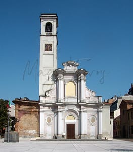
– Rich cultural and historical heritage to explore and enjoy.
– Opportunities for community integration and social connections.
– Reasonable air quality contributes to a healthy living environment.
– Accessible transportation options for convenient travel.
– Local amenities and services cater to daily needs.
– Peaceful atmosphere conducive to retirement living.
– Internet connectivity supports remote work and communication.
– Limited infrastructure can hinder access to some modern conveniences.
– Cultural activities may be less vibrant than in larger cities.
– Limited shopping options for those who enjoy retail therapy.
– Public transportation might not be very frequent or reliable.
– Language barrier may complicate social integration for newcomers.
– Internet speed may not support heavy usage for all.
– Local nightlife options may be too quiet for some.
– Seasonal tourism can lead to crowded areas at times.
– Limited educational facilities for those with school-aged children.
– Weather can be quite humid during the summer months.
Population
2500
Real Population (5km band)
23900
Births Per 100 Deaths
20.0
Population Data Source
ISTAT,2023
Estimated Unemployment Rate
Touristy Index
No Data
Income per capita (2023)
20500
Income rank in Italy (2023)
3885 out of 7901
Closest Airport
Name
Connectivity Score
Driving Time
2nd Closest Airport
Name
Connectivity Score
Driving Time
3rd Closest Airport
Name
Connectivity Score
Driving Time
Closest Rail
Name
Stazione di Canaro
Connectivity Score
4
Driving Time
5min(s)
Train service at Stazione di Canaro is provided primarily by Trenitalia, connecting it with various regional destinations. The rail line that stops here mainly services the regional routes. Key destinations accessible directly from Stazione di Canaro include Rovigo and Ferrara, with trains typically operating a few times per day. The frequency of departures is generally less than every hour, with some routes seeing a couple of trains throughout the day. Stazione di Canaro does not serve high-speed trains; it is focused on regional services only, providing an essential link for local commuters and travellers.
2nd Closest Rail
Name
Stazione di Polesella
Connectivity Score
6
Driving Time
10min(s)
Train service at Stazione di Polesella provides the following structured summary:
– **Rail lines that stop here**: Primarily regional train services.
– **Key destinations connected by direct trains**: Notable connections include Rovigo (approximately 13 minutes), Bologna (around 1 hour), Ferrara (about 20 minutes), Bologna Centrale, Padova (51 minutes), and San Pietro in Casale (42 minutes).
– **Train operators**: The services are mainly operated by Trenitalia.
– **Frequency of departures**: Trains to Rovigo have about 8 departures per day, Bologna has 11, Ferrara has 6, and Padova has 9, typically with frequencies spread throughout the day.
– **Train types**: The station predominantly hosts regional trains, with no high-speed services.
3rd Closest Rail
Name
Stazione di Occhiobello
Connectivity Score
6
Driving Time
11min(s)
Train service at Stazione di Occhiobello provides access to several rail lines operated by Trenitalia and Italo. Key destinations connected by direct trains include Venice, Bologna, Ferrara, La Spezia Centrale, and Milan. The frequency of departures varies by destination; trains to Venice run approximately 13 times daily, Bologna 11 times daily, Ferrara 6 times daily, La Spezia Centrale 12 times daily, and Milan 15 times daily. The service includes both high-speed trains and regional trains, making it a mix of train types.
Within 10km
Auto Repair Shops
48
Bars
36
Cafes
41
Cinemas
1
Dentists
14
Golf Courses
0
Gyms
10
Health Clinics
1
Hiking Trails
1
Historical Sites
33
Libraries
2
Museums
2
Parks
8
Pharmacies
8
Restaurants
22
Shopping Centres
4
Supermarkets
25
Spas
39
Beach
Name
Driving Distance
Water Quality Rating
Mountain Resort
Name
Belmonte - Treschè Conca
Driving Distance
100.0mins
Healthcare Score
74.0
Nearest Hospital Name
S. M. della Misericordia-P. So
Drive Time to Nearest Hospital
26 minutes
Hospitals and Clinics Within 10km
2
Local Public Healthcare Provider
AZIENDA ULSS N. 5 POLESANA
Healthcare Quality Description
In this area of Veneto, healthcare quality presents a mixed picture. While overall performance across all indicators is moderate within the national landscape, specific aspects reveal disparities. Hospital care falls short of national standards, and heart attack readmissions exceed average levels. Conversely, swift treatment for bone fractures and STEMI situations are commendable. Post-operative care efficiency is also notably high, yet minimally invasive breast cancer surgery significantly lags. Prospective residents should weigh these factors when considering local healthcare facilities.
Seismic Zone (risk of earthquakes)
Moderate to Low Earthquake Risk
Road Accidents Rate per 10k Inhabitants
8
Percentage of Population at Landslide Risk
Percentage of Population at Flood Risk
Car Insurance Price Index
93.139
Housing availability
Relatively Low
Property Prices per m²
First Quartile
144
Median
156
Third Quartile
508
Walkability Description
Somewhat Walkable
Avg Download Speed (Mbps)
158
Fast Download Speed (Mbps)
226
Slow Download Speed (Mbps)
113
Avg Schools Ranking (All Criteria)
Top 30%
Avg Schools Ranking (Standardised Tests)
Top 40%
Counts of School
| Town/City | Primary Schools | Kindergartens | Comprehensive Schools | Medium High Schools | Scientific High Schools | Technical Commercial Schools | Classical High Schools | Industrial Technical Schools | Higher Education Institutes |
|---|---|---|---|---|---|---|---|---|---|
| Canaro | 1 | 0 | N/A | 1 | N/A | N/A | N/A | N/A | N/A |
Precipitation
Somewhat Low (21st-30th percentile)
Sunshine
Below Average (31st-40th percentile)
Snowfall
Somewhat Low (21st-30th percentile)
Min Annual Temperature (°C)
0.4
Max Annual Temperature (°C)
31.2
Climate Description
Canaro, nestled in Italy, enjoys a temperate climate suited for those seeking stability and mild seasonal variations. The region benefits from consistent sun exposure throughout the year, offering bright and pleasant days ideal for both expatriates and retirees focused on outdoor leisure activities. Winters here are manageable, with rare instances of snowfall that add a scenic touch without causing significant disruptions. Summers are warm without the extremes found in other parts of the country, setting perfect conditions for an array of rural pursuits. Overall, Canaro offers a comfortable setting with its moderate warmth and light rainfall, ensuring a hospitable environment year-round.
Annual Temperature Chart (Min)
Climate data provided by Open Meteo, based on 2010–2022 averages.
| Town | Min Temp Jan | Min Temp Feb | Min Temp Mar | Min Temp Apr | Min Temp May | Min Temp Jun | Min Temp Jul | Min Temp Aug | Min Temp Sep | Min Temp Oct | Min Temp Nov | Min Temp Dec |
|---|---|---|---|---|---|---|---|---|---|---|---|---|
| Canaro | 0,40 | 1,50 | 4,90 | 8,90 | 12,60 | 17,80 | 20,60 | 20,10 | 16,10 | 11,80 | 7,30 | 1,40 |
Annual Temperature Chart (Max)
Climate data provided by Open Meteo, based on 2010–2022 averages.
| Town | Max Temp Jan | Max Temp Feb | Max Temp Mar | Max Temp Apr | Max Temp May | Max Temp Jun | Max Temp Jul | Max Temp Aug | Max Temp Sep | Max Temp Oct | Max Temp Nov | Max Temp Dec |
|---|---|---|---|---|---|---|---|---|---|---|---|---|
| Canaro | 8,2 | 9,80 | 15,00 | 19,30 | 22,80 | 28,20 | 31,20 | 30,90 | 25,60 | 20,00 | 14,30 | 8,80 |
Sunny Days By Month
Climate data provided by Open Meteo, based on 2010–2022 averages.
| Town | Sunny Days % Jan | Sunny Days % Feb | Sunny Days % Mar | Sunny Days % Apr | Sunny Days % May | Sunny Days % Jun | Sunny Days % Jul | Sunny Days % Aug | Sunny Days % Sep | Sunny Days % Oct | Sunny Days % Nov | Sunny Days % Dec |
|---|---|---|---|---|---|---|---|---|---|---|---|---|
| Canaro | 40 | 38 | 55 | 54 | 60 | 66 | 69 | 69 | 57 | 39 | 30 | 38 |
Classifications
PM10
Fair
PM2.5
Fair
NO2
Good
SO2
Good
O₃
Fair
Air Quality Rating
82
Air Quality Description
Canaro, Italy boasts an air quality profile that is conducive to both short-term visitors and long-term residents. The predominant particulate matter sizes, PM10 and PM2.5, maintain levels that are generally considered fair, suggesting an atmosphere that supports easy breathing and outdoor activities without significant concern. Contributing to this are the nitrogen dioxide and sulphur dioxide levels, both classified as good, which indicate relatively low industrial pollutants and combustion by-products. Ozone in Canaro also retains a fair classification, providing an environment where the influence of this gas is typical of moderate urban settings. Collectively, these factors afford residents a comfortable and health-conscious living condition.
Canaro, Italy boasts an air quality profile that is conducive to both short-term visitors and long-term residents. The predominant particulate matter sizes, PM10 and PM2.5, maintain levels that are generally considered fair, suggesting an atmosphere that supports easy breathing and outdoor activities without significant concern. Contributing to this are the nitrogen dioxide and sulphur dioxide levels, both classified as good, which indicate relatively low industrial pollutants and combustion by-products. Ozone in Canaro also retains a fair classification, providing an environment where the influence of this gas is typical of moderate urban settings. Collectively, these factors afford residents a comfortable and health-conscious living condition.
Getting There
Getting Around
Local Cuisine
Canaro, situated in the Veneto region, boasts a culinary scene characterized by its rich traditional dishes and a selection of dining options. Traditional cuisine features notable dishes such as Bigoli—Venetian pasta, Risotto di gò made from black goby, and Baccalà alla vicentina, which features stoccafisso served with polenta. Other remarkable dishes include Risotto all’amarone, Brasato all’amarone, and the horsemeat stew Pastissada de caval, all highlighting the region’s emphasis on quality ingredients like Amarone wine and Radicchio Rosso di Treviso. In terms of dining establishments, while Canaro may not have specific international influences prominently highlighted, the broader Veneto region is known for its diverse cuisine, which can include options reflecting Mediterranean flavors. Currently, there are no Michelin-starred establishments specifically cited in Canaro.
Shopping Overview
Neighborhoods
Green Areas and Parks
✅ Pros
– High-quality healthcare services available in the region.
– Low unemployment rate providing economic stability.
– Pleasant climate ideal for outdoor activities year-round.
– Rich cultural and historical heritage to explore and enjoy.
– Opportunities for community integration and social connections.
– Reasonable air quality contributes to a healthy living environment.
– Accessible transportation options for convenient travel.
– Local amenities and services cater to daily needs.
– Peaceful atmosphere conducive to retirement living.
– Internet connectivity supports remote work and communication.
❌ Cons
– Limited infrastructure can hinder access to some modern conveniences.
– Cultural activities may be less vibrant than in larger cities.
– Limited shopping options for those who enjoy retail therapy.
– Public transportation might not be very frequent or reliable.
– Language barrier may complicate social integration for newcomers.
– Internet speed may not support heavy usage for all.
– Local nightlife options may be too quiet for some.
– Seasonal tourism can lead to crowded areas at times.
– Limited educational facilities for those with school-aged children.
– Weather can be quite humid during the summer months.
FAQs
No posts found for the town.
Our innovative AI assistant is eager to help. Try it out for free here:

