
Elevation
[?]
Elevation of a city refers to the height above sea level at which the city is located, measured in meters.
329
Population
[?]
This is a town's official population, measured each year by the national statistics authority.
66200
Real Population (5km)
[?]
Our "Real Population" metric reflects more accurately a town's real size by including inhabitants in the immediate vicinity of the town's official borders.
128300
Air Quality Rating
[?]
Based on PM10, PM2.5, NO2, SO2, and ozone levels. Higher scores indicate cleaner air.
90
Region
Lazio
Walkability
Walker’s Paradise
Housing availability
[?]
Based on total number of properties (sale and rent) classifies housing availability into five categories: low, relativel ylow, medium, relatively high and high.
High
Avg Download Speed (Mbps) / Avg Upload Speed (Mbps)
308
/ 183
Climate Description
Moderate warmth, mild winters, sunny summers, and balanced rainfall support a tranquil lifestyle.
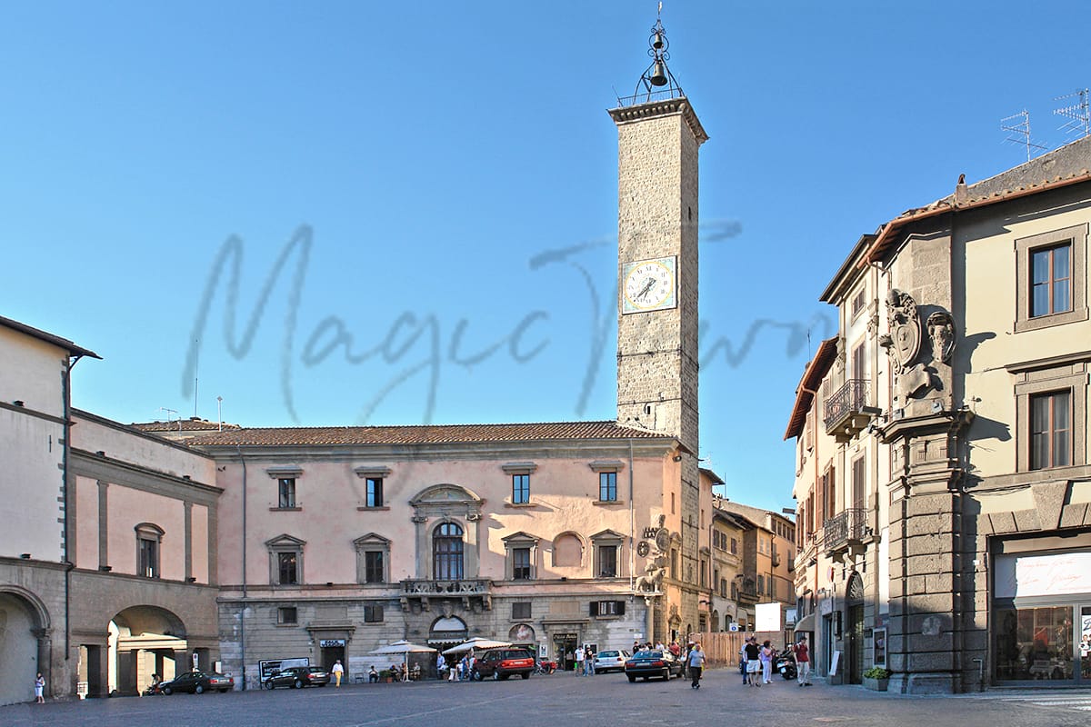
Viterbo
Lazio
Historic town with medieval architecture, cultural events, natural attractions, and affordable living costs.
Quality of Life Score
[?]Factors in air quality, amenities, walkability, population, and environmental risks. Higher scores suggest better living conditions.
73
Quality of Infrastructure
[?]Measures internet speed, healthcare access, airports, rail, and walkability. Higher scores mean better connectivity and essential services.
64
Quality of Economy
[?]Based on income, property prices, job availability, and population density. Higher scores indicate stronger economic conditions.
80
Viterbo Demographics
Population
[?]
This is a town's official population, measured each year by the national statistics authority.
66200
Real Population (5km band)
[?]
Our "Real Population" metric reflects more accurately a town's real size by including inhabitants in the immediate vicinity of the town's official borders.
128300
Births Per 100 Deaths
50.0
Population Data Source
ISTAT,2023
Estimated Unemployment Rate
Touristy Index
[?]
Calculation of tourist density index for the city, comparing its total tourist number to the overall average tourist number of the region
relative to its own population.The index indicates how a location’s tourist density compares to the average, with values above
100 representing higher-than-average density and values below 100 representing lower-than-average density.
Some Tourism
Income per capita (2023)
[?]
This is an estimation of average income per resident for this town, based on 2023 data from the Italian Ministry of Finance.
22500
Income rank in Italy (2023)
[?]
This is a ranking of the town's average income per resident, against the full list of townships in Italy.
2165 out of 7901
Infrastructure and Connectivity
Create an account to explore more
This content is for Members only | Already a Member? Sign in
Infrastructure & Amenities
Create an account to explore more
This content is for Members only | Already a Member? Sign in
Healthcare
Create an account to explore more
This content is for Members only | Already a Member? Sign in
Housing & Property Market
Create an account to explore more
This content is for Members only | Already a Member? Sign in
Connectivity & Digital Access
Create an account to explore more
This content is for Members only | Already a Member? Sign in
Education
Create an account to explore more
This content is for Members only | Already a Member? Sign in
Climate & Weather
Create an account to explore more
This content is for Members only | Already a Member? Sign in
Precipitation
[?] Based on daily climate data for precipitation from OPEN-METEO this parameter indicates how a city's annual precipitation compares to others in terms of percentage, with values ranging from 0 (lowest) to 1 (highest). For example, a percentile rank of 0.75 means the city's total precipitation is higher than 75% of other cities.
Somewhat Low (21st-30th percentile)
Sunshine
High (71st-80th percentile)
Snowfall
Somewhat Low (21st-30th percentile)
Min Annual Temperature (°C)
[?] This parameter represents the monthly average of daily minimum temperatures for January, based on data from OPEN-METEO.
2.3
Max Annual Temperature (°C)
[?] This parameter represents the monthly average of daily minimum temperatures for January, based on data from OPEN-METEO.
30.5
Climate Description
Viterbo enjoys a climate characterized by moderate warmth and adequate sunlight, making it an ideal destination for retirees and expats seeking comfort and natural beauty year-round. The winters are typically mild with ephemeral snowfall, signaling brief but picturesque winterscapes that are as fleeting as they are charming. Summers in Viterbo are often bathed in abundant sunshine, ensuring that days can be spent enjoying the lush landscapes or historic architecture under clear skies. Rainfall is evenly distributed throughout the year, maintaining a balance that supports the verdant surroundings without overwhelming residents with excessive wet periods. This harmonious climate supports an active yet tranquil lifestyle for those enchanted by Viterbo’s magic.
Annual Temperature Chart (Min)
Error
There was a problem with your SQL connection - Please contact the administrator
There was a problem with your SQL connection - Please contact the administrator
Annual Temperature Chart (Max)
Error
There was a problem with your SQL connection - Please contact the administrator
There was a problem with your SQL connection - Please contact the administrator
Sunny Days By Month
Error
There was a problem with your SQL connection - Please contact the administrator
There was a problem with your SQL connection - Please contact the administrator
Environmental & Air Quality
Create an account to explore more
This content is for Members only | Already a Member? Sign in
Classifications
PM10
[?]
PM10 levels indicate Good air quality at 0–20 µg/m³, Fair at 20–40 µg/m³, Moderate at 40–50 µg/m³, Poor at 50–100 µg/m³, Very Poor at 100–150 µg/m³, and Extremely Poor at 150–1200 µg/m³.
Good
PM2.5
[?]
PM2.5 is Good if PM2.5 levels are between 0–10 µg/m³, Fair between 10–20 µg/m³, Moderate between 20–25 µg/m³, Poor between 25–50 µg/m³, Very Poor between 50–75 µg/m³, and Extremely Poor between 75–800 µg/m³.
Good
NO2
[?]
NO₂ levels are considered Good at 0–40 µg/m³, Fair at 40–90 µg/m³, Moderate at 90–120 µg/m³, Poor at 120–230 µg/m³, Very Poor at 230–340 µg/m³, and Extremely Poor at 340–1000 µg/m³.
Good
SO2
[?]
SO₂ levels indicate Good air quality at 0–100 µg/m³, Fair at 100–200 µg/m³, Moderate at 200–350 µg/m³, Poor at 350–500 µg/m³, Very Poor at 500–750 µg/m³, and Extremely Poor at 750–1250 µg/m³.
Good
O₃
[?]
For O₃, the air is Good at 0–50 µg/m³, Fair at 50–100 µg/m³, Moderate at 100–130 µg/m³, Poor at 130–240 µg/m³, Very Poor at 240–380 µg/m³, and Extremely Poor at 380–800 µg/m³.
Fair
Air Quality Rating
[?]
Based on PM10, PM2.5, NO2, SO2, and ozone levels. Higher scores indicate cleaner air.
90
Air Quality Description
In Viterbo, Italy, the air quality generally presents a refreshing prospect for residents and visitors alike. The locality demonstrates commendable levels of particulate matter and gaseous pollutants, which are well within comfortable ranges. This results in air that is largely pleasant and comfortable to breathe. There’s a consistency in the air quality, with particulates and gas measurements indicating healthy living conditions. However, attention might be drawn to the ozone levels which, while not alarming, are moderate and could affect individuals sensitive to such conditions. Overall, Viterbo offers an inviting atmosphere conducive to those seeking a serene environment.
In Viterbo, Italy, the air quality generally presents a refreshing prospect for residents and visitors alike. The locality demonstrates commendable levels of particulate matter and gaseous pollutants, which are well within comfortable ranges. This results in air that is largely pleasant and comfortable to breathe. There’s a consistency in the air quality, with particulates and gas measurements indicating healthy living conditions. However, attention might be drawn to the ozone levels which, while not alarming, are moderate and could affect individuals sensitive to such conditions. Overall, Viterbo offers an inviting atmosphere conducive to those seeking a serene environment.
Town Descriptions
Create an account to explore more
This content is for Members only | Already a Member? Sign in
Getting There
Viterbo is accessible primarily via road, with connections to the A1 motorway facilitating travel to Rome and Florence. The nearest airports are Ciampino and Fiumicino, both located approximately an hour away. Train services are available from two nearby stations, offering limited connectivity options.
Getting Around
Local Cuisine
Viterbo boasts a culinary scene characterized by traditional dishes that reflect its rich agricultural heritage and local ingredients. Signature dishes include ‘Acquacotta’, a rustic soup with stale bread, wild greens, vegetables, and ‘Pignattaccia’, a hearty beef and vegetable stew. The local pasta, ‘Lombrichelli’, is often served with various sauces and complements a range of fresh fish and vegetable dishes sourced from the nearby Lake Bolsena. The gastronomy emphasizes robust flavors, with seasonal offerings like chickpea and chestnut soup during the holidays. International dining options are available but are complemented by the area’s focus on traditional Italian cuisine and its reliance on locally sourced ingredients. As for Michelin-starred establishments, Viterbo has notable contenders, although specific recognition may vary over time.
Shopping Overview
Shopping options in the area include supermarkets, open-air markets, and artisanal boutiques. Major supermarkets provide an extensive range of food products and household necessities. Weekly markets enhance the shopping experience, with fresh produce and local products. Streets leading from a central square feature local and high-end boutiques, while artisan shops specialise in ceramics and handcrafted items. This multifaceted retail landscape caters to diverse needs, combining convenience with unique shopping experiences.
Neighborhoods
Green Areas and Parks
Viterbo offers various outdoor activities and green spaces suitable for expats and retirees. Notable trails include the Via Francigena, a historic pilgrimage route with segments like the Viterbo to Vetralla trail. Monte Cimino via Valle Gelata provides forested paths through the Cimini Mountains. The Lake Vico area is ideal for nature excursions and tours, blending aquatic scenery with mountainous terrain. Outdoor enthusiasts can also explore cycling on the Via Francigena Cycling Route from Viterbo to Sutri. These locations are well-mapped and accessible, ensuring a breadth of hiking and cycling opportunities.
✅ Pros
– Rich historical and cultural heritage to explore and enjoy.
– Good air quality promotes a healthy living environment.
– Affordable cost of living compared to larger Italian cities.
– Strong community feel with integration opportunities for newcomers.
– Access to quality healthcare services in the region.
– Efficient local transportation connects to nearby cities easily.
– Mild climate with pleasant seasons for year-round activities.
– Moderate unemployment rate supports local economic stability.
– Scenic landscapes and natural beauty enhance outdoor lifestyle.
– Active tourism offers cultural events and local experiences.
❌ Cons
– Limited nightlife options for after-hours entertainment seekers.
– Healthcare services could improve despite being generally accessible.
– Internet connectivity may lag behind larger urban centers.
– Language barrier may hinder some integration efforts for newcomers.
– Limited shopping options compared to larger cities might frustrate.
– Public transport schedules can be infrequent during off-peak hours.
– Some areas may lack modern amenities and infrastructure updates.
– Tourist influx can disrupt local peace during peak seasons.
– Limited job opportunities for those seeking employment options.
– Weather can be quite humid, especially in summer months.
FAQs
Summary
Viterbo, located about 90 minutes north of Rome, is a historic town renowned for its medieval architecture and rich cultural landscape. The well-preserved historical center features cobbled streets, ancient stone towers, and significant historical sites, making it an attractive spot for retirees seeking tranquility combined with an active community life. Viterbo hosts various cultural events throughout the year, enhancing its appeal to expats with a diverse social calendar. The proximity to natural attractions, including the hot springs of nearby lakes, offers residents unique leisure opportunities.
While Viterbo offers a relatively affordable cost of living, it may pose challenges for those accustomed to urban conveniences. Public transport options are variable, which can impact mobility. Nevertheless, the town’s excellent healthcare facilities and strong community ties create a welcoming atmosphere for newcomers. Expats and retirees will find themselves immersed in a lifestyle rich in history and local traditions.
✅ Pros
– Rich historical and cultural heritage to explore and enjoy.
– Good air quality promotes a healthy living environment.
– Affordable cost of living compared to larger Italian cities.
– Strong community feel with integration opportunities for newcomers.
– Access to quality healthcare services in the region.
– Efficient local transportation connects to nearby cities easily.
– Mild climate with pleasant seasons for year-round activities.
– Moderate unemployment rate supports local economic stability.
– Scenic landscapes and natural beauty enhance outdoor lifestyle.
– Active tourism offers cultural events and local experiences.
❌ Cons
– Limited nightlife options for after-hours entertainment seekers.
– Healthcare services could improve despite being generally accessible.
– Internet connectivity may lag behind larger urban centers.
– Language barrier may hinder some integration efforts for newcomers.
– Limited shopping options compared to larger cities might frustrate.
– Public transport schedules can be infrequent during off-peak hours.
– Some areas may lack modern amenities and infrastructure updates.
– Tourist influx can disrupt local peace during peak seasons.
– Limited job opportunities for those seeking employment options.
– Weather can be quite humid, especially in summer months.
Related Posts
No posts found for the town.
More questions about Viterbo ? Ask Magic AI.
Our innovative AI assistant is eager to help. Try it out here: