

Elevation
[?]
Elevation of a city refers to the height above sea level at which the city is located, measured in meters.
3
Population
[?]
This is a town's official population, measured each year by the national statistics authority.
251900
Real Population (5km)
[?]
Our "Real Population" metric reflects more accurately a town's real size by including inhabitants in the immediate vicinity of the town's official borders.
490200
Air Quality Rating
[?]
Based on PM10, PM2.5, NO2, SO2, and ozone levels. Higher scores indicate cleaner air.
88
Region
Veneto
Walkability
Very Walkable
Housing availability
[?]
Based on total number of properties (sale and rent) classifies housing availability into five categories: low, relativel ylow, medium, relatively high and high.
High
Avg Download Speed (Mbps) / Avg Upload Speed (Mbps)
296
/ 177
Climate Description
Ample sunlight and modest rainfall shape a climate with gentle winters and tepid summers.
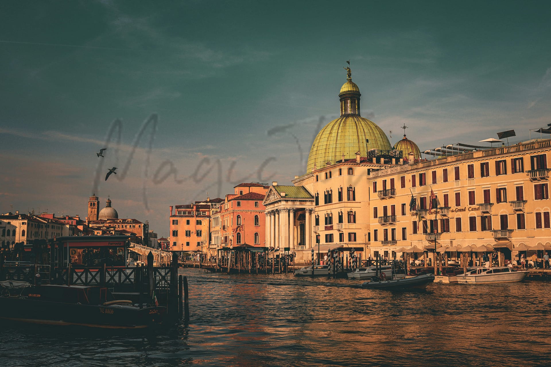
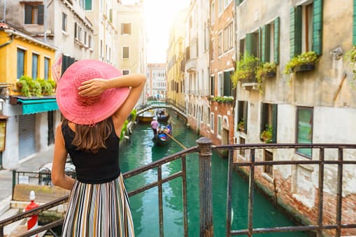
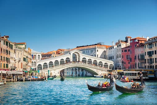
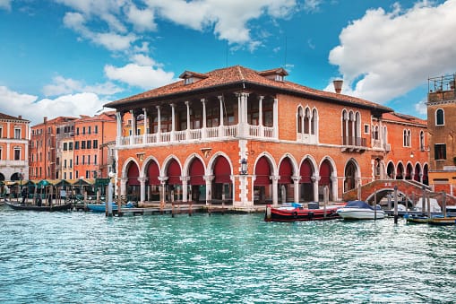
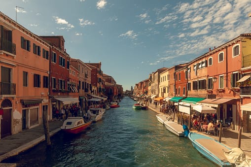
Venice
Veneto
A car-free city of islands linked by bridges and famed for its Gothic and Byzantine architecture, facing challenges like flooding and overtourism.
Quality of Life Score
[?]Factors in air quality, amenities, walkability, population, and environmental risks. Higher scores suggest better living conditions.
84
Quality of Infrastructure
[?]Measures internet speed, healthcare access, airports, rail, and walkability. Higher scores mean better connectivity and essential services.
100
Quality of Economy
[?]Based on income, property prices, job availability, and population density. Higher scores indicate stronger economic conditions.
81
Venezia Demographics
Population
[?]
This is a town's official population, measured each year by the national statistics authority.
251900
Real Population (5km band)
[?]
Our "Real Population" metric reflects more accurately a town's real size by including inhabitants in the immediate vicinity of the town's official borders.
490200
Births Per 100 Deaths
50.0
Population Data Source
ISTAT,2023
Estimated Unemployment Rate
Touristy Index
[?]
Calculation of tourist density index for the city, comparing its total tourist number to the overall average tourist number of the region
relative to its own population.The index indicates how a location’s tourist density compares to the average, with values above
100 representing higher-than-average density and values below 100 representing lower-than-average density.
Highly Touristic
Income per capita (2023)
[?]
This is an estimation of average income per resident for this town, based on 2023 data from the Italian Ministry of Finance.
23700
Income rank in Italy (2023)
[?]
This is a ranking of the town's average income per resident, against the full list of townships in Italy.
1154 out of 7901
Infrastructure and Connectivity
Create an account to explore more
This content is for Members only | Already a Member? Sign in
Infrastructure & Amenities
Create an account to explore more
This content is for Members only | Already a Member? Sign in
Within 10km
Auto Repair Shops
26
Bars
8
Cafes
5
Cinemas
11
Dentists
25
Golf Courses
1
Gyms
74
Health Clinics
17
Hiking Trails
9
Historical Sites
198
Libraries
13
Museums
35
Parks
5
Pharmacies
29
Restaurants
123
Shopping Centres
7
Supermarkets
68
Spas
26
Beach
Name
Venezia Lido Ospedale Al Mare
Driving Distance
42mins
Water Quality Rating
1 - Excellent
Mountain Resort
Name
Alpe del Nevegal
Driving Distance
74.0mins
Healthcare
Create an account to explore more
This content is for Members only | Already a Member? Sign in
Healthcare Score
[?]
Evaluates hospital/clinic access, drive time to care, and regional quality rankings. Higher scores mean better healthcare.
99.0
Nearest Hospital Name
Ospedale dell'Angelo-P. Soccor
Drive Time to Nearest Hospital
20 minutes
Hospitals and Clinics Within 10km
1
Healthcare Quality Description
In this area of Veneto, the local health authority demonstrates above-average efficiency and quality in hospital care and timely treatment of bone fractures. It excels in reducing post-operative stays and rapid intervention for heart attacks. However, there are challenges in areas such as minimally invasive breast cancer surgeries and readmissions after heart failure. Post-heart attack readmissions also indicate room for improvement. The overall healthcare quality remains strong within the national context, appealing to expats and retirees seeking access to competent medical services.
Local Public Healthcare Provider
AZIENDA ULSS N. 3 SERENISSIMA
Safety
Seismic Zone (risk of earthquakes)
[?]
Official seismic zones classify areas based on earthquake risk.
Moderate to Low Earthquake Risk
Road Accidents Rate per 10k Inhabitants
[?]
Calculation of road accidents per 10,000 people based on the number of deaths and injuries registered in roads for year 2022 for the city.
36
Percentage of Population at Landslide Risk
[?] Percentage of the population in high or moderate landslide risk zones. Higher values indicate greater environmental risk.
Percentage of Population at Flood Risk
[?] Percentage of the population in high or moderate flood risk zones. Higher values indicate greater environmental risk.
Car Insurance Price Index
[?]
The car insurance price index is a measure of how a city's average car insurance premium compares to the national average,
expressed as a percentage. A value of 100 indicates that the city's premium is equal to the national average.
Values above 100 show higher premiums, while values below 100 show lower premiums.
106.3
Housing & Property Market
Create an account to explore more
This content is for Members only | Already a Member? Sign in
Housing availability
[?]
Based on total number of properties (sale and rent) classifies housing availability into five categories: low, relativel ylow, medium, relatively high and high.
High
Property Prices per m²
[?]
Calculation of property sale prices per square meter for apartments, houses in the city.
Median (50th Percentile): The midpoint price, where half the values are above and half below.
First Quartile (25th Percentile): The price below which 25% of properties fall.
Third Quartile (75th Percentile): The price below which 75% of properties fall.
First Quartile
2088
Median
3700
Third Quartile
5253
Connectivity & Digital Access
Create an account to explore more
This content is for Members only | Already a Member? Sign in
Walkability Description
Very Walkable
Avg Download Speed (Mbps)
296
Fast Download Speed (Mbps)
370
Slow Download Speed (Mbps)
227
Education
Create an account to explore more
This content is for Members only | Already a Member? Sign in
Avg Schools Ranking (All Criteria)
[?]
This ranking shows in which decile the town's public schools fall while looking at all the indicators provided by the Italian Ministry of Education for the most recent available year. Note that figures are only provided by the ministry at the school catchment area level, and therefore several schools may be grouped together.
Bottom 30%
Avg Schools Ranking (Standardised Tests)
[?]
This ranking shows in which decile the town's public schools fall while looking the students' results in national standardised tests. The data is provided by the Italian Ministry of Education for the most recent available year.
Bottom 30%
Counts of School
Error
There was a problem with your SQL connection - Please contact the administrator
There was a problem with your SQL connection - Please contact the administrator
Climate & Weather
Create an account to explore more
This content is for Members only | Already a Member? Sign in
Precipitation
[?] Based on daily climate data for precipitation from OPEN-METEO this parameter indicates how a city's annual precipitation compares to others in terms of percentage, with values ranging from 0 (lowest) to 1 (highest). For example, a percentile rank of 0.75 means the city's total precipitation is higher than 75% of other cities.
Average (41st-50th percentile)
Sunshine
Above Average (51st-60th percentile)
Snowfall
Somewhat Low (21st-30th percentile)
Min Annual Temperature (°C)
[?] This parameter represents the monthly average of daily minimum temperatures for January, based on data from OPEN-METEO.
1.2
Max Annual Temperature (°C)
[?] This parameter represents the monthly average of daily minimum temperatures for January, based on data from OPEN-METEO.
29.9
Climate Description
Venezia has a mild climate with comfortable winters and warm summers. The city enjoys many sunny days, which is perfect for outdoor activities. Winters can bring light snow, adding a special charm to the canals and buildings. Summers are ideal for exploring the city's art and architecture. Rainfall is spread out throughout the year.
Annual Temperature Chart (Min)
Error
There was a problem with your SQL connection - Please contact the administrator
There was a problem with your SQL connection - Please contact the administrator
Annual Temperature Chart (Max)
Error
There was a problem with your SQL connection - Please contact the administrator
There was a problem with your SQL connection - Please contact the administrator
Sunny Days By Month
Error
There was a problem with your SQL connection - Please contact the administrator
There was a problem with your SQL connection - Please contact the administrator
Environmental & Air Quality
Create an account to explore more
This content is for Members only | Already a Member? Sign in
Classifications
PM10
[?]
PM10 levels indicate Good air quality at 0–20 µg/m³, Fair at 20–40 µg/m³, Moderate at 40–50 µg/m³, Poor at 50–100 µg/m³, Very Poor at 100–150 µg/m³, and Extremely Poor at 150–1200 µg/m³.
Fair
PM2.5
[?]
PM2.5 is Good if PM2.5 levels are between 0–10 µg/m³, Fair between 10–20 µg/m³, Moderate between 20–25 µg/m³, Poor between 25–50 µg/m³, Very Poor between 50–75 µg/m³, and Extremely Poor between 75–800 µg/m³.
Fair
NO2
[?]
NO₂ levels are considered Good at 0–40 µg/m³, Fair at 40–90 µg/m³, Moderate at 90–120 µg/m³, Poor at 120–230 µg/m³, Very Poor at 230–340 µg/m³, and Extremely Poor at 340–1000 µg/m³.
Good
SO2
[?]
SO₂ levels indicate Good air quality at 0–100 µg/m³, Fair at 100–200 µg/m³, Moderate at 200–350 µg/m³, Poor at 350–500 µg/m³, Very Poor at 500–750 µg/m³, and Extremely Poor at 750–1250 µg/m³.
Good
O₃
[?]
For O₃, the air is Good at 0–50 µg/m³, Fair at 50–100 µg/m³, Moderate at 100–130 µg/m³, Poor at 130–240 µg/m³, Very Poor at 240–380 µg/m³, and Extremely Poor at 380–800 µg/m³.
Fair
Air Quality Rating
[?]
Based on PM10, PM2.5, NO2, SO2, and ozone levels. Higher scores indicate cleaner air.
88
Air Quality Description
In Venezia, the atmospheric conditions reflect a moderate interfusion of pollutants. According to metrics, particulate matter and ozone concentrations sustain a level that is generally perceived as fair—neither acutely pristine nor significantly degrading. Notably, nitrogen and sulfur dioxide levels maintain commendable lower concentrations, indicating efficient management or lesser emission of these gases. For those contemplating residency here, the air quality presents no severe deterrent, supporting a conducive environment for everyday activities and leisure strolling along its historic canals. Overall, Venezia’s air profile balances between urban demands and maintaining acceptable air purity standards.
In Venezia, the atmospheric conditions reflect a moderate interfusion of pollutants. According to metrics, particulate matter and ozone concentrations sustain a level that is generally perceived as fair—neither acutely pristine nor significantly degrading. Notably, nitrogen and sulfur dioxide levels maintain commendable lower concentrations, indicating efficient management or lesser emission of these gases. For those contemplating residency here, the air quality presents no severe deterrent, supporting a conducive environment for everyday activities and leisure strolling along its historic canals. Overall, Venezia’s air profile balances between urban demands and maintaining acceptable air purity standards.
Town Descriptions
Create an account to explore more
This content is for Members only | Already a Member? Sign in
Getting There
Venezia offers strong connectivity, accessible via Marco Polo Airport and Antonio Canova Airport. The town is also served by major road links, including the A4 motorway, facilitating travel to regional cities. Train services further enhance its transport options, contributing to its excellent infrastructure rating.
Getting Around
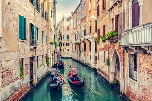
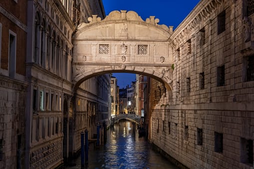
Exploring the city is best done by water bus or gondola, with comprehensive vaporetto services linking the islands. Navigating the intricate network of canals is efficient and scenic, while walking offers intimate access to Venezia’s hidden alleys and bridges, though it can be labyrinthine for new visitors.
Local Cuisine
The culinary scene in Venezia, part of the Veneto region, is rich in traditional dishes such as Sarde in saor, Scampi alla veneziana, Bigoli in salsa, Risi e bisi, and Bacalà mantecato, showcasing the region’s seafood-based heritage. The variety of dining options is considerable, encompassing local venues offering authentic Venetian flavors and international cuisine spots catering to diverse palates. Notably, Venezia is home to several Michelin-starred restaurants, including Ristorante Glam, Ristorante Quadri, Il Ridotto, and Osteria Da Fiore, which represent the pinnacle of fine dining in the area. The presence of international restaurants has increased, featuring cuisines from various cultures and providing options for those seeking culinary diversity alongside traditional Venetian fare.
Shopping Overview
The shopping landscape features a blend of low-end trinket stores and mid-range to upscale boutiques concentrated along prominent pedestrian streets. Notable categories include local crafts, such as glassware and lace products, alongside traditional masks. Specialty food shops provide regional delicacies, while a variety of bookshops cater to literary interests. Open-air markets further enhance the shopping experience, presenting fresh produce and artisanal goods, thus catering to diverse consumer needs.
Neighborhoods
– **Cannaregio**: Known for its historic Jewish Ghetto and a largely residential feel, offering a glimpse into local Venetian life minus heavy tourist traffic.
– **Santa Croce**: Partial hub of Venice’s transport with the Piazzale Roma bridge, maintaining a balance between residential and tourist interests.
– **San Polo**: Smallest sestiere, home to the famous Rialto Market and significant for its vibrant past as a centre of trade.
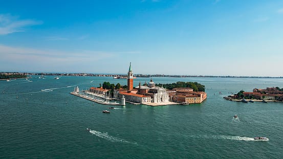
– **Dorsoduro**: Houses several notable art museums, including the Peggy Guggenheim Collection, marking it as the cultural heart of the city.
– **Castello**: The largest district, featuring both the bustling Via Garibaldi and serene landscapes around San Pietro di Castello.
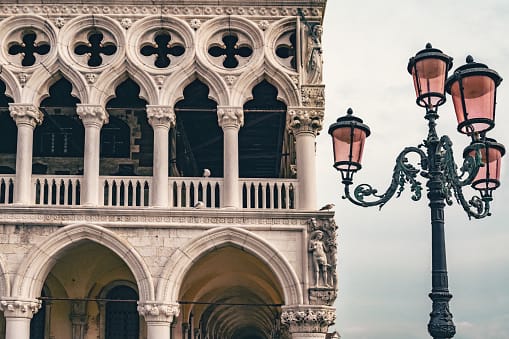
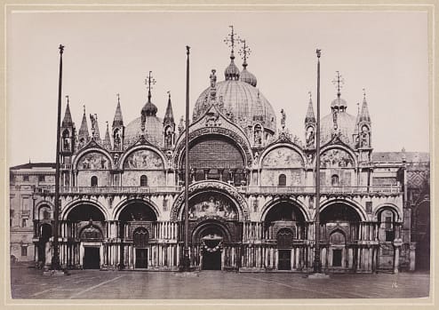
– **San Marco**: The political and religious nucleus of the city, famed for landmarks like St. Mark’s Basilica and the Doge’s Palace.
Green Areas and Parks
Venice offers various outdoor activities and green spaces fitting for expats and retirees. Giardini della Biennale provides a significant green area and hosts the renowned art exhibition, La Biennale di Venezia. Giardini Papadopoli, located near Santa Lucia train station, includes a playground suited for families. Parco Savorgnan, also near Santa Lucia, is discreetly situated and features a children’s playground. The Isola San Giorgio offers expansive views and a garden maze. For less structured green spaces, Campo Santa Margherita and Campo San Vio serve as open squares ideal for leisurely visits and social gatherings.
✅ Pros
– Excellent healthcare quality with high availability of services.
– Scenic canals and rich cultural history enhance daily life.
– Efficient transportation system facilitates easy movement around town.
– Low unemployment rate offers economic stability and job opportunities.
– Vibrant expat community encourages integration and social connections.
– Mild climate with pleasant weather year-round for outdoor activities.
– Top-notch infrastructure supports a comfortable living environment.
– Access to high-quality educational facilities for all ages.
– Good air quality promotes a healthier lifestyle.
– Abundant tourist attractions provide diverse recreational options.
❌ Cons
– Constant influx of tourists can disrupt daily life.
– Housing costs are high due to tourist demand.
– Limited space for parking and driving vehicles.
– Canals may smell unpleasant during hot weather.
– Flooding can be an occasional nuisance for residents.
– Internet connectivity may not match major urban areas.
– Some residents find the pace of life too slow.
– Limited shopping options outside tourist areas.
– Language barrier may hinder integration for some expats.
– Local bureaucracy can be frustratingly complex and slow.
FAQs
Summary
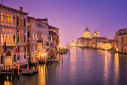
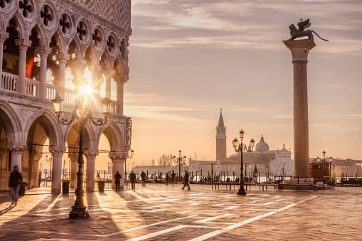
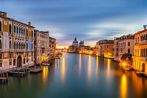
Venice, known in Italian as Venezia, is a unique city situated in northeastern Italy that has existed since the 5th century AD when it emerged from a collection of islands in the Venetian Lagoon. Famous for its network of canals, the city has over 150 waterways and 400 bridges connecting its islands. As a car-free urban area, Venice relies on boats for transportation. This offers both locals and visitors an extraordinary urban experience. The architecture in Venice exhibits Byzantine and Gothic influences, with landmarks like the Basilica di San Marco underlining the city’s story. Despite issues like flooding and over-tourism, Venice remains a major centre for international tourism.
✅ Pros
– Excellent healthcare quality with high availability of services.
– Scenic canals and rich cultural history enhance daily life.
– Efficient transportation system facilitates easy movement around town.
– Low unemployment rate offers economic stability and job opportunities.
– Vibrant expat community encourages integration and social connections.
– Mild climate with pleasant weather year-round for outdoor activities.
– Top-notch infrastructure supports a comfortable living environment.
– Access to high-quality educational facilities for all ages.
– Good air quality promotes a healthier lifestyle.
– Abundant tourist attractions provide diverse recreational options.
❌ Cons
– Constant influx of tourists can disrupt daily life.
– Housing costs are high due to tourist demand.
– Limited space for parking and driving vehicles.
– Canals may smell unpleasant during hot weather.
– Flooding can be an occasional nuisance for residents.
– Internet connectivity may not match major urban areas.
– Some residents find the pace of life too slow.
– Limited shopping options outside tourist areas.
– Language barrier may hinder integration for some expats.
– Local bureaucracy can be frustratingly complex and slow.
Related Posts
More questions about Venezia ? Ask Magic AI.
Our innovative AI assistant is eager to help. Try it out here: