
Elevation
[?]
Elevation of a city refers to the height above sea level at which the city is located, measured in meters.
252
Population
[?]
This is a town's official population, measured each year by the national statistics authority.
15700
Real Population (5km)
[?]
Our "Real Population" metric reflects more accurately a town's real size by including inhabitants in the immediate vicinity of the town's official borders.
94500
Air Quality Rating
[?]
Based on PM10, PM2.5, NO2, SO2, and ozone levels. Higher scores indicate cleaner air.
92
Region
Lazio
Walkability
Very Walkable
Housing availability
[?]
Based on total number of properties (sale and rent) classifies housing availability into five categories: low, relativel ylow, medium, relatively high and high.
Low
Avg Download Speed (Mbps) / Avg Upload Speed (Mbps)
146
/ 67
Climate Description
Moderate climate with mild winters, warm summers, and ample sunshine year-round.
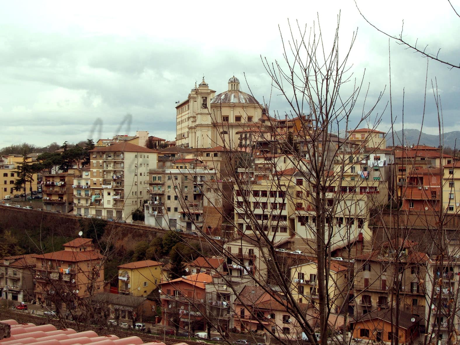
Valmontone
Lazio
Small town in Lazio with Renaissance architecture, local markets, festivals, and proximity to an amusement park.
Quality of Life Score
[?]Factors in air quality, amenities, walkability, population, and environmental risks. Higher scores suggest better living conditions.
82
Quality of Infrastructure
[?]Measures internet speed, healthcare access, airports, rail, and walkability. Higher scores mean better connectivity and essential services.
65
Quality of Economy
[?]Based on income, property prices, job availability, and population density. Higher scores indicate stronger economic conditions.
66
Valmontone Demographics
Population
[?]
This is a town's official population, measured each year by the national statistics authority.
15700
Real Population (5km band)
[?]
Our "Real Population" metric reflects more accurately a town's real size by including inhabitants in the immediate vicinity of the town's official borders.
94500
Births Per 100 Deaths
80.0
Population Data Source
ISTAT,2023
Estimated Unemployment Rate
Touristy Index
[?]
Calculation of tourist density index for the city, comparing its total tourist number to the overall average tourist number of the region
relative to its own population.The index indicates how a location’s tourist density compares to the average, with values above
100 representing higher-than-average density and values below 100 representing lower-than-average density.
Some Tourism
Income per capita (2023)
[?]
This is an estimation of average income per resident for this town, based on 2023 data from the Italian Ministry of Finance.
19300
Income rank in Italy (2023)
[?]
This is a ranking of the town's average income per resident, against the full list of townships in Italy.
4617 out of 7901
Infrastructure and Connectivity
Create an account to explore more
This content is for Members only | Already a Member? Sign in
Infrastructure & Amenities
Create an account to explore more
This content is for Members only | Already a Member? Sign in
Healthcare
Create an account to explore more
This content is for Members only | Already a Member? Sign in
Housing & Property Market
Create an account to explore more
This content is for Members only | Already a Member? Sign in
Connectivity & Digital Access
Create an account to explore more
This content is for Members only | Already a Member? Sign in
Education
Create an account to explore more
This content is for Members only | Already a Member? Sign in
Climate & Weather
Create an account to explore more
This content is for Members only | Already a Member? Sign in
Precipitation
[?] Based on daily climate data for precipitation from OPEN-METEO this parameter indicates how a city's annual precipitation compares to others in terms of percentage, with values ranging from 0 (lowest) to 1 (highest). For example, a percentile rank of 0.75 means the city's total precipitation is higher than 75% of other cities.
Above Average (51st-60th percentile)
Sunshine
High (71st-80th percentile)
Snowfall
Low (11th-20th percentile)
Min Annual Temperature (°C)
[?] This parameter represents the monthly average of daily minimum temperatures for January, based on data from OPEN-METEO.
1.6
Max Annual Temperature (°C)
[?] This parameter represents the monthly average of daily minimum temperatures for January, based on data from OPEN-METEO.
30.6
Climate Description
Valmontone, Italy, offers a climate that balances distinct seasonal shifts with moderate conditions throughout the year, ideal for both expats and retirees seeking a new haven. The town enjoys ample sunshine, allowing for enjoyable outdoor activities and vibrant town life almost year-round. Winters are mild with a very light dusting of snow, a rarity that adds a touch of scenic wonder without causing much disruption. Summers in Valmontone are pleasantly warm but not excessively hot, creating perfect conditions for exploring the enchanting surroundings or indulging in the local café culture. This climate ensures that Valmontone remains a charming destination all year long.
Annual Temperature Chart (Min)
Error
There was a problem with your SQL connection - Please contact the administrator
There was a problem with your SQL connection - Please contact the administrator
Annual Temperature Chart (Max)
Error
There was a problem with your SQL connection - Please contact the administrator
There was a problem with your SQL connection - Please contact the administrator
Sunny Days By Month
Error
There was a problem with your SQL connection - Please contact the administrator
There was a problem with your SQL connection - Please contact the administrator
Environmental & Air Quality
Create an account to explore more
This content is for Members only | Already a Member? Sign in
Classifications
PM10
[?]
PM10 levels indicate Good air quality at 0–20 µg/m³, Fair at 20–40 µg/m³, Moderate at 40–50 µg/m³, Poor at 50–100 µg/m³, Very Poor at 100–150 µg/m³, and Extremely Poor at 150–1200 µg/m³.
Good
PM2.5
[?]
PM2.5 is Good if PM2.5 levels are between 0–10 µg/m³, Fair between 10–20 µg/m³, Moderate between 20–25 µg/m³, Poor between 25–50 µg/m³, Very Poor between 50–75 µg/m³, and Extremely Poor between 75–800 µg/m³.
Fair
NO2
[?]
NO₂ levels are considered Good at 0–40 µg/m³, Fair at 40–90 µg/m³, Moderate at 90–120 µg/m³, Poor at 120–230 µg/m³, Very Poor at 230–340 µg/m³, and Extremely Poor at 340–1000 µg/m³.
Good
SO2
[?]
SO₂ levels indicate Good air quality at 0–100 µg/m³, Fair at 100–200 µg/m³, Moderate at 200–350 µg/m³, Poor at 350–500 µg/m³, Very Poor at 500–750 µg/m³, and Extremely Poor at 750–1250 µg/m³.
Good
O₃
[?]
For O₃, the air is Good at 0–50 µg/m³, Fair at 50–100 µg/m³, Moderate at 100–130 µg/m³, Poor at 130–240 µg/m³, Very Poor at 240–380 µg/m³, and Extremely Poor at 380–800 µg/m³.
Fair
Air Quality Rating
[?]
Based on PM10, PM2.5, NO2, SO2, and ozone levels. Higher scores indicate cleaner air.
92
Air Quality Description
Valmontone, Italy offers a largely pleasant environment when it comes to air quality. The small particles in the air, which can affect breathing and health, are present at moderate levels. While fine particulate matter remains within acceptable thresholds, it is advisable for sensitive groups to stay informed about daily fluctuations. Nitrogen and sulfur dioxide levels are consistently low, underscoring the area’s compliance with relevant air quality standards. Ozone levels, however, can occasionally rise to less comfortable levels during certain times of the year. Overall, residents and visitors enjoy an atmosphere that supports outdoor activities and a healthy lifestyle.
Valmontone, Italy offers a largely pleasant environment when it comes to air quality. The small particles in the air, which can affect breathing and health, are present at moderate levels. While fine particulate matter remains within acceptable thresholds, it is advisable for sensitive groups to stay informed about daily fluctuations. Nitrogen and sulfur dioxide levels are consistently low, underscoring the area’s compliance with relevant air quality standards. Ozone levels, however, can occasionally rise to less comfortable levels during certain times of the year. Overall, residents and visitors enjoy an atmosphere that supports outdoor activities and a healthy lifestyle.
Town Descriptions
Create an account to explore more
This content is for Members only | Already a Member? Sign in
Getting There
Valmontone benefits from robust transport links, situated near the A1 highway, which connects to Rome and the north. The town is served by two train stations, providing efficient access to regional destinations. Proximity to Ciampino and Fiumicino airports further enhances its connectivity for international travel.
Getting Around
Local Cuisine
Valmontone’s culinary scene is deeply rooted in the rich traditions of Lazio, highlighted by iconic local dishes such as carbonara, bucatini all’amatriciana, and cacio e pepe. The region is also recognized for its hearty meat dishes, including pollo alla romana and porchetta. Dining options in the town range from traditional Italian eateries to international cuisines, featuring establishments that offer sushi, Mediterranean, and Asian dishes. Valmontone is also home to at least one Michelin-starred restaurant, demonstrating its capability to deliver high-quality culinary experiences.
Shopping Overview
Shopping in the area includes a prominent outlet that houses over 180 stores, offering a wide range of fashion, accessories, and home goods at discounted prices. Supermarkets provide essential groceries, while various smaller boutiques cater to specific items and personalised service. Markets present opportunities for local products and fresh produce. The outlet is designed in a town centre layout, enhancing the shopping experience with cafes and dining options, making it a comprehensive destination for diverse retail needs.
Neighborhoods
Green Areas and Parks
Valmontone offers a range of hiking opportunities and outdoor activities, appealing to expats and retirees. Notable hiking trails include the Valmontone to Arcinazzo Romano route, a 21.71-mile trail with a notable elevation gain. Other significant trails are the Roma Santiago to Castel Gandolfo, part of the Francigena Way, and the challenging Santissima Trinità trail covering 34.79 miles with significant elevation. These trails cater to various fitness levels and provide scenic views of the Lazio region, making them a suitable choice for outdoor leisure and exploration.
✅ Pros
– Quality healthcare services available in the town.
– Good air quality enhances overall living experience.
– Low unemployment rate supports economic stability.
– Close proximity to Rome via efficient transportation options.
– Rich cultural and historical heritage to explore.
– Opportunities for social integration and community involvement.
– Mild climate ideal for year-round outdoor activities.
– Adequate educational facilities for various age groups.
– Growing tourism adds vibrancy to local economy.
– Reliable internet connectivity for remote work and leisure.
❌ Cons
– Limited nightlife options can leave you counting stars instead.
– Small-town charm may feel stifling after city living.
– Infrastructure improvements needed for better accessibility and convenience.
– Growing tourism can lead to seasonal crowding and noise.
– Language barrier may hinder full integration and socializing.
– Limited shopping options might test your retail patience.
– Average internet speed may frustrate heavy users.
– Weather can be humid, perfect for sweat enthusiasts.
– Less variety in cultural events compared to larger cities.
– Occasional bureaucratic hurdles can feel like a marathon.
FAQs
Summary
Valmontone, located in the Lazio region of Italy, offers expats and retirees a blend of historical charm and modern conveniences. This small town, approximately 22 minutes from a major airport, features a pedestrian-friendly environment with an impressive walk score, providing easy access to local shops and services. Valmontone is renowned for its striking Renaissance architecture, including the Palazzo Doria Pamphilj and the vibrant local market that showcases regional products and culinary delights. The nearby Rainbow MagicLand amusement park adds an element of fun for families.
Culturally, Valmontone hosts various festivals throughout the year, celebrating local traditions and fostering community spirit. However, expats should note that while the air quality is excellent, healthcare quality can vary. Additionally, the closest beach is a short drive away, which may require some planning for those eager for coastal leisure. Internet speed is adequate for remote work, making it a viable option for digital nomads seeking a quieter lifestyle.
✅ Pros
– Quality healthcare services available in the town.
– Good air quality enhances overall living experience.
– Low unemployment rate supports economic stability.
– Close proximity to Rome via efficient transportation options.
– Rich cultural and historical heritage to explore.
– Opportunities for social integration and community involvement.
– Mild climate ideal for year-round outdoor activities.
– Adequate educational facilities for various age groups.
– Growing tourism adds vibrancy to local economy.
– Reliable internet connectivity for remote work and leisure.
❌ Cons
– Limited nightlife options can leave you counting stars instead.
– Small-town charm may feel stifling after city living.
– Infrastructure improvements needed for better accessibility and convenience.
– Growing tourism can lead to seasonal crowding and noise.
– Language barrier may hinder full integration and socializing.
– Limited shopping options might test your retail patience.
– Average internet speed may frustrate heavy users.
– Weather can be humid, perfect for sweat enthusiasts.
– Less variety in cultural events compared to larger cities.
– Occasional bureaucratic hurdles can feel like a marathon.
Related Posts
No posts found for the town.
More questions about Valmontone ? Ask Magic AI.
Our innovative AI assistant is eager to help. Try it out here: