
Elevation
[?]
Elevation of a city refers to the height above sea level at which the city is located, measured in meters.
101
Population
[?]
This is a town's official population, measured each year by the national statistics authority.
12000
Real Population (5km)
[?]
Our "Real Population" metric reflects more accurately a town's real size by including inhabitants in the immediate vicinity of the town's official borders.
107200
Air Quality Rating
[?]
Based on PM10, PM2.5, NO2, SO2, and ozone levels. Higher scores indicate cleaner air.
80
Region
Puglia
Walkability
Very Walkable
Housing availability
[?]
Based on total number of properties (sale and rent) classifies housing availability into five categories: low, relativel ylow, medium, relatively high and high.
Relatively Low
Avg Download Speed (Mbps) / Avg Upload Speed (Mbps)
121
/ 32
Climate Description
Mild climate with long summers, mild winters, and abundant sunlight year-round.
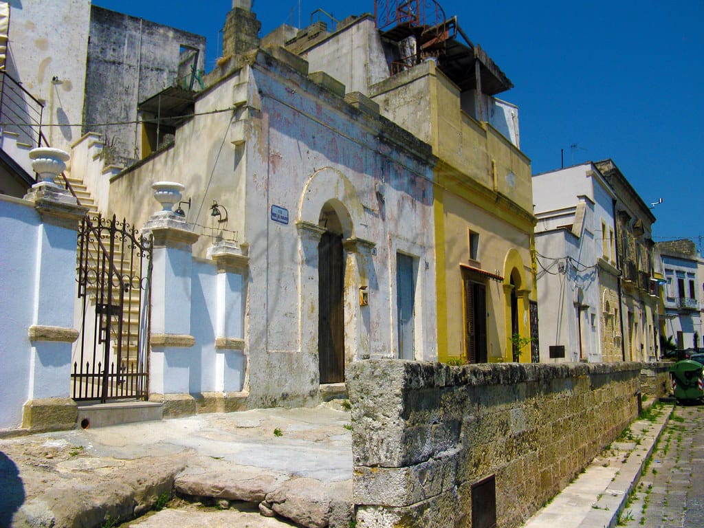
Ugento
Puglia
Coastal town with archaeological sites, medieval architecture, beaches, agriculture, limited healthcare, and cultural events.
Quality of Life Score
[?]Factors in air quality, amenities, walkability, population, and environmental risks. Higher scores suggest better living conditions.
77
Quality of Infrastructure
[?]Measures internet speed, healthcare access, airports, rail, and walkability. Higher scores mean better connectivity and essential services.
55
Quality of Economy
[?]Based on income, property prices, job availability, and population density. Higher scores indicate stronger economic conditions.
57
Ugento Demographics
Population
[?]
This is a town's official population, measured each year by the national statistics authority.
12000
Real Population (5km band)
[?]
Our "Real Population" metric reflects more accurately a town's real size by including inhabitants in the immediate vicinity of the town's official borders.
107200
Births Per 100 Deaths
50.0
Population Data Source
ISTAT,2023
Estimated Unemployment Rate
Touristy Index
[?]
Calculation of tourist density index for the city, comparing its total tourist number to the overall average tourist number of the region
relative to its own population.The index indicates how a location’s tourist density compares to the average, with values above
100 representing higher-than-average density and values below 100 representing lower-than-average density.
Moderate Tourism
Income per capita (2023)
[?]
This is an estimation of average income per resident for this town, based on 2023 data from the Italian Ministry of Finance.
14200
Income rank in Italy (2023)
[?]
This is a ranking of the town's average income per resident, against the full list of townships in Italy.
7396 out of 7901
Infrastructure and Connectivity
Create an account to explore more
This content is for Members only | Already a Member? Sign in
Infrastructure & Amenities
Create an account to explore more
This content is for Members only | Already a Member? Sign in
Healthcare
Create an account to explore more
This content is for Members only | Already a Member? Sign in
Housing & Property Market
Create an account to explore more
This content is for Members only | Already a Member? Sign in
Connectivity & Digital Access
Create an account to explore more
This content is for Members only | Already a Member? Sign in
Education
Create an account to explore more
This content is for Members only | Already a Member? Sign in
Climate & Weather
Create an account to explore more
This content is for Members only | Already a Member? Sign in
Precipitation
[?] Based on daily climate data for precipitation from OPEN-METEO this parameter indicates how a city's annual precipitation compares to others in terms of percentage, with values ranging from 0 (lowest) to 1 (highest). For example, a percentile rank of 0.75 means the city's total precipitation is higher than 75% of other cities.
Low (11th-20th percentile)
Sunshine
Exceptional (Top 10%)
Snowfall
Very Low (Bottom 10%)
Min Annual Temperature (°C)
[?] This parameter represents the monthly average of daily minimum temperatures for January, based on data from OPEN-METEO.
8.1
Max Annual Temperature (°C)
[?] This parameter represents the monthly average of daily minimum temperatures for January, based on data from OPEN-METEO.
29.9
Climate Description
Snow is unknown in Ugento, a charming destination for those enchanted by steady warmth and plenty of sunlight. Benefiting from Ugento’s stable and pleasant climate, expats and retirees will find comfort in the mild yet distinct seasonal shifts that favor outdoor activities almost year-round. In this corner of Italy, long summers and mild winters create an ideal setting for those interested in exploring historic sites or engaging in outdoor leisure without the interruption of extreme weather. The generous sunlight defines the area, covering its ancient architecture and vibrant streets with a warm glow, facilitating a unique lifestyle embraced by locals and newcomers alike.
Annual Temperature Chart (Min)
Error
There was a problem with your SQL connection - Please contact the administrator
There was a problem with your SQL connection - Please contact the administrator
Annual Temperature Chart (Max)
Error
There was a problem with your SQL connection - Please contact the administrator
There was a problem with your SQL connection - Please contact the administrator
Sunny Days By Month
Error
There was a problem with your SQL connection - Please contact the administrator
There was a problem with your SQL connection - Please contact the administrator
Environmental & Air Quality
Create an account to explore more
This content is for Members only | Already a Member? Sign in
Classifications
PM10
[?]
PM10 levels indicate Good air quality at 0–20 µg/m³, Fair at 20–40 µg/m³, Moderate at 40–50 µg/m³, Poor at 50–100 µg/m³, Very Poor at 100–150 µg/m³, and Extremely Poor at 150–1200 µg/m³.
Good
PM2.5
[?]
PM2.5 is Good if PM2.5 levels are between 0–10 µg/m³, Fair between 10–20 µg/m³, Moderate between 20–25 µg/m³, Poor between 25–50 µg/m³, Very Poor between 50–75 µg/m³, and Extremely Poor between 75–800 µg/m³.
Fair
NO2
[?]
NO₂ levels are considered Good at 0–40 µg/m³, Fair at 40–90 µg/m³, Moderate at 90–120 µg/m³, Poor at 120–230 µg/m³, Very Poor at 230–340 µg/m³, and Extremely Poor at 340–1000 µg/m³.
Good
SO2
[?]
SO₂ levels indicate Good air quality at 0–100 µg/m³, Fair at 100–200 µg/m³, Moderate at 200–350 µg/m³, Poor at 350–500 µg/m³, Very Poor at 500–750 µg/m³, and Extremely Poor at 750–1250 µg/m³.
Good
O₃
[?]
For O₃, the air is Good at 0–50 µg/m³, Fair at 50–100 µg/m³, Moderate at 100–130 µg/m³, Poor at 130–240 µg/m³, Very Poor at 240–380 µg/m³, and Extremely Poor at 380–800 µg/m³.
Fair
Air Quality Rating
[?]
Based on PM10, PM2.5, NO2, SO2, and ozone levels. Higher scores indicate cleaner air.
80
Air Quality Description
Ugento, Italy, offers an air quality profile that befits its serene environment. Consistently labeled as “Good” in the categories of nitrogen dioxide and sulphur dioxide, Ugento ensures a wholesome environment conducive for daily activities without the worry of harmful pollutants. While ozone and PM2.5 levels are described as “Fair”, indicating moderate levels, these are not commonly a cause for concern and are reflective of typical urban settings found elsewhere in Italy. Overall, Ugento’s air quality supports a healthy lifestyle, making it a suitable spot for expats and retirees seeking a tranquil yet vibrant living space.
Ugento, Italy, offers an air quality profile that befits its serene environment. Consistently labeled as “Good” in the categories of nitrogen dioxide and sulphur dioxide, Ugento ensures a wholesome environment conducive for daily activities without the worry of harmful pollutants. While ozone and PM2.5 levels are described as “Fair”, indicating moderate levels, these are not commonly a cause for concern and are reflective of typical urban settings found elsewhere in Italy. Overall, Ugento’s air quality supports a healthy lifestyle, making it a suitable spot for expats and retirees seeking a tranquil yet vibrant living space.
Town Descriptions
Create an account to explore more
This content is for Members only | Already a Member? Sign in
Getting There
Ugento is accessible via the SS274, connecting to larger road networks in Puglia. The nearest airports are Brindisi and Bari, providing regional air travel options. Local train stations, while within a short distance, offer limited connectivity with moderate infrastructure ratings, which may affect overall travel convenience.
Getting Around
Local Cuisine
Ugento, situated in the Puglia region, boasts a rich culinary scene characterized by its embrace of traditional flavors and local ingredients. The regional cuisine features stalls and restaurants serving renowned dishes such as handmade orecchiette pasta with turnip tops, crispy focaccia topped with tomatoes, and frugal vegetarian fare utilizing grano arso (burnt flour). Noteworthy local delicacies include pasticciotto, a cream-filled pastry, cotognata, a quince jam, and fried chickpea tagliatelle. Ugento also offers Michelin-starred dining experiences, notably at ‘Il Tempo Nuovo,’ where traditional Salento dishes are presented in contemporary interpretations. The town’s dining landscape is further enriched by a variety of eateries catering to diverse tastes, including international cuisines, providing a comprehensive gastronomic experience.
Shopping Overview
The shopping landscape encompasses department stores and a variety of specialty shops. Gift and artisanal items are prevalent, catering to diverse tastes. Larger shopping centres may feature a selection of retail outlets, while local markets offer fresh produce and regional delicacies. Overall, shoppers can find a mix of contemporary retail options alongside traditional, locally sourced goods.
Neighborhoods
Green Areas and Parks
Ugento offers outdoor activities through Litorale di Ugento Regional Nature Park, presenting trails suitable for hiking and biking. Key routes include Fontanelle – Riva di Ugento, a 7.4-mile moderate trail estimated at 2 hours 37 minutes, and Anello Lido Marini, a 5.5-mile moderate trail. Serra delle Fontanelle and Marathon Del Salento cater to more extensive explorations, with the latter being favored by biking enthusiasts for its length and challenge. Trails range up to 1,837 feet in elevation, supporting varied activity levels. These resources affirm Ugento’s appeal for active, nature-focused lifestyles.
✅ Pros
– Mild Mediterranean climate year-round for outdoor activities.
– Rich cultural heritage with historical sites and traditions.
– Opportunities for integration within friendly local community.
– Moderate tourism enhances local economy and vibrancy.
– Sufficient healthcare facilities, though some may require travel.
– Scenic coastal landscapes and beautiful beaches nearby.
– Public transportation available, though limited compared to cities.
– Affordable cost of living compared to major Italian cities.
– Good air quality contributing to overall well-being.
– Access to local markets for fresh, regional produce.
❌ Cons
– Limited healthcare quality may necessitate travel for serious needs.
– Public transport options are sparse and infrequent for commuters.
– Job opportunities are scarce, especially for foreign retirees.
– Internet speeds lag behind urban areas, frustrating remote work.
– Cultural activities may be limited compared to larger towns.
– Weather can be too hot in summer for some.
– Local economy struggles with higher unemployment than national average.
– Limited educational facilities may not suit families with children.
– Some areas may lack modern infrastructure and amenities.
– Integration may be challenging for those not speaking Italian.
FAQs
Summary
Ugento, nestled along the Ionian coast in Puglia, presents a blend of rich history and natural beauty, appealing to expats and retirees alike. This coastal gem, with its archaeological treasures, ancient ruins, and medieval architecture, offers a unique charm. Residents can enjoy pristine beaches with excellent water quality just a short drive away, attracting sun-seekers and water enthusiasts. The town hosts numerous cultural events and festivals, showcasing traditional music, dance, and local cuisine, fostering a vibrant community atmosphere.
Local industries thrive on agriculture, with Puglia being a major supplier of olive oil and quality wines, reflecting the region’s agricultural richness. However, potential residents should be aware of limited healthcare facilities, which may necessitate travel to nearby towns for more extensive services. While Ugento’s quaint environment provides a serene lifestyle, those accustomed to urban conveniences might find the amenities somewhat sparse.
✅ Pros
– Mild Mediterranean climate year-round for outdoor activities.
– Rich cultural heritage with historical sites and traditions.
– Opportunities for integration within friendly local community.
– Moderate tourism enhances local economy and vibrancy.
– Sufficient healthcare facilities, though some may require travel.
– Scenic coastal landscapes and beautiful beaches nearby.
– Public transportation available, though limited compared to cities.
– Affordable cost of living compared to major Italian cities.
– Good air quality contributing to overall well-being.
– Access to local markets for fresh, regional produce.
❌ Cons
– Limited healthcare quality may necessitate travel for serious needs.
– Public transport options are sparse and infrequent for commuters.
– Job opportunities are scarce, especially for foreign retirees.
– Internet speeds lag behind urban areas, frustrating remote work.
– Cultural activities may be limited compared to larger towns.
– Weather can be too hot in summer for some.
– Local economy struggles with higher unemployment than national average.
– Limited educational facilities may not suit families with children.
– Some areas may lack modern infrastructure and amenities.
– Integration may be challenging for those not speaking Italian.
Related Posts
More questions about Ugento ? Ask Magic AI.
Our innovative AI assistant is eager to help. Try it out here: