
Elevation
[?]
Elevation of a city refers to the height above sea level at which the city is located, measured in meters.
230
Population
[?]
This is a town's official population, measured each year by the national statistics authority.
17700
Real Population (5km)
[?]
Our "Real Population" metric reflects more accurately a town's real size by including inhabitants in the immediate vicinity of the town's official borders.
42700
Air Quality Rating
[?]
Based on PM10, PM2.5, NO2, SO2, and ozone levels. Higher scores indicate cleaner air.
90
Region
Marche
Walkability
Walker’s Paradise
Housing availability
[?]
Based on total number of properties (sale and rent) classifies housing availability into five categories: low, relativel ylow, medium, relatively high and high.
Relatively Low
Avg Download Speed (Mbps) / Avg Upload Speed (Mbps)
228
/ 138
Climate Description
Varied climate; abundant sun, mild winters, warm summers, moderate year-round rainfall.
Tolentino
Marche
Historical town in Marche features a basilica, museum, and access to outdoor activities.
Quality of Life Score
[?]Factors in air quality, amenities, walkability, population, and environmental risks. Higher scores suggest better living conditions.
86
Quality of Infrastructure
[?]Measures internet speed, healthcare access, airports, rail, and walkability. Higher scores mean better connectivity and essential services.
72
Quality of Economy
[?]Based on income, property prices, job availability, and population density. Higher scores indicate stronger economic conditions.
74
Tolentino Demographics
Population
[?]
This is a town's official population, measured each year by the national statistics authority.
17700
Real Population (5km band)
[?]
Our "Real Population" metric reflects more accurately a town's real size by including inhabitants in the immediate vicinity of the town's official borders.
42700
Births Per 100 Deaths
40.0
Population Data Source
ISTAT,2023
Estimated Unemployment Rate
Touristy Index
[?]
Calculation of tourist density index for the city, comparing its total tourist number to the overall average tourist number of the region
relative to its own population.The index indicates how a location’s tourist density compares to the average, with values above
100 representing higher-than-average density and values below 100 representing lower-than-average density.
Not Touristic
Income per capita (2023)
[?]
This is an estimation of average income per resident for this town, based on 2023 data from the Italian Ministry of Finance.
21300
Income rank in Italy (2023)
[?]
This is a ranking of the town's average income per resident, against the full list of townships in Italy.
3293 out of 7901
Infrastructure and Connectivity
Create an account to explore more
This content is for Members only | Already a Member? Sign in
Infrastructure & Amenities
Create an account to explore more
This content is for Members only | Already a Member? Sign in
Healthcare
Create an account to explore more
This content is for Members only | Already a Member? Sign in
Housing & Property Market
Create an account to explore more
This content is for Members only | Already a Member? Sign in
Connectivity & Digital Access
Create an account to explore more
This content is for Members only | Already a Member? Sign in
Education
Create an account to explore more
This content is for Members only | Already a Member? Sign in
Climate & Weather
Create an account to explore more
This content is for Members only | Already a Member? Sign in
Precipitation
[?] Based on daily climate data for precipitation from OPEN-METEO this parameter indicates how a city's annual precipitation compares to others in terms of percentage, with values ranging from 0 (lowest) to 1 (highest). For example, a percentile rank of 0.75 means the city's total precipitation is higher than 75% of other cities.
Low (11th-20th percentile)
Sunshine
High (71st-80th percentile)
Snowfall
Above Average (51st-60th percentile)
Min Annual Temperature (°C)
[?] This parameter represents the monthly average of daily minimum temperatures for January, based on data from OPEN-METEO.
1
Max Annual Temperature (°C)
[?] This parameter represents the monthly average of daily minimum temperatures for January, based on data from OPEN-METEO.
29.9
Climate Description
In Tolentino, Italy, the year-round climate is discernibly varied, catering well to those looking for a balance in weather patterns. Sunshine is abundant throughout the year, illuminating the historic town and enhancing its magical appeal, ideal for retirees and expats looking to soak up some Mediterranean sun while enjoying a comfortable setting. Winters are mild but do have their share of brief snowfalls that add a picturesque white blanket to the landscape, typically not persisting for long. Summers bring warmth conducive to outdoor pursuits and leisure, yet the overall temperatures remain pleasant enough to avoid the severity of some hotter climates. Rainfall is relatively moderate but evenly spread across the seasons, ensuring lush, green surroundings without excessive dampness.
Annual Temperature Chart (Min)
Error
There was a problem with your SQL connection - Please contact the administrator
There was a problem with your SQL connection - Please contact the administrator
Annual Temperature Chart (Max)
Error
There was a problem with your SQL connection - Please contact the administrator
There was a problem with your SQL connection - Please contact the administrator
Sunny Days By Month
Error
There was a problem with your SQL connection - Please contact the administrator
There was a problem with your SQL connection - Please contact the administrator
Environmental & Air Quality
Create an account to explore more
This content is for Members only | Already a Member? Sign in
Classifications
PM10
[?]
PM10 levels indicate Good air quality at 0–20 µg/m³, Fair at 20–40 µg/m³, Moderate at 40–50 µg/m³, Poor at 50–100 µg/m³, Very Poor at 100–150 µg/m³, and Extremely Poor at 150–1200 µg/m³.
Good
PM2.5
[?]
PM2.5 is Good if PM2.5 levels are between 0–10 µg/m³, Fair between 10–20 µg/m³, Moderate between 20–25 µg/m³, Poor between 25–50 µg/m³, Very Poor between 50–75 µg/m³, and Extremely Poor between 75–800 µg/m³.
Good
NO2
[?]
NO₂ levels are considered Good at 0–40 µg/m³, Fair at 40–90 µg/m³, Moderate at 90–120 µg/m³, Poor at 120–230 µg/m³, Very Poor at 230–340 µg/m³, and Extremely Poor at 340–1000 µg/m³.
Good
SO2
[?]
SO₂ levels indicate Good air quality at 0–100 µg/m³, Fair at 100–200 µg/m³, Moderate at 200–350 µg/m³, Poor at 350–500 µg/m³, Very Poor at 500–750 µg/m³, and Extremely Poor at 750–1250 µg/m³.
Good
O₃
[?]
For O₃, the air is Good at 0–50 µg/m³, Fair at 50–100 µg/m³, Moderate at 100–130 µg/m³, Poor at 130–240 µg/m³, Very Poor at 240–380 µg/m³, and Extremely Poor at 380–800 µg/m³.
Fair
Air Quality Rating
[?]
Based on PM10, PM2.5, NO2, SO2, and ozone levels. Higher scores indicate cleaner air.
90
Air Quality Description
In Tolentino, Italy, the air quality is predominantly favorable, showing particularly low levels of particulate matter and nitrogen dioxide. This presents an inviting environment, especially for those concerned about urban pollution. Daily life here is complemented by a backdrop of good air standings, marked especially by the cleanliness in terms of fine particles like PM10 and PM2.5, which are minimal. Nitrogen dioxide and sulfur dioxide, often elevated in urban settings, are also reassuringly low in this locale. However, it’s worth noting that ozone levels indicate moderate exposure which could be a point of consideration for sensitive individuals during certain periods.
In Tolentino, Italy, the air quality is predominantly favorable, showing particularly low levels of particulate matter and nitrogen dioxide. This presents an inviting environment, especially for those concerned about urban pollution. Daily life here is complemented by a backdrop of good air standings, marked especially by the cleanliness in terms of fine particles like PM10 and PM2.5, which are minimal. Nitrogen dioxide and sulfur dioxide, often elevated in urban settings, are also reassuringly low in this locale. However, it’s worth noting that ozone levels indicate moderate exposure which could be a point of consideration for sensitive individuals during certain periods.
Town Descriptions
Create an account to explore more
This content is for Members only | Already a Member? Sign in
Getting There
Tolentino is accessible via key roadways including the SS77 and SS361. The nearest railway stations are a short distance away, contributing to moderate connectivity. The closest airports, Ancona and Perugia, further enhance travel options, but overall infrastructure is rated relatively well, providing essential connectivity to the region.
Getting Around
Local Cuisine
Tolentino, located in the Marche region, showcases a rich culinary tradition that includes notable local dishes such as Moscioli (wild mussels), Vincisgrassi (a lasagna variant), and Ascoli stuffed olives. The dining scene is characterized by a mix of traditional eateries and modern bistros, offering a range of international influences alongside authentic Marche cuisine. Notably, the town is home to Osteria Ime, which has earned a Michelin star, reflecting its commitment to exceptional culinary standards.
Shopping Overview
The city offers a diverse shopping landscape, characterised by various categories including supermarkets, boutiques, and dedicated shopping centres. Supermarkets provide essential groceries, while boutiques offer local fashion and unique products. Adjacent to these, shopping venues feature diverse retail options from personal care to home and leisure goods, alongside dining establishments. A notable retail park enhances the shopping experience, incorporating both large hypermarket chains and smaller specialty stores, catering to various consumer needs and preferences.
Neighborhoods
Green Areas and Parks
Tolentino offers various outdoor and recreational activities suitable for expats and retirees. The Riserva Naturale Abbadia di Fiastra provides three main walking trails, protected as a nature reserve since 1984. Hikers can explore the countryside on trails such as the Tolentino path and the lengthy Tolentino-Pollenza trail, the latter extending 22.6 miles with a 2,509-foot elevation gain. These tracks cater to different skill levels, accommodating both relaxed walks and more challenging hikes. Furthermore, areas like Lago di Fiastra offer opportunities for numerous water-based activities, adding diversity to outdoor experiences in the region.
✅ Pros
– High-quality healthcare with a strong local network available.
– Excellent air quality for a healthier living environment.
– Low unemployment rate fostering economic stability and opportunity.
– Non-touristic town offers a peaceful, authentic Italian experience.
– Rich cultural and historical backdrop to explore and enjoy.
– Good transportation connections for easy travel across Italy.
– Integration opportunities with welcoming local community and events.
– Moderate climate suitable for year-round outdoor activities.
– Educational facilities providing quality learning for all ages.
– Reliable internet connectivity supporting remote work and communication.
❌ Cons
– Limited nightlife and entertainment options for young expats.
– Small-town charm may feel isolating for some newcomers.
– Language barriers could complicate daily communication and integration.
– Public transport may not always run on time.
– Fewer international amenities compared to larger cities.
– Seasonal weather fluctuations can be unpredictable at times.
– Limited shopping and dining choices may frustrate some residents.
– Cultural events may not cater to all interests.
– Parking can be challenging in town center areas.
– Slow bureaucratic processes can test your patience.
FAQs
Summary
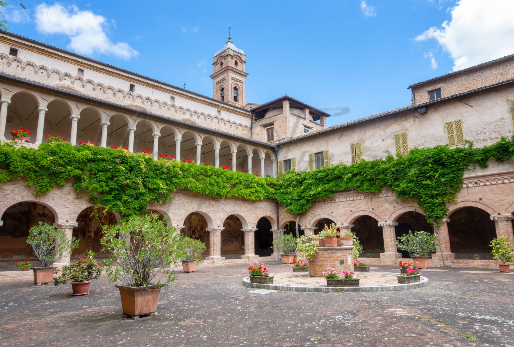
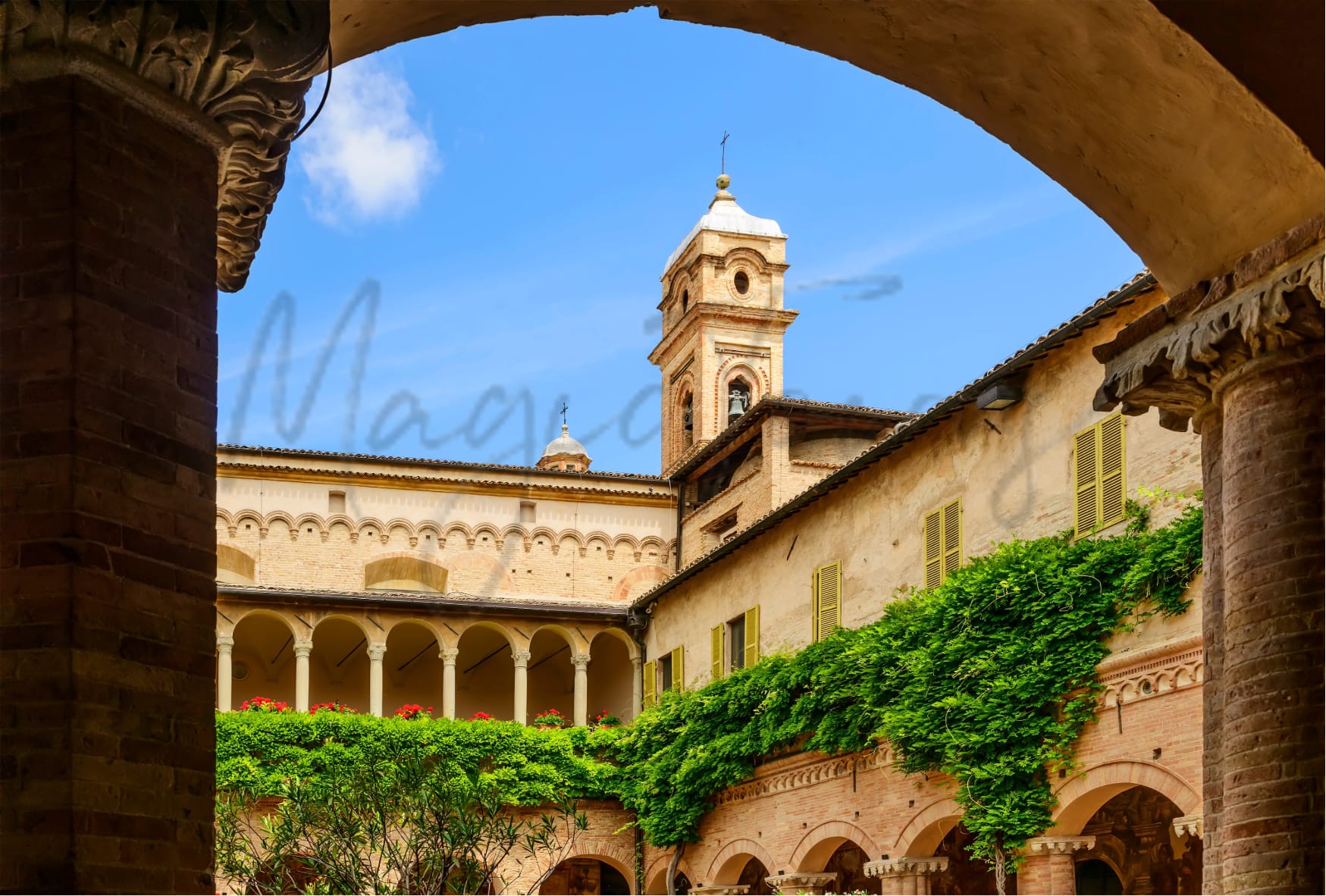
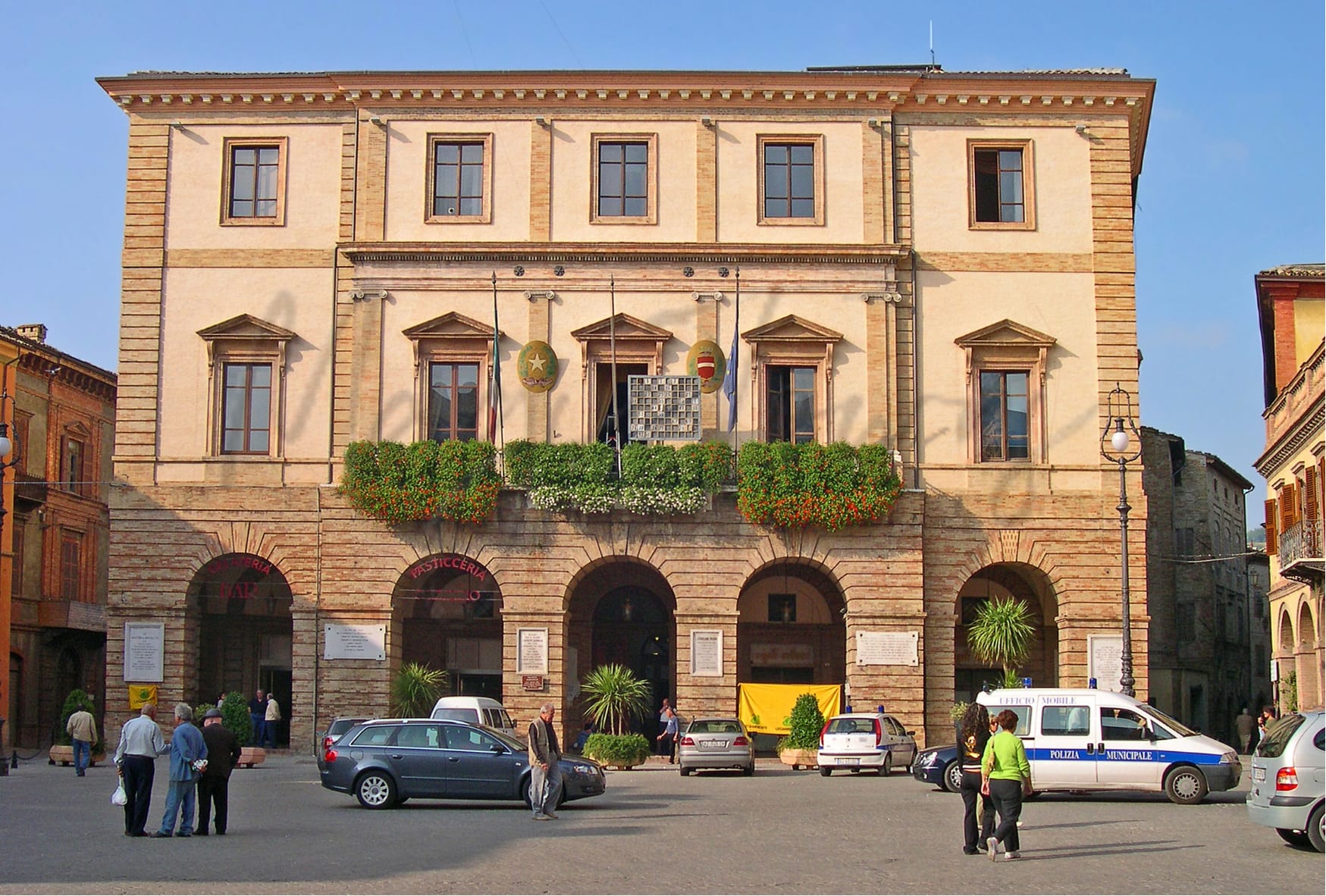
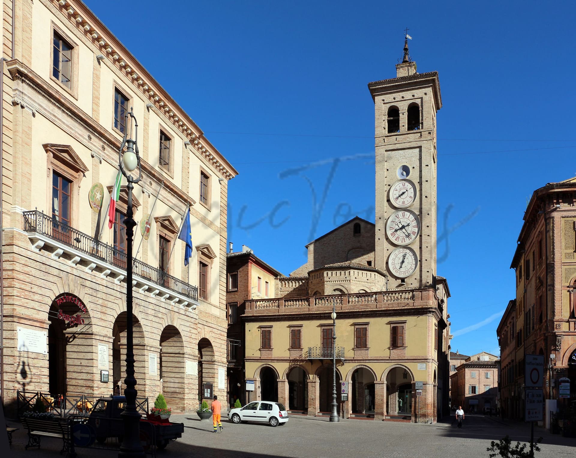
Tolentino, a historical town in Marche, Italy, is steeped in rich culture and tradition, making it appealing to expats and retirees. Nestled in a picturesque valley, it is home to the Basilica of St Nicholas, featuring impressive frescoes and a tranquil cloister, as well as the International Museum of Caricature and Humour in Art. Outdoor enthusiasts will appreciate the proximity to the Sibillini Mountains, ideal for hiking and nature walks. The town’s culinary scene offers authentic local dishes, enhancing the cultural experience.
However, its relatively low walkability and modest healthcare rankings may pose challenges for some newcomers. Essential services are accessible by car, with the nearest airport a 39-minute drive away. While the town’s charm and historical significance attract many, potential residents should be prepared for a quieter lifestyle that may lack some modern conveniences.
✅ Pros
– High-quality healthcare with a strong local network available.
– Excellent air quality for a healthier living environment.
– Low unemployment rate fostering economic stability and opportunity.
– Non-touristic town offers a peaceful, authentic Italian experience.
– Rich cultural and historical backdrop to explore and enjoy.
– Good transportation connections for easy travel across Italy.
– Integration opportunities with welcoming local community and events.
– Moderate climate suitable for year-round outdoor activities.
– Educational facilities providing quality learning for all ages.
– Reliable internet connectivity supporting remote work and communication.
❌ Cons
– Limited nightlife and entertainment options for young expats.
– Small-town charm may feel isolating for some newcomers.
– Language barriers could complicate daily communication and integration.
– Public transport may not always run on time.
– Fewer international amenities compared to larger cities.
– Seasonal weather fluctuations can be unpredictable at times.
– Limited shopping and dining choices may frustrate some residents.
– Cultural events may not cater to all interests.
– Parking can be challenging in town center areas.
– Slow bureaucratic processes can test your patience.
Related Posts
More questions about Tolentino ? Ask Magic AI.
Our innovative AI assistant is eager to help. Try it out here: