
Elevation
[?]
Elevation of a city refers to the height above sea level at which the city is located, measured in meters.
210
Population
[?]
This is a town's official population, measured each year by the national statistics authority.
38600
Real Population (5km)
[?]
Our "Real Population" metric reflects more accurately a town's real size by including inhabitants in the immediate vicinity of the town's official borders.
213600
Air Quality Rating
[?]
Based on PM10, PM2.5, NO2, SO2, and ozone levels. Higher scores indicate cleaner air.
82
Region
Lombardia
Walkability
Walker’s Paradise
Housing availability
[?]
Based on total number of properties (sale and rent) classifies housing availability into five categories: low, relativel ylow, medium, relatively high and high.
Relatively Low
Avg Download Speed (Mbps) / Avg Upload Speed (Mbps)
297
/ 205
Climate Description
Temperate climate with mild winters, warm summers, moderate rainfall, and abundant sunshine.
Saronno
Lombardia
Lombardy town with walkable center, historical architecture, Amaretto production, and proximity to Milan.
Quality of Life Score
[?]Factors in air quality, amenities, walkability, population, and environmental risks. Higher scores suggest better living conditions.
78
Quality of Infrastructure
[?]Measures internet speed, healthcare access, airports, rail, and walkability. Higher scores mean better connectivity and essential services.
81
Quality of Economy
[?]Based on income, property prices, job availability, and population density. Higher scores indicate stronger economic conditions.
85
Saronno Demographics
Population
[?]
This is a town's official population, measured each year by the national statistics authority.
38600
Real Population (5km band)
[?]
Our "Real Population" metric reflects more accurately a town's real size by including inhabitants in the immediate vicinity of the town's official borders.
213600
Births Per 100 Deaths
50.0
Population Data Source
ISTAT,2023
Estimated Unemployment Rate
Touristy Index
[?]
Calculation of tourist density index for the city, comparing its total tourist number to the overall average tourist number of the region
relative to its own population.The index indicates how a location’s tourist density compares to the average, with values above
100 representing higher-than-average density and values below 100 representing lower-than-average density.
Some Tourism
Income per capita (2023)
[?]
This is an estimation of average income per resident for this town, based on 2023 data from the Italian Ministry of Finance.
27200
Income rank in Italy (2023)
[?]
This is a ranking of the town's average income per resident, against the full list of townships in Italy.
56 out of 7901
Infrastructure and Connectivity
Create an account to explore more
This content is for Members only | Already a Member? Sign in
Infrastructure & Amenities
Create an account to explore more
This content is for Members only | Already a Member? Sign in
Healthcare
Create an account to explore more
This content is for Members only | Already a Member? Sign in
Housing & Property Market
Create an account to explore more
This content is for Members only | Already a Member? Sign in
Connectivity & Digital Access
Create an account to explore more
This content is for Members only | Already a Member? Sign in
Education
Create an account to explore more
This content is for Members only | Already a Member? Sign in
Climate & Weather
Create an account to explore more
This content is for Members only | Already a Member? Sign in
Precipitation
[?] Based on daily climate data for precipitation from OPEN-METEO this parameter indicates how a city's annual precipitation compares to others in terms of percentage, with values ranging from 0 (lowest) to 1 (highest). For example, a percentile rank of 0.75 means the city's total precipitation is higher than 75% of other cities.
Very High (81st-90th percentile)
Sunshine
Somewhat Low (21st-30th percentile)
Snowfall
Above Average (51st-60th percentile)
Min Annual Temperature (°C)
[?] This parameter represents the monthly average of daily minimum temperatures for January, based on data from OPEN-METEO.
-0.7
Max Annual Temperature (°C)
[?] This parameter represents the monthly average of daily minimum temperatures for January, based on data from OPEN-METEO.
28.1
Climate Description
Saronno, nestled in Italy, experiences a temperate climate that combines bright, abundant sunshine with moderate rainfall. The winters are mild with an infrequent dusting of snow, creating picturesque scenes reminiscent of traditional European winters. During summer, the town enjoys warm but not excessively hot conditions, ideal for enjoying outdoor cafes and scenic walks around its heritage sites. Transitioning seamlessly through the seasons, Saronno offers a year-round mild climate that is a boon for expats and retirees seeking a balance between vibrant Mediterranean summers and gentle winters. This balanced climatic pattern ensures a comfortable lifestyle and the opportunity to enjoy Saronno’s cultural events year-round.
Annual Temperature Chart (Min)
Error
There was a problem with your SQL connection - Please contact the administrator
There was a problem with your SQL connection - Please contact the administrator
Annual Temperature Chart (Max)
Error
There was a problem with your SQL connection - Please contact the administrator
There was a problem with your SQL connection - Please contact the administrator
Sunny Days By Month
Error
There was a problem with your SQL connection - Please contact the administrator
There was a problem with your SQL connection - Please contact the administrator
Environmental & Air Quality
Create an account to explore more
This content is for Members only | Already a Member? Sign in
Classifications
PM10
[?]
PM10 levels indicate Good air quality at 0–20 µg/m³, Fair at 20–40 µg/m³, Moderate at 40–50 µg/m³, Poor at 50–100 µg/m³, Very Poor at 100–150 µg/m³, and Extremely Poor at 150–1200 µg/m³.
Fair
PM2.5
[?]
PM2.5 is Good if PM2.5 levels are between 0–10 µg/m³, Fair between 10–20 µg/m³, Moderate between 20–25 µg/m³, Poor between 25–50 µg/m³, Very Poor between 50–75 µg/m³, and Extremely Poor between 75–800 µg/m³.
Moderate
NO2
[?]
NO₂ levels are considered Good at 0–40 µg/m³, Fair at 40–90 µg/m³, Moderate at 90–120 µg/m³, Poor at 120–230 µg/m³, Very Poor at 230–340 µg/m³, and Extremely Poor at 340–1000 µg/m³.
Good
SO2
[?]
SO₂ levels indicate Good air quality at 0–100 µg/m³, Fair at 100–200 µg/m³, Moderate at 200–350 µg/m³, Poor at 350–500 µg/m³, Very Poor at 500–750 µg/m³, and Extremely Poor at 750–1250 µg/m³.
Good
O₃
[?]
For O₃, the air is Good at 0–50 µg/m³, Fair at 50–100 µg/m³, Moderate at 100–130 µg/m³, Poor at 130–240 µg/m³, Very Poor at 240–380 µg/m³, and Extremely Poor at 380–800 µg/m³.
Fair
Air Quality Rating
[?]
Based on PM10, PM2.5, NO2, SO2, and ozone levels. Higher scores indicate cleaner air.
82
Air Quality Description
Nestled in the lush landscape of northern Italy, Saronno offers a breathable climate that largely benefits from its modest industrial activity. The town’s air is characterized by relatively stable levels of particulate matter, with PM10 and ozone concentrations presenting a fair balance, conducive for daily activities outdoors. PM2.5 levels are moderate, advocating for routine air quality monitoring, typical of an active urban environment. Additionally, the presence of nitrogen and sulfur dioxide is minimal, underscoring efficient local management of vehicular and industrial emissions. Such an atmosphere is suitable for those considering Saronno as a new base, providing a generally conducive environment for health and wellness.
Nestled in the lush landscape of northern Italy, Saronno offers a breathable climate that largely benefits from its modest industrial activity. The town’s air is characterized by relatively stable levels of particulate matter, with PM10 and ozone concentrations presenting a fair balance, conducive for daily activities outdoors. PM2.5 levels are moderate, advocating for routine air quality monitoring, typical of an active urban environment. Additionally, the presence of nitrogen and sulfur dioxide is minimal, underscoring efficient local management of vehicular and industrial emissions. Such an atmosphere is suitable for those considering Saronno as a new base, providing a generally conducive environment for health and wellness.
Town Descriptions
Create an account to explore more
This content is for Members only | Already a Member? Sign in
Getting There
Saronno is well-connected, with significant proximity to major transport hubs. The nearest airports, Malpensa and Linate, facilitate international travel. Accessibility is enhanced by nearby train stations providing frequent services, complemented by effective road links including the A9 motorway, linking to Milan and the broader Lombardy region.
Getting Around
Local Cuisine
Saronno, nestled in the Lombardy region of Italy, boasts a distinctive culinary scene characterized by both traditional and modern influences. One of its hallmark products is the renowned ‘Amaretti di Saronno’, almond cookies that originated here in the early 18th century. Beyond this iconic pastry, the town features a diverse array of dining options that reflect both local tastes and international flavors. The restaurant landscape includes various styles, from pizzerias and trattorias to fine dining establishments. Notably, Saronno is home to ‘Sui Generis’, a Michelin-starred restaurant known for its high-quality creative dishes. The dining scene is complemented by numerous international influences, with offerings including Asian, Mediterranean, and ethnic cuisines, which cater to a wide range of preferences.
Shopping Overview
In the vicinity, shopping options are diverse, catering to various needs. There are several large supermarkets offering daily essentials and groceries. For those seeking retail therapy, boutique stores are available, providing unique fashion and lifestyle products. Shopping centres feature a range of mid-tier to high-end brands and often include recreational facilities. Malls can be found, providing a comprehensive shopping experience under one roof, hosting numerous shops and dining options. Overall, the shopping landscape accommodates both basic and specialised needs, making it suitable for residents and visitors alike.
Neighborhoods
Green Areas and Parks
Located in the Lombardy region, Saronno offers a variety of green spaces and outdoor activities suitable for expats and retirees. The Parco Lura, part of the Lura Park, provides extended walking paths ideal for leisurely hikes. Nearby, the Parco delle Groane offers trails that traverse diverse landscapes, including woods and wetlands, popular with walkers. These parks are complemented by organized nature and wildlife tours that enhance the exploration experience. While sporting facilities in the area provide opportunities for exercise, Saronno’s strategic location also allows easy access to larger natural reserves.
✅ Pros
– Excellent transportation links to Milan and surrounding areas.
– Rich cultural and historical backdrop to explore and enjoy.
– Strong local economy with low unemployment rate.
– Air quality is relatively good for urban living.
– Reliable healthcare facilities and services available nearby.
– Integration opportunities through local community events and activities.
– Mild climate conducive to outdoor activities year-round.
– Well-developed infrastructure supporting daily living needs.
– Access to educational facilities for all ages.
– Some tourist activity enhances local vibrancy and amenities.
❌ Cons
– Limited healthcare quality could impact serious medical needs significantly.
– Some areas may feel overly industrial and less charming.
– Occasional traffic congestion during peak commuting hours is frustrating.
– Limited nightlife options for those seeking evening entertainment.
– Weather can be humid in summer, making it uncomfortable.
– Internet connectivity might not be reliable for remote work.
– Cultural events may not appeal to everyone’s tastes.
– Some expats might struggle with local dialects and language barriers.
– Tourist activity can occasionally disrupt local tranquility.
FAQs
Summary
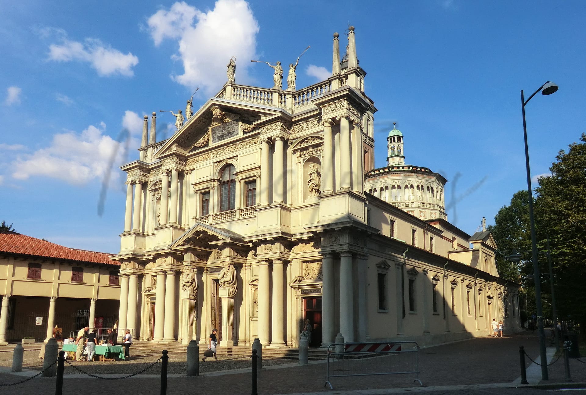
Saronno, located in the Lombardy region of Italy, is an appealing option for expats and retirees seeking a blend of urban convenience and suburban tranquility. Known for its excellent walkability, Saronno boasts a vibrant town center with shops, cafes, and cultural venues. The town is steeped in history, and its beautiful architecture reflects its rich past, making it a charming place to explore. Additionally, being just a short drive from Milan enhances its accessibility to one of Europe’s major cities, broadening options for work and leisure.
Culturally, Saronno is famous for its production of Amaretto, a sweet liqueur, while its local festivals showcase Italian traditions. Although the healthcare quality may not be ranked among the highest in the region, residents benefit from adequate medical services along with a solid expat community. Saronno’s proximity to both urban and natural attractions, including nearby beaches, contributes to its overall appeal as a welcoming destination for newcomers.
✅ Pros
– Excellent transportation links to Milan and surrounding areas.
– Rich cultural and historical backdrop to explore and enjoy.
– Strong local economy with low unemployment rate.
– Air quality is relatively good for urban living.
– Reliable healthcare facilities and services available nearby.
– Integration opportunities through local community events and activities.
– Mild climate conducive to outdoor activities year-round.
– Well-developed infrastructure supporting daily living needs.
– Access to educational facilities for all ages.
– Some tourist activity enhances local vibrancy and amenities.
❌ Cons
– Limited healthcare quality could impact serious medical needs significantly.
– Some areas may feel overly industrial and less charming.
– Occasional traffic congestion during peak commuting hours is frustrating.
– Limited nightlife options for those seeking evening entertainment.
– Weather can be humid in summer, making it uncomfortable.
– Internet connectivity might not be reliable for remote work.
– Cultural events may not appeal to everyone’s tastes.
– Some expats might struggle with local dialects and language barriers.
– Tourist activity can occasionally disrupt local tranquility.
Related Posts
No posts found for the town.
More questions about Saronno ? Ask Magic AI.
Our innovative AI assistant is eager to help. Try it out here: