
Elevation
[?]
Elevation of a city refers to the height above sea level at which the city is located, measured in meters.
191
Population
[?]
This is a town's official population, measured each year by the national statistics authority.
10600
Real Population (5km)
[?]
Our "Real Population" metric reflects more accurately a town's real size by including inhabitants in the immediate vicinity of the town's official borders.
20800
Air Quality Rating
[?]
Based on PM10, PM2.5, NO2, SO2, and ozone levels. Higher scores indicate cleaner air.
80
Region
Sardegna
Walkability
Very Walkable
Housing availability
[?]
Based on total number of properties (sale and rent) classifies housing availability into five categories: low, relativel ylow, medium, relatively high and high.
Low
Avg Download Speed (Mbps) / Avg Upload Speed (Mbps)
132
/ 54
Climate Description
Mild winters, warm dry summers, abundant sunshine, no extreme weather, ideal year-round climate.
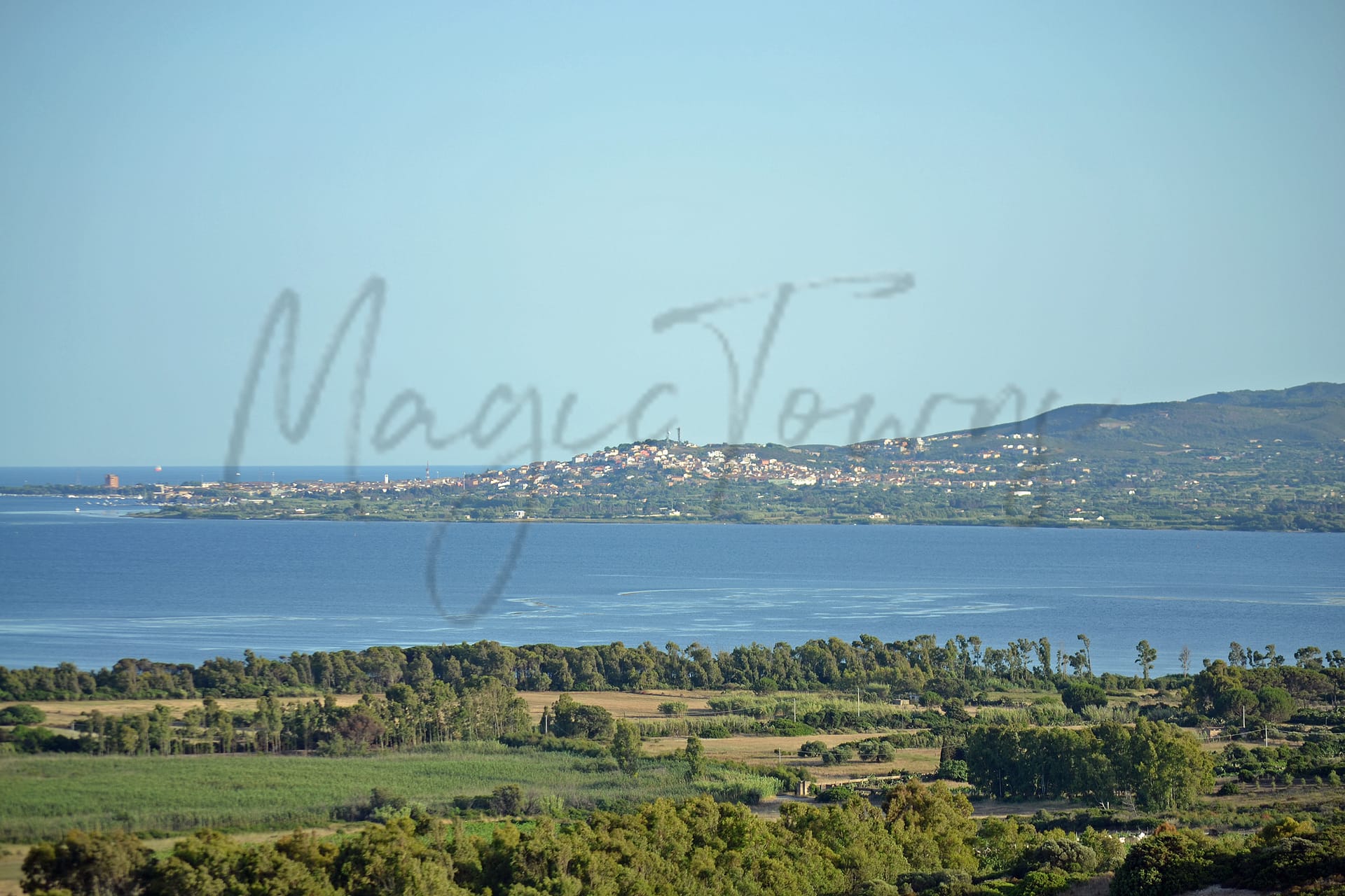
Sant’Antioco
Sardegna
Southwest Sardinian town with historical ruins, strong local cuisine, and limited nightlife options.
Quality of Life Score
[?]Factors in air quality, amenities, walkability, population, and environmental risks. Higher scores suggest better living conditions.
64
Quality of Infrastructure
[?]Measures internet speed, healthcare access, airports, rail, and walkability. Higher scores mean better connectivity and essential services.
47
Quality of Economy
[?]Based on income, property prices, job availability, and population density. Higher scores indicate stronger economic conditions.
57
Sant'Antioco Demographics
Population
[?]
This is a town's official population, measured each year by the national statistics authority.
10600
Real Population (5km band)
[?]
Our "Real Population" metric reflects more accurately a town's real size by including inhabitants in the immediate vicinity of the town's official borders.
20800
Births Per 100 Deaths
20.0
Population Data Source
ISTAT,2023
Estimated Unemployment Rate
Touristy Index
[?]
Calculation of tourist density index for the city, comparing its total tourist number to the overall average tourist number of the region
relative to its own population.The index indicates how a location’s tourist density compares to the average, with values above
100 representing higher-than-average density and values below 100 representing lower-than-average density.
Some Tourism
Income per capita (2023)
[?]
This is an estimation of average income per resident for this town, based on 2023 data from the Italian Ministry of Finance.
17600
Income rank in Italy (2023)
[?]
This is a ranking of the town's average income per resident, against the full list of townships in Italy.
5653 out of 7901
Infrastructure and Connectivity
Create an account to explore more
This content is for Members only | Already a Member? Sign in
Infrastructure & Amenities
Create an account to explore more
This content is for Members only | Already a Member? Sign in
Healthcare
Create an account to explore more
This content is for Members only | Already a Member? Sign in
Housing & Property Market
Create an account to explore more
This content is for Members only | Already a Member? Sign in
Connectivity & Digital Access
Create an account to explore more
This content is for Members only | Already a Member? Sign in
Education
Create an account to explore more
This content is for Members only | Already a Member? Sign in
Climate & Weather
Create an account to explore more
This content is for Members only | Already a Member? Sign in
Precipitation
[?] Based on daily climate data for precipitation from OPEN-METEO this parameter indicates how a city's annual precipitation compares to others in terms of percentage, with values ranging from 0 (lowest) to 1 (highest). For example, a percentile rank of 0.75 means the city's total precipitation is higher than 75% of other cities.
Very Low (Bottom 10%)
Sunshine
Exceptional (Top 10%)
Snowfall
Very Low (Bottom 10%)
Min Annual Temperature (°C)
[?] This parameter represents the monthly average of daily minimum temperatures for January, based on data from OPEN-METEO.
6.8
Max Annual Temperature (°C)
[?] This parameter represents the monthly average of daily minimum temperatures for January, based on data from OPEN-METEO.
29.8
Climate Description
Sant'Antioco enjoys a temperate Mediterranean climate, characterized by mild winters and warm, dry summers. The island, benefiting considerably from an abundance of sunshine throughout the year, often has clear skies that appeal to those seeking consistent weather patterns commonly favored by retirees and expats. Notably, while winters are gentle without any snowfall, summers peak with comfortable warmth rather than oppressive heat. This balance provides an ideal setting for outdoor activities year-round, particularly appealing to those from colder or more variable climates. The absence of extreme weather conditions ensures that Sant'Antioco remains a hospitable environment for settlement and leisure throughout the year.
Annual Temperature Chart (Min)
Error
There was a problem with your SQL connection - Please contact the administrator
There was a problem with your SQL connection - Please contact the administrator
Annual Temperature Chart (Max)
Error
There was a problem with your SQL connection - Please contact the administrator
There was a problem with your SQL connection - Please contact the administrator
Sunny Days By Month
Error
There was a problem with your SQL connection - Please contact the administrator
There was a problem with your SQL connection - Please contact the administrator
Environmental & Air Quality
Create an account to explore more
This content is for Members only | Already a Member? Sign in
Classifications
PM10
[?]
PM10 levels indicate Good air quality at 0–20 µg/m³, Fair at 20–40 µg/m³, Moderate at 40–50 µg/m³, Poor at 50–100 µg/m³, Very Poor at 100–150 µg/m³, and Extremely Poor at 150–1200 µg/m³.
Good
PM2.5
[?]
PM2.5 is Good if PM2.5 levels are between 0–10 µg/m³, Fair between 10–20 µg/m³, Moderate between 20–25 µg/m³, Poor between 25–50 µg/m³, Very Poor between 50–75 µg/m³, and Extremely Poor between 75–800 µg/m³.
Fair
NO2
[?]
NO₂ levels are considered Good at 0–40 µg/m³, Fair at 40–90 µg/m³, Moderate at 90–120 µg/m³, Poor at 120–230 µg/m³, Very Poor at 230–340 µg/m³, and Extremely Poor at 340–1000 µg/m³.
Good
SO2
[?]
SO₂ levels indicate Good air quality at 0–100 µg/m³, Fair at 100–200 µg/m³, Moderate at 200–350 µg/m³, Poor at 350–500 µg/m³, Very Poor at 500–750 µg/m³, and Extremely Poor at 750–1250 µg/m³.
Good
O₃
[?]
For O₃, the air is Good at 0–50 µg/m³, Fair at 50–100 µg/m³, Moderate at 100–130 µg/m³, Poor at 130–240 µg/m³, Very Poor at 240–380 µg/m³, and Extremely Poor at 380–800 µg/m³.
Fair
Air Quality Rating
[?]
Based on PM10, PM2.5, NO2, SO2, and ozone levels. Higher scores indicate cleaner air.
80
Air Quality Description
In Sant’Antioco, Italy, the air quality generally holds to commendable standards, presenting an appealing environment for expats and retirees. The particulate matter with a diameter less than 10 microns (PM10) is recorded at healthy levels, contributing to clear, breathable air. Although fine particles (PM2.5) meet satisfactory conditions overall, there might be room for improvement when compared to the cleaner PM10 assessments. Both nitrogen dioxide and sulphur dioxide levels are notably low, underscoring a minimal industrial footprint. However, ozone levels are moderate, which suggests occasional fluctuations that newcomers should be aware of in this serene locale. Overall, Sant’Antioco offers a refreshing setting, balanced by generally good air quality conducive to wellness-focused living.
In Sant’Antioco, Italy, the air quality generally holds to commendable standards, presenting an appealing environment for expats and retirees. The particulate matter with a diameter less than 10 microns (PM10) is recorded at healthy levels, contributing to clear, breathable air. Although fine particles (PM2.5) meet satisfactory conditions overall, there might be room for improvement when compared to the cleaner PM10 assessments. Both nitrogen dioxide and sulphur dioxide levels are notably low, underscoring a minimal industrial footprint. However, ozone levels are moderate, which suggests occasional fluctuations that newcomers should be aware of in this serene locale. Overall, Sant’Antioco offers a refreshing setting, balanced by generally good air quality conducive to wellness-focused living.
Town Descriptions
Create an account to explore more
This content is for Members only | Already a Member? Sign in
Getting There
Sant’Antioco is accessible primarily via the SS126 road, connecting to Cagliari and Carbonia. The nearest airport is Cagliari Elmas, followed by Alghero Fertilia. Train stations are located within 25 and 51 minutes, both offering solid connectivity. The town’s infrastructure is rated moderately, reflecting average accessibility.
Getting Around
Local Cuisine
Sant’Antioco features a rich culinary scene anchored in traditional Sardinian dishes, primarily emphasizing seafood. The island’s heritage is reflected in its offerings, such as homemade ravioli filled with ricotta and saffron sauce and various seafood delicacies. Local dining options include a blend of authentic Italian cuisines and international influences, characterized by fresh ingredients and home-style preparations. Notably, Ristorante Da Achille is recognized as a Michelin-starred establishment, highlighting the region’s capability to deliver exceptional culinary experiences.
Shopping Overview
Shopping in the region features a blend of supermarkets, specialised boutiques, and local markets. Larger shopping venues such as markets typically offer a variety of everyday goods and groceries, while department stores provide a wider selection of clothing, homeware, and accessories. The area also hosts several smaller artisanal shops and galleries focusing on local crafts. Expats and retirees will find essential services complemented by charming boutiques that reflect the local culture.
Neighborhoods
Green Areas and Parks
Sant’Antioco, Sardegna, offers diverse outdoor activities ideal for expats and retirees. Prominent hiking trails include the South Coast Tour and Punta Caragoli-Calasetta. The former is a moderate 6.5-mile journey with an estimated completion time of 2 hours and 48 minutes, while the latter spans 27.4 miles, taking approximately 9 hours and 34 minutes. Additionally, the Serra Is Tres Portus trail provides a moderate 4.5-mile hike. Other recreational opportunities include visiting Grotta le Sirene and Lunga Beach via Mercuri. These options offer varied difficulty levels and durations for outdoor enthusiasts.
✅ Pros
– Mild Mediterranean climate with warm summers and mild winters.
– Rich cultural heritage with historical sites and local traditions.
– Opportunities for integration within a welcoming local community.
– Basic healthcare services available, though quality may vary.
– Reasonable air quality, suitable for outdoor activities.
– Limited tourism offers a peaceful living environment.
– Coastal access for beautiful beaches and outdoor recreation.
– Local cuisine showcases fresh, regional ingredients and flavors.
– Slower pace of life ideal for relaxation and retirement.
– Unique Sardinian culture enriches daily living and experiences.
❌ Cons
– Healthcare quality may leave you longing for more options.
– Public transportation options are limited and infrequent.
– Unemployment rate higher than the national average is concerning.
– Economic opportunities might require creative thinking to pursue.
– Internet connectivity can be slow, disrupting your streaming plans.
– Infrastructure could use some serious upgrades and attention.
– Limited educational facilities may not suit all needs.
– Seasonal weather can bring uncomfortably hot summers.
– Local shops may not always stock familiar products.
– Some may find the pace excessively slow for their liking.
FAQs
Summary
Sant’Antioco, located in the southwest of Sardinia, is a captivating destination for expatriates seeking a blend of history and tranquility. The island, accessible via a causeway, features remnants of the ancient city of Sulci, along with notable Phoenician cemeteries and intriguing catacombs that tell the story of its rich past. Residents can enjoy the local cuisine, influenced by fishing and agriculture, while the community hosts traditional festivals that reflect its vibrant culture.
Despite its charm, expats may encounter challenges such as limited nightlife and recreational activities, and the town’s walkability is hindered by poor infrastructure. While healthcare services are rated highly and the cost of living remains affordable, internet access can be slow. The nearest beach, approximately seven kilometers away, offers excellent water quality, making it an attractive option for leisure. Overall, Sant’Antioco balances a serene lifestyle with historical allure, catering to a laid-back expatriate community that appreciates its unique character.
✅ Pros
– Mild Mediterranean climate with warm summers and mild winters.
– Rich cultural heritage with historical sites and local traditions.
– Opportunities for integration within a welcoming local community.
– Basic healthcare services available, though quality may vary.
– Reasonable air quality, suitable for outdoor activities.
– Limited tourism offers a peaceful living environment.
– Coastal access for beautiful beaches and outdoor recreation.
– Local cuisine showcases fresh, regional ingredients and flavors.
– Slower pace of life ideal for relaxation and retirement.
– Unique Sardinian culture enriches daily living and experiences.
❌ Cons
– Healthcare quality may leave you longing for more options.
– Public transportation options are limited and infrequent.
– Unemployment rate higher than the national average is concerning.
– Economic opportunities might require creative thinking to pursue.
– Internet connectivity can be slow, disrupting your streaming plans.
– Infrastructure could use some serious upgrades and attention.
– Limited educational facilities may not suit all needs.
– Seasonal weather can bring uncomfortably hot summers.
– Local shops may not always stock familiar products.
– Some may find the pace excessively slow for their liking.
Related Posts
No posts found for the town.
More questions about Sant'Antioco ? Ask Magic AI.
Our innovative AI assistant is eager to help. Try it out here: