
Elevation
[?]
Elevation of a city refers to the height above sea level at which the city is located, measured in meters.
56
Population
[?]
This is a town's official population, measured each year by the national statistics authority.
32400
Real Population (5km)
[?]
Our "Real Population" metric reflects more accurately a town's real size by including inhabitants in the immediate vicinity of the town's official borders.
700500
Air Quality Rating
[?]
Based on PM10, PM2.5, NO2, SO2, and ozone levels. Higher scores indicate cleaner air.
88
Region
Campania
Walkability
Very Walkable
Housing availability
[?]
Based on total number of properties (sale and rent) classifies housing availability into five categories: low, relativel ylow, medium, relatively high and high.
Low
Avg Download Speed (Mbps) / Avg Upload Speed (Mbps)
239
/ 137
Climate Description
Temperate climate with warm summers, mild winters, abundant sunshine, and balanced rainfall.
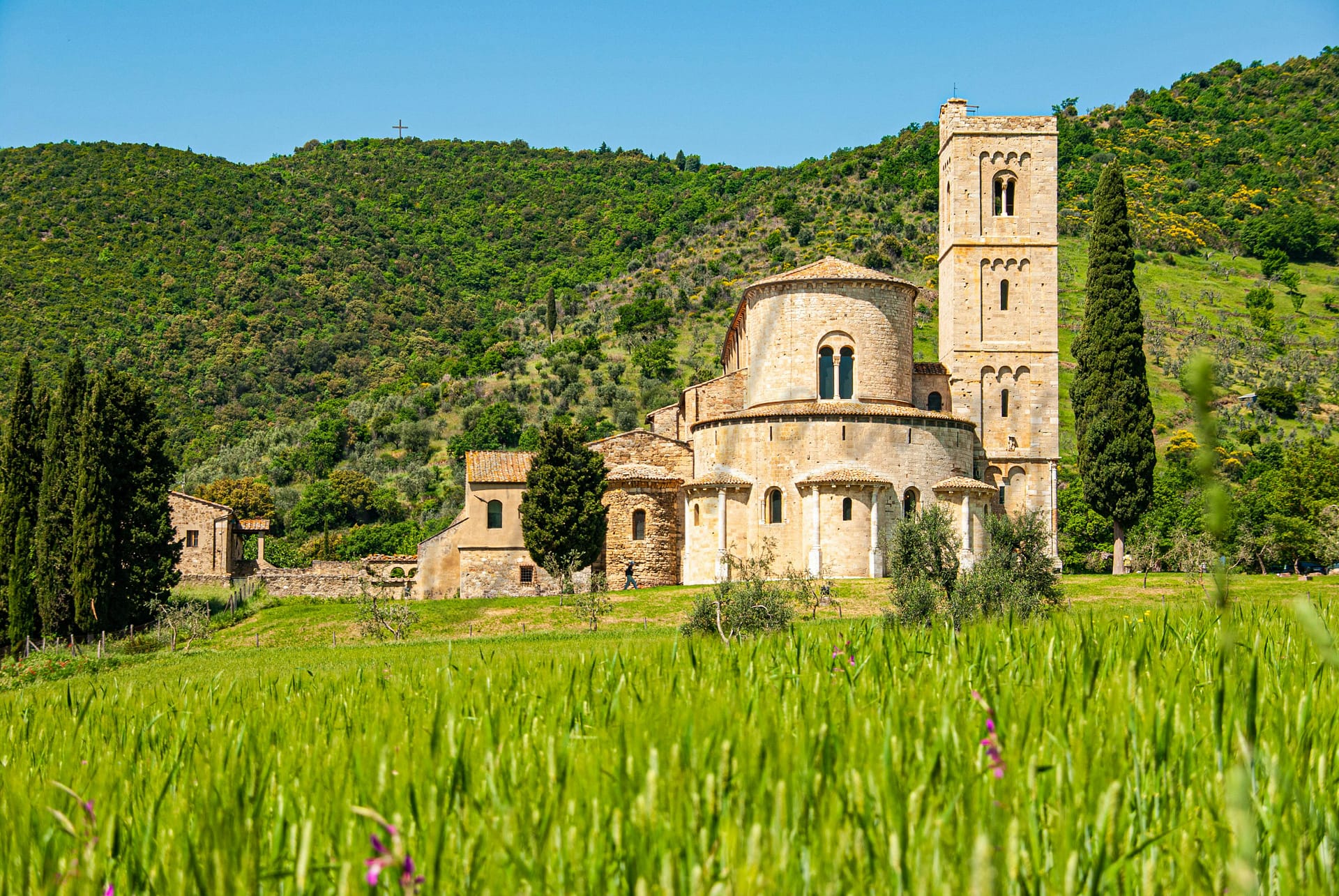
Sant’Antimo
Campania
Town with 32,000 residents. Features historical sites and proximity to Naples and beaches.
Quality of Life Score
[?]Factors in air quality, amenities, walkability, population, and environmental risks. Higher scores suggest better living conditions.
76
Quality of Infrastructure
[?]Measures internet speed, healthcare access, airports, rail, and walkability. Higher scores mean better connectivity and essential services.
70
Quality of Economy
[?]Based on income, property prices, job availability, and population density. Higher scores indicate stronger economic conditions.
56
Sant'Antimo Demographics
Population
[?]
This is a town's official population, measured each year by the national statistics authority.
32400
Real Population (5km band)
[?]
Our "Real Population" metric reflects more accurately a town's real size by including inhabitants in the immediate vicinity of the town's official borders.
700500
Births Per 100 Deaths
110.0
Population Data Source
ISTAT,2023
Estimated Unemployment Rate
Touristy Index
[?]
Calculation of tourist density index for the city, comparing its total tourist number to the overall average tourist number of the region
relative to its own population.The index indicates how a location’s tourist density compares to the average, with values above
100 representing higher-than-average density and values below 100 representing lower-than-average density.
No Data
Income per capita (2023)
[?]
This is an estimation of average income per resident for this town, based on 2023 data from the Italian Ministry of Finance.
16300
Income rank in Italy (2023)
[?]
This is a ranking of the town's average income per resident, against the full list of townships in Italy.
6372 out of 7901
Infrastructure and Connectivity
Create an account to explore more
This content is for Members only | Already a Member? Sign in
Closest Airport
Name
Capodichino (Naples)
Connectivity Score
[?]
Measures travel time and service quality of nearby airport stations. Higher scores mean better transport access.
9
Driving Time
19min(s)
Capodichino Airport, officially known as Naples International Airport, is located in Capodichino, Naples, Campania, Italy, approximately 5.9 km north-northeast of Naples city centre. It is the largest airport in Southern Italy, handling over 12 million passengers annually, and serves as a base for airlines such as easyJet, Ryanair, Volotea, and Wizz Air. The airport offers connections to major domestic destinations like Milan and Turin, as well as international routes to cities including Barcelona, London, Munich, Frankfurt, and New York City, making it a key hub for travellers in the Mediterranean region.
2nd Closest Airport
Name
Salerno Costa d'Amalfi (Salerno)
Connectivity Score
[?]
Measures travel time and service quality of nearby airport stations. Higher scores mean better transport access.
4
Driving Time
51min(s)
Salerno Costa d’Amalfi Airport is situated in Pontecagnano Faiano, Italy, and lies 20 kilometres from Salerno and 44 kilometres from the Amalfi Coast, closer than Naples. The airport, with a current runway of 2,000 meters, is gradually resuming services and targets full operations by 2026-2027. It offers seasonal flights to destinations like London, Milan, and resorts in North Africa and Greece, served by airlines including easyJet and British Airways, indicating a focus on leisure travel.
3rd Closest Airport
Name
Ciampino (Rome)
Connectivity Score
[?]
Measures travel time and service quality of nearby airport stations. Higher scores mean better transport access.
4
Driving Time
92min(s)
Rome Ciampino Airport (CIA) is located 12 km southeast of central Rome, close to the Greater Ring Road. It functions primarily as a base for budget airlines like Ryanair and Wizz Air, offering connections to key European destinations such as London–Stansted, Budapest, and Bucharest. As a secondary airport to Fiumicino, it serves nearly 6 million passengers annually, providing a convenient alternative with its focus on low-cost carriers.
Closest Rail
Name
Stazione di Sant'Antimo-Sant'Arpino
Connectivity Score
[?]
Measures travel time and service quality of nearby rail stations. Higher scores mean better transport access.
4
Driving Time
6min(s)
Train service at Stazione di Sant’Antimo-Sant’Arpino offers the following:
– **Rail lines that stop here**: Primarily regional lines operated by Trenitalia.
– **Key destinations connected by direct trains**: The main destinations include Napoli Centrale, with some regional trains also connecting to other areas within the Campania region.
– **Train operators**: The primary operator is Trenitalia, which runs the regional services.
– **Frequency of departures**: Trains typically run on an hourly basis, with variations depending on the time of day and weekends.
– **Train types**: The station primarily services regional trains, with no high-speed train services available.
2nd Closest Rail
Name
Aversa Ippodromo
Connectivity Score
[?]
Measures travel time and service quality of nearby rail stations. Higher scores mean better transport access.
6
Driving Time
6min(s)
Train service at Aversa Ippodromo includes multiple rail lines and extensive connectivity to key destinations. The station operates the following key services:
– **Rail Lines**: Aversa Ippodromo is served by the Rome–Formia–Naples line and the Naples–Foggia line.
– **Key Destinations**: Direct trains connect to various major destinations including Salerno, Lamezia Terme, Messina, Palermo, Taranto, and others.
– **Train Operators**: The primary operators are Trenitalia and MetroCampania NordEst, providing a mix of services including regional and intercity.
– **Frequency of Departures**: There are approximately 156 trains departing per day, indicating a high frequency of service.
– **Type of Trains**: The station accommodates a mix of train types, including regional trains, express trains, InterCity, and InterCity Night trains.
3rd Closest Rail
Name
Stazione di Giugliano
Connectivity Score
[?]
Measures travel time and service quality of nearby rail stations. Higher scores mean better transport access.
5
Driving Time
7min(s)
Train service at Stazione di Giugliano includes the following elements:
– **Rail Lines**: The station serves Line 11 of the Naples Metro, which connects to significant local destinations.
– **Key Destinations**: Direct trains operate to Napoli Centrale, Napoli Campi Flegrei, Villa Literno, and Aversa, among others.
– **Train Operators**: The primary operator for these services is Trenitalia.
– **Frequency of Departures**: Trains typically run every 30 minutes during peak times, with a mix of more frequent and less frequent services at different times.
– **Train Types**: The station offers regional services, and there is no indication of high-speed train services stopping here.
Overall, the train services at Stazione di Giugliano are essential for local commuter travel, connecting various suburbs and towns to major hubs in Naples.
Infrastructure & Amenities
Create an account to explore more
This content is for Members only | Already a Member? Sign in
Healthcare
Create an account to explore more
This content is for Members only | Already a Member? Sign in
Housing & Property Market
Create an account to explore more
This content is for Members only | Already a Member? Sign in
Connectivity & Digital Access
Create an account to explore more
This content is for Members only | Already a Member? Sign in
Education
Create an account to explore more
This content is for Members only | Already a Member? Sign in
Climate & Weather
Create an account to explore more
This content is for Members only | Already a Member? Sign in
Precipitation
[?] Based on daily climate data for precipitation from OPEN-METEO this parameter indicates how a city's annual precipitation compares to others in terms of percentage, with values ranging from 0 (lowest) to 1 (highest). For example, a percentile rank of 0.75 means the city's total precipitation is higher than 75% of other cities.
Average (41st-50th percentile)
Sunshine
High (71st-80th percentile)
Snowfall
Very Low (Bottom 10%)
Min Annual Temperature (°C)
[?] This parameter represents the monthly average of daily minimum temperatures for January, based on data from OPEN-METEO.
5.6
Max Annual Temperature (°C)
[?] This parameter represents the monthly average of daily minimum temperatures for January, based on data from OPEN-METEO.
29.9
Climate Description
Sant'Antimo enjoys a comfortably temperate climate, characterized by its warmth in the summers and moderate chill during the winter months. The area is blessed with abundant sunshine throughout the year, ensuring that days are generally bright and pleasant. Precipitation is evenly distributed, providing the region with lush greenery without the discomfort of excessive rainfall. Winters occasionally see a dusting of snow, adding a brief touch of winter wonder to this charming Italian town. Overall, Sant'Antimo offers an inviting climate that appeals particularly to retirees and expats looking for a serene environment with few extremes.
Annual Temperature Chart (Min)
Error
There was a problem with your SQL connection - Please contact the administrator
There was a problem with your SQL connection - Please contact the administrator
Annual Temperature Chart (Max)
Error
There was a problem with your SQL connection - Please contact the administrator
There was a problem with your SQL connection - Please contact the administrator
Sunny Days By Month
Error
There was a problem with your SQL connection - Please contact the administrator
There was a problem with your SQL connection - Please contact the administrator
Environmental & Air Quality
Create an account to explore more
This content is for Members only | Already a Member? Sign in
Classifications
PM10
[?]
PM10 levels indicate Good air quality at 0–20 µg/m³, Fair at 20–40 µg/m³, Moderate at 40–50 µg/m³, Poor at 50–100 µg/m³, Very Poor at 100–150 µg/m³, and Extremely Poor at 150–1200 µg/m³.
Fair
PM2.5
[?]
PM2.5 is Good if PM2.5 levels are between 0–10 µg/m³, Fair between 10–20 µg/m³, Moderate between 20–25 µg/m³, Poor between 25–50 µg/m³, Very Poor between 50–75 µg/m³, and Extremely Poor between 75–800 µg/m³.
Fair
NO2
[?]
NO₂ levels are considered Good at 0–40 µg/m³, Fair at 40–90 µg/m³, Moderate at 90–120 µg/m³, Poor at 120–230 µg/m³, Very Poor at 230–340 µg/m³, and Extremely Poor at 340–1000 µg/m³.
Good
SO2
[?]
SO₂ levels indicate Good air quality at 0–100 µg/m³, Fair at 100–200 µg/m³, Moderate at 200–350 µg/m³, Poor at 350–500 µg/m³, Very Poor at 500–750 µg/m³, and Extremely Poor at 750–1250 µg/m³.
Good
O₃
[?]
For O₃, the air is Good at 0–50 µg/m³, Fair at 50–100 µg/m³, Moderate at 100–130 µg/m³, Poor at 130–240 µg/m³, Very Poor at 240–380 µg/m³, and Extremely Poor at 380–800 µg/m³.
Fair
Air Quality Rating
[?]
Based on PM10, PM2.5, NO2, SO2, and ozone levels. Higher scores indicate cleaner air.
88
Air Quality Description
Situated in Italy, Sant’Antimo offers an air quality that provides a generally pleasant environment for expatriates and retirees alike. The concentrations of particulate matter in the town, both fine and coarser particles, are moderate, indicating a fair level of air purity. Comparable consideration is given to the levels of nitrogen dioxide and sulfur dioxide, where the air features satisfactory cleanliness. With regard to ozone, it also presents at a fair measure. This profile suggests that while the air quality is acceptable, residents may want to consider routine monitoring to maximize their comfort and health.
Situated in Italy, Sant’Antimo offers an air quality that provides a generally pleasant environment for expatriates and retirees alike. The concentrations of particulate matter in the town, both fine and coarser particles, are moderate, indicating a fair level of air purity. Comparable consideration is given to the levels of nitrogen dioxide and sulfur dioxide, where the air features satisfactory cleanliness. With regard to ozone, it also presents at a fair measure. This profile suggests that while the air quality is acceptable, residents may want to consider routine monitoring to maximize their comfort and health.
Town Descriptions
Create an account to explore more
This content is for Members only | Already a Member? Sign in
Getting There
Sant’Antimo in Campania is accessible via the A1 motorway and the SS7 quarters, facilitating travel to Naples and surrounding areas. Capodichino Airport, the nearest, serves as the primary air travel hub, while local train connections offer limited service.
Getting Around
Local Cuisine
Sant’Antimo, located in the Campania region, embraces a culinary scene deeply rooted in the rich traditions of Neapolitan cuisine, characterized by an array of local dishes. Traditional staples include pizza, known for its thin crust and robust toppings, and pasta dishes like spaghetti alle vongole, which showcases the area’s seafood bounty. The town also reflects the agricultural richness of the region, with local tomato varieties and mozzarella di bufala playing pivotal roles in its culinary offerings. In addition to local fare, Sant’Antimo hosts a variety of restaurants catering to international tastes, incorporating flavors from across the globe. Notably, while Sant’Antimo itself may not feature Michelin-starred establishments, the proximity to Naples provides access to several distinguished dining options in the region, showcasing innovative interpretations of classic Neapolitan dishes. The dining scene is thus a harmonious blend of traditional and modern, appealing to diverse palates.
Shopping Overview
Shopping options in the area feature a mix of supermarkets, boutiques, and shopping centres. Major supermarkets provide essential groceries and daily needs. For a wider range of products, notable shopping centres include modern outlets catering to diverse consumer interests. Expats and retirees can find specialty boutiques that encompass local artisan goods, fashion, and homeware. Farmers’ markets may also present opportunities for fresh produce and regional delicacies. This combination of retail choices caters to both convenience and lifestyle needs.
Neighborhoods
Green Areas and Parks
In and around Sant’Antimo, outdoor activities include hiking trails that appeal to various skill levels. Notable routes are found on Komoot, such as the intermediate 7.18-mile Piazza Dante loop from Colli Aminei and the expert-level 14.2-mile hiking loop from Frullone. Additional outdoor pursuits can be located on platforms like Tripadvisor, offering access to local parks such as Parco Francesco Solimene. Various sites provide detailed hiking and cycling maps, enhancing options for outdoor enthusiasts.
✅ Pros
– Rich cultural and historical backdrop enhances community experience.
– Mild climate ideal for year-round outdoor activities and relaxation.
– Good air quality promotes a healthier lifestyle and well-being.
– Opportunities for local integration and community engagement are abundant.
– Access to basic healthcare services, though quality may vary.
– Affordable cost of living compared to larger Italian cities.
– Decent transportation options facilitate travel within and outside the town.
– Variety of local cuisine showcases the rich culinary tradition.
– Scenic surroundings offer beautiful landscapes and nature exploration.
– Community-focused environment fosters friendly interactions and support networks.
❌ Cons
– Healthcare quality could leave you feeling underwhelmed and anxious.
– Unemployment rate higher than the national average; job prospects limited.
– Limited educational facilities may not meet diverse learning needs.
– Internet speed, while decent, may frustrate heavy users occasionally.
– Transportation options exist, but don’t expect extensive networks.
– Economic activity lacks vibrancy compared to larger cities nearby.
– Cultural attractions may be sparse for avid explorers.
– Seasonal heat can be uncomfortable for those sensitive to temperatures.
– Local shops may not always satisfy diverse shopping cravings.
– nightlife options can feel non-existent for the party enthusiasts.
FAQs
Summary
Sant’Antimo, nestled in Campania, is a vibrant town with a population of approximately 32,000. Known for its rich cultural heritage, it boasts notable attractions such as the Castello Baronale and the Chiesa del Convento di Santa Maria del Carmine, appealing to those interested in history and architecture. Its strategic location, only a 20-minute drive from Naples and less than 30 minutes from the beach, ensures easy access to urban amenities and coastal leisure.
✅ Pros
– Rich cultural and historical backdrop enhances community experience.
– Mild climate ideal for year-round outdoor activities and relaxation.
– Good air quality promotes a healthier lifestyle and well-being.
– Opportunities for local integration and community engagement are abundant.
– Access to basic healthcare services, though quality may vary.
– Affordable cost of living compared to larger Italian cities.
– Decent transportation options facilitate travel within and outside the town.
– Variety of local cuisine showcases the rich culinary tradition.
– Scenic surroundings offer beautiful landscapes and nature exploration.
– Community-focused environment fosters friendly interactions and support networks.
❌ Cons
– Healthcare quality could leave you feeling underwhelmed and anxious.
– Unemployment rate higher than the national average; job prospects limited.
– Limited educational facilities may not meet diverse learning needs.
– Internet speed, while decent, may frustrate heavy users occasionally.
– Transportation options exist, but don’t expect extensive networks.
– Economic activity lacks vibrancy compared to larger cities nearby.
– Cultural attractions may be sparse for avid explorers.
– Seasonal heat can be uncomfortable for those sensitive to temperatures.
– Local shops may not always satisfy diverse shopping cravings.
– nightlife options can feel non-existent for the party enthusiasts.
Related Posts
No posts found for the town.
More questions about Sant'Antimo ? Ask Magic AI.
Our innovative AI assistant is eager to help. Try it out here: