
Elevation
[?]
Elevation of a city refers to the height above sea level at which the city is located, measured in meters.
9
Population
[?]
This is a town's official population, measured each year by the national statistics authority.
18400
Real Population (5km)
[?]
Our "Real Population" metric reflects more accurately a town's real size by including inhabitants in the immediate vicinity of the town's official borders.
68300
Air Quality Rating
[?]
Based on PM10, PM2.5, NO2, SO2, and ozone levels. Higher scores indicate cleaner air.
80
Region
Lazio
Walkability
Very Walkable
Housing availability
[?]
Based on total number of properties (sale and rent) classifies housing availability into five categories: low, relativel ylow, medium, relatively high and high.
Low
Avg Download Speed (Mbps) / Avg Upload Speed (Mbps)
110
/ 28
Climate Description
Mild winters, warm summers, sunny, moderate rain; ideal for year-round outdoor activities.
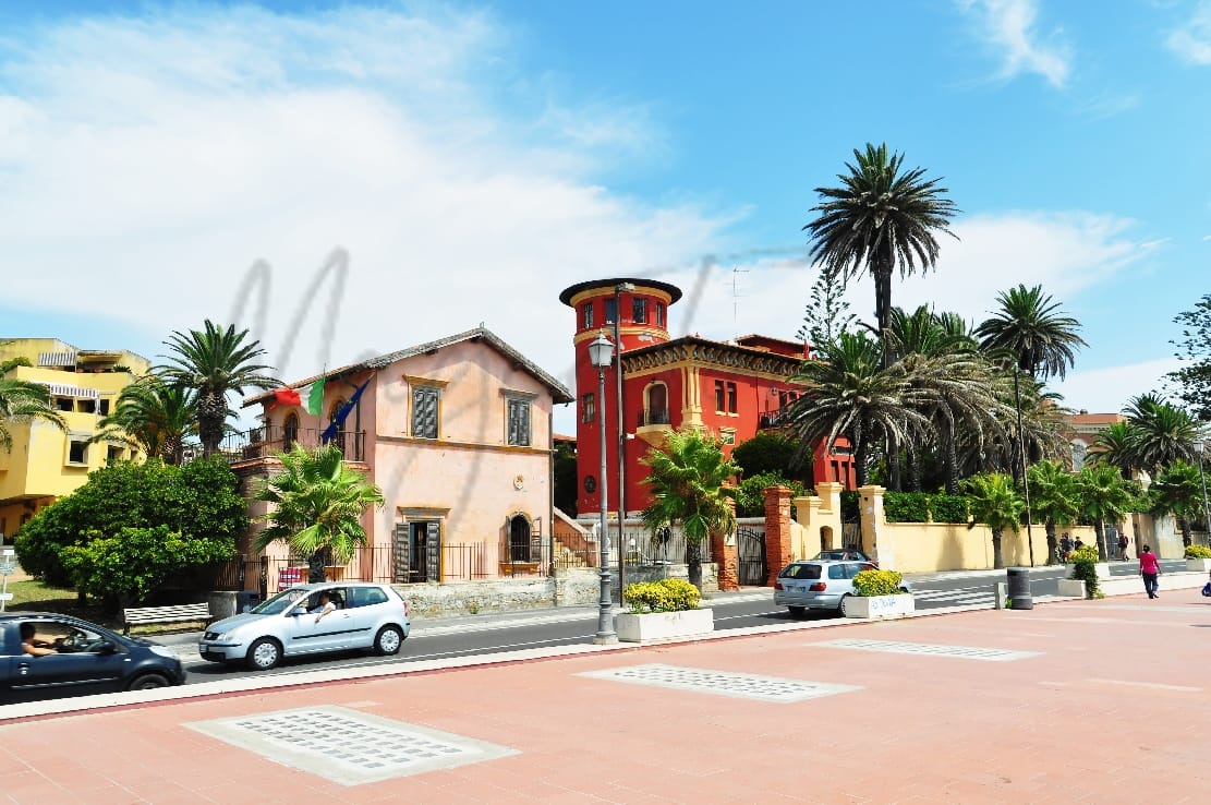
Santa Marinella
Lazio
Coastal town near Rome, known for beaches, historic castle, and outdoor activities.
Quality of Life Score
[?]Factors in air quality, amenities, walkability, population, and environmental risks. Higher scores suggest better living conditions.
84
Quality of Infrastructure
[?]Measures internet speed, healthcare access, airports, rail, and walkability. Higher scores mean better connectivity and essential services.
66
Quality of Economy
[?]Based on income, property prices, job availability, and population density. Higher scores indicate stronger economic conditions.
71
Santa Marinella Demographics
Population
[?]
This is a town's official population, measured each year by the national statistics authority.
18400
Real Population (5km band)
[?]
Our "Real Population" metric reflects more accurately a town's real size by including inhabitants in the immediate vicinity of the town's official borders.
68300
Births Per 100 Deaths
50.0
Population Data Source
ISTAT,2023
Estimated Unemployment Rate
Touristy Index
[?]
Calculation of tourist density index for the city, comparing its total tourist number to the overall average tourist number of the region
relative to its own population.The index indicates how a location’s tourist density compares to the average, with values above
100 representing higher-than-average density and values below 100 representing lower-than-average density.
Some Tourism
Income per capita (2023)
[?]
This is an estimation of average income per resident for this town, based on 2023 data from the Italian Ministry of Finance.
23000
Income rank in Italy (2023)
[?]
This is a ranking of the town's average income per resident, against the full list of townships in Italy.
1704 out of 7901
Infrastructure and Connectivity
Create an account to explore more
This content is for Members only | Already a Member? Sign in
Infrastructure & Amenities
Create an account to explore more
This content is for Members only | Already a Member? Sign in
Healthcare
Create an account to explore more
This content is for Members only | Already a Member? Sign in
Housing & Property Market
Create an account to explore more
This content is for Members only | Already a Member? Sign in
Connectivity & Digital Access
Create an account to explore more
This content is for Members only | Already a Member? Sign in
Education
Create an account to explore more
This content is for Members only | Already a Member? Sign in
Climate & Weather
Create an account to explore more
This content is for Members only | Already a Member? Sign in
Precipitation
[?] Based on daily climate data for precipitation from OPEN-METEO this parameter indicates how a city's annual precipitation compares to others in terms of percentage, with values ranging from 0 (lowest) to 1 (highest). For example, a percentile rank of 0.75 means the city's total precipitation is higher than 75% of other cities.
Somewhat Low (21st-30th percentile)
Sunshine
Exceptional (Top 10%)
Snowfall
Low (11th-20th percentile)
Min Annual Temperature (°C)
[?] This parameter represents the monthly average of daily minimum temperatures for January, based on data from OPEN-METEO.
7.9
Max Annual Temperature (°C)
[?] This parameter represents the monthly average of daily minimum temperatures for January, based on data from OPEN-METEO.
27.9
Climate Description
Santa Marinella enjoys a climate that is conducive to outdoor activities nearly year-round. Summertime peaks with warm temperatures, making it ideal for beach excursions and coastal walks, while winters remain mild, with only occasional snowfall briefly dusting the landscape. The weather is predominantly sunny, blessing residents with ample sunshine that supports a thriving local flora. Rainfall is moderate throughout the year, supporting lush vegetation without causing significant disruptions to daily life. This balanced weather pattern makes Santa Marinella an appealing destination for expats and retirees seeking a comfortable, vibrant environment by the Mediterranean.
Annual Temperature Chart (Min)
Error
There was a problem with your SQL connection - Please contact the administrator
There was a problem with your SQL connection - Please contact the administrator
Annual Temperature Chart (Max)
Error
There was a problem with your SQL connection - Please contact the administrator
There was a problem with your SQL connection - Please contact the administrator
Sunny Days By Month
Error
There was a problem with your SQL connection - Please contact the administrator
There was a problem with your SQL connection - Please contact the administrator
Environmental & Air Quality
Create an account to explore more
This content is for Members only | Already a Member? Sign in
Classifications
PM10
[?]
PM10 levels indicate Good air quality at 0–20 µg/m³, Fair at 20–40 µg/m³, Moderate at 40–50 µg/m³, Poor at 50–100 µg/m³, Very Poor at 100–150 µg/m³, and Extremely Poor at 150–1200 µg/m³.
Good
PM2.5
[?]
PM2.5 is Good if PM2.5 levels are between 0–10 µg/m³, Fair between 10–20 µg/m³, Moderate between 20–25 µg/m³, Poor between 25–50 µg/m³, Very Poor between 50–75 µg/m³, and Extremely Poor between 75–800 µg/m³.
Fair
NO2
[?]
NO₂ levels are considered Good at 0–40 µg/m³, Fair at 40–90 µg/m³, Moderate at 90–120 µg/m³, Poor at 120–230 µg/m³, Very Poor at 230–340 µg/m³, and Extremely Poor at 340–1000 µg/m³.
Good
SO2
[?]
SO₂ levels indicate Good air quality at 0–100 µg/m³, Fair at 100–200 µg/m³, Moderate at 200–350 µg/m³, Poor at 350–500 µg/m³, Very Poor at 500–750 µg/m³, and Extremely Poor at 750–1250 µg/m³.
Good
O₃
[?]
For O₃, the air is Good at 0–50 µg/m³, Fair at 50–100 µg/m³, Moderate at 100–130 µg/m³, Poor at 130–240 µg/m³, Very Poor at 240–380 µg/m³, and Extremely Poor at 380–800 µg/m³.
Fair
Air Quality Rating
[?]
Based on PM10, PM2.5, NO2, SO2, and ozone levels. Higher scores indicate cleaner air.
80
Air Quality Description
In Santa Marinella, air quality largely complies with international cleanliness standards, presenting minimal barriers to everyday activity and health. Particulate matter remains significantly low, endorsing an environment that sustains active outdoor lifestyles. However, the presence of ozone and finer particulates registers at moderate levels, presenting occasional considerations for sensitive individuals during certain periods of the year. Notably, emissions such as nitrogen and sulphur dioxide are consistently low, underscoring an atmosphere relatively unburdened by industrial pollution; a significant advantage for those seeking a tranquil retirement setting in Italy. Santa Marinella offers a reassuring option for those attentive to environmental cleanliness.
In Santa Marinella, air quality largely complies with international cleanliness standards, presenting minimal barriers to everyday activity and health. Particulate matter remains significantly low, endorsing an environment that sustains active outdoor lifestyles. However, the presence of ozone and finer particulates registers at moderate levels, presenting occasional considerations for sensitive individuals during certain periods of the year. Notably, emissions such as nitrogen and sulphur dioxide are consistently low, underscoring an atmosphere relatively unburdened by industrial pollution; a significant advantage for those seeking a tranquil retirement setting in Italy. Santa Marinella offers a reassuring option for those attentive to environmental cleanliness.
Town Descriptions
Create an account to explore more
This content is for Members only | Already a Member? Sign in
Getting There
Santa Marinella is accessible via the A12 motorway, connecting it to Rome and nearby coastal towns. The town benefits from two nearby train stations, providing convenient rail links. Major airports, including Leonardo da Vinci and Ciampino, support international travel options.
Getting Around
Local Cuisine
Santa Marinella’s culinary scene is greatly influenced by its coastal location in Lazio, offering a rich selection of seafood-based dishes. Key traditional dishes include spaghetti alle vongole and various seafood antipasti, complemented by regional specialties like pasta carbonara and pasta all’amatriciana. The dining landscape features a variety of restaurants serving both local and international cuisine, with an emphasis on fresh ingredients and Mediterranean seafood. Notably, there is a Michelin-starred restaurant in the town, enhancing its gastronomic reputation. The area is characterized by a relaxed dining atmosphere, particularly in beachfront establishments, where patrons can enjoy local dishes paired with fine white wines from the region. Overall, the culinary scene reflects a blend of traditional Roman flavors and modern dining experiences, making Santa Marinella a notable destination for food enthusiasts.
Shopping Overview
The shopping landscape features supermarkets offering everyday essentials and local produce. Retail hubs provide diverse options, ranging from fashion boutiques to speciality gift shops. Shopping centres feature a combination of local and international brands, while marketplaces complement this with artisanal goods. Expats and retirees will appreciate the accessibility of various grocery outlets and the integration of outdoor markets that highlight regional products.
Neighborhoods
Green Areas and Parks
Santa Marinella in Lazio offers a variety of outdoor activities for expats and retirees. The area is known for difficult hiking trails such as the Santa Severa – La Tolfaccia route, which is 40 miles long, featuring significant elevation gains and panoramic views, suitable for multi-day excursions. Additionally, the Macchiatonda Nature Reserve provides a serene green space perfect for walks and nature observation, supporting local biodiversity. Outdoor enthusiasts can also engage in seaside activities along Santa Marinella’s beaches, facilitating a blend of both terrestrial and aquatic experiences.
✅ Pros
– High-quality healthcare services available for residents and expats.
– Pleasant Mediterranean climate with mild winters and warm summers.
– Rich cultural and historical backdrop for exploration and enjoyment.
– Good transportation links to Rome and other nearby areas.
– Low unemployment rate promoting local economic stability and growth.
– Opportunities for integration within a welcoming expatriate community.
– Sufficient internet connectivity for remote work and communication needs.
– Beautiful coastal scenery with access to beaches and outdoor activities.
– Moderate tourist presence enhances local amenities without overcrowding.
– Educational facilities that cater to both locals and expatriates.
❌ Cons
– Air quality could be better for sensitive residents and visitors.
– Infrastructure improvements needed for public transport and roads.
– Limited shopping options outside major brands and local markets.
– Some cultural activities may be less frequent than in larger cities.
– Beaches can become crowded during the peak tourist season.
– Language barrier may pose challenges for non-Italian speakers.
– Limited nightlife options may not suit younger expats.
– Weather can be quite hot during peak summer months.
– Local bureaucracy can be slow and frustrating at times.
– Job opportunities may be scarce for specific professions.
FAQs
Summary
Santa Marinella is a tranquil coastal town located about 60 kilometers northwest of Rome, offering an appealing mix of history and beautiful scenery. Known for its inviting beaches and crystal-clear waters, the town features a 14th-century castle and a charming historic center, where restaurants and cafés create a lively yet relaxed atmosphere. The nearby Maremma regional park provides excellent opportunities for outdoor activities like hiking and biking, appealing to active retirees and expats looking for a peaceful lifestyle.
The local culture reflects a blend of tradition and modern living, with local dining experiences often highlighted for their quality, although the peak tourist months can lead to crowded conditions. While Santa Marinella may lack the extensive amenities found in larger cities, its strong community spirit and proximity to Rome make it an attractive option for those seeking a quieter life in Italy.
✅ Pros
– High-quality healthcare services available for residents and expats.
– Pleasant Mediterranean climate with mild winters and warm summers.
– Rich cultural and historical backdrop for exploration and enjoyment.
– Good transportation links to Rome and other nearby areas.
– Low unemployment rate promoting local economic stability and growth.
– Opportunities for integration within a welcoming expatriate community.
– Sufficient internet connectivity for remote work and communication needs.
– Beautiful coastal scenery with access to beaches and outdoor activities.
– Moderate tourist presence enhances local amenities without overcrowding.
– Educational facilities that cater to both locals and expatriates.
❌ Cons
– Air quality could be better for sensitive residents and visitors.
– Infrastructure improvements needed for public transport and roads.
– Limited shopping options outside major brands and local markets.
– Some cultural activities may be less frequent than in larger cities.
– Beaches can become crowded during the peak tourist season.
– Language barrier may pose challenges for non-Italian speakers.
– Limited nightlife options may not suit younger expats.
– Weather can be quite hot during peak summer months.
– Local bureaucracy can be slow and frustrating at times.
– Job opportunities may be scarce for specific professions.
Related Posts
No posts found for the town.
More questions about Santa Marinella ? Ask Magic AI.
Our innovative AI assistant is eager to help. Try it out here: