
Elevation
[?]
Elevation of a city refers to the height above sea level at which the city is located, measured in meters.
88
Population
[?]
This is a town's official population, measured each year by the national statistics authority.
49300
Real Population (5km)
[?]
Our "Real Population" metric reflects more accurately a town's real size by including inhabitants in the immediate vicinity of the town's official borders.
92100
Air Quality Rating
[?]
Based on PM10, PM2.5, NO2, SO2, and ozone levels. Higher scores indicate cleaner air.
96
Region
Puglia
Walkability
Walker’s Paradise
Housing availability
[?]
Based on total number of properties (sale and rent) classifies housing availability into five categories: low, relativel ylow, medium, relatively high and high.
Relatively High
Avg Download Speed (Mbps) / Avg Upload Speed (Mbps)
213
/ 133
Climate Description
Temperate climate with mild winters, warm summers, abundant sunshine, and modest rainfall.
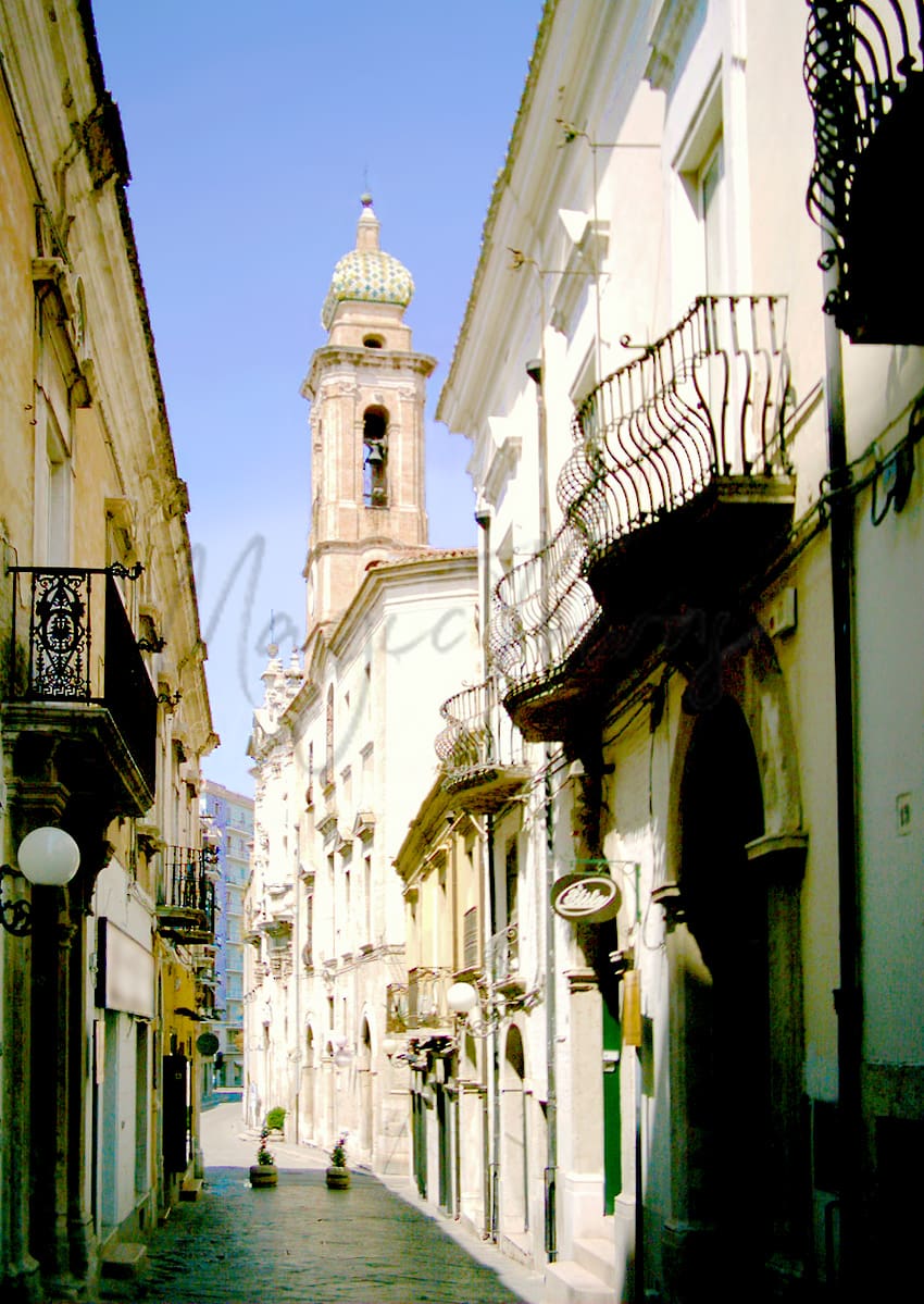
San Severo
Puglia
Historic town in Puglia, known for Baroque architecture, agriculture, wines, and community pride.
Quality of Life Score
[?]Factors in air quality, amenities, walkability, population, and environmental risks. Higher scores suggest better living conditions.
75
Quality of Infrastructure
[?]Measures internet speed, healthcare access, airports, rail, and walkability. Higher scores mean better connectivity and essential services.
61
Quality of Economy
[?]Based on income, property prices, job availability, and population density. Higher scores indicate stronger economic conditions.
71
San Severo Demographics
Population
[?]
This is a town's official population, measured each year by the national statistics authority.
49300
Real Population (5km band)
[?]
Our "Real Population" metric reflects more accurately a town's real size by including inhabitants in the immediate vicinity of the town's official borders.
92100
Births Per 100 Deaths
70.0
Population Data Source
ISTAT,2023
Estimated Unemployment Rate
Touristy Index
[?]
Calculation of tourist density index for the city, comparing its total tourist number to the overall average tourist number of the region
relative to its own population.The index indicates how a location’s tourist density compares to the average, with values above
100 representing higher-than-average density and values below 100 representing lower-than-average density.
Not Touristic
Income per capita (2023)
[?]
This is an estimation of average income per resident for this town, based on 2023 data from the Italian Ministry of Finance.
16600
Income rank in Italy (2023)
[?]
This is a ranking of the town's average income per resident, against the full list of townships in Italy.
6162 out of 7901
Infrastructure and Connectivity
Create an account to explore more
This content is for Members only | Already a Member? Sign in
Closest Airport
Name
Karol Wojtyla (Bari)
Connectivity Score
[?]
Measures travel time and service quality of nearby airport stations. Higher scores mean better transport access.
7
Driving Time
76min(s)
Bari Karol Wojtyła Airport is located approximately 8 kilometres northwest of Bari, Italy, and serves as a significant hub in the Puglia region. It handled over 6 million passengers in 2023, largely acting as a focus city for low-cost carriers like Ryanair and Volotea. The airport connects to numerous European cities, with main routes including destinations such as London, Paris, Milan, and Istanbul, and benefits from seasonal services to cities like New York and Vienna, marking it as a convenient base for both domestic and international travel.
2nd Closest Airport
Name
Abruzzo Airport (Pescara)
Connectivity Score
[?]
Measures travel time and service quality of nearby airport stations. Higher scores mean better transport access.
7
Driving Time
81min(s)
Abruzzo Airport, located about 4 kilometers from Pescara city centre and approximately 180 kilometers from Rome, is a medium-sized international gateway serving Abruzzo and neighbouring regions such as Molise and Marche. Handling over 700,000 passengers in 2022, the airport connects travellers to 18 destinations across 11 countries, with key routes including London Stansted, Milan, Bucharest, and Malta. Notably, it offers budget-friendly parking options and serves as a hub for low-cost carriers like Ryanair, facilitating both domestic and international travel.
3rd Closest Airport
Name
Capodichino (Naples)
Connectivity Score
[?]
Measures travel time and service quality of nearby airport stations. Higher scores mean better transport access.
9
Driving Time
113min(s)
Capodichino Airport, officially known as Naples International Airport, is located in Capodichino, Naples, Campania, Italy, approximately 5.9 km north-northeast of Naples city centre. It is the largest airport in Southern Italy, handling over 12 million passengers annually, and serves as a base for airlines such as easyJet, Ryanair, Volotea, and Wizz Air. The airport offers connections to major domestic destinations like Milan and Turin, as well as international routes to cities including Barcelona, London, Munich, Frankfurt, and New York City, making it a key hub for travellers in the Mediterranean region.
Closest Rail
Name
Stazione di Rignano Garganico
Connectivity Score
[?]
Measures travel time and service quality of nearby rail stations. Higher scores mean better transport access.
4
Driving Time
14min(s)
Train service at Stazione di Rignano Garganico provides essential regional connections in the Italian railway network. The station is served predominantly by regional trains operated by Trenitalia, catering to passengers wishing to travel to nearby towns and cities.
### Rail Lines:
– The primary rail line servicing the station is the Foggia to Barletta line.
### Key Destinations:
– Passengers can take direct trains to several key destinations, including Foggia and Barletta.
### Train Operators:
– The main train operator at this station is Trenitalia, which is responsible for regional rail services. High-speed services, such as those offered by Italo, do not stop at this station.
### Frequency of Departures:
– Trains typically operate on an hourly basis, with some services running more frequently during peak times, while a few may be offered during off-peak hours.
### Train Types:
– Stazione di Rignano Garganico mainly offers regional train services, without high-speed options available.
2nd Closest Rail
Name
Stazione di San Severo
Connectivity Score
[?]
Measures travel time and service quality of nearby rail stations. Higher scores mean better transport access.
7
Driving Time
15min(s)
Train service at Stazione di San Severo includes the Adriatic railway line. Direct trains connect to key destinations such as Foggia, Rome, Pescara, and Bari. The main train operator is Trenitalia, which provides Inter-city, express, and local train services. Departure frequency varies typically from hourly to a few trains per day depending on the route. The station services a mix of high-speed and regional trains, catering to both quick and local travel needs.
3rd Closest Rail
Name
Stazione di Apricena
Connectivity Score
[?]
Measures travel time and service quality of nearby rail stations. Higher scores mean better transport access.
6
Driving Time
26min(s)
Train service at Stazione di Apricena includes regional train services primarily operated by Ferrovie del Gargano. The main rail line that stops here is the San Severo–Peschici railway, connecting Apricena with key destinations such as Foggia, San Severo, and Peschici. The frequency of departures is approximately every hour throughout the day, with multiple services available. The station does not host high-speed trains; it offers regional services only. Overall, the train services provide good local connectivity for passengers travelling within the region of Puglia.
Infrastructure & Amenities
Create an account to explore more
This content is for Members only | Already a Member? Sign in
Healthcare
Create an account to explore more
This content is for Members only | Already a Member? Sign in
Housing & Property Market
Create an account to explore more
This content is for Members only | Already a Member? Sign in
Connectivity & Digital Access
Create an account to explore more
This content is for Members only | Already a Member? Sign in
Education
Create an account to explore more
This content is for Members only | Already a Member? Sign in
Climate & Weather
Create an account to explore more
This content is for Members only | Already a Member? Sign in
Precipitation
[?] Based on daily climate data for precipitation from OPEN-METEO this parameter indicates how a city's annual precipitation compares to others in terms of percentage, with values ranging from 0 (lowest) to 1 (highest). For example, a percentile rank of 0.75 means the city's total precipitation is higher than 75% of other cities.
Very Low (Bottom 10%)
Sunshine
Very High (81st-90th percentile)
Snowfall
Low (11th-20th percentile)
Min Annual Temperature (°C)
[?] This parameter represents the monthly average of daily minimum temperatures for January, based on data from OPEN-METEO.
3.7
Max Annual Temperature (°C)
[?] This parameter represents the monthly average of daily minimum temperatures for January, based on data from OPEN-METEO.
32.5
Climate Description
San Severo, Italy, enjoys a temperate climate defined by mild winters and warm summers. The town benefits significantly from abundant sunshine throughout the year, ensuring a luminous atmosphere perfect for both visitors and expats seeking a sunny retreat. Winters here see only a slight touch of snowfall, creating picturesque scenes without the hassle of severe winter conditions. Summers in San Severo can be quite warm, making it ideal for those who appreciate sun-drenched days. The rainfall is modest and fairly distributed across the year, which helps maintain the natural greenery without overwhelming residents or visitors with excessive wet weather.
Annual Temperature Chart (Min)
Error
There was a problem with your SQL connection - Please contact the administrator
There was a problem with your SQL connection - Please contact the administrator
Annual Temperature Chart (Max)
Error
There was a problem with your SQL connection - Please contact the administrator
There was a problem with your SQL connection - Please contact the administrator
Sunny Days By Month
Error
There was a problem with your SQL connection - Please contact the administrator
There was a problem with your SQL connection - Please contact the administrator
Environmental & Air Quality
Create an account to explore more
This content is for Members only | Already a Member? Sign in
Classifications
PM10
[?]
PM10 levels indicate Good air quality at 0–20 µg/m³, Fair at 20–40 µg/m³, Moderate at 40–50 µg/m³, Poor at 50–100 µg/m³, Very Poor at 100–150 µg/m³, and Extremely Poor at 150–1200 µg/m³.
Good
PM2.5
[?]
PM2.5 is Good if PM2.5 levels are between 0–10 µg/m³, Fair between 10–20 µg/m³, Moderate between 20–25 µg/m³, Poor between 25–50 µg/m³, Very Poor between 50–75 µg/m³, and Extremely Poor between 75–800 µg/m³.
Good
NO2
[?]
NO₂ levels are considered Good at 0–40 µg/m³, Fair at 40–90 µg/m³, Moderate at 90–120 µg/m³, Poor at 120–230 µg/m³, Very Poor at 230–340 µg/m³, and Extremely Poor at 340–1000 µg/m³.
Good
SO2
[?]
SO₂ levels indicate Good air quality at 0–100 µg/m³, Fair at 100–200 µg/m³, Moderate at 200–350 µg/m³, Poor at 350–500 µg/m³, Very Poor at 500–750 µg/m³, and Extremely Poor at 750–1250 µg/m³.
Good
O₃
[?]
For O₃, the air is Good at 0–50 µg/m³, Fair at 50–100 µg/m³, Moderate at 100–130 µg/m³, Poor at 130–240 µg/m³, Very Poor at 240–380 µg/m³, and Extremely Poor at 380–800 µg/m³.
Fair
Air Quality Rating
[?]
Based on PM10, PM2.5, NO2, SO2, and ozone levels. Higher scores indicate cleaner air.
96
Air Quality Description
San Severo, nestled in Italy, offers a reassuring setting for those concerned about air quality. The particulate matter under 10 micrometers (PM10) and under 2.5 micrometers (PM2.5) are well within the ‘Good’ category. These particles, often highlighted in environmental reports, are low enough to alleviate any concerns regarding routine outdoor activities. Furthermore, levels of nitrogen and sulphur dioxide, which could pose risks at high concentrations, are similarly categorized as ‘Good,’ signifying minimal presence in the town’s atmosphere. Only ozone reaches a ‘Fair’ level, indicating a need for modest attention during peak sunny days.
San Severo, nestled in Italy, offers a reassuring setting for those concerned about air quality. The particulate matter under 10 micrometers (PM10) and under 2.5 micrometers (PM2.5) are well within the ‘Good’ category. These particles, often highlighted in environmental reports, are low enough to alleviate any concerns regarding routine outdoor activities. Furthermore, levels of nitrogen and sulphur dioxide, which could pose risks at high concentrations, are similarly categorized as ‘Good,’ signifying minimal presence in the town’s atmosphere. Only ozone reaches a ‘Fair’ level, indicating a need for modest attention during peak sunny days.
Town Descriptions
Create an account to explore more
This content is for Members only | Already a Member? Sign in
Getting There
San Severo is accessible via the A14 motorway, with significant road links to major cities in Puglia and beyond. The nearest airports are Bari and Pescara, facilitating regional and international travel. Local train stations provide limited connectivity, contributing to a moderate infrastructure rating.
Getting Around
Local Cuisine
San Severo, a town in Puglia, boasts a vibrant culinary scene deeply rooted in its rich agricultural heritage. Traditional dishes include fresh seafood, homemade pasta, and grilled meats, showcasing locally-sourced ingredients such as olive oil and wine. Restaurants offer a variety of local Apulian cuisine along with international influences, benefiting from the region’s diverse cultural history. Notably, San Severo is home to Michelin-starred establishments like La Fossa del Grano, which exemplifies the quality and innovation present in the area’s dining options.
Shopping Overview
The area offers diverse shopping options encompassing supermarkets, boutiques, and shopping malls. Major shopping centres include several named establishments, providing a wide range of retail experiences. Supermarkets cater to daily needs, while boutique shops offer specialised goods. Noteworthy malls enhance the overall shopping landscape, accommodating both local and international preferences. Specialty and gift shops further contribute to a varied shopping experience, appealing to different consumer interests. Overall, the shopping scene is well-equipped to meet the requirements of expats and retirees looking for convenience and variety in their retail choices.
Neighborhoods
Green Areas and Parks
San Severo offers several notable green spaces and parks. Villa Comunale is a prominent garden providing serene environments for relaxation. Parco Baden Powell is another significant park in the area, offering green vistas for leisurely walks. The region also features Giokolandia A S D, known for its recreational facilities. Additionally, the nearby Gargano National Park, a short drive away, presents expansive opportunities for hiking and exploring diverse natural landscapes, making it a crucial destination for outdoor enthusiasts.
✅ Pros
– Rich cultural and historical backdrop to explore daily.
– Mild climate ideal for outdoor activities year-round.
– Strong community feel with integration opportunities for newcomers.
– Non-touristic, providing a more authentic Italian experience.
– Reasonable healthcare facilities available for residents.
– Good air quality contributes to overall well-being.
– Transportation options facilitate easy access to nearby cities.
– Local markets offer fresh and quality produce.
– Affordable cost of living compared to larger Italian cities.
– Quiet lifestyle perfect for relaxation and retirement activities.
❌ Cons
– Healthcare facilities may not meet all expat needs adequately.
– Limited entertainment options for those seeking vibrant nightlife.
– Infrastructure improvements needed for better connectivity and services.
– Unemployment rate slightly higher than the national average.
– Internet speeds may not satisfy heavy streaming or gaming.
– Public transportation can be infrequent and less reliable.
– Cultural events may lack the frequency found in larger cities.
– Shops and amenities may close early, limiting convenience.
– Language barrier could hinder integration for non-Italian speakers.
– Economic opportunities may be limited for new ventures.
FAQs
Summary
San Severo, located in the heart of Puglia, is a town steeped in history and vibrant culture, appealing to foreign expats and retirees. Once the capital of Capitanata, it features an impressive Baroque architectural landscape, highlighted by the Cathedral Santa Maria Assunta and the picturesque Teatro Giuseppe Verdi. With a walkable environment and rich historical legacy dating back to the Palaeolithic era, residents can explore various churches and cultural sites, fostering a sense of community and pride.
Local traditions are prominent, particularly in agriculture and winemaking, where quality wines are produced. Regular markets and events celebrate its heritage, though the town faces challenges like limited healthcare options and proximity to beaches, situated over 30 kilometers away. Nevertheless, San Severo’s affordability and charm, combined with its appealing air quality and internet connectivity, ensure a comfortable living experience in this enchanting region of Italy.
✅ Pros
– Rich cultural and historical backdrop to explore daily.
– Mild climate ideal for outdoor activities year-round.
– Strong community feel with integration opportunities for newcomers.
– Non-touristic, providing a more authentic Italian experience.
– Reasonable healthcare facilities available for residents.
– Good air quality contributes to overall well-being.
– Transportation options facilitate easy access to nearby cities.
– Local markets offer fresh and quality produce.
– Affordable cost of living compared to larger Italian cities.
– Quiet lifestyle perfect for relaxation and retirement activities.
❌ Cons
– Healthcare facilities may not meet all expat needs adequately.
– Limited entertainment options for those seeking vibrant nightlife.
– Infrastructure improvements needed for better connectivity and services.
– Unemployment rate slightly higher than the national average.
– Internet speeds may not satisfy heavy streaming or gaming.
– Public transportation can be infrequent and less reliable.
– Cultural events may lack the frequency found in larger cities.
– Shops and amenities may close early, limiting convenience.
– Language barrier could hinder integration for non-Italian speakers.
– Economic opportunities may be limited for new ventures.
Related Posts
No posts found for the town.
More questions about San Severo ? Ask Magic AI.
Our innovative AI assistant is eager to help. Try it out here: