
Elevation
[?]
Elevation of a city refers to the height above sea level at which the city is located, measured in meters.
175
Population
[?]
This is a town's official population, measured each year by the national statistics authority.
19400
Real Population (5km)
[?]
Our "Real Population" metric reflects more accurately a town's real size by including inhabitants in the immediate vicinity of the town's official borders.
129000
Air Quality Rating
[?]
Based on PM10, PM2.5, NO2, SO2, and ozone levels. Higher scores indicate cleaner air.
76
Region
Lombardia
Walkability
Very Walkable
Housing availability
[?]
Based on total number of properties (sale and rent) classifies housing availability into five categories: low, relativel ylow, medium, relatively high and high.
Low
Avg Download Speed (Mbps) / Avg Upload Speed (Mbps)
238
/ 142
Climate Description
Mild climate with sunny days, gentle winters, warm summers, and evenly distributed rainfall.
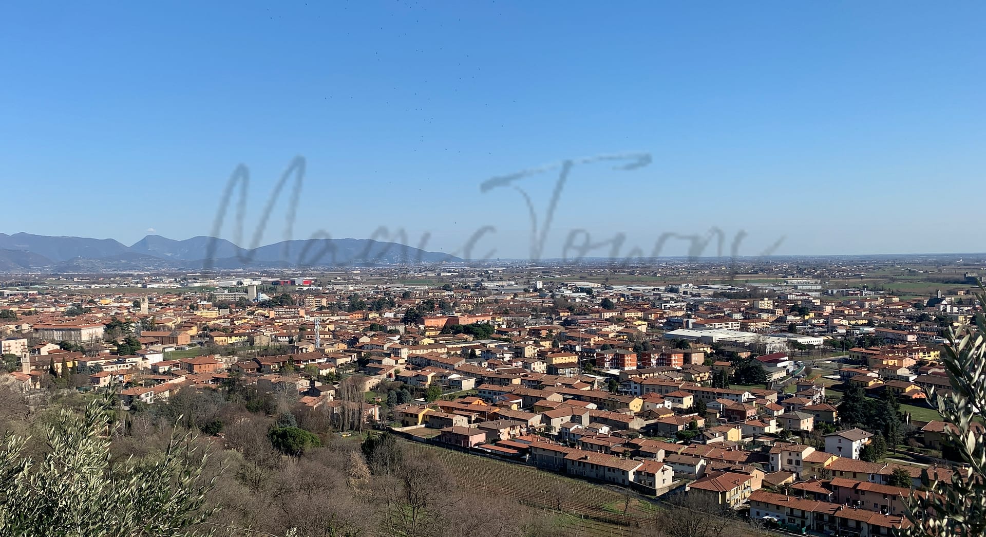
Rovato
Lombardia
Small town with vibrant public spaces, historical sites, and proximity to Franciacorta wine region.
Quality of Life Score
[?]Factors in air quality, amenities, walkability, population, and environmental risks. Higher scores suggest better living conditions.
86
Quality of Infrastructure
[?]Measures internet speed, healthcare access, airports, rail, and walkability. Higher scores mean better connectivity and essential services.
72
Quality of Economy
[?]Based on income, property prices, job availability, and population density. Higher scores indicate stronger economic conditions.
72
Rovato Demographics
Population
[?]
This is a town's official population, measured each year by the national statistics authority.
19400
Real Population (5km band)
[?]
Our "Real Population" metric reflects more accurately a town's real size by including inhabitants in the immediate vicinity of the town's official borders.
129000
Births Per 100 Deaths
120.0
Population Data Source
ISTAT,2023
Estimated Unemployment Rate
Touristy Index
[?]
Calculation of tourist density index for the city, comparing its total tourist number to the overall average tourist number of the region
relative to its own population.The index indicates how a location’s tourist density compares to the average, with values above
100 representing higher-than-average density and values below 100 representing lower-than-average density.
Not Touristic
Income per capita (2023)
[?]
This is an estimation of average income per resident for this town, based on 2023 data from the Italian Ministry of Finance.
22000
Income rank in Italy (2023)
[?]
This is a ranking of the town's average income per resident, against the full list of townships in Italy.
2655 out of 7901
Infrastructure and Connectivity
Create an account to explore more
This content is for Members only | Already a Member? Sign in
Infrastructure & Amenities
Create an account to explore more
This content is for Members only | Already a Member? Sign in
Healthcare
Create an account to explore more
This content is for Members only | Already a Member? Sign in
Housing & Property Market
Create an account to explore more
This content is for Members only | Already a Member? Sign in
Connectivity & Digital Access
Create an account to explore more
This content is for Members only | Already a Member? Sign in
Education
Create an account to explore more
This content is for Members only | Already a Member? Sign in
Climate & Weather
Create an account to explore more
This content is for Members only | Already a Member? Sign in
Precipitation
[?] Based on daily climate data for precipitation from OPEN-METEO this parameter indicates how a city's annual precipitation compares to others in terms of percentage, with values ranging from 0 (lowest) to 1 (highest). For example, a percentile rank of 0.75 means the city's total precipitation is higher than 75% of other cities.
Somewhat High (61st-70th percentile)
Sunshine
Below Average (31st-40th percentile)
Snowfall
Average (41st-50th percentile)
Min Annual Temperature (°C)
[?] This parameter represents the monthly average of daily minimum temperatures for January, based on data from OPEN-METEO.
-0.3
Max Annual Temperature (°C)
[?] This parameter represents the monthly average of daily minimum temperatures for January, based on data from OPEN-METEO.
27.6
Climate Description
In Rovato, Italy, the climate is characterized by a generous amount of sunshine throughout the year, enhancing the appeal for those who appreciate bright, clear days. Winters gently usher in cooler temperatures with occasional snowfall, creating a picturesque setting without severe cold. Summers are pleasantly warm, not prone to extreme heat, which makes it comfortable for outdoor activities and relaxation. The rainfall is well-distributed across the seasons, ensuring lush landscapes and fruitful vineyards that contribute to the local charm. Rovato offers a moderate climate that appeals to retirees and expats looking for a place with both beauty and balanced weather conditions.
Annual Temperature Chart (Min)
Error
There was a problem with your SQL connection - Please contact the administrator
There was a problem with your SQL connection - Please contact the administrator
Annual Temperature Chart (Max)
Error
There was a problem with your SQL connection - Please contact the administrator
There was a problem with your SQL connection - Please contact the administrator
Sunny Days By Month
Error
There was a problem with your SQL connection - Please contact the administrator
There was a problem with your SQL connection - Please contact the administrator
Environmental & Air Quality
Create an account to explore more
This content is for Members only | Already a Member? Sign in
Classifications
PM10
[?]
PM10 levels indicate Good air quality at 0–20 µg/m³, Fair at 20–40 µg/m³, Moderate at 40–50 µg/m³, Poor at 50–100 µg/m³, Very Poor at 100–150 µg/m³, and Extremely Poor at 150–1200 µg/m³.
Fair
PM2.5
[?]
PM2.5 is Good if PM2.5 levels are between 0–10 µg/m³, Fair between 10–20 µg/m³, Moderate between 20–25 µg/m³, Poor between 25–50 µg/m³, Very Poor between 50–75 µg/m³, and Extremely Poor between 75–800 µg/m³.
Fair
NO2
[?]
NO₂ levels are considered Good at 0–40 µg/m³, Fair at 40–90 µg/m³, Moderate at 90–120 µg/m³, Poor at 120–230 µg/m³, Very Poor at 230–340 µg/m³, and Extremely Poor at 340–1000 µg/m³.
Good
SO2
[?]
SO₂ levels indicate Good air quality at 0–100 µg/m³, Fair at 100–200 µg/m³, Moderate at 200–350 µg/m³, Poor at 350–500 µg/m³, Very Poor at 500–750 µg/m³, and Extremely Poor at 750–1250 µg/m³.
Good
O₃
[?]
For O₃, the air is Good at 0–50 µg/m³, Fair at 50–100 µg/m³, Moderate at 100–130 µg/m³, Poor at 130–240 µg/m³, Very Poor at 240–380 µg/m³, and Extremely Poor at 380–800 µg/m³.
Fair
Air Quality Rating
[?]
Based on PM10, PM2.5, NO2, SO2, and ozone levels. Higher scores indicate cleaner air.
76
Air Quality Description
Rovato, Italy presents an overall moderate air quality environment, marked by a balance between urban activities and its proximity to greener landscapes. Levels of particulate matter such as PM10 and PM2.5 are notedly fair, indicating occasional raises above the ideal threshold but generally maintaining a breathable atmosphere. Similarly, ozone concentration hovers in a fair range, often influenced by regional climatic conditions. Noteworthy, however, is the commendable status of nitrogen and sulphur dioxide levels—both categorized as good and signaling effective emission control measures within this community. For those considering a relocation to Rovato, the air serves as a decent backdrop to everyday life, melding small-town charm with a mindful acknowledgment of environmental respect.
Rovato, Italy presents an overall moderate air quality environment, marked by a balance between urban activities and its proximity to greener landscapes. Levels of particulate matter such as PM10 and PM2.5 are notedly fair, indicating occasional raises above the ideal threshold but generally maintaining a breathable atmosphere. Similarly, ozone concentration hovers in a fair range, often influenced by regional climatic conditions. Noteworthy, however, is the commendable status of nitrogen and sulphur dioxide levels—both categorized as good and signaling effective emission control measures within this community. For those considering a relocation to Rovato, the air serves as a decent backdrop to everyday life, melding small-town charm with a mindful acknowledgment of environmental respect.
Town Descriptions
Create an account to explore more
This content is for Members only | Already a Member? Sign in
Getting There
Rovato is well-connected by transport links. The town is served by two nearby train stations, facilitating regional travel. Major road connections include the A4 motorway, providing access to key urban centers and the Orio al Serio and Montichiari airports, both within a short distance.
Getting Around
Local Cuisine
Rovato, located in the Lombardy region of Italy, is known for its rich culinary traditions, dominated by heartwarming local fare. The town’s signature dish, Manzo all’Olio, features beef slow-cooked in olive oil, typically served with polenta, capturing the essence of local flavors. Dining options in Rovato offer a range of experiences from rustic trattorias to contemporary restaurants, with a focus on imported and locally sourced ingredients. International influences are evident, with various cuisines represented, including Mediterranean, vegetarian, and vegan options. The culinary landscape is complemented by local wines from the nearby Franciacorta region. Notably, Rovato is home to two Michelin-starred establishments that exemplify the region’s gastronomic excellence while adhering to local traditions.
Shopping Overview
The region offers diverse shopping options, including several prominent shopping centres. Notable categories comprise large shopping centres equipped with various retail outlets, restaurants, and leisure facilities. Additionally, there are boutique stores located within picturesque local settings, enhancing the shopping experience. For those seeking value, outlet shopping venues are also available, featuring discounted designer goods. Alongside, traditional markets provide a selection of fresh produce and artisanal products, appealing to both expats and retirees looking for local flavours and unique items.
Neighborhoods
Green Areas and Parks
Rovato in Lombardia offers green areas and activities catering to outdoor enthusiasts. Noteworthy is the Monte Orfano via Sentiero di Cresta trail, a 7.9-mile loop favored by hikers, providing a moderately challenging route through the Franciacorta region. This trail, suitable for both hiking and cycling, starts from Rovato and extends to Monte Orfano at 452 meters. The area supports various outdoor activities and access to scenic landscapes, enhancing its appeal as a leisure destination.
✅ Pros
– High-quality healthcare services available in the area.
– Low unemployment rate ensures economic stability.
– Pleasant climate ideal for year-round outdoor activities.
– Rich cultural and historical backdrop to explore.
– Strong local community with integration opportunities.
– Good infrastructure supporting transportation and daily life.
– Limited tourist presence provides a peaceful living environment.
– Reliable internet connectivity for work and leisure.
– Accessible transportation options to nearby cities.
– Affordable cost of living compared to larger cities.
❌ Cons
– Limited options for international cuisine and diverse dining experiences.
– Local language barriers may hinder social integration efforts.
– Air quality could use a bit more fresh mountain air.
– Infrastructure could improve to match rising population demands.
– Educational facilities may not match larger urban centers’ standards.
– Lack of nightlife options for younger or more energetic expats.
– Public transportation might lack frequency during off-peak hours.
– Limited cultural events compared to larger cities nearby.
– Proximity to larger cities means occasional noise from commuters.
– Rural charm may not suit everyone’s urban lifestyle preferences.
FAQs
Summary
Rovato, located in the heart of Lombardy, offers a unique blend of small-town charm and accessibility to nearby cities like Brescia and Milan. With a tranquil population of approximately 19,500, this town stands out for its vibrant public spaces, including the picturesque Piazza Cavour, where residents enjoy a community atmosphere. Key attractions include historical sites like the Santuario di Santo Stefano and the SS. Annunciata Convent, as well as scenic opportunities at the nearby Monte Orfano and Lake Iseo. The town is particularly noted for its proximity to the Franciacorta wine region, a draw for both local and visiting wine enthusiasts.
Despite its appealing characteristics, expats may encounter challenges such as limited cultural and nightlife options, often resulting in a lifestyle that focuses on close-knit community interactions rather than extensive entertainment. Seasonal weather can also be a consideration, with long cold winters and hot summers. Overall, Rovato presents a cozy setting for retirees and expats seeking a quieter Italian lifestyle.
✅ Pros
– High-quality healthcare services available in the area.
– Low unemployment rate ensures economic stability.
– Pleasant climate ideal for year-round outdoor activities.
– Rich cultural and historical backdrop to explore.
– Strong local community with integration opportunities.
– Good infrastructure supporting transportation and daily life.
– Limited tourist presence provides a peaceful living environment.
– Reliable internet connectivity for work and leisure.
– Accessible transportation options to nearby cities.
– Affordable cost of living compared to larger cities.
❌ Cons
– Limited options for international cuisine and diverse dining experiences.
– Local language barriers may hinder social integration efforts.
– Air quality could use a bit more fresh mountain air.
– Infrastructure could improve to match rising population demands.
– Educational facilities may not match larger urban centers’ standards.
– Lack of nightlife options for younger or more energetic expats.
– Public transportation might lack frequency during off-peak hours.
– Limited cultural events compared to larger cities nearby.
– Proximity to larger cities means occasional noise from commuters.
– Rural charm may not suit everyone’s urban lifestyle preferences.
Related Posts
More questions about Rovato ? Ask Magic AI.
Our innovative AI assistant is eager to help. Try it out here: