
Elevation
[?]
Elevation of a city refers to the height above sea level at which the city is located, measured in meters.
643
Population
[?]
This is a town's official population, measured each year by the national statistics authority.
17600
Real Population (5km)
[?]
Our "Real Population" metric reflects more accurately a town's real size by including inhabitants in the immediate vicinity of the town's official borders.
274500
Air Quality Rating
[?]
Based on PM10, PM2.5, NO2, SO2, and ozone levels. Higher scores indicate cleaner air.
80
Region
Lazio
Walkability
Very Walkable
Housing availability
[?]
Based on total number of properties (sale and rent) classifies housing availability into five categories: low, relativel ylow, medium, relatively high and high.
Low
Avg Download Speed (Mbps) / Avg Upload Speed (Mbps)
71
/ 21
Climate Description
Moderate warmth with seasonal variation; mild summers, gentle winters, balanced rainfall, ample sunlight.
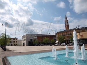
Rocca di Papa
Lazio
Historical town with picturesque architecture, notable figures, outdoor activities, and slower pace of life.
Quality of Life Score
[?]Factors in air quality, amenities, walkability, population, and environmental risks. Higher scores suggest better living conditions.
79
Quality of Infrastructure
[?]Measures internet speed, healthcare access, airports, rail, and walkability. Higher scores mean better connectivity and essential services.
61
Quality of Economy
[?]Based on income, property prices, job availability, and population density. Higher scores indicate stronger economic conditions.
68
Rocca di Papa Demographics
Population
[?]
This is a town's official population, measured each year by the national statistics authority.
17600
Real Population (5km band)
[?]
Our "Real Population" metric reflects more accurately a town's real size by including inhabitants in the immediate vicinity of the town's official borders.
274500
Births Per 100 Deaths
60.0
Population Data Source
ISTAT,2023
Estimated Unemployment Rate
Touristy Index
[?]
Calculation of tourist density index for the city, comparing its total tourist number to the overall average tourist number of the region
relative to its own population.The index indicates how a location’s tourist density compares to the average, with values above
100 representing higher-than-average density and values below 100 representing lower-than-average density.
Not Touristic
Income per capita (2023)
[?]
This is an estimation of average income per resident for this town, based on 2023 data from the Italian Ministry of Finance.
21100
Income rank in Italy (2023)
[?]
This is a ranking of the town's average income per resident, against the full list of townships in Italy.
3419 out of 7901
Infrastructure and Connectivity
Create an account to explore more
This content is for Members only | Already a Member? Sign in
Infrastructure & Amenities
Create an account to explore more
This content is for Members only | Already a Member? Sign in
Healthcare
Create an account to explore more
This content is for Members only | Already a Member? Sign in
Housing & Property Market
Create an account to explore more
This content is for Members only | Already a Member? Sign in
Connectivity & Digital Access
Create an account to explore more
This content is for Members only | Already a Member? Sign in
Education
Create an account to explore more
This content is for Members only | Already a Member? Sign in
Climate & Weather
Create an account to explore more
This content is for Members only | Already a Member? Sign in
Precipitation
[?] Based on daily climate data for precipitation from OPEN-METEO this parameter indicates how a city's annual precipitation compares to others in terms of percentage, with values ranging from 0 (lowest) to 1 (highest). For example, a percentile rank of 0.75 means the city's total precipitation is higher than 75% of other cities.
Above Average (51st-60th percentile)
Sunshine
High (71st-80th percentile)
Snowfall
Average (41st-50th percentile)
Min Annual Temperature (°C)
[?] This parameter represents the monthly average of daily minimum temperatures for January, based on data from OPEN-METEO.
0.7
Max Annual Temperature (°C)
[?] This parameter represents the monthly average of daily minimum temperatures for January, based on data from OPEN-METEO.
27.5
Climate Description
Rocca di Papa, Italy, benefits from a climate appealing to those preferring moderate warmth with distinct seasonal variation. Winters offer occasional snowfall, bringing a picturesque allure to the landscape, ideal for those from cooler regions seeking a gentler winter. Summers, while warm, are rarely oppressive, making outdoor pursuits and exploration comfortable for retirees and expats alike. The region receives a balanced amount of rainfall annually, ensuring lush, verdant surroundings without the discomfort of prolonged wet periods. Overall, the town enjoys a generous amount of sunlight yearly, allowing plenty of opportunities for solar enjoyment and light-infused living spaces.
Annual Temperature Chart (Min)
Error
There was a problem with your SQL connection - Please contact the administrator
There was a problem with your SQL connection - Please contact the administrator
Annual Temperature Chart (Max)
Error
There was a problem with your SQL connection - Please contact the administrator
There was a problem with your SQL connection - Please contact the administrator
Sunny Days By Month
Error
There was a problem with your SQL connection - Please contact the administrator
There was a problem with your SQL connection - Please contact the administrator
Environmental & Air Quality
Create an account to explore more
This content is for Members only | Already a Member? Sign in
Classifications
PM10
[?]
PM10 levels indicate Good air quality at 0–20 µg/m³, Fair at 20–40 µg/m³, Moderate at 40–50 µg/m³, Poor at 50–100 µg/m³, Very Poor at 100–150 µg/m³, and Extremely Poor at 150–1200 µg/m³.
Good
PM2.5
[?]
PM2.5 is Good if PM2.5 levels are between 0–10 µg/m³, Fair between 10–20 µg/m³, Moderate between 20–25 µg/m³, Poor between 25–50 µg/m³, Very Poor between 50–75 µg/m³, and Extremely Poor between 75–800 µg/m³.
Fair
NO2
[?]
NO₂ levels are considered Good at 0–40 µg/m³, Fair at 40–90 µg/m³, Moderate at 90–120 µg/m³, Poor at 120–230 µg/m³, Very Poor at 230–340 µg/m³, and Extremely Poor at 340–1000 µg/m³.
Good
SO2
[?]
SO₂ levels indicate Good air quality at 0–100 µg/m³, Fair at 100–200 µg/m³, Moderate at 200–350 µg/m³, Poor at 350–500 µg/m³, Very Poor at 500–750 µg/m³, and Extremely Poor at 750–1250 µg/m³.
Good
O₃
[?]
For O₃, the air is Good at 0–50 µg/m³, Fair at 50–100 µg/m³, Moderate at 100–130 µg/m³, Poor at 130–240 µg/m³, Very Poor at 240–380 µg/m³, and Extremely Poor at 380–800 µg/m³.
Fair
Air Quality Rating
[?]
Based on PM10, PM2.5, NO2, SO2, and ozone levels. Higher scores indicate cleaner air.
80
Air Quality Description
Rocca di Papa offers an air quality that is largely beneficial, making it ideal for retirees and expats seeking a healthier lifestyle. The locale’s atmosphere maintains commendable levels of particulate matter and nitrogen dioxide, both classified as good. However, retirees should note that fine particulates and ozone levels remain average, potentially necessitating occasional precautions for those with respiratory sensitivities. Overall, the air in Rocca di Papa supports a wholesome environment conducive to outdoor activities and leisure, aligned well with a relaxed, health-oriented lifestyle in this picturesque Italian town.
Rocca di Papa offers an air quality that is largely beneficial, making it ideal for retirees and expats seeking a healthier lifestyle. The locale’s atmosphere maintains commendable levels of particulate matter and nitrogen dioxide, both classified as good. However, retirees should note that fine particulates and ozone levels remain average, potentially necessitating occasional precautions for those with respiratory sensitivities. Overall, the air in Rocca di Papa supports a wholesome environment conducive to outdoor activities and leisure, aligned well with a relaxed, health-oriented lifestyle in this picturesque Italian town.
Town Descriptions
Create an account to explore more
This content is for Members only | Already a Member? Sign in
Getting There
Rocca di Papa is accessible via major roads, including the Via dei Laghi and the SS 217. Public transport options include nearby train stations for regional connections. The town’s infrastructure rating reflects moderate connectivity, with Ciampino Airport closest for air travel.
Getting Around
Local Cuisine
Rocca di Papa, located in the Alban Hills of Lazio, offers a rich culinary scene characterized by traditional Italian cuisine. Local specialties such as porchetta, a savory roasted pork dish seasoned with herbs, and handmade pastas like pappardelle served with wild boar ragù highlight the area’s gastronomic heritage. The dining options range from rustic trattorias to modern eateries, reflecting both national and international influences. While the town is predominantly Italian in its offerings, international flavors can be found alongside a burgeoning interest in modern fine dining. Notably, Rocca di Papa is home to one Michelin-starred restaurant, enhancing its appeal to culinary enthusiasts.
Shopping Overview
Shopping in the area encompasses a range of options, including local boutiques and essential supermarkets for daily needs. There are also expansive shopping centres nearby that provide a broader selection of retail choices, from groceries to specialty items. Additionally, traditional markets are present, offering a variety of regional products. Overall, the shopping landscape caters effectively to both casual visitors and residents seeking convenience and diversity in their shopping experiences.
Neighborhoods
Green Areas and Parks
Rocca di Papa in Lazio offers a variety of outdoor activities and green areas ideally suited for hiking enthusiasts. Key trails include the Maschio delle Faete Loop and Monte Gentile to Monte Cavo, both moderate in difficulty. The region is known for its trails, such as Pratoni del Vivaro to Monte Maschio d’Artemisio, which is notably challenging. Another prominent green area is the expansive Pratoni del Vivaro, suitable for a picnic or horseback riding. These diverse trails cater to hikers, bikers, and runners alike, facilitating outdoor engagement for all skill levels.
✅ Pros
– Beautiful climate with mild winters and warm summers.
– Rich cultural and historical backdrop for exploration.
– Access to quality healthcare services and facilities.
– Low unemployment rate fosters economic stability and opportunities.
– Good air quality enhances overall well-being and health.
– Less touristy, providing a tranquil living environment.
– Convenient transportation options for easy regional access.
– Opportunities for community integration and local engagement.
– Moderate infrastructure score supports essential services and utilities.
– Internet connectivity generally supports remote work and communication.
❌ Cons
– Healthcare score indicates potential room for improvement.
– Air quality rating suggests it’s not always optimal.
– Limited tourism may lead to fewer entertainment options.
– Infrastructure score shows some essential services could be lacking.
– Income rank indicates lower relative economic standing.
– Internet speeds may not satisfy heavy data users.
– Less bustling atmosphere might feel isolating for some.
– Local educational facilities might lack variety for families.
– Language barrier could hinder full community integration.
– Mild winters could still feel chilly for some.
FAQs
Summary
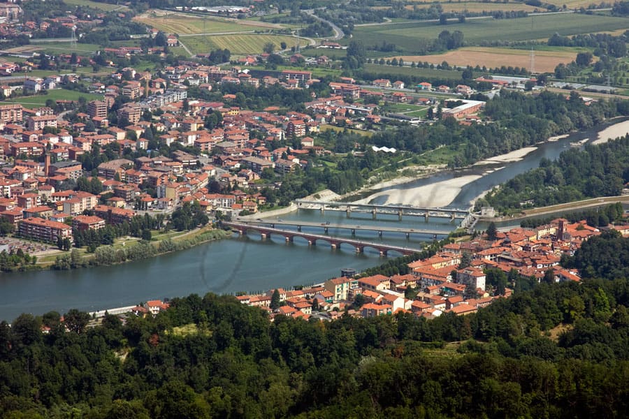
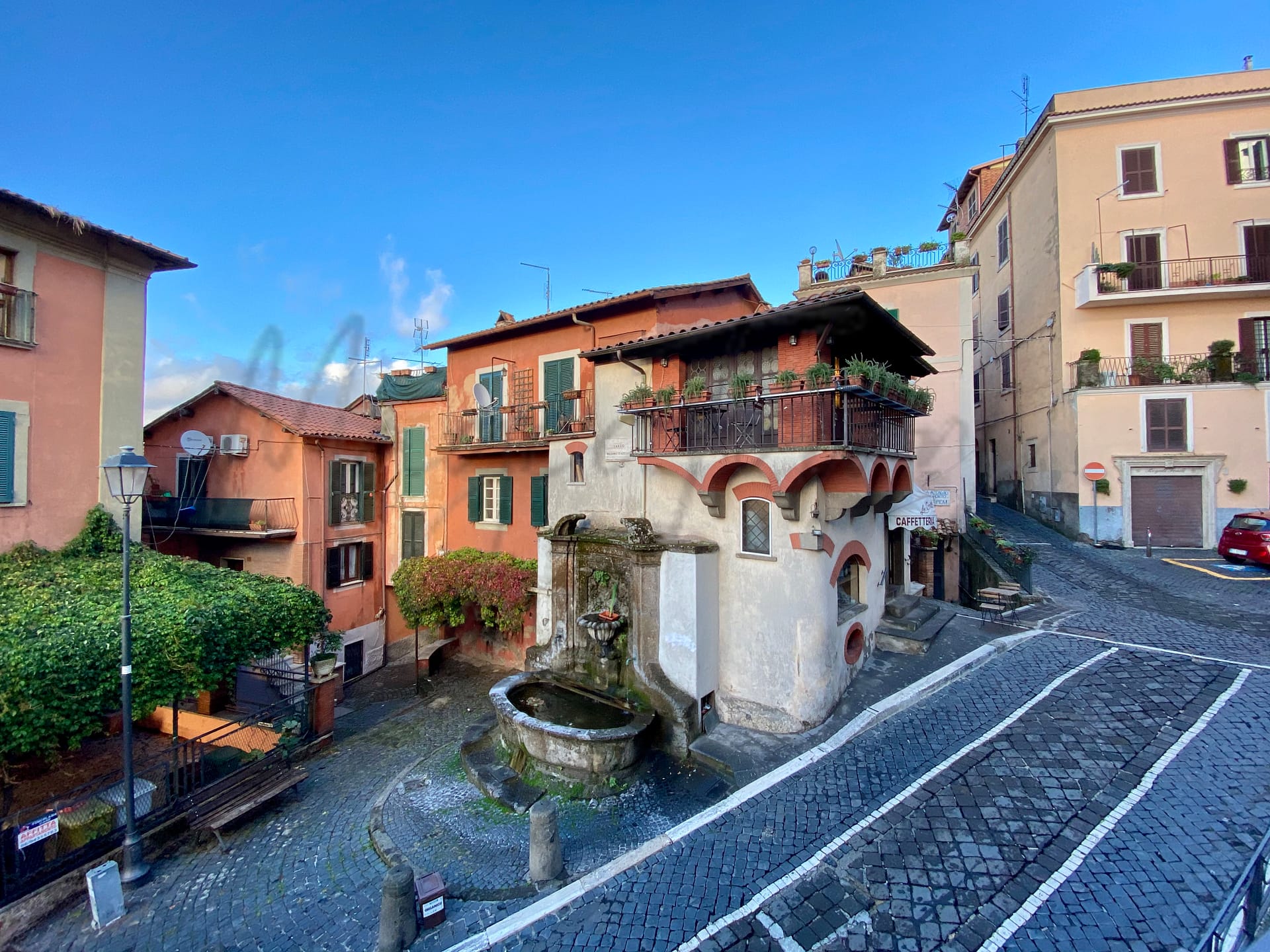
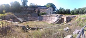
Rocca di Papa, located in the Alban Hills southeast of Rome, offers a blend of historical and cultural experiences ideal for both expatriates and retirees. Known for its picturesque architecture, the town showcases vibrant murals and narrow alleys, lending a unique charm to its numerous attractions, such as the Duomo dell’Assunta and the Sanctuary of the Madonna del Tufo. Its historical significance is deep-rooted, having been a haven for notable figures, including the inventor Guglielmo Marconi. Rocca di Papa’s proximity to the Regional Park of the Castelli Romani provides ample opportunities for outdoor activities, including hiking and cultural excursions.
However, new residents may find challenges in adapting to the town’s slower pace of life and limited urban amenities. While healthcare is adequate, it might not match the standards of larger cities. Furthermore, with the nearest airport a short drive away, navigating travel connections can require careful planning. Despite these considerations, Rocca di Papa remains an attractive locale for those seeking a quieter lifestyle in Italy.
✅ Pros
– Beautiful climate with mild winters and warm summers.
– Rich cultural and historical backdrop for exploration.
– Access to quality healthcare services and facilities.
– Low unemployment rate fosters economic stability and opportunities.
– Good air quality enhances overall well-being and health.
– Less touristy, providing a tranquil living environment.
– Convenient transportation options for easy regional access.
– Opportunities for community integration and local engagement.
– Moderate infrastructure score supports essential services and utilities.
– Internet connectivity generally supports remote work and communication.
❌ Cons
– Healthcare score indicates potential room for improvement.
– Air quality rating suggests it’s not always optimal.
– Limited tourism may lead to fewer entertainment options.
– Infrastructure score shows some essential services could be lacking.
– Income rank indicates lower relative economic standing.
– Internet speeds may not satisfy heavy data users.
– Less bustling atmosphere might feel isolating for some.
– Local educational facilities might lack variety for families.
– Language barrier could hinder full community integration.
– Mild winters could still feel chilly for some.
Related Posts
More questions about Rocca di Papa ? Ask Magic AI.
Our innovative AI assistant is eager to help. Try it out here: