
Elevation
[?]
Elevation of a city refers to the height above sea level at which the city is located, measured in meters.
57
Population
[?]
This is a town's official population, measured each year by the national statistics authority.
10700
Real Population (5km)
[?]
Our "Real Population" metric reflects more accurately a town's real size by including inhabitants in the immediate vicinity of the town's official borders.
49500
Air Quality Rating
[?]
Based on PM10, PM2.5, NO2, SO2, and ozone levels. Higher scores indicate cleaner air.
80
Region
Puglia
Walkability
Very Walkable
Housing availability
[?]
Based on total number of properties (sale and rent) classifies housing availability into five categories: low, relativel ylow, medium, relatively high and high.
Low
Avg Download Speed (Mbps) / Avg Upload Speed (Mbps)
63
/ 26
Climate Description
Mild, sunny climate with warm days, no snow, moderate rain, and gentle weather patterns.
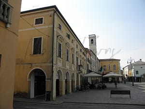
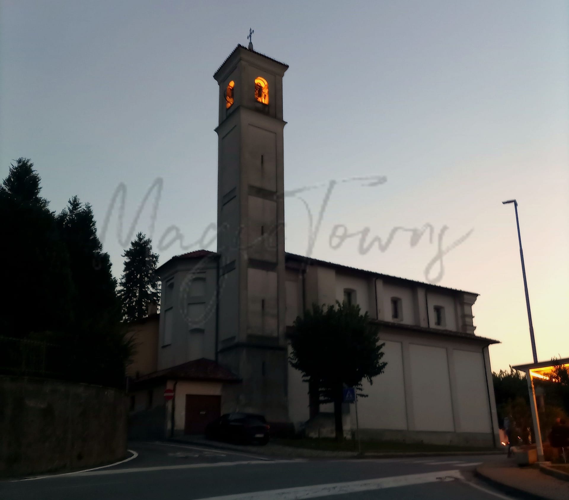
Racale
Puglia
Town in Puglia known for historical towers, museums, cultural festivals, and nearby beaches.
Quality of Life Score
[?]Factors in air quality, amenities, walkability, population, and environmental risks. Higher scores suggest better living conditions.
77
Quality of Infrastructure
[?]Measures internet speed, healthcare access, airports, rail, and walkability. Higher scores mean better connectivity and essential services.
49
Quality of Economy
[?]Based on income, property prices, job availability, and population density. Higher scores indicate stronger economic conditions.
58
Racale Demographics
Population
[?]
This is a town's official population, measured each year by the national statistics authority.
10700
Real Population (5km band)
[?]
Our "Real Population" metric reflects more accurately a town's real size by including inhabitants in the immediate vicinity of the town's official borders.
49500
Births Per 100 Deaths
80.0
Population Data Source
ISTAT,2023
Estimated Unemployment Rate
Touristy Index
[?]
Calculation of tourist density index for the city, comparing its total tourist number to the overall average tourist number of the region
relative to its own population.The index indicates how a location’s tourist density compares to the average, with values above
100 representing higher-than-average density and values below 100 representing lower-than-average density.
Not Touristic
Income per capita (2023)
[?]
This is an estimation of average income per resident for this town, based on 2023 data from the Italian Ministry of Finance.
14600
Income rank in Italy (2023)
[?]
This is a ranking of the town's average income per resident, against the full list of townships in Italy.
7233 out of 7901
Infrastructure and Connectivity
Create an account to explore more
This content is for Members only | Already a Member? Sign in
Infrastructure & Amenities
Create an account to explore more
This content is for Members only | Already a Member? Sign in
Healthcare
Create an account to explore more
This content is for Members only | Already a Member? Sign in
Housing & Property Market
Create an account to explore more
This content is for Members only | Already a Member? Sign in
Connectivity & Digital Access
Create an account to explore more
This content is for Members only | Already a Member? Sign in
Education
Create an account to explore more
This content is for Members only | Already a Member? Sign in
Climate & Weather
Create an account to explore more
This content is for Members only | Already a Member? Sign in
Precipitation
[?] Based on daily climate data for precipitation from OPEN-METEO this parameter indicates how a city's annual precipitation compares to others in terms of percentage, with values ranging from 0 (lowest) to 1 (highest). For example, a percentile rank of 0.75 means the city's total precipitation is higher than 75% of other cities.
Very Low (Bottom 10%)
Sunshine
Exceptional (Top 10%)
Snowfall
Very Low (Bottom 10%)
Min Annual Temperature (°C)
[?] This parameter represents the monthly average of daily minimum temperatures for January, based on data from OPEN-METEO.
8.5
Max Annual Temperature (°C)
[?] This parameter represents the monthly average of daily minimum temperatures for January, based on data from OPEN-METEO.
30
Climate Description
Racale, nestled in Italy, enjoys an enviably stable climate suited to those seeking mild temperatures year-round. The town benefits from abundant sunlight, contributing to lengthy periods of warm and inviting days, ideal for outdoor pursuits and leisurely exploration. Though snowfall is non-existent in Racale, the absence of severe winter conditions makes it particularly attractive to retirees and expats preferring gentler weather patterns. Rainfall is moderate, ensuring lush landscapes without the prevalence of damp or overly humid conditions. Overall, Racale presents a climate that balances warmth and light with just enough precipitation to maintain its scenic charm.
Annual Temperature Chart (Min)
Error
There was a problem with your SQL connection - Please contact the administrator
There was a problem with your SQL connection - Please contact the administrator
Annual Temperature Chart (Max)
Error
There was a problem with your SQL connection - Please contact the administrator
There was a problem with your SQL connection - Please contact the administrator
Sunny Days By Month
Error
There was a problem with your SQL connection - Please contact the administrator
There was a problem with your SQL connection - Please contact the administrator
Environmental & Air Quality
Create an account to explore more
This content is for Members only | Already a Member? Sign in
Classifications
PM10
[?]
PM10 levels indicate Good air quality at 0–20 µg/m³, Fair at 20–40 µg/m³, Moderate at 40–50 µg/m³, Poor at 50–100 µg/m³, Very Poor at 100–150 µg/m³, and Extremely Poor at 150–1200 µg/m³.
Good
PM2.5
[?]
PM2.5 is Good if PM2.5 levels are between 0–10 µg/m³, Fair between 10–20 µg/m³, Moderate between 20–25 µg/m³, Poor between 25–50 µg/m³, Very Poor between 50–75 µg/m³, and Extremely Poor between 75–800 µg/m³.
Fair
NO2
[?]
NO₂ levels are considered Good at 0–40 µg/m³, Fair at 40–90 µg/m³, Moderate at 90–120 µg/m³, Poor at 120–230 µg/m³, Very Poor at 230–340 µg/m³, and Extremely Poor at 340–1000 µg/m³.
Good
SO2
[?]
SO₂ levels indicate Good air quality at 0–100 µg/m³, Fair at 100–200 µg/m³, Moderate at 200–350 µg/m³, Poor at 350–500 µg/m³, Very Poor at 500–750 µg/m³, and Extremely Poor at 750–1250 µg/m³.
Good
O₃
[?]
For O₃, the air is Good at 0–50 µg/m³, Fair at 50–100 µg/m³, Moderate at 100–130 µg/m³, Poor at 130–240 µg/m³, Very Poor at 240–380 µg/m³, and Extremely Poor at 380–800 µg/m³.
Fair
Air Quality Rating
[?]
Based on PM10, PM2.5, NO2, SO2, and ozone levels. Higher scores indicate cleaner air.
80
Air Quality Description
Racale offers residents and visitors an air quality that supports well-being and healthy outdoor activities. Classified predominantly as good, levels of nitrogen dioxide and sulphur dioxide are notably low, providing a fresh backdrop to the town’s scenic views. Particulate matter smaller than 10 microns remains within acceptable bounds, falling under the ‘Good’ category, while finer particles (PM2.5) receive a ‘Fair’ classification, signaling moderate conditions. Ozone levels exhibit similar fairness, suitable for most individuals but warranting occasional caution for sensitive groups. Overall, Racale’s air is conducive to both relaxation and typical daily pursuits without significant environmental concern.
Racale offers residents and visitors an air quality that supports well-being and healthy outdoor activities. Classified predominantly as good, levels of nitrogen dioxide and sulphur dioxide are notably low, providing a fresh backdrop to the town’s scenic views. Particulate matter smaller than 10 microns remains within acceptable bounds, falling under the ‘Good’ category, while finer particles (PM2.5) receive a ‘Fair’ classification, signaling moderate conditions. Ozone levels exhibit similar fairness, suitable for most individuals but warranting occasional caution for sensitive groups. Overall, Racale’s air is conducive to both relaxation and typical daily pursuits without significant environmental concern.
Town Descriptions
Create an account to explore more
This content is for Members only | Already a Member? Sign in
Getting There
Racale is accessible via the SS274 road, connecting to the coastal town of Gallipoli. Papola Casale Airport in Brindisi serves as the nearest airport, while Bari Airport is also a viable option. The town’s train stations, nearby, offer limited railway connectivity, reflecting moderate infrastructure ratings.
Getting Around
Local Cuisine
Racale, located in the Puglia region of Italy, boasts a rich culinary heritage characterized by traditional dishes such as orecchiette e cime di rapa (ear-shaped pasta with broccoli rabe), polpette di pane (bread fritters), and pasticciotti (custard-filled pastries). The dining scene is diverse, with numerous establishments serving local Italian fare alongside Mediterranean seafood options, reflecting Puglia’s coastal setting. Notably, Racale is home to the Michelin-starred restaurant L’Acchiatura, which enhances the gastronomic profile of the town. International influences are also present in various eateries, offering a cosmopolitan touch to the traditional Italian offerings.
Shopping Overview
The city offers a variety of shopping options, including supermarkets, boutique shops, and local markets. Supermarkets provide essential groceries and household items, catering to everyday needs. Boutique shops specialise in unique clothing, gifts, and local crafts, appealing to those seeking distinctive products. Additionally, local markets often feature fresh produce, regional delicacies, and artisan goods, enhancing the shopping experience. Residents can also access larger shopping centres nearby, accommodating a wide range of retail preferences. Overall, the shopping landscape is diverse, catering well to the needs of both expats and retirees.
Neighborhoods
Green Areas and Parks
Racale, situated in Puglia, offers several well-documented outdoor activities and hiking opportunities. The Parco Naturale Regionale Isola di Sant’Andrea e Litorale di Punta Pizzo provides varied trails, such as the 8.45-mile intermediate loop from Mancaversa. Additionally, the Sea of Devils includes an easy 4.27-mile route from Alliste. The coastal hiking paths around Punta Pizzo to Punta della Suina offer routes ranging from easy to intermediate, including a 3.53-mile and a 7.91-mile path, respectively. These trails afford opportunities for hiking in scenic natural reserves, suitable for both novice and experienced hikers.
✅ Pros
– Rich cultural and historical backdrop for exploration and learning.
– Mild climate with warm summers and mild winters.
– Opportunities for integration within the local community.
– Proximity to beautiful beaches along the Ionian Sea.
– Less touristy atmosphere, ensuring a peaceful living experience.
– Local markets offer fresh produce and authentic Italian cuisine.
– Access to basic healthcare services within the town.
– Affordable cost of living compared to larger Italian cities.
– Developing infrastructure with potential for future improvements.
– Nearby cities provide additional amenities and transportation options.
❌ Cons
– Limited healthcare quality may require traveling for better services.
– Transportation options can be sparse and inconvenient for daily needs.
– Internet connectivity can be slower than in larger cities.
– Job opportunities are limited, especially for non-locals.
– Local economy may not offer diverse business prospects.
– Educational facilities may not meet all expatriate expectations.
– Air quality is suboptimal for those sensitive to pollution.
– Infrastructure improvements are slow and not prioritized.
– Summer heat can be overwhelming for some residents.
– Cultural activities may be limited outside local community events.
FAQs
Summary
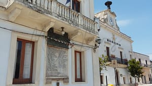
Racale, located in the Salento region of Puglia, is an inviting town known for its rich historical and artistic heritage, making it appealing for expats and retirees. Key attractions include notable historical towers such as Torre Rinalda and Torre Suda, alongside a variety of vibrant local festivals that celebrate traditional culture. The town’s museums, including the Museo Civico Archeologico, offer insights into the region’s past, while nearby beaches, like Spiaggia Santu Mauru, provide excellent water quality and natural beauty.
However, newcomers may find certain challenges. Racale’s walkability is limited, which could affect regular commuting without a vehicle. Additionally, while healthcare facilities are present, their quality could vary, and there may be less access to certain services found in larger cities. Overall, Racale serves as a tranquil base for those seeking to integrate into local life while enjoying the scenic allure of Puglia.
✅ Pros
– Rich cultural and historical backdrop for exploration and learning.
– Mild climate with warm summers and mild winters.
– Opportunities for integration within the local community.
– Proximity to beautiful beaches along the Ionian Sea.
– Less touristy atmosphere, ensuring a peaceful living experience.
– Local markets offer fresh produce and authentic Italian cuisine.
– Access to basic healthcare services within the town.
– Affordable cost of living compared to larger Italian cities.
– Developing infrastructure with potential for future improvements.
– Nearby cities provide additional amenities and transportation options.
❌ Cons
– Limited healthcare quality may require traveling for better services.
– Transportation options can be sparse and inconvenient for daily needs.
– Internet connectivity can be slower than in larger cities.
– Job opportunities are limited, especially for non-locals.
– Local economy may not offer diverse business prospects.
– Educational facilities may not meet all expatriate expectations.
– Air quality is suboptimal for those sensitive to pollution.
– Infrastructure improvements are slow and not prioritized.
– Summer heat can be overwhelming for some residents.
– Cultural activities may be limited outside local community events.
Related Posts
No posts found for the town.
More questions about Racale ? Ask Magic AI.
Our innovative AI assistant is eager to help. Try it out here: