
Elevation
[?]
Elevation of a city refers to the height above sea level at which the city is located, measured in meters.
182
Population
[?]
This is a town's official population, measured each year by the national statistics authority.
28100
Real Population (5km)
[?]
Our "Real Population" metric reflects more accurately a town's real size by including inhabitants in the immediate vicinity of the town's official borders.
282100
Air Quality Rating
[?]
Based on PM10, PM2.5, NO2, SO2, and ozone levels. Higher scores indicate cleaner air.
82
Region
Lombardia
Walkability
Walker’s Paradise
Housing availability
[?]
Based on total number of properties (sale and rent) classifies housing availability into five categories: low, relativel ylow, medium, relatively high and high.
Low
Avg Download Speed (Mbps) / Avg Upload Speed (Mbps)
144
/ 88
Climate Description
Crisp winters, warm summers, ample sunshine, mild snow, balanced rainfall, verdant scenery.
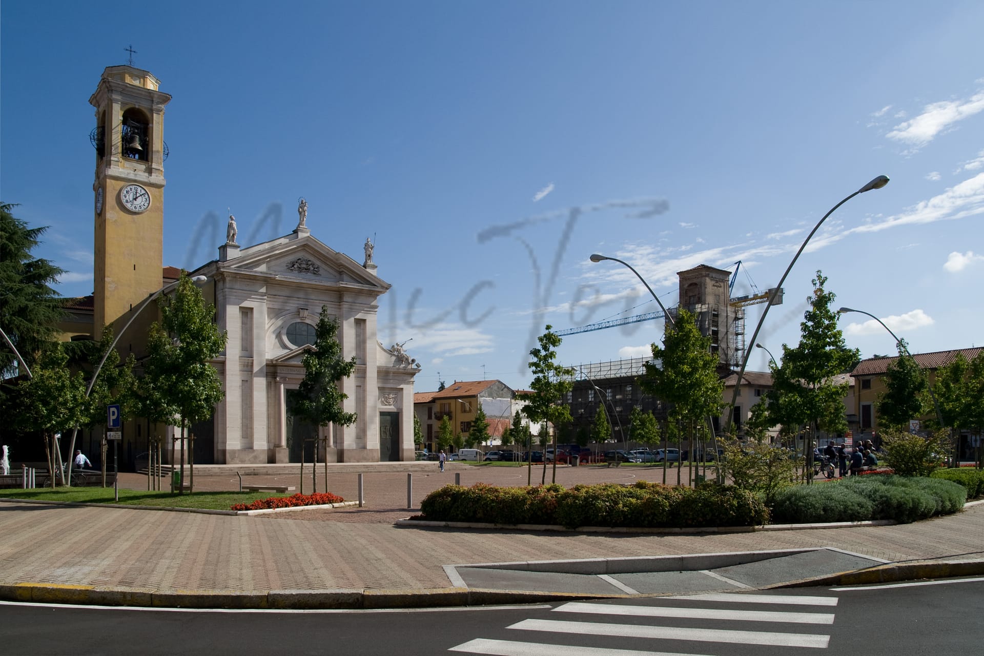
Parabiago
Lombardia
Lombardia town known for shoemaking, Liberty architecture, local parks, and proximity to Milan.
Quality of Life Score
[?]Factors in air quality, amenities, walkability, population, and environmental risks. Higher scores suggest better living conditions.
78
Quality of Infrastructure
[?]Measures internet speed, healthcare access, airports, rail, and walkability. Higher scores mean better connectivity and essential services.
78
Quality of Economy
[?]Based on income, property prices, job availability, and population density. Higher scores indicate stronger economic conditions.
80
Parabiago Demographics
Population
[?]
This is a town's official population, measured each year by the national statistics authority.
28100
Real Population (5km band)
[?]
Our "Real Population" metric reflects more accurately a town's real size by including inhabitants in the immediate vicinity of the town's official borders.
282100
Births Per 100 Deaths
70.0
Population Data Source
ISTAT,2023
Estimated Unemployment Rate
Touristy Index
[?]
Calculation of tourist density index for the city, comparing its total tourist number to the overall average tourist number of the region
relative to its own population.The index indicates how a location’s tourist density compares to the average, with values above
100 representing higher-than-average density and values below 100 representing lower-than-average density.
Not Touristic
Income per capita (2023)
[?]
This is an estimation of average income per resident for this town, based on 2023 data from the Italian Ministry of Finance.
25700
Income rank in Italy (2023)
[?]
This is a ranking of the town's average income per resident, against the full list of townships in Italy.
250 out of 7901
Infrastructure and Connectivity
Create an account to explore more
This content is for Members only | Already a Member? Sign in
Infrastructure & Amenities
Create an account to explore more
This content is for Members only | Already a Member? Sign in
Healthcare
Create an account to explore more
This content is for Members only | Already a Member? Sign in
Housing & Property Market
Create an account to explore more
This content is for Members only | Already a Member? Sign in
Connectivity & Digital Access
Create an account to explore more
This content is for Members only | Already a Member? Sign in
Education
Create an account to explore more
This content is for Members only | Already a Member? Sign in
Climate & Weather
Create an account to explore more
This content is for Members only | Already a Member? Sign in
Precipitation
[?] Based on daily climate data for precipitation from OPEN-METEO this parameter indicates how a city's annual precipitation compares to others in terms of percentage, with values ranging from 0 (lowest) to 1 (highest). For example, a percentile rank of 0.75 means the city's total precipitation is higher than 75% of other cities.
Very High (81st-90th percentile)
Sunshine
Somewhat Low (21st-30th percentile)
Snowfall
Above Average (51st-60th percentile)
Min Annual Temperature (°C)
[?] This parameter represents the monthly average of daily minimum temperatures for January, based on data from OPEN-METEO.
-0.4
Max Annual Temperature (°C)
[?] This parameter represents the monthly average of daily minimum temperatures for January, based on data from OPEN-METEO.
28.5
Climate Description
Parabiago, nestled in Italy, offers a climate that balances crisp winters with warm summers, making it suitable for those who prefer a range of weather experiences. The town enjoys a generous amount of sunshine throughout the year, illuminating its picturesque landscapes and historical architecture. Winters see a mild frosting of snow, transforming the area into a serene winter wonderland briefly before spring arrives. Rainfall is adequately spread across the months, ensuring lush, verdant scenery without overwhelming residents and visitors. Overall, Parabiago's climate provides a pleasant backdrop for retirees and expats looking to soak in the beauty and culture of a magical Italian town.
Annual Temperature Chart (Min)
Error
There was a problem with your SQL connection - Please contact the administrator
There was a problem with your SQL connection - Please contact the administrator
Annual Temperature Chart (Max)
Error
There was a problem with your SQL connection - Please contact the administrator
There was a problem with your SQL connection - Please contact the administrator
Sunny Days By Month
Error
There was a problem with your SQL connection - Please contact the administrator
There was a problem with your SQL connection - Please contact the administrator
Environmental & Air Quality
Create an account to explore more
This content is for Members only | Already a Member? Sign in
Classifications
PM10
[?]
PM10 levels indicate Good air quality at 0–20 µg/m³, Fair at 20–40 µg/m³, Moderate at 40–50 µg/m³, Poor at 50–100 µg/m³, Very Poor at 100–150 µg/m³, and Extremely Poor at 150–1200 µg/m³.
Fair
PM2.5
[?]
PM2.5 is Good if PM2.5 levels are between 0–10 µg/m³, Fair between 10–20 µg/m³, Moderate between 20–25 µg/m³, Poor between 25–50 µg/m³, Very Poor between 50–75 µg/m³, and Extremely Poor between 75–800 µg/m³.
Moderate
NO2
[?]
NO₂ levels are considered Good at 0–40 µg/m³, Fair at 40–90 µg/m³, Moderate at 90–120 µg/m³, Poor at 120–230 µg/m³, Very Poor at 230–340 µg/m³, and Extremely Poor at 340–1000 µg/m³.
Good
SO2
[?]
SO₂ levels indicate Good air quality at 0–100 µg/m³, Fair at 100–200 µg/m³, Moderate at 200–350 µg/m³, Poor at 350–500 µg/m³, Very Poor at 500–750 µg/m³, and Extremely Poor at 750–1250 µg/m³.
Good
O₃
[?]
For O₃, the air is Good at 0–50 µg/m³, Fair at 50–100 µg/m³, Moderate at 100–130 µg/m³, Poor at 130–240 µg/m³, Very Poor at 240–380 µg/m³, and Extremely Poor at 380–800 µg/m³.
Fair
Air Quality Rating
[?]
Based on PM10, PM2.5, NO2, SO2, and ozone levels. Higher scores indicate cleaner air.
82
Air Quality Description
Parabiago, Italy offers an air quality profile that suits those prioritizing a cleaner living environment. The region maintains respectable levels of nitrogen dioxide and sulfur dioxide, both classified as good, highlighting the town’s ability to sustain a relatively fresh atmosphere. Particulate matter such as PM2.5 and PM10 are rated as moderate and fair respectively; these particles are within acceptable limits but suggest room for improvement. Ozone levels, while fair, are stable, providing an overall agreeable air quality for retirees and expats seeking a serene Italian setting without the burden of industrial pollution.
Parabiago, Italy offers an air quality profile that suits those prioritizing a cleaner living environment. The region maintains respectable levels of nitrogen dioxide and sulfur dioxide, both classified as good, highlighting the town’s ability to sustain a relatively fresh atmosphere. Particulate matter such as PM2.5 and PM10 are rated as moderate and fair respectively; these particles are within acceptable limits but suggest room for improvement. Ozone levels, while fair, are stable, providing an overall agreeable air quality for retirees and expats seeking a serene Italian setting without the burden of industrial pollution.
Town Descriptions
Create an account to explore more
This content is for Members only | Already a Member? Sign in
Getting There
Parabiago is well-connected, with proximity to major transport hubs. The nearest airports, Malpensa and Linate, facilitate international access. Two nearby train stations enhance rail connectivity, both rated moderately. The town is supported by solid infrastructure, enhancing overall accessibility throughout the Lombardia region.
Getting Around
Local Cuisine
Parabiago, located in the Lombardy region, showcases a vibrant culinary scene that reflects both local traditions and international influences. The local cuisine is rich with traditional dishes that include risotto, ossobuco, and various forms of polenta, which are staples in Lombard cooking. The town features a diverse array of restaurants offering Italian cuisine alongside Mediterranean, seafood, Japanese, and American options. While specific restaurant names are omitted, it is notable that the area does not have any Michelin-starred establishments, indicating a focus on casual dining experiences rather than high-end gastronomy. The overall dining scene is characterized by a blend of authentic regional flavors and a willingness to embrace global culinary trends.
Shopping Overview
The area offers diverse shopping choices including supermarkets, boutique shops, and expansive shopping malls. Notably, the town is recognised for its shoe production, featuring specialty stores dedicated to footwear. Additionally, several nearby outlet centres provide a variety of branded goods at discounted prices. Supermarkets cater to everyday grocery needs, while boutiques and local markets ensure a unique shopping experience that emphasises artisanal products and local craftsmanship.
Neighborhoods
Green Areas and Parks
Parabiago offers several outdoor activities and trails ideal for walking and cycling. The “Pista Ciclabile Canale Villoresi” is a 13.8-mile pathway running through the Lombardy countryside, suitable for biking and accommodating families. Another notable route is the “Canale Villoresi: Parabiago to Nova Milanese,” covering 15.2 miles of agricultural landscapes. For longer excursions, the “1001 Miglia d’Italia” begins in Parabiago, spanning 70.1 miles across diverse terrains. Moreover, “Parco del Roccolo,” a wooded reserve, provides a moderate trail of 25.5 miles, enhancing the city’s appeal for nature enthusiasts.
✅ Pros
– Excellent transport links to Milan and surrounding areas.
– Rich cultural and historical heritage to explore and enjoy.
– Low unemployment rate promotes economic stability and job opportunities.
– Diverse integration opportunities for expats and retirees.
– Good quality healthcare facilities available in the vicinity.
– Favorable air quality contributes to a healthier lifestyle.
– Mild climate with pleasant seasons for outdoor activities.
– Well-developed infrastructure ensures convenient daily living.
– Less touristy, offering a more authentic Italian experience.
– Access to quality educational facilities for lifelong learning.
❌ Cons
– Healthcare score indicates room for improvement and accessibility challenges.
– Air quality rating is just above the suboptimal threshold.
– Limited tourist amenities may stifle social activities for newcomers.
– Average internet speed might frustrate heavy users or remote workers.
– Weather can be humid during summer, leading to discomfort.
– Less vibrant nightlife compared to major urban centers nearby.
– Smaller town means fewer cultural events and activities year-round.
– Limited shopping options may require trips to larger cities.
– Integration can take time due to local language barriers.
– The town’s peacefulness may feel too quiet for some.
FAQs
Summary
Parabiago is a town in Lombardia, known for its vibrant local culture and accessibility to major urban centers, including Milan, just a short train ride away. It boasts the title “Città della Calzatura,” underscoring its rich tradition in shoemaking, with various outlets that cater to discerning shoppers. Key attractions include the Villa Ida Lampugnani, a notable example of Liberty architecture, and the Crespi Bonsai, which highlights the town’s respect for nature and culture. The local churches, such as the Chiesa dei SS. Gervaso e Protaso, reflect the area’s historical depth, while parks like Parco dei Mulini provide recreational space amid urban life. While Parabiago excels in cultural offerings, expats may notice a quieter lifestyle compared to the nearby metropolitan hustle. The healthcare system and public amenities may not always meet the expectations of those accustomed to larger cities. Nonetheless, Parabiago presents an intriguing blend of tradition and modern living, suitable for a peaceful retirement or an enriching expatriate experience.
✅ Pros
– Excellent transport links to Milan and surrounding areas.
– Rich cultural and historical heritage to explore and enjoy.
– Low unemployment rate promotes economic stability and job opportunities.
– Diverse integration opportunities for expats and retirees.
– Good quality healthcare facilities available in the vicinity.
– Favorable air quality contributes to a healthier lifestyle.
– Mild climate with pleasant seasons for outdoor activities.
– Well-developed infrastructure ensures convenient daily living.
– Less touristy, offering a more authentic Italian experience.
– Access to quality educational facilities for lifelong learning.
❌ Cons
– Healthcare score indicates room for improvement and accessibility challenges.
– Air quality rating is just above the suboptimal threshold.
– Limited tourist amenities may stifle social activities for newcomers.
– Average internet speed might frustrate heavy users or remote workers.
– Weather can be humid during summer, leading to discomfort.
– Less vibrant nightlife compared to major urban centers nearby.
– Smaller town means fewer cultural events and activities year-round.
– Limited shopping options may require trips to larger cities.
– Integration can take time due to local language barriers.
– The town’s peacefulness may feel too quiet for some.
Related Posts
No posts found for the town.
More questions about Parabiago ? Ask Magic AI.
Our innovative AI assistant is eager to help. Try it out here: