
Elevation
[?]
Elevation of a city refers to the height above sea level at which the city is located, measured in meters.
180
Population
[?]
This is a town's official population, measured each year by the national statistics authority.
21400
Real Population (5km)
[?]
Our "Real Population" metric reflects more accurately a town's real size by including inhabitants in the immediate vicinity of the town's official borders.
26200
Air Quality Rating
[?]
Based on PM10, PM2.5, NO2, SO2, and ozone levels. Higher scores indicate cleaner air.
84
Region
Sicilia
Walkability
Very Walkable
Housing availability
[?]
Based on total number of properties (sale and rent) classifies housing availability into five categories: low, relativel ylow, medium, relatively high and high.
Relatively Low
Avg Download Speed (Mbps) / Avg Upload Speed (Mbps)
65
/ 18
Climate Description
Stable, warm climate; no snow; abundant sunshine; mild to warm temperatures year-round.
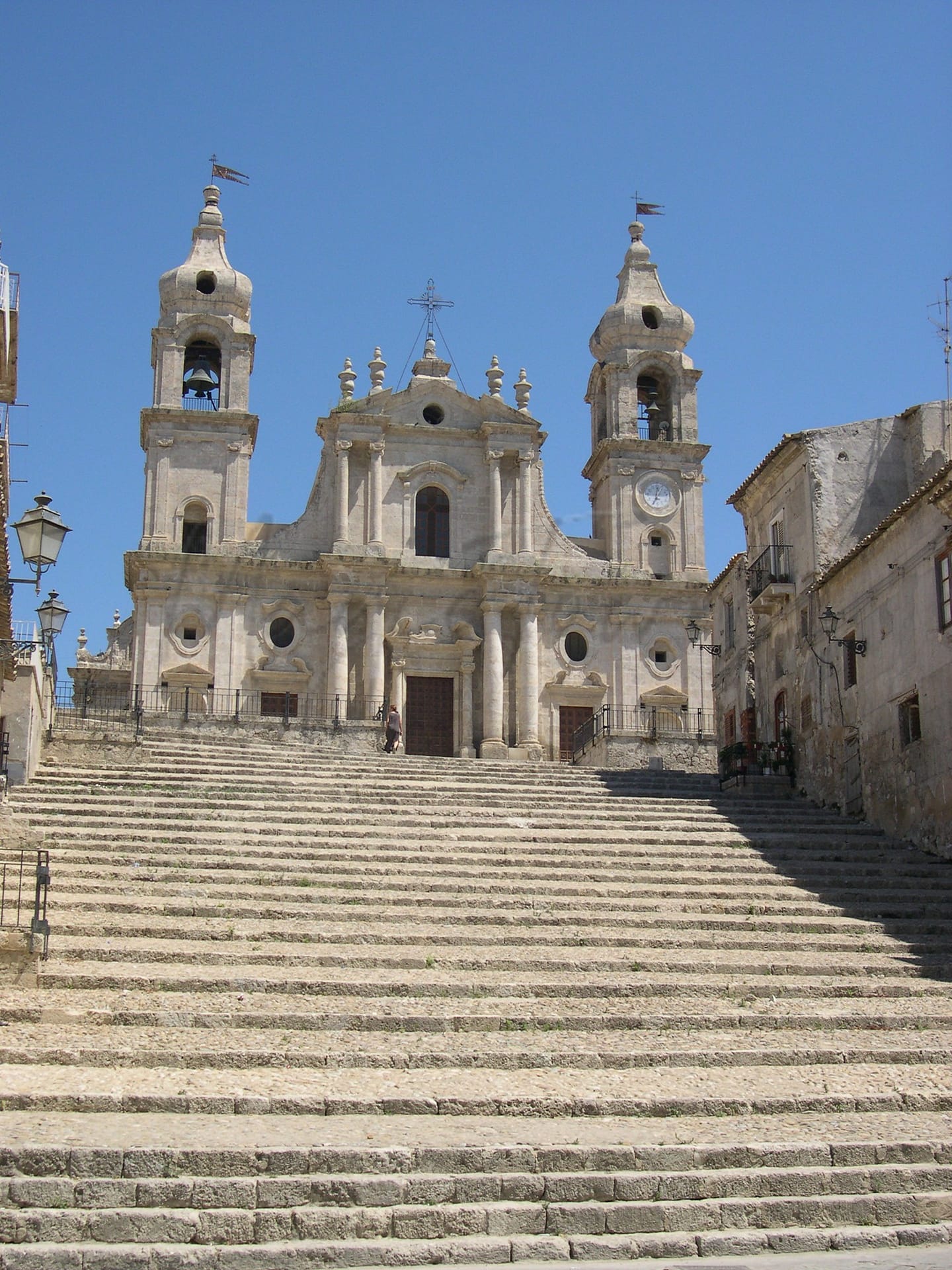
Palma di Montechiaro
Sicilia
Historical town near Agrigento, known for Baroque architecture, sandy beaches, and agricultural heritage.
Quality of Life Score
[?]Factors in air quality, amenities, walkability, population, and environmental risks. Higher scores suggest better living conditions.
64
Quality of Infrastructure
[?]Measures internet speed, healthcare access, airports, rail, and walkability. Higher scores mean better connectivity and essential services.
49
Quality of Economy
[?]Based on income, property prices, job availability, and population density. Higher scores indicate stronger economic conditions.
57
Palma di Montechiaro Demographics
Population
[?]
This is a town's official population, measured each year by the national statistics authority.
21400
Real Population (5km band)
[?]
Our "Real Population" metric reflects more accurately a town's real size by including inhabitants in the immediate vicinity of the town's official borders.
26200
Births Per 100 Deaths
70.0
Population Data Source
ISTAT,2023
Estimated Unemployment Rate
Touristy Index
[?]
Calculation of tourist density index for the city, comparing its total tourist number to the overall average tourist number of the region
relative to its own population.The index indicates how a location’s tourist density compares to the average, with values above
100 representing higher-than-average density and values below 100 representing lower-than-average density.
Not Touristic
Income per capita (2023)
[?]
This is an estimation of average income per resident for this town, based on 2023 data from the Italian Ministry of Finance.
13300
Income rank in Italy (2023)
[?]
This is a ranking of the town's average income per resident, against the full list of townships in Italy.
7651 out of 7901
Infrastructure and Connectivity
Create an account to explore more
This content is for Members only | Already a Member? Sign in
Infrastructure & Amenities
Create an account to explore more
This content is for Members only | Already a Member? Sign in
Healthcare
Create an account to explore more
This content is for Members only | Already a Member? Sign in
Housing & Property Market
Create an account to explore more
This content is for Members only | Already a Member? Sign in
Connectivity & Digital Access
Create an account to explore more
This content is for Members only | Already a Member? Sign in
Education
Create an account to explore more
This content is for Members only | Already a Member? Sign in
Climate & Weather
Create an account to explore more
This content is for Members only | Already a Member? Sign in
Precipitation
[?] Based on daily climate data for precipitation from OPEN-METEO this parameter indicates how a city's annual precipitation compares to others in terms of percentage, with values ranging from 0 (lowest) to 1 (highest). For example, a percentile rank of 0.75 means the city's total precipitation is higher than 75% of other cities.
Very Low (Bottom 10%)
Sunshine
Exceptional (Top 10%)
Snowfall
Very Low (Bottom 10%)
Min Annual Temperature (°C)
[?] This parameter represents the monthly average of daily minimum temperatures for January, based on data from OPEN-METEO.
6.6
Max Annual Temperature (°C)
[?] This parameter represents the monthly average of daily minimum temperatures for January, based on data from OPEN-METEO.
31.3
Climate Description
Palma di Montechiaro offers a pleasant and stable climate beneficial for expats and retirees seeking a consistent, warm environment. With no snowfall throughout the year, the town is ideal for those wishing to avoid colder weather activities and maintenance. Sunshine is abundant, facilitating various outdoor pursuits such as hiking and coastal walks, enhancing the quality of day-to-day life. Temperatures range from mild to warm without extremes, making it comfortable to enjoy both the historic and natural beauty that this Sicilian town offers year-round. This climatic balance supports not only usual living conditions but also favors vineyards and olive groves that dot the landscape.
Annual Temperature Chart (Min)
Error
There was a problem with your SQL connection - Please contact the administrator
There was a problem with your SQL connection - Please contact the administrator
Annual Temperature Chart (Max)
Error
There was a problem with your SQL connection - Please contact the administrator
There was a problem with your SQL connection - Please contact the administrator
Sunny Days By Month
Error
There was a problem with your SQL connection - Please contact the administrator
There was a problem with your SQL connection - Please contact the administrator
Environmental & Air Quality
Create an account to explore more
This content is for Members only | Already a Member? Sign in
Classifications
PM10
[?]
PM10 levels indicate Good air quality at 0–20 µg/m³, Fair at 20–40 µg/m³, Moderate at 40–50 µg/m³, Poor at 50–100 µg/m³, Very Poor at 100–150 µg/m³, and Extremely Poor at 150–1200 µg/m³.
Good
PM2.5
[?]
PM2.5 is Good if PM2.5 levels are between 0–10 µg/m³, Fair between 10–20 µg/m³, Moderate between 20–25 µg/m³, Poor between 25–50 µg/m³, Very Poor between 50–75 µg/m³, and Extremely Poor between 75–800 µg/m³.
Good
NO2
[?]
NO₂ levels are considered Good at 0–40 µg/m³, Fair at 40–90 µg/m³, Moderate at 90–120 µg/m³, Poor at 120–230 µg/m³, Very Poor at 230–340 µg/m³, and Extremely Poor at 340–1000 µg/m³.
Good
SO2
[?]
SO₂ levels indicate Good air quality at 0–100 µg/m³, Fair at 100–200 µg/m³, Moderate at 200–350 µg/m³, Poor at 350–500 µg/m³, Very Poor at 500–750 µg/m³, and Extremely Poor at 750–1250 µg/m³.
Good
O₃
[?]
For O₃, the air is Good at 0–50 µg/m³, Fair at 50–100 µg/m³, Moderate at 100–130 µg/m³, Poor at 130–240 µg/m³, Very Poor at 240–380 µg/m³, and Extremely Poor at 380–800 µg/m³.
Fair
Air Quality Rating
[?]
Based on PM10, PM2.5, NO2, SO2, and ozone levels. Higher scores indicate cleaner air.
84
Air Quality Description
In Palma di Montechiaro, Italy, the air quality generally ranks as commendable. The town’s atmosphere benefits from good levels of particulate matter, with both PM10 and PM2.5 particles sufficiently low to meet healthful standards. Nitrogen dioxide and sulphur dioxide are also minimal, nurturing an environment that supports well-being. However, a modest concern arises with ozone concentrations which stand at fair conditions. For those considering relocation, especially retirees and expats seeking a cleaner, serene setting, Palma di Montechiaro offers a largely uncontaminated air profile aligning with ambient living and wellness.
In Palma di Montechiaro, Italy, the air quality generally ranks as commendable. The town’s atmosphere benefits from good levels of particulate matter, with both PM10 and PM2.5 particles sufficiently low to meet healthful standards. Nitrogen dioxide and sulphur dioxide are also minimal, nurturing an environment that supports well-being. However, a modest concern arises with ozone concentrations which stand at fair conditions. For those considering relocation, especially retirees and expats seeking a cleaner, serene setting, Palma di Montechiaro offers a largely uncontaminated air profile aligning with ambient living and wellness.
Town Descriptions
Create an account to explore more
This content is for Members only | Already a Member? Sign in
Getting There
Palma di Montechiaro, situated in Sicily, is accessible via the SS115 road, linking it to nearby towns. The closest airports are Catania Fontanarossa and Falcone Borsellino in Palermo. Additionally, the town is served by two train stations, offering modest connectivity to the regional rail network, though infrastructure ratings suggest room for improvement.
Getting Around
Local Cuisine
Palma di Montechiaro boasts a rich culinary scene reflective of traditional Sicilian cuisine, featuring local staples such as seafood, fresh vegetables, and homemade pasta. Notable dishes include ‘caponata’, a sweet and sour eggplant stew, and various forms of ‘couscous’, particularly the fish variant popular in coastal areas. The dining landscape includes a variety of restaurants that serve both traditional dishes and modern interpretations, while also offering international influences, particularly in pizzerias that cater to diverse palates. Outdoor dining options often enhance the dining experience with scenic views. Notably, there is a Michelin-starred restaurant in the vicinity, illustrating the area’s potential for culinary excellence.
Shopping Overview
Shopping in this area is diverse, catering to various needs. Visitors can find local markets offering fresh produce and artisanal products, alongside supermarkets providing everyday essentials. Boutique shops feature local handicrafts and fashion, although options may be limited compared to larger cities. Shopping centres typically combine retail outlets and dining, creating a comprehensive experience for residents and visitors. The overall availability of shopping options reflects a balanced mix of convenience and local culture, suitable for both expats and retirees seeking to adapt to their surroundings.
Neighborhoods
Green Areas and Parks
Palma di Montechiaro in Sicily offers several options for outdoor enthusiasts. Visitors can explore the Grotta Zubbia, a notable cavern in the area. The nearby Cala Vincenzina provides a beach experience. For hiking, the local trails offer routes such as those leading to the Punta Bianca Nature Reserve, which is located approximately 20 km south of Agrigento. Additionally, cycling tours, including routes to historical sites like the Castellp di Montechiaro, enhance the active lifestyle opportunities in the region.
✅ Pros
– Mild Mediterranean climate year-round, ideal for outdoor activities.
– Rich cultural and historical heritage to explore and appreciate.
– Opportunities for local integration and community engagement.
– Affordable cost of living compared to larger Italian cities.
– Relatively low tourist presence allowing for authentic local experiences.
– Access to local markets and fresh produce options.
– Scenic landscapes and proximity to beautiful Sicilian coastlines.
– Basic healthcare services available, though with room for improvement.
– Transportation options available for travel within Sicily and beyond.
– Growing digital infrastructure supporting internet connectivity improvements.
❌ Cons
– Healthcare quality may leave you longing for a miracle cure.
– Limited educational facilities for families seeking quality schooling options.
– Transportation connections can be sporadic and occasionally unreliable.
– Unemployment rate slightly above the national average concerns job seekers.
– Infrastructure development is lacking, making daily life somewhat challenging.
– Internet speed could frustrate those reliant on high connectivity.
– Air quality is less than ideal for respiratory sensitivities.
– Limited social activities may lead to boredom on quiet days.
– The local economy may offer few job opportunities for expats.
– High summer temperatures could test your love for Mediterranean climate.
FAQs
Summary
Palma di Montechiaro, a town located near Agrigento in Sicily, offers a blend of historical significance and cultural richness, appealing to foreign expats and retirees seeking a serene environment. Known as the “City of the Leopard,” it boasts a picturesque landscape with proximity to beautiful sandy beaches, just a short drive away. Key attractions include the impressive Mother Church, exemplifying Sicilian Baroque architecture, and the Ducal Palace, associated with the historical Tomasi family. The town’s agricultural heritage underpins its local economy, with a focus on producing fresh and robust Sicilian cuisine.
While Palma di Montechiaro enjoys a walkable environment and excellent air quality, expats may encounter challenges such as limited healthcare facilities and connectivity options. However, its historical sites, vibrant community traditions, and the welcoming atmosphere make it a noteworthy destination for those contemplating a slower pace of life in Italy.
✅ Pros
– Mild Mediterranean climate year-round, ideal for outdoor activities.
– Rich cultural and historical heritage to explore and appreciate.
– Opportunities for local integration and community engagement.
– Affordable cost of living compared to larger Italian cities.
– Relatively low tourist presence allowing for authentic local experiences.
– Access to local markets and fresh produce options.
– Scenic landscapes and proximity to beautiful Sicilian coastlines.
– Basic healthcare services available, though with room for improvement.
– Transportation options available for travel within Sicily and beyond.
– Growing digital infrastructure supporting internet connectivity improvements.
❌ Cons
– Healthcare quality may leave you longing for a miracle cure.
– Limited educational facilities for families seeking quality schooling options.
– Transportation connections can be sporadic and occasionally unreliable.
– Unemployment rate slightly above the national average concerns job seekers.
– Infrastructure development is lacking, making daily life somewhat challenging.
– Internet speed could frustrate those reliant on high connectivity.
– Air quality is less than ideal for respiratory sensitivities.
– Limited social activities may lead to boredom on quiet days.
– The local economy may offer few job opportunities for expats.
– High summer temperatures could test your love for Mediterranean climate.
Related Posts
No posts found for the town.
More questions about Palma di Montechiaro ? Ask Magic AI.
Our innovative AI assistant is eager to help. Try it out for free here: