
Elevation
[?]
Elevation of a city refers to the height above sea level at which the city is located, measured in meters.
342
Population
[?]
This is a town's official population, measured each year by the national statistics authority.
15200
Real Population (5km)
[?]
Our "Real Population" metric reflects more accurately a town's real size by including inhabitants in the immediate vicinity of the town's official borders.
99800
Air Quality Rating
[?]
Based on PM10, PM2.5, NO2, SO2, and ozone levels. Higher scores indicate cleaner air.
84
Region
Puglia
Walkability
Very Walkable
Housing availability
[?]
Based on total number of properties (sale and rent) classifies housing availability into five categories: low, relativel ylow, medium, relatively high and high.
Low
Avg Download Speed (Mbps) / Avg Upload Speed (Mbps)
141
/ 50
Climate Description
Sunny, wide temperature range, mild winters, rare snow, moderate rainfall, supports outdoor activities.
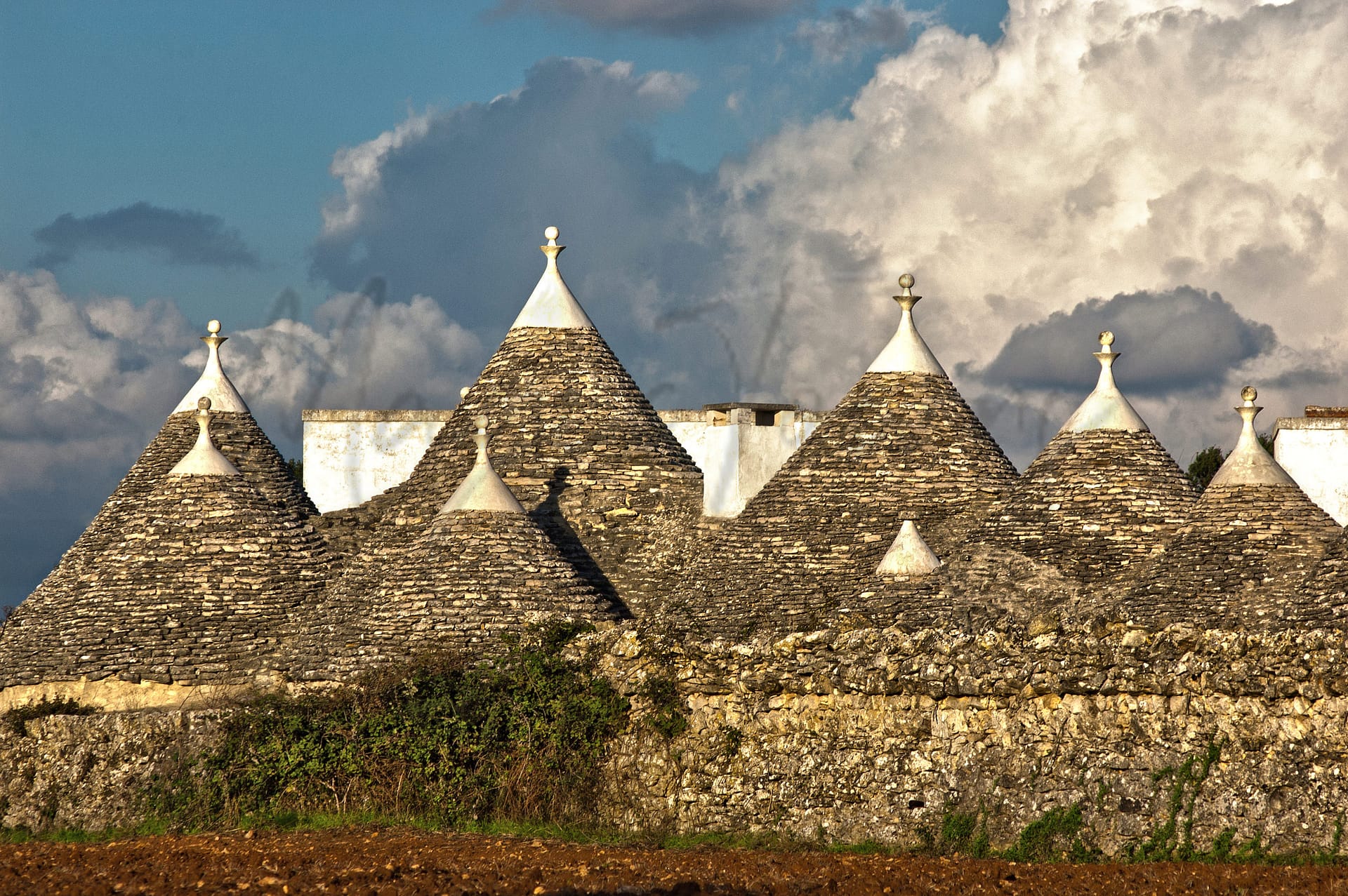
Mottola
Puglia
Hilltop town in Puglia with historical sites, rock-hewn churches, agriculture-focused economy, and moderate internet.
Quality of Life Score
[?]Factors in air quality, amenities, walkability, population, and environmental risks. Higher scores suggest better living conditions.
72
Quality of Infrastructure
[?]Measures internet speed, healthcare access, airports, rail, and walkability. Higher scores mean better connectivity and essential services.
54
Quality of Economy
[?]Based on income, property prices, job availability, and population density. Higher scores indicate stronger economic conditions.
62
Mottola Demographics
Population
[?]
This is a town's official population, measured each year by the national statistics authority.
15200
Real Population (5km band)
[?]
Our "Real Population" metric reflects more accurately a town's real size by including inhabitants in the immediate vicinity of the town's official borders.
99800
Births Per 100 Deaths
50.0
Population Data Source
ISTAT,2023
Estimated Unemployment Rate
Touristy Index
[?]
Calculation of tourist density index for the city, comparing its total tourist number to the overall average tourist number of the region
relative to its own population.The index indicates how a location’s tourist density compares to the average, with values above
100 representing higher-than-average density and values below 100 representing lower-than-average density.
Not Touristic
Income per capita (2023)
[?]
This is an estimation of average income per resident for this town, based on 2023 data from the Italian Ministry of Finance.
17200
Income rank in Italy (2023)
[?]
This is a ranking of the town's average income per resident, against the full list of townships in Italy.
5881 out of 7901
Infrastructure and Connectivity
Create an account to explore more
This content is for Members only | Already a Member? Sign in
Infrastructure & Amenities
Create an account to explore more
This content is for Members only | Already a Member? Sign in
Healthcare
Create an account to explore more
This content is for Members only | Already a Member? Sign in
Housing & Property Market
Create an account to explore more
This content is for Members only | Already a Member? Sign in
Connectivity & Digital Access
Create an account to explore more
This content is for Members only | Already a Member? Sign in
Education
Create an account to explore more
This content is for Members only | Already a Member? Sign in
Climate & Weather
Create an account to explore more
This content is for Members only | Already a Member? Sign in
Precipitation
[?] Based on daily climate data for precipitation from OPEN-METEO this parameter indicates how a city's annual precipitation compares to others in terms of percentage, with values ranging from 0 (lowest) to 1 (highest). For example, a percentile rank of 0.75 means the city's total precipitation is higher than 75% of other cities.
Very Low (Bottom 10%)
Sunshine
Exceptional (Top 10%)
Snowfall
Low (11th-20th percentile)
Min Annual Temperature (°C)
[?] This parameter represents the monthly average of daily minimum temperatures for January, based on data from OPEN-METEO.
4
Max Annual Temperature (°C)
[?] This parameter represents the monthly average of daily minimum temperatures for January, based on data from OPEN-METEO.
31.1
Climate Description
Mottola enjoys a remarkably sunny climate, generous in daylight hours, which plays a tremendous role in everyday life and outdoor planning. The town experiences a wide temperature range, capable of supporting both warm summers and relatively brisk winters. Precisely suited for those seeking a place with distinct seasonal changes without the extremes, Mottola boasts a mild winter with rare snowfall that delicately blankets the town—a sight to behold yet fleeting. Rainfall is moderate throughout the year, ensuring lush landscapes without the discomfort of persistent wet seasons. For expats and retirees, this climate supports an active lifestyle with ample opportunities for year-round outdoor activities.
Annual Temperature Chart (Min)
Error
There was a problem with your SQL connection - Please contact the administrator
There was a problem with your SQL connection - Please contact the administrator
Annual Temperature Chart (Max)
Error
There was a problem with your SQL connection - Please contact the administrator
There was a problem with your SQL connection - Please contact the administrator
Sunny Days By Month
Error
There was a problem with your SQL connection - Please contact the administrator
There was a problem with your SQL connection - Please contact the administrator
Environmental & Air Quality
Create an account to explore more
This content is for Members only | Already a Member? Sign in
Classifications
PM10
[?]
PM10 levels indicate Good air quality at 0–20 µg/m³, Fair at 20–40 µg/m³, Moderate at 40–50 µg/m³, Poor at 50–100 µg/m³, Very Poor at 100–150 µg/m³, and Extremely Poor at 150–1200 µg/m³.
Good
PM2.5
[?]
PM2.5 is Good if PM2.5 levels are between 0–10 µg/m³, Fair between 10–20 µg/m³, Moderate between 20–25 µg/m³, Poor between 25–50 µg/m³, Very Poor between 50–75 µg/m³, and Extremely Poor between 75–800 µg/m³.
Good
NO2
[?]
NO₂ levels are considered Good at 0–40 µg/m³, Fair at 40–90 µg/m³, Moderate at 90–120 µg/m³, Poor at 120–230 µg/m³, Very Poor at 230–340 µg/m³, and Extremely Poor at 340–1000 µg/m³.
Good
SO2
[?]
SO₂ levels indicate Good air quality at 0–100 µg/m³, Fair at 100–200 µg/m³, Moderate at 200–350 µg/m³, Poor at 350–500 µg/m³, Very Poor at 500–750 µg/m³, and Extremely Poor at 750–1250 µg/m³.
Good
O₃
[?]
For O₃, the air is Good at 0–50 µg/m³, Fair at 50–100 µg/m³, Moderate at 100–130 µg/m³, Poor at 130–240 µg/m³, Very Poor at 240–380 µg/m³, and Extremely Poor at 380–800 µg/m³.
Fair
Air Quality Rating
[?]
Based on PM10, PM2.5, NO2, SO2, and ozone levels. Higher scores indicate cleaner air.
84
Air Quality Description
Mottola, situated in the heart of Italy, offers an attractive environment for expatriates and retirees cognizant of air quality. The town has consistently recorded good levels of particulate matter, including both PM10 and PM2.5, meaning those sensitive to respiratory issues can breathe easier. Nitrogen dioxide and sulphur dioxide, pollutants contributing to environmental and health concerns, are also pleasantly low in this locale. However, the ozone levels present a fair rating, suggesting some periods where vulnerability to this particular element may require caution. Overall, Mottola’s air quality stands as a strong testament to its suitability for health-conscious residents seeking cleaner air amidst an idyllic Italian setting.
Mottola, situated in the heart of Italy, offers an attractive environment for expatriates and retirees cognizant of air quality. The town has consistently recorded good levels of particulate matter, including both PM10 and PM2.5, meaning those sensitive to respiratory issues can breathe easier. Nitrogen dioxide and sulphur dioxide, pollutants contributing to environmental and health concerns, are also pleasantly low in this locale. However, the ozone levels present a fair rating, suggesting some periods where vulnerability to this particular element may require caution. Overall, Mottola’s air quality stands as a strong testament to its suitability for health-conscious residents seeking cleaner air amidst an idyllic Italian setting.
Town Descriptions
Create an account to explore more
This content is for Members only | Already a Member? Sign in
Getting There
Mottola’s connectivity is primarily served by the A14 motorway, linking it to major cities in Puglia. The nearest airport is Karol Wojtyla (Bari) 35 minutes away, with Papola Casale (Brindisi) further at 56 minutes. Two train stations nearby have limited connectivity scores, impacting rail access.
Getting Around
Local Cuisine
Mottola, a town in the Puglia region, is renowned for its rich culinary heritage that reflects the agricultural bounty of Southern Italy. Traditional dishes include Orecchiette pasta, typically served with seasonal vegetables such as cardoncelli mushrooms and pumpkin, as well as a variety of cold cuts and cheeses including pecorino and ricotta. Focaccia, a distinctive Pugliese bread, and unique meat dishes like marinated pork and grilled offal also exemplify local gastronomy. The dining scene is complemented by several restaurants, some emphasizing traditional cooking techniques and regional wines, providing a mix of local and innovative culinary expressions. Though notable Italian cuisine predominates, international influences can also be observed in the town’s dining options. In terms of Michelin recognition, there appear to be no Michelin-starred establishments specifically located in Mottola, but nearby Taranto boasts several Michelin-rated venues worth exploring.
Shopping Overview
The shopping landscape in the area features several categories catering to diverse preferences. Supermarkets and large grocery stores offer daily essentials, while shopping centres host a mix of retail outlets, including fashion and home goods. Various boutiques provide local artisanal products. Markets are present, enhancing the local shopping experience. For substantial choices, well-known malls in the vicinity feature a selection of brands and dining options. Overall, the retail scene is practical and accessible, appealing to both expats and retirees.
Neighborhoods
Green Areas and Parks
Mottola, situated in Puglia, offers a variety of outdoor activities primarily focused on its renowned hiking trails. The Via Ellenica – Terra delle Gravine, Tappa 4 trail is one of the most significant routes. Spanning 10.1 miles, it passes through notable landscapes including ancient sheep tracks and rock settlements like Casalrotto. This moderately challenging trail takes approximately four hours to complete. The region is also known for the Regional Natural Park of Gravine, adding to its appeal for nature enthusiasts.
✅ Pros
– Rich cultural and historical backdrop to explore and enjoy.
– Strong sense of community and integration opportunities available.
– Pleasant climate with warm summers and mild winters.
– Air quality rating is relatively good for outdoor activities.
– Low unemployment rate indicates job stability in the area.
– Less touristy, offering an authentic Italian living experience.
– Affordable cost of living compared to larger Italian cities.
– Access to local markets and fresh, regional produce.
– Basic healthcare services available, supporting community needs.
– Adequate public transportation links to nearby cities and regions.
❌ Cons
– Limited healthcare quality may require travel for better services.
– Public transportation can be infrequent and inconvenient for some.
– Internet connectivity may frustrate heavy users and remote workers.
– Few educational facilities for those seeking advanced learning opportunities.
– Infrastructure score suggests potential issues with roads and services.
– Low local income rank may impact community investment and resources.
– Cultural activities might feel limited compared to larger cities.
– Limited nightlife options for those seeking vibrant social scenes.
– Small-town pace might feel slow for some expats’ lifestyles.
FAQs
Summary
Mottola, positioned in Puglia, boasts scenic hilltop views of the Gulf of Taranto, attracting both expats and retirees. The town features charming narrow streets and significant historical sites, including the 12th-century Chiesa Matrice and remnants of 6th-century Greek walls, which offer a glimpse into its rich past. Known for its rock-hewn churches, Mottola provides cultural immersion through local events like Carnevale, celebrated with vibrant festivities. The economy is primarily driven by agriculture, notably the production of Extra Virgin Olive Oil, appealing to those interested in culinary traditions.
Despite its picturesque setting, Mottola faces challenges, particularly in healthcare accessibility, and its nearest beach is 23 kilometers away. However, with a walkable urban environment and a modest internet speed conducive for remote work, it remains an attractive option for those seeking a tranquil lifestyle amidst Italy’s cultural heritage.
✅ Pros
– Rich cultural and historical backdrop to explore and enjoy.
– Strong sense of community and integration opportunities available.
– Pleasant climate with warm summers and mild winters.
– Air quality rating is relatively good for outdoor activities.
– Low unemployment rate indicates job stability in the area.
– Less touristy, offering an authentic Italian living experience.
– Affordable cost of living compared to larger Italian cities.
– Access to local markets and fresh, regional produce.
– Basic healthcare services available, supporting community needs.
– Adequate public transportation links to nearby cities and regions.
❌ Cons
– Limited healthcare quality may require travel for better services.
– Public transportation can be infrequent and inconvenient for some.
– Internet connectivity may frustrate heavy users and remote workers.
– Few educational facilities for those seeking advanced learning opportunities.
– Infrastructure score suggests potential issues with roads and services.
– Low local income rank may impact community investment and resources.
– Cultural activities might feel limited compared to larger cities.
– Limited nightlife options for those seeking vibrant social scenes.
– Small-town pace might feel slow for some expats’ lifestyles.
Related Posts
No posts found for the town.
More questions about Mottola ? Ask Magic AI.
Our innovative AI assistant is eager to help. Try it out here: