
Elevation
[?]
Elevation of a city refers to the height above sea level at which the city is located, measured in meters.
115
Population
[?]
This is a town's official population, measured each year by the national statistics authority.
41100
Real Population (5km)
[?]
Our "Real Population" metric reflects more accurately a town's real size by including inhabitants in the immediate vicinity of the town's official borders.
94000
Air Quality Rating
[?]
Based on PM10, PM2.5, NO2, SO2, and ozone levels. Higher scores indicate cleaner air.
92
Region
Lazio
Walkability
Walker’s Paradise
Housing availability
[?]
Based on total number of properties (sale and rent) classifies housing availability into five categories: low, relativel ylow, medium, relatively high and high.
Low
Avg Download Speed (Mbps) / Avg Upload Speed (Mbps)
79
/ 36
Climate Description
Temperate climate, mild winters, moderate precipitation, warm yet bearable summers.
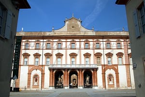
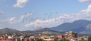
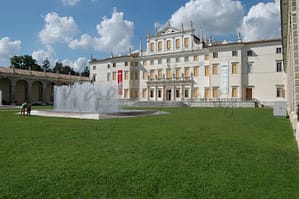
Monterotondo
Lazio
Historical charm, modern convenience, excellent transport links, vibrant culture, quality healthcare, friendly community.
Quality of Life Score
[?]Factors in air quality, amenities, walkability, population, and environmental risks. Higher scores suggest better living conditions.
85
Quality of Infrastructure
[?]Measures internet speed, healthcare access, airports, rail, and walkability. Higher scores mean better connectivity and essential services.
69
Quality of Economy
[?]Based on income, property prices, job availability, and population density. Higher scores indicate stronger economic conditions.
68
Monterotondo Demographics
Population
[?]
This is a town's official population, measured each year by the national statistics authority.
41100
Real Population (5km band)
[?]
Our "Real Population" metric reflects more accurately a town's real size by including inhabitants in the immediate vicinity of the town's official borders.
94000
Births Per 100 Deaths
70.0
Population Data Source
ISTAT,2023
Estimated Unemployment Rate
Touristy Index
[?]
Calculation of tourist density index for the city, comparing its total tourist number to the overall average tourist number of the region
relative to its own population.The index indicates how a location’s tourist density compares to the average, with values above
100 representing higher-than-average density and values below 100 representing lower-than-average density.
Not Touristic
Income per capita (2023)
[?]
This is an estimation of average income per resident for this town, based on 2023 data from the Italian Ministry of Finance.
21900
Income rank in Italy (2023)
[?]
This is a ranking of the town's average income per resident, against the full list of townships in Italy.
2727 out of 7901
Infrastructure and Connectivity
Create an account to explore more
This content is for Members only | Already a Member? Sign in
Infrastructure & Amenities
Create an account to explore more
This content is for Members only | Already a Member? Sign in
Healthcare
Create an account to explore more
This content is for Members only | Already a Member? Sign in
Housing & Property Market
Create an account to explore more
This content is for Members only | Already a Member? Sign in
Connectivity & Digital Access
Create an account to explore more
This content is for Members only | Already a Member? Sign in
Education
Create an account to explore more
This content is for Members only | Already a Member? Sign in
Climate & Weather
Create an account to explore more
This content is for Members only | Already a Member? Sign in
Precipitation
[?] Based on daily climate data for precipitation from OPEN-METEO this parameter indicates how a city's annual precipitation compares to others in terms of percentage, with values ranging from 0 (lowest) to 1 (highest). For example, a percentile rank of 0.75 means the city's total precipitation is higher than 75% of other cities.
Somewhat Low (21st-30th percentile)
Sunshine
Exceptional (Top 10%)
Snowfall
Low (11th-20th percentile)
Min Annual Temperature (°C)
[?] This parameter represents the monthly average of daily minimum temperatures for January, based on data from OPEN-METEO.
1.6
Max Annual Temperature (°C)
[?] This parameter represents the monthly average of daily minimum temperatures for January, based on data from OPEN-METEO.
32.6
Climate Description
Monterotondo, Italy, presents a temperate climate that comfortably blends moderate warmth with palpable doses of sunlight. The town experiences a moderate level of precipitation annually, ensuring lush landscapes without excessive wetness. Winters are generally mild, with rare snowfall that briefly blankets the area, creating picturesque scenes typical of northern Italian winters. Summer brings peak temperatures that are high but seldom oppressive, allowing outdoor activities and leisure to be pursued with vigor. This balance makes Monterotondo an appealing destination for expats and retirees from the Magic Towns readership, offering a climate that supports both relaxation and the enjoyment of the natural environment.
Annual Temperature Chart (Min)
Error
There was a problem with your SQL connection - Please contact the administrator
There was a problem with your SQL connection - Please contact the administrator
Annual Temperature Chart (Max)
Error
There was a problem with your SQL connection - Please contact the administrator
There was a problem with your SQL connection - Please contact the administrator
Sunny Days By Month
Error
There was a problem with your SQL connection - Please contact the administrator
There was a problem with your SQL connection - Please contact the administrator
Environmental & Air Quality
Create an account to explore more
This content is for Members only | Already a Member? Sign in
Classifications
PM10
[?]
PM10 levels indicate Good air quality at 0–20 µg/m³, Fair at 20–40 µg/m³, Moderate at 40–50 µg/m³, Poor at 50–100 µg/m³, Very Poor at 100–150 µg/m³, and Extremely Poor at 150–1200 µg/m³.
Good
PM2.5
[?]
PM2.5 is Good if PM2.5 levels are between 0–10 µg/m³, Fair between 10–20 µg/m³, Moderate between 20–25 µg/m³, Poor between 25–50 µg/m³, Very Poor between 50–75 µg/m³, and Extremely Poor between 75–800 µg/m³.
Fair
NO2
[?]
NO₂ levels are considered Good at 0–40 µg/m³, Fair at 40–90 µg/m³, Moderate at 90–120 µg/m³, Poor at 120–230 µg/m³, Very Poor at 230–340 µg/m³, and Extremely Poor at 340–1000 µg/m³.
Good
SO2
[?]
SO₂ levels indicate Good air quality at 0–100 µg/m³, Fair at 100–200 µg/m³, Moderate at 200–350 µg/m³, Poor at 350–500 µg/m³, Very Poor at 500–750 µg/m³, and Extremely Poor at 750–1250 µg/m³.
Good
O₃
[?]
For O₃, the air is Good at 0–50 µg/m³, Fair at 50–100 µg/m³, Moderate at 100–130 µg/m³, Poor at 130–240 µg/m³, Very Poor at 240–380 µg/m³, and Extremely Poor at 380–800 µg/m³.
Fair
Air Quality Rating
[?]
Based on PM10, PM2.5, NO2, SO2, and ozone levels. Higher scores indicate cleaner air.
92
Air Quality Description
In Monterotondo, the air quality largely reflects positive indices, contributing effectively to the town’s serene and inviting atmosphere. Positioned near Italy’s bustling capital, Monterotondo manages to maintain commendable levels of nitrogen dioxide and sulfur dioxide, indicative of a generally pollutant-sparse ambience. However, particulate matter presents a slightly varied picture with PM2.5 levels noting a fair rating, suggesting moderate caution for those sensitive to airborne particles. Ozone levels are similarly marked as fair, advising slight vigilance particularly during high-heat periods which may elevate concentrations. Altogether, Monterotondo offers a breathable environment that favors outdoor activities and leisurely living.
In Monterotondo, the air quality largely reflects positive indices, contributing effectively to the town’s serene and inviting atmosphere. Positioned near Italy’s bustling capital, Monterotondo manages to maintain commendable levels of nitrogen dioxide and sulfur dioxide, indicative of a generally pollutant-sparse ambience. However, particulate matter presents a slightly varied picture with PM2.5 levels noting a fair rating, suggesting moderate caution for those sensitive to airborne particles. Ozone levels are similarly marked as fair, advising slight vigilance particularly during high-heat periods which may elevate concentrations. Altogether, Monterotondo offers a breathable environment that favors outdoor activities and leisurely living.
Town Descriptions
Create an account to explore more
This content is for Members only | Already a Member? Sign in
Getting There
Monterotondo enjoys accessible transport links, positioned near the A24 and A1 motorways, facilitating road travel. Two train stations nearby enhance its connectivity, both scoring well on transport metrics. The town is served by two airports, Ciampino and Fiumicino, providing international access.
Getting Around
Local Cuisine
Monterotondo, located in the Lazio region of Italy, boasts a rich culinary scene that reflects both traditional Roman influences and local specialties. The typical local cuisine features hearty dishes like abbacchio (roast lamb), porchetta, and various preparations of rabbit. Additionally, pasta plays a central role in the diet, with traditional recipes such as gnocchi and regional variations of carbonara. Dining options in Monterotondo are varied, with numerous trattorias and ristorantes offering authentic local dishes, while also accommodating international tastes through pizzerias and multicultural eateries. Among notable dining venues, ‘Trattoria della Fortuna’ stands out with its genuine approach to traditional cuisine. Overall, Monterotondo’s culinary landscape offers a blend of local favorites and global flavors, enhancing the dining experience for residents and visitors alike.
Shopping Overview
The shopping landscape in the area features a combination of supermarkets, local boutiques, and a notable shopping centre that caters to diverse retail needs. Supermarkets provide essential grocery items, while boutiques offer unique fashion and artisan products. Additionally, a significant shopping venue hosts numerous shops, ensuring a wide array of consumer goods ranging from clothing to electronics. Weekly markets also contribute to the local shopping experience, offering fresh produce and local delicacies, thus enhancing the vibrant retail atmosphere for residents and visitors alike.
Neighborhoods
Green Areas and Parks
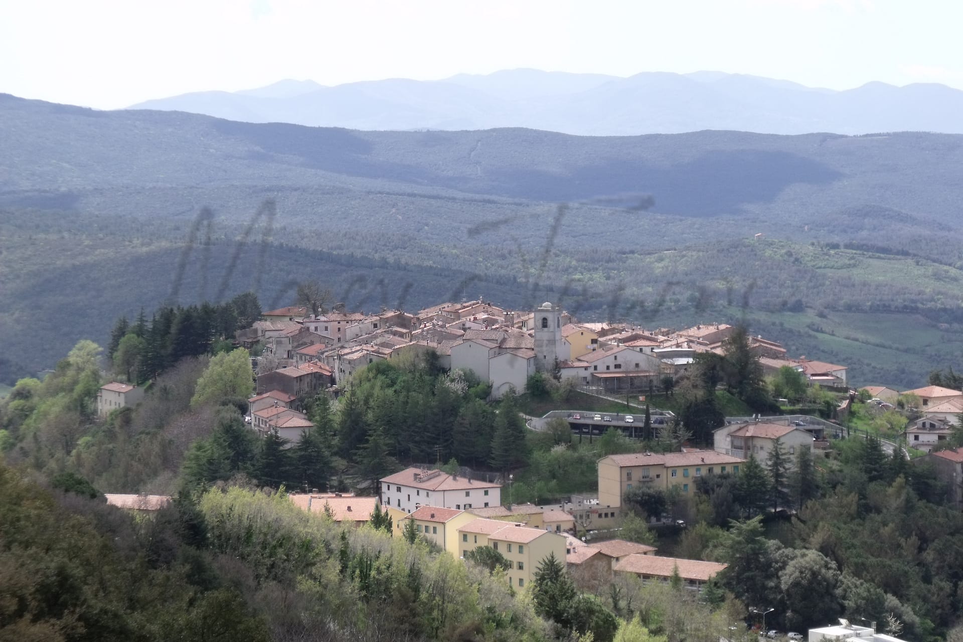
Monterotondo offers well-regarded sites for outdoor enthusiasts. The Riserva Naturale Macchia di Gattaceca e Macchia del Barco, known for its wildlife and forestry, provides leisurely walking paths and nature exploration. Another essential spot is the Monumento Naturale “Cave di Monterotondo Scalo,” attracting those interested in geological formations. For avid hikers, the Via di Francesco trail presents an arduous but rewarding 18-mile stretch from Monterotondo toward Ponticelli di Scandriglia, incorporating sections of the historical pilgrimage route connected to St. Francis.
✅ Pros
– Excellent healthcare quality and access to medical facilities.
– Good air quality for a healthy living environment.
– Low unemployment rate supports a stable local economy.
– Convenient transportation links to nearby cities and regions.
– Rich cultural and historical heritage to explore and enjoy.
– Opportunities for community integration and social engagement.
– Moderate climate with pleasant weather year-round.
– Quiet, non-touristic atmosphere ideal for relaxation and living.
– Adequate educational facilities for all age groups.
– Reliable internet connectivity for remote work and communication.
❌ Cons
– Limited nightlife options for those craving vibrant entertainment.
– Smaller town may lack amenities found in larger cities.
– Public transportation may not be frequent enough for everyone.
– Some may find the pace of life too slow.
– Less diverse dining options compared to larger urban areas.
– Limited shopping choices for specific international products.
– Language barrier could pose challenges for non-Italian speakers.
– Cultural activities may not cater to all interests.
– Seasonal weather can lead to occasional discomfort.
– Country living might feel isolating for some expats.
FAQs
Summary
Monterotondo, located in the Lazio region of Italy, offers a blend of historical charm and modern convenience, making it a noteworthy choice for expatriates and retirees. With excellent transport links to Rome, the town is well-suited for those who appreciate urban access yet desire a quieter lifestyle. Its vibrant local culture is reflected in numerous festivals and events that celebrate its rich heritage. While the healthcare system in Monterotondo is recognized for its quality, residents should be mindful of higher crime rates which may affect perceptions of safety. The town boasts plentiful sunshine and mild winters, enhancing outdoor enjoyment, though its proximity to beaches requires a short drive. Despite some challenges, including limited cycling infrastructure, Monterotondo’s friendly community and availability of English-speaking services make it an attractive destination for newcomers seeking to immerse themselves in Italian life.
✅ Pros
– Excellent healthcare quality and access to medical facilities.
– Good air quality for a healthy living environment.
– Low unemployment rate supports a stable local economy.
– Convenient transportation links to nearby cities and regions.
– Rich cultural and historical heritage to explore and enjoy.
– Opportunities for community integration and social engagement.
– Moderate climate with pleasant weather year-round.
– Quiet, non-touristic atmosphere ideal for relaxation and living.
– Adequate educational facilities for all age groups.
– Reliable internet connectivity for remote work and communication.
❌ Cons
– Limited nightlife options for those craving vibrant entertainment.
– Smaller town may lack amenities found in larger cities.
– Public transportation may not be frequent enough for everyone.
– Some may find the pace of life too slow.
– Less diverse dining options compared to larger urban areas.
– Limited shopping choices for specific international products.
– Language barrier could pose challenges for non-Italian speakers.
– Cultural activities may not cater to all interests.
– Seasonal weather can lead to occasional discomfort.
– Country living might feel isolating for some expats.
Related Posts
No posts found for the town.
More questions about Monterotondo ? Ask Magic AI.
Our innovative AI assistant is eager to help. Try it out here: