
Elevation
[?]
Elevation of a city refers to the height above sea level at which the city is located, measured in meters.
19
Population
[?]
This is a town's official population, measured each year by the national statistics authority.
24400
Real Population (5km)
[?]
Our "Real Population" metric reflects more accurately a town's real size by including inhabitants in the immediate vicinity of the town's official borders.
70500
Air Quality Rating
[?]
Based on PM10, PM2.5, NO2, SO2, and ozone levels. Higher scores indicate cleaner air.
82
Region
Emilia-Romagna
Walkability
Very Walkable
Housing availability
[?]
Based on total number of properties (sale and rent) classifies housing availability into five categories: low, relativel ylow, medium, relatively high and high.
Medium
Avg Download Speed (Mbps) / Avg Upload Speed (Mbps)
150
/ 76
Climate Description
Mild winters, warm summers, balanced rain, ample sunshine, temperate, and inviting climate.
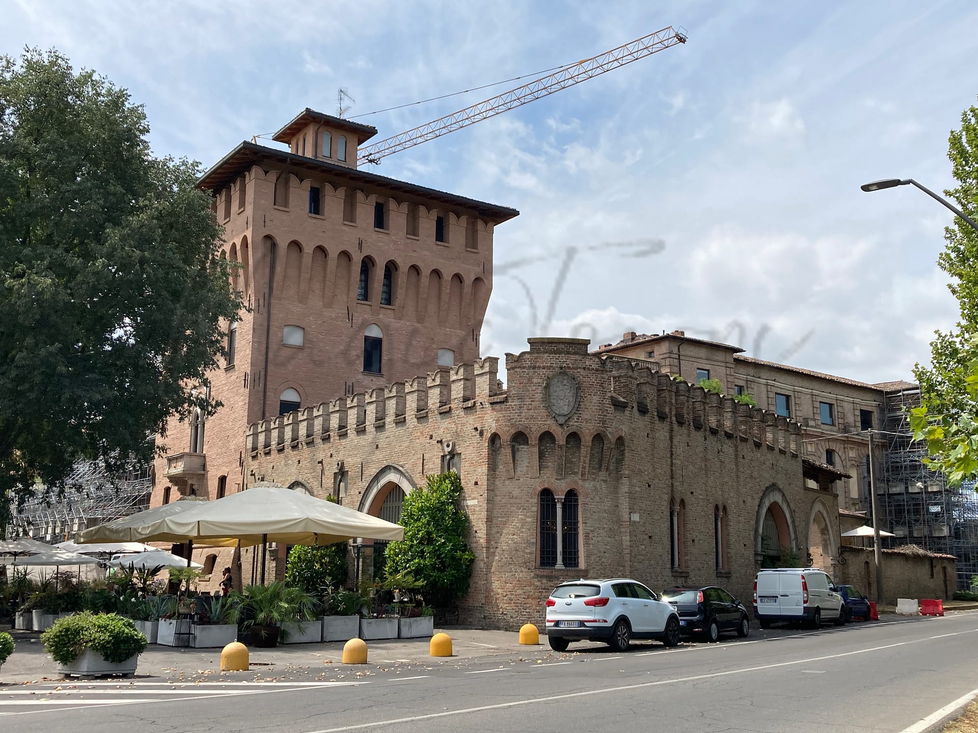
Mirandola
Emilia-Romagna
Historical town with architectural heritage, biomedical industry, culinary traditions, and efficient infrastructure.
Quality of Life Score
[?]Factors in air quality, amenities, walkability, population, and environmental risks. Higher scores suggest better living conditions.
87
Quality of Infrastructure
[?]Measures internet speed, healthcare access, airports, rail, and walkability. Higher scores mean better connectivity and essential services.
63
Quality of Economy
[?]Based on income, property prices, job availability, and population density. Higher scores indicate stronger economic conditions.
82
Mirandola Demographics
Population
[?]
This is a town's official population, measured each year by the national statistics authority.
24400
Real Population (5km band)
[?]
Our "Real Population" metric reflects more accurately a town's real size by including inhabitants in the immediate vicinity of the town's official borders.
70500
Births Per 100 Deaths
70.0
Population Data Source
ISTAT,2023
Estimated Unemployment Rate
Touristy Index
[?]
Calculation of tourist density index for the city, comparing its total tourist number to the overall average tourist number of the region
relative to its own population.The index indicates how a location’s tourist density compares to the average, with values above
100 representing higher-than-average density and values below 100 representing lower-than-average density.
Not Touristic
Income per capita (2023)
[?]
This is an estimation of average income per resident for this town, based on 2023 data from the Italian Ministry of Finance.
23900
Income rank in Italy (2023)
[?]
This is a ranking of the town's average income per resident, against the full list of townships in Italy.
964 out of 7901
Infrastructure and Connectivity
Create an account to explore more
This content is for Members only | Already a Member? Sign in
Infrastructure & Amenities
Create an account to explore more
This content is for Members only | Already a Member? Sign in
Healthcare
Create an account to explore more
This content is for Members only | Already a Member? Sign in
Housing & Property Market
Create an account to explore more
This content is for Members only | Already a Member? Sign in
Connectivity & Digital Access
Create an account to explore more
This content is for Members only | Already a Member? Sign in
Education
Create an account to explore more
This content is for Members only | Already a Member? Sign in
Climate & Weather
Create an account to explore more
This content is for Members only | Already a Member? Sign in
Precipitation
[?] Based on daily climate data for precipitation from OPEN-METEO this parameter indicates how a city's annual precipitation compares to others in terms of percentage, with values ranging from 0 (lowest) to 1 (highest). For example, a percentile rank of 0.75 means the city's total precipitation is higher than 75% of other cities.
Somewhat Low (21st-30th percentile)
Sunshine
Above Average (51st-60th percentile)
Snowfall
Below Average (31st-40th percentile)
Min Annual Temperature (°C)
[?] This parameter represents the monthly average of daily minimum temperatures for January, based on data from OPEN-METEO.
0.2
Max Annual Temperature (°C)
[?] This parameter represents the monthly average of daily minimum temperatures for January, based on data from OPEN-METEO.
31
Climate Description
In Mirandola, Italy, the climate lends itself to a comfortable and varied living experience throughout the year. Winter introduces light snowfall, while the summers bring warmth without oppressive heat, suitable for both expats and retirees. With a soothing balance of rainy days dispersed across the year, residents enjoy ample sunshine, illuminating Mirandola’s charming settings for the majority of the year. The average annual temperatures create an inviting atmosphere for those from colder or hotter climes seeking refuge in a more temperate environment. This blend of mild winters and warm summers corroborates the appeal of Mirandola as an enriching place to reside or visit.
Annual Temperature Chart (Min)
Error
There was a problem with your SQL connection - Please contact the administrator
There was a problem with your SQL connection - Please contact the administrator
Annual Temperature Chart (Max)
Error
There was a problem with your SQL connection - Please contact the administrator
There was a problem with your SQL connection - Please contact the administrator
Sunny Days By Month
Error
There was a problem with your SQL connection - Please contact the administrator
There was a problem with your SQL connection - Please contact the administrator
Environmental & Air Quality
Create an account to explore more
This content is for Members only | Already a Member? Sign in
Classifications
PM10
[?]
PM10 levels indicate Good air quality at 0–20 µg/m³, Fair at 20–40 µg/m³, Moderate at 40–50 µg/m³, Poor at 50–100 µg/m³, Very Poor at 100–150 µg/m³, and Extremely Poor at 150–1200 µg/m³.
Fair
PM2.5
[?]
PM2.5 is Good if PM2.5 levels are between 0–10 µg/m³, Fair between 10–20 µg/m³, Moderate between 20–25 µg/m³, Poor between 25–50 µg/m³, Very Poor between 50–75 µg/m³, and Extremely Poor between 75–800 µg/m³.
Fair
NO2
[?]
NO₂ levels are considered Good at 0–40 µg/m³, Fair at 40–90 µg/m³, Moderate at 90–120 µg/m³, Poor at 120–230 µg/m³, Very Poor at 230–340 µg/m³, and Extremely Poor at 340–1000 µg/m³.
Good
SO2
[?]
SO₂ levels indicate Good air quality at 0–100 µg/m³, Fair at 100–200 µg/m³, Moderate at 200–350 µg/m³, Poor at 350–500 µg/m³, Very Poor at 500–750 µg/m³, and Extremely Poor at 750–1250 µg/m³.
Good
O₃
[?]
For O₃, the air is Good at 0–50 µg/m³, Fair at 50–100 µg/m³, Moderate at 100–130 µg/m³, Poor at 130–240 µg/m³, Very Poor at 240–380 µg/m³, and Extremely Poor at 380–800 µg/m³.
Fair
Air Quality Rating
[?]
Based on PM10, PM2.5, NO2, SO2, and ozone levels. Higher scores indicate cleaner air.
82
Air Quality Description
In the quaint town of Mirandola, Italy, expats and retirees can appreciate an atmosphere that provides a balanced air quality scenario. The town maintains a level of pollutant particles that hovers within acceptable ranges, ensuring a relatively clean breathing environment. Mirandola’s air contains moderate levels of fine and coarse particulate matter, commonly referred to as PM2.5 and PM10. Additionally, the levels of nitrogen dioxide and sulfur dioxide are commendably low, contributing to the overall good conditions for respiratory health. The ozone presence, typically heightened by sunlight, remains within fair limits, providing a safe outdoor experience most days of the year.
In the quaint town of Mirandola, Italy, expats and retirees can appreciate an atmosphere that provides a balanced air quality scenario. The town maintains a level of pollutant particles that hovers within acceptable ranges, ensuring a relatively clean breathing environment. Mirandola’s air contains moderate levels of fine and coarse particulate matter, commonly referred to as PM2.5 and PM10. Additionally, the levels of nitrogen dioxide and sulfur dioxide are commendably low, contributing to the overall good conditions for respiratory health. The ozone presence, typically heightened by sunlight, remains within fair limits, providing a safe outdoor experience most days of the year.
Town Descriptions
Create an account to explore more
This content is for Members only | Already a Member? Sign in
Getting There
Mirandola is accessible via several key transport routes, including the A22 motorway facilitating connections to northern and southern Italy. The nearest airports are Reggio Emilia and Valerio Catullo in Verona. Local train stations provide adequate connectivity, both rated 7 out of 10 for access.
Getting Around
Local Cuisine
Mirandola’s culinary scene is characterized by its rich traditional dishes, notably zampone—a seasoned pork dish stuffed into a pig’s leg, and maccherone al pettine, a local pasta specialty. The dining landscape includes various restaurants that celebrate these local flavors, particularly during regional fairs focused on culinary events throughout the year. While there are options that cater to international tastes, the presence of Michelin-starred establishments is notable, yet the town does not host any Michelin-rated restaurants as of the latest guides.
Shopping Overview
The area offers diverse shopping options, including supermarkets, department stores, and specialised boutiques. Shopping centres provide a variety of brands and dining options, while street markets feature local and artisanal products. Specific categories include fashion, home goods, and gifts, catering to both everyday essentials and unique items. This blend ensures that residents and visitors can engage in comprehensive shopping experiences suitable to different preferences and needs.
Neighborhoods
Green Areas and Parks
In Mirandola, outdoor enthusiasts can enjoy the Pista ciclabile da Mirandola a Finale Emilia, a trail suitable for biking activities. Although specific hiking locations within Mirandola are not prominent, nearby Emilia-Romagna offers various trails like the moderate Crinale del Carpanè Loop via Sentiero G. G. Lorenzoni and difficult paths such as Monte Adone via SP. 59. These trails present opportunities for diverse hiking experiences.
✅ Pros
– High-quality healthcare services available locally.
– Low unemployment rate fosters economic stability.
– Rich cultural and historical heritage to explore.
– Mild climate with pleasant seasons year-round.
– Opportunities for community integration and local engagement.
– Good air quality enhances overall well-being.
– Accessible transportation options for regional travel.
– Local education facilities support various learning needs.
– Less touristy, offering a peaceful living environment.
– Reliable internet connectivity for remote work and communication.
❌ Cons
– Limited nightlife and entertainment options for social outings.
– Language barrier can hinder integration and daily interactions.
– Smaller selection of international cuisine compared to larger cities.
– Some public transport options may lack frequency and coverage.
– Occasional cultural events may be less frequent than in bigger towns.
– Limited availability of specialized medical services in the area.
– Infrastructure could benefit from upgrades and modernization efforts.
– Less exposure to diverse expat communities and experiences.
– Less vibrant arts scene compared to major urban centers.
– Local shops may have limited hours and product variety.
FAQs
Summary
Mirandola, situated in Emilia-Romagna, offers a blend of historical richness and modern living that appeals to expats and retirees. Known as the city of the Pico family, it boasts significant architectural heritage and is the birthplace of Giovanni Pico della Mirandola, a key figure of the Renaissance. While this charming town thrives in its biomedical industry, offering robust job opportunities, it is also famous for its culinary traditions, including the creation of zampone, a local delicacy. The recently reopened Church of Santa Maria Maggiore serves as a cultural landmark, complementing local dining experiences featuring dishes such as Maccherone al Pettine.
Despite its attractiveness, living in Mirandola may present some challenges; the nearest coastal beach is over 99 kilometers away, which could be a downside for those seeking a seaside lifestyle. However, its impressive walkability, efficient internet connectivity, and proximity to Modena make it a practical choice for expats.
✅ Pros
– High-quality healthcare services available locally.
– Low unemployment rate fosters economic stability.
– Rich cultural and historical heritage to explore.
– Mild climate with pleasant seasons year-round.
– Opportunities for community integration and local engagement.
– Good air quality enhances overall well-being.
– Accessible transportation options for regional travel.
– Local education facilities support various learning needs.
– Less touristy, offering a peaceful living environment.
– Reliable internet connectivity for remote work and communication.
❌ Cons
– Limited nightlife and entertainment options for social outings.
– Language barrier can hinder integration and daily interactions.
– Smaller selection of international cuisine compared to larger cities.
– Some public transport options may lack frequency and coverage.
– Occasional cultural events may be less frequent than in bigger towns.
– Limited availability of specialized medical services in the area.
– Infrastructure could benefit from upgrades and modernization efforts.
– Less exposure to diverse expat communities and experiences.
– Less vibrant arts scene compared to major urban centers.
– Local shops may have limited hours and product variety.
Related Posts
No posts found for the town.
More questions about Mirandola ? Ask Magic AI.
Our innovative AI assistant is eager to help. Try it out here: