
Elevation
[?]
Elevation of a city refers to the height above sea level at which the city is located, measured in meters.
286
Population
[?]
This is a town's official population, measured each year by the national statistics authority.
11500
Real Population (5km)
[?]
Our "Real Population" metric reflects more accurately a town's real size by including inhabitants in the immediate vicinity of the town's official borders.
26900
Air Quality Rating
[?]
Based on PM10, PM2.5, NO2, SO2, and ozone levels. Higher scores indicate cleaner air.
92
Region
Friuli-Venezia Giulia
Walkability
Very Walkable
Housing availability
[?]
Based on total number of properties (sale and rent) classifies housing availability into five categories: low, relativel ylow, medium, relatively high and high.
Medium
Avg Download Speed (Mbps) / Avg Upload Speed (Mbps)
73
/ 26
Climate Description
Distinct seasons; moderately cold winters, warm summers, ample sun, and manageable rain.
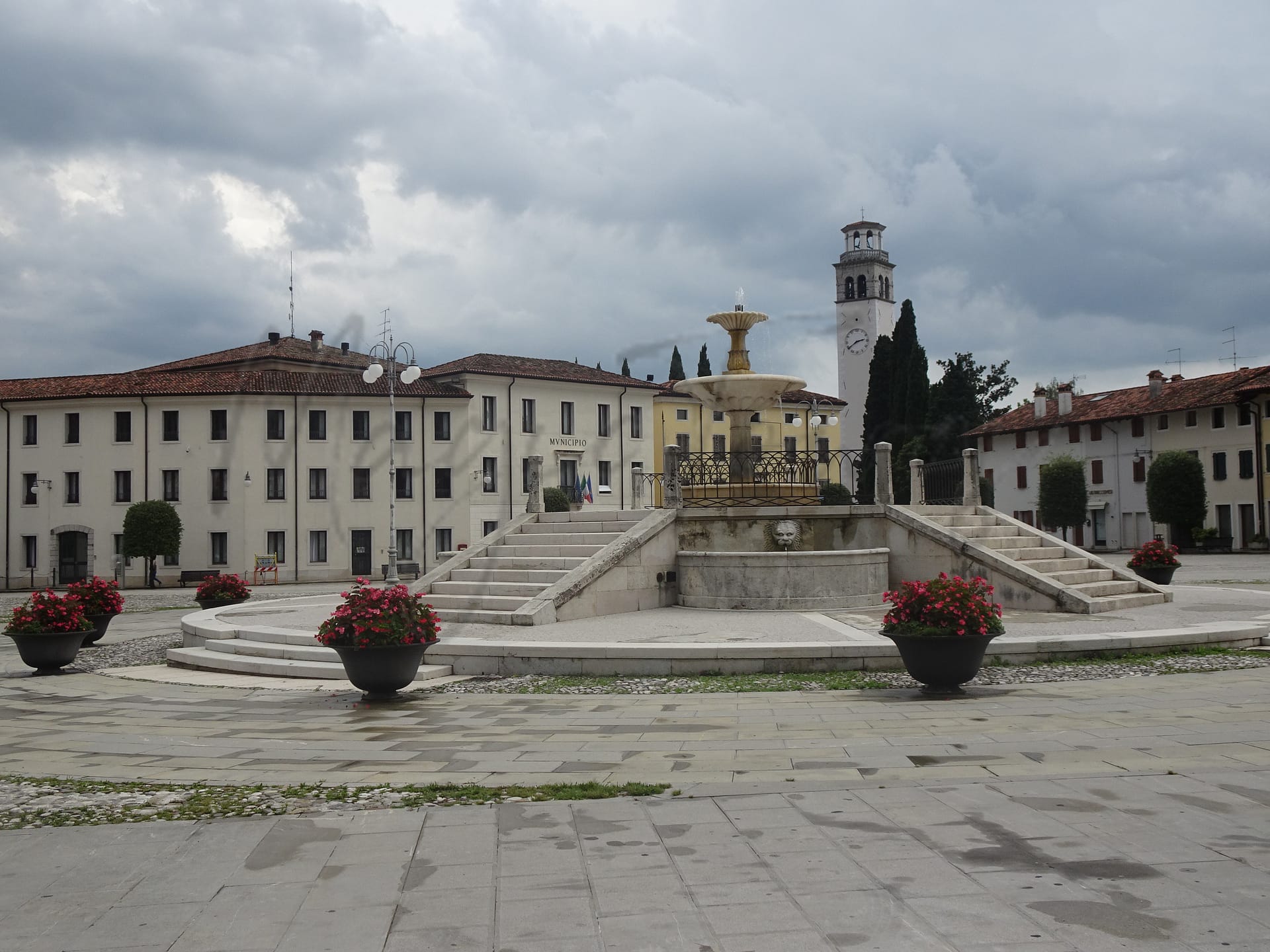
Maniago
Friuli-Venezia Giulia
This town features knife-making heritage, high air quality, walkable urban center, and accessible healthcare.
Quality of Life Score
[?]Factors in air quality, amenities, walkability, population, and environmental risks. Higher scores suggest better living conditions.
76
Quality of Infrastructure
[?]Measures internet speed, healthcare access, airports, rail, and walkability. Higher scores mean better connectivity and essential services.
58
Quality of Economy
[?]Based on income, property prices, job availability, and population density. Higher scores indicate stronger economic conditions.
81
Maniago Demographics
Population
[?]
This is a town's official population, measured each year by the national statistics authority.
11500
Real Population (5km band)
[?]
Our "Real Population" metric reflects more accurately a town's real size by including inhabitants in the immediate vicinity of the town's official borders.
26900
Births Per 100 Deaths
50.0
Population Data Source
ISTAT,2023
Estimated Unemployment Rate
Touristy Index
[?]
Calculation of tourist density index for the city, comparing its total tourist number to the overall average tourist number of the region
relative to its own population.The index indicates how a location’s tourist density compares to the average, with values above
100 representing higher-than-average density and values below 100 representing lower-than-average density.
Not Touristic
Income per capita (2023)
[?]
This is an estimation of average income per resident for this town, based on 2023 data from the Italian Ministry of Finance.
23100
Income rank in Italy (2023)
[?]
This is a ranking of the town's average income per resident, against the full list of townships in Italy.
1626 out of 7901
Infrastructure and Connectivity
Create an account to explore more
This content is for Members only | Already a Member? Sign in
Infrastructure & Amenities
Create an account to explore more
This content is for Members only | Already a Member? Sign in
Healthcare
Create an account to explore more
This content is for Members only | Already a Member? Sign in
Housing & Property Market
Create an account to explore more
This content is for Members only | Already a Member? Sign in
Connectivity & Digital Access
Create an account to explore more
This content is for Members only | Already a Member? Sign in
Education
Create an account to explore more
This content is for Members only | Already a Member? Sign in
Climate & Weather
Create an account to explore more
This content is for Members only | Already a Member? Sign in
Precipitation
[?] Based on daily climate data for precipitation from OPEN-METEO this parameter indicates how a city's annual precipitation compares to others in terms of percentage, with values ranging from 0 (lowest) to 1 (highest). For example, a percentile rank of 0.75 means the city's total precipitation is higher than 75% of other cities.
Very High (81st-90th percentile)
Sunshine
Low (11th-20th percentile)
Snowfall
Average (41st-50th percentile)
Min Annual Temperature (°C)
[?] This parameter represents the monthly average of daily minimum temperatures for January, based on data from OPEN-METEO.
-1.6
Max Annual Temperature (°C)
[?] This parameter represents the monthly average of daily minimum temperatures for January, based on data from OPEN-METEO.
25.9
Climate Description
Maniago, nestled in Italy, enjoys a climate characterized by distinct seasonal changes, offering residents a variety of weather experiences. Winters here are moderately cold with occasional snowfalls, lending a brief, picturesque charm to the landscape. Summers are pleasantly warm but seldom oppressive, ideal for enjoying the lush, green surroundings that this region is known for. The town receives a generous amount of sunlight throughout the year which, coupled with frequent but manageable rain, supports its rich agricultural backdrop. The overall mild temperatures make Maniago an appealing choice for expats and retirees looking for a stable, yet stimulating climate.
Annual Temperature Chart (Min)
Error
There was a problem with your SQL connection - Please contact the administrator
There was a problem with your SQL connection - Please contact the administrator
Annual Temperature Chart (Max)
Error
There was a problem with your SQL connection - Please contact the administrator
There was a problem with your SQL connection - Please contact the administrator
Sunny Days By Month
Error
There was a problem with your SQL connection - Please contact the administrator
There was a problem with your SQL connection - Please contact the administrator
Environmental & Air Quality
Create an account to explore more
This content is for Members only | Already a Member? Sign in
Classifications
PM10
[?]
PM10 levels indicate Good air quality at 0–20 µg/m³, Fair at 20–40 µg/m³, Moderate at 40–50 µg/m³, Poor at 50–100 µg/m³, Very Poor at 100–150 µg/m³, and Extremely Poor at 150–1200 µg/m³.
Good
PM2.5
[?]
PM2.5 is Good if PM2.5 levels are between 0–10 µg/m³, Fair between 10–20 µg/m³, Moderate between 20–25 µg/m³, Poor between 25–50 µg/m³, Very Poor between 50–75 µg/m³, and Extremely Poor between 75–800 µg/m³.
Fair
NO2
[?]
NO₂ levels are considered Good at 0–40 µg/m³, Fair at 40–90 µg/m³, Moderate at 90–120 µg/m³, Poor at 120–230 µg/m³, Very Poor at 230–340 µg/m³, and Extremely Poor at 340–1000 µg/m³.
Good
SO2
[?]
SO₂ levels indicate Good air quality at 0–100 µg/m³, Fair at 100–200 µg/m³, Moderate at 200–350 µg/m³, Poor at 350–500 µg/m³, Very Poor at 500–750 µg/m³, and Extremely Poor at 750–1250 µg/m³.
Good
O₃
[?]
For O₃, the air is Good at 0–50 µg/m³, Fair at 50–100 µg/m³, Moderate at 100–130 µg/m³, Poor at 130–240 µg/m³, Very Poor at 240–380 µg/m³, and Extremely Poor at 380–800 µg/m³.
Fair
Air Quality Rating
[?]
Based on PM10, PM2.5, NO2, SO2, and ozone levels. Higher scores indicate cleaner air.
92
Air Quality Description
Nestled in the serene landscape of northeast Italy, Maniago offers its residents air quality that generally supports a healthy lifestyle. The town benefits notably from relatively low concentrations of nitrogen dioxide and sulphur dioxide, both indicators of a fresher environment conducive to outdoor activities. While particulate matters such as PM10 and PM2.5 are kept within satisfactory levels, there is room for minor improvement in maintaining a cleaner atmosphere. The ozone levels are moderate, fitting for those sensitive to air purity. Overall, Maniago presents a comforting promise of good air quality, aligning well with the needs of expats and retirees seeking a tranquil habitat.
Nestled in the serene landscape of northeast Italy, Maniago offers its residents air quality that generally supports a healthy lifestyle. The town benefits notably from relatively low concentrations of nitrogen dioxide and sulphur dioxide, both indicators of a fresher environment conducive to outdoor activities. While particulate matters such as PM10 and PM2.5 are kept within satisfactory levels, there is room for minor improvement in maintaining a cleaner atmosphere. The ozone levels are moderate, fitting for those sensitive to air purity. Overall, Maniago presents a comforting promise of good air quality, aligning well with the needs of expats and retirees seeking a tranquil habitat.
Town Descriptions
Create an account to explore more
This content is for Members only | Already a Member? Sign in
Getting There
Maniago is connected via the SS463 and SS251 roads. The closest major airports are Antonio Canova in Treviso and Marco Polo in Venice, both reachable within an hour. Local train stations offer limited connectivity, scoring 6 and 4 out of 10, respectively, influencing overall infrastructure quality rated at 58 out of 100.
Getting Around
Local Cuisine
Maniago is situated in the Friuli-Venezia Giulia region, a culinary landscape known for its rich traditions and diverse offerings. The region boasts a variety of traditional dishes including Frico, a cheese and potato casserole, and Jota, a hearty stew made with sauerkraut and beans. Other notable items include Sarde in saor, a sweet-and-sour sardine dish, and local seafood specialties, often prepared with polenta. The dining scene in Maniago features a range of local trattorias serving these traditional meals alongside modern interpretations. While the area offers some international dining influences, it prominently celebrates its Friulian heritage. Notably, there is at least one Michelin-starred establishment, Trattoria al Cacciatore by La Subida, recognized for its interpretation of local gastronomy. Overall, Maniago presents a balanced fusion of traditional and modern culinary experiences, encapsulating the essence of Friuli-Venezia Giulia’s rich gastronomic culture.
Shopping Overview
Shopping opportunities are diverse, featuring local markets, supermarkets, and specialty shops. Weekly markets offer fresh produce, local cheeses, and a cultural immersion for residents. Supermarkets provide everyday essentials, while boutiques and gift shops showcase regional crafts and artisanal products. Nearby, larger shopping centres cater to a variety of needs, further enhancing the shopping experience. This blend of options suits the lifestyles of expats and retirees, fostering both convenience and community engagement.
Neighborhoods
Green Areas and Parks
Maniago, situated in Friuli-Venezia Giulia, offers notable outdoor activities. Anello Monte San Lorenzo via Russoledo presents a challenging 2.9-mile trail in the Colvera Valley, reaching Mount San Lorenzo. Diga di Ravedis – Poffabro is a strenuous 15.5-mile route starting near the Ravedis Dam, encompassing the village of Poffabro and scenic sights such as Forca de la Crous and waterfalls. These trails are integral for hiking enthusiasts seeking varied landscapes and historical sites.
✅ Pros
– High air quality, promoting a healthy lifestyle outdoors.
– Low unemployment rate, indicating economic stability in the area.
– Affordable living costs compared to many larger Italian cities.
– Rich cultural and historical backdrop to explore and enjoy.
– Strong community spirit fostering integration and support for newcomers.
– Accessible healthcare services ensuring residents’ medical needs are met.
– Moderate climate with warm summers and mild winters.
– Good infrastructure for transportation and local amenities.
– Non-touristy environment, providing a peaceful living experience.
– Opportunities for outdoor activities in beautiful natural surroundings.
❌ Cons
– Limited healthcare quality may affect accessibility for some residents.
– Average internet speed could frustrate remote workers or gamers.
– Public transportation options may not be as frequent or reliable.
– Fewer educational facilities might limit options for families with children.
– Economic opportunities may be less diverse than in larger cities.
– Cultural events might not be as frequent or varied.
– Limited shopping options may require travel to larger towns.
– Language barrier could hinder social integration for non-Italian speakers.
– Mild winters might lack the charm of snowy atmospheres.
– Peacefulness could translate to boredom for some seeking excitement.
FAQs
Summary
Maniago, nestled in the Friuli-Venezia Giulia region of Italy, offers a compelling mix of natural beauty and rich tradition, making it an attractive option for expats and retirees. Known for its picturesque mountain backdrop and vibrant atmosphere, Maniago boasts a walkable urban center with an 80 Walk Score, enhancing daily convenience. The town is renowned for its knife-making industry, a homage to its artisanal heritage, providing unique cultural experiences and local craftsmanship. Expats will appreciate the high air quality and accessible healthcare services, though those seeking immediate access to larger urban amenities may find some limitations, as the nearest international airport is about an hour’s drive away. While the coastline is a short distance away, the local charm and community life of Maniago present a distinctive allure for those looking to immerse themselves in Italian culture without the bustle of major tourist hubs.
✅ Pros
– High air quality, promoting a healthy lifestyle outdoors.
– Low unemployment rate, indicating economic stability in the area.
– Affordable living costs compared to many larger Italian cities.
– Rich cultural and historical backdrop to explore and enjoy.
– Strong community spirit fostering integration and support for newcomers.
– Accessible healthcare services ensuring residents’ medical needs are met.
– Moderate climate with warm summers and mild winters.
– Good infrastructure for transportation and local amenities.
– Non-touristy environment, providing a peaceful living experience.
– Opportunities for outdoor activities in beautiful natural surroundings.
❌ Cons
– Limited healthcare quality may affect accessibility for some residents.
– Average internet speed could frustrate remote workers or gamers.
– Public transportation options may not be as frequent or reliable.
– Fewer educational facilities might limit options for families with children.
– Economic opportunities may be less diverse than in larger cities.
– Cultural events might not be as frequent or varied.
– Limited shopping options may require travel to larger towns.
– Language barrier could hinder social integration for non-Italian speakers.
– Mild winters might lack the charm of snowy atmospheres.
– Peacefulness could translate to boredom for some seeking excitement.
Related Posts
No posts found for the town.
More questions about Maniago ? Ask Magic AI.
Our innovative AI assistant is eager to help. Try it out here: