
Elevation
[?]
Elevation of a city refers to the height above sea level at which the city is located, measured in meters.
462
Population
[?]
This is a town's official population, measured each year by the national statistics authority.
21600
Real Population (5km)
[?]
Our "Real Population" metric reflects more accurately a town's real size by including inhabitants in the immediate vicinity of the town's official borders.
106200
Air Quality Rating
[?]
Based on PM10, PM2.5, NO2, SO2, and ozone levels. Higher scores indicate cleaner air.
76
Region
Lombardia
Walkability
Very Walkable
Housing availability
[?]
Based on total number of properties (sale and rent) classifies housing availability into five categories: low, relativel ylow, medium, relatively high and high.
Low
Avg Download Speed (Mbps) / Avg Upload Speed (Mbps)
113
/ 36
Climate Description
Distinct seasons with cool winters, warm summers, regular rain, and plenty of sunshine.
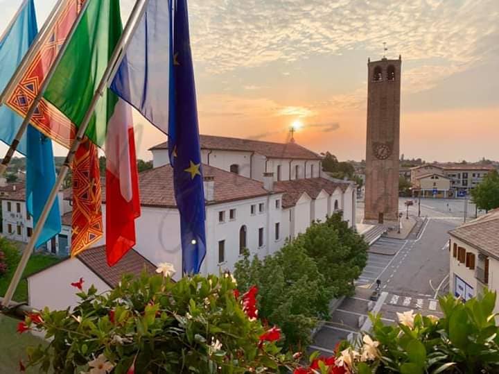
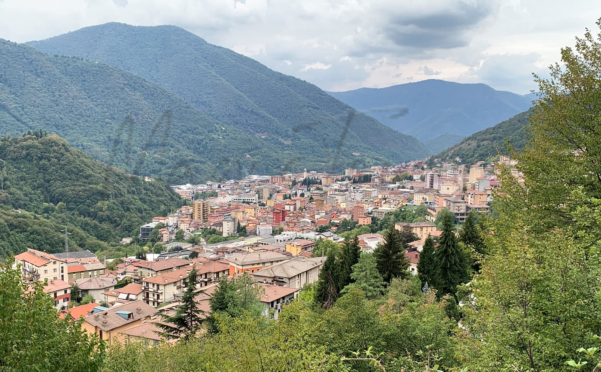
Lumezzane
Lombardia
Emerging locale in Lombardy, characterized by historical architecture and a strong manufacturing economy.
Quality of Life Score
[?]Factors in air quality, amenities, walkability, population, and environmental risks. Higher scores suggest better living conditions.
82
Quality of Infrastructure
[?]Measures internet speed, healthcare access, airports, rail, and walkability. Higher scores mean better connectivity and essential services.
65
Quality of Economy
[?]Based on income, property prices, job availability, and population density. Higher scores indicate stronger economic conditions.
77
Lumezzane Demographics
Population
[?]
This is a town's official population, measured each year by the national statistics authority.
21600
Real Population (5km band)
[?]
Our "Real Population" metric reflects more accurately a town's real size by including inhabitants in the immediate vicinity of the town's official borders.
106200
Births Per 100 Deaths
70.0
Population Data Source
ISTAT,2023
Estimated Unemployment Rate
Touristy Index
[?]
Calculation of tourist density index for the city, comparing its total tourist number to the overall average tourist number of the region
relative to its own population.The index indicates how a location’s tourist density compares to the average, with values above
100 representing higher-than-average density and values below 100 representing lower-than-average density.
No Data
Income per capita (2023)
[?]
This is an estimation of average income per resident for this town, based on 2023 data from the Italian Ministry of Finance.
23500
Income rank in Italy (2023)
[?]
This is a ranking of the town's average income per resident, against the full list of townships in Italy.
1273 out of 7901
Infrastructure and Connectivity
Create an account to explore more
This content is for Members only | Already a Member? Sign in
Infrastructure & Amenities
Create an account to explore more
This content is for Members only | Already a Member? Sign in
Healthcare
Create an account to explore more
This content is for Members only | Already a Member? Sign in
Housing & Property Market
Create an account to explore more
This content is for Members only | Already a Member? Sign in
Connectivity & Digital Access
Create an account to explore more
This content is for Members only | Already a Member? Sign in
Education
Create an account to explore more
This content is for Members only | Already a Member? Sign in
Climate & Weather
Create an account to explore more
This content is for Members only | Already a Member? Sign in
Precipitation
[?] Based on daily climate data for precipitation from OPEN-METEO this parameter indicates how a city's annual precipitation compares to others in terms of percentage, with values ranging from 0 (lowest) to 1 (highest). For example, a percentile rank of 0.75 means the city's total precipitation is higher than 75% of other cities.
Somewhat High (61st-70th percentile)
Sunshine
Somewhat Low (21st-30th percentile)
Snowfall
Average (41st-50th percentile)
Min Annual Temperature (°C)
[?] This parameter represents the monthly average of daily minimum temperatures for January, based on data from OPEN-METEO.
-1.2
Max Annual Temperature (°C)
[?] This parameter represents the monthly average of daily minimum temperatures for January, based on data from OPEN-METEO.
25.5
Climate Description
Lumezzane experiences a climate marked by distinct seasonal variations, ideal for expats and retirees seeking a balance of sun and snow. Winters are cool with occasional snowfall, creating a picturesque setting without extreme cold, while summers are pleasantly warm, allowing for ample enjoyment of outdoor activities. The town receives a fair amount of rainfall throughout the year, maintaining lush greenery and supporting local agriculture. Sunshine is generous, providing plenty of bright days to explore the scenic surroundings or simply relax in the tranquil ambiance of this charming Italian town. Lumezzane's moderate climate makes it an appealing year-round destination for those seeking a serene lifestyle with a touch of magic.
Annual Temperature Chart (Min)
Error
There was a problem with your SQL connection - Please contact the administrator
There was a problem with your SQL connection - Please contact the administrator
Annual Temperature Chart (Max)
Error
There was a problem with your SQL connection - Please contact the administrator
There was a problem with your SQL connection - Please contact the administrator
Sunny Days By Month
Error
There was a problem with your SQL connection - Please contact the administrator
There was a problem with your SQL connection - Please contact the administrator
Environmental & Air Quality
Create an account to explore more
This content is for Members only | Already a Member? Sign in
Classifications
PM10
[?]
PM10 levels indicate Good air quality at 0–20 µg/m³, Fair at 20–40 µg/m³, Moderate at 40–50 µg/m³, Poor at 50–100 µg/m³, Very Poor at 100–150 µg/m³, and Extremely Poor at 150–1200 µg/m³.
Good
PM2.5
[?]
PM2.5 is Good if PM2.5 levels are between 0–10 µg/m³, Fair between 10–20 µg/m³, Moderate between 20–25 µg/m³, Poor between 25–50 µg/m³, Very Poor between 50–75 µg/m³, and Extremely Poor between 75–800 µg/m³.
Fair
NO2
[?]
NO₂ levels are considered Good at 0–40 µg/m³, Fair at 40–90 µg/m³, Moderate at 90–120 µg/m³, Poor at 120–230 µg/m³, Very Poor at 230–340 µg/m³, and Extremely Poor at 340–1000 µg/m³.
Good
SO2
[?]
SO₂ levels indicate Good air quality at 0–100 µg/m³, Fair at 100–200 µg/m³, Moderate at 200–350 µg/m³, Poor at 350–500 µg/m³, Very Poor at 500–750 µg/m³, and Extremely Poor at 750–1250 µg/m³.
Good
O₃
[?]
For O₃, the air is Good at 0–50 µg/m³, Fair at 50–100 µg/m³, Moderate at 100–130 µg/m³, Poor at 130–240 µg/m³, Very Poor at 240–380 µg/m³, and Extremely Poor at 380–800 µg/m³.
Fair
Air Quality Rating
[?]
Based on PM10, PM2.5, NO2, SO2, and ozone levels. Higher scores indicate cleaner air.
76
Air Quality Description
In Lumezzane, Italy, the air quality generally presents a refreshing contrast to more industrialized urban centers. Particulate matter is modest, with fine particles and slightly coarser pollutants kept well within respectful limits, attributing to a predominantly good rating in air composition. Nitrogen and sulfur dioxide levels, markers of industrial activity, are notably low, reflecting the town’s effective environmental management strategies. Conversely, ozone levels, while slightly elevated, still linger around a fair classification. This overall scenario suggests that Lumezzane offers an environment conducive to those who prioritize clean air in their choice of residence.
In Lumezzane, Italy, the air quality generally presents a refreshing contrast to more industrialized urban centers. Particulate matter is modest, with fine particles and slightly coarser pollutants kept well within respectful limits, attributing to a predominantly good rating in air composition. Nitrogen and sulfur dioxide levels, markers of industrial activity, are notably low, reflecting the town’s effective environmental management strategies. Conversely, ozone levels, while slightly elevated, still linger around a fair classification. This overall scenario suggests that Lumezzane offers an environment conducive to those who prioritize clean air in their choice of residence.
Town Descriptions
Create an account to explore more
This content is for Members only | Already a Member? Sign in
Getting There
Lumezzane boasts reasonable connectivity, primarily accessed via SS237 and SS668 roads. The closest airports are Orio al Serio in Bergamo and Montichiari in Brescia. Train services nearby offer moderate connectivity, reflected in scores of 6 out of 10.
Getting Around
Local Cuisine
Lumezzane, situated in the Lombardy region of Italy, exhibits a diverse culinary scene characterized by traditional regional dishes and an array of dining options. The cuisine is heavily influenced by the culinary heritage of Lombardy, which is known for its hearty and flavorful preparations. Traditional dishes include Risotto alla Milanese, Ossobuco, Cotoletta alla Milanese, and Polenta, with various cheeses such as Gorgonzola and Grana Padano frequently incorporated into meals. Other regional specialties include Bresaola, Cassoeula, and Sbrisolona cake. The local dining landscape is enriched by restaurants offering both authentic Italian fare and international cuisine, catering to various tastes and preferences. While Lumezzane hosts a variety of eateries, currently, it does not feature any Michelin-starred establishments. The focus remains on traditional Italian dining experiences, showcasing the culinary traditions of the region in a welcoming atmosphere.
Shopping Overview
Shopping options in the area include a mix of well-equipped shopping centres, local boutiques, and supermarkets. Notable categories feature spacious malls offering a variety of retail brands, alongside dedicated supermarkets for daily needs. Specialty shops cater to unique tastes, while larger centres provide a one-stop shopping experience. Additionally, there are outlet villages featuring discounted goods. This diverse landscape accommodates both convenience and leisure shopping pursuits, appealing to a broad demographic, including retirees and expats.
Neighborhoods
Green Areas and Parks
Lumezzane, in Lombardia, features notable outdoor activities focusing on its diverse hiking trails. Mount Prealba offers an intermediate ring tour extending over 5.38 miles with a moderate 3-hour trek. Monte Conche presents a 3.11-mile intermediate path, estimated at 2 hours. For more experienced hikers, the Conche Shrine to Monte Conche loop covers 9.56 miles and requires over six hours. Additionally, the loop around Mount S. Emiliano stretches 8.11 miles, suggesting a 4-hour duration. Expert hikers can explore the Corna di Sonclino and Malga Artecle loop, spanning 10.8 miles with an approximate 6-hour commitment.
✅ Pros
– High-quality healthcare services available in the region.
– Strong local economy with low unemployment rate.
– Pleasant climate with warm summers and mild winters.
– Rich cultural and historical heritage to explore.
– Opportunities for social integration within the community.
– Sufficient educational facilities for various age groups.
– Decent internet connectivity for remote work and leisure.
– Convenient transportation options for local and regional travel.
– Scenic surroundings with beautiful landscapes and outdoor activities.
– Friendly atmosphere fostering a sense of belonging.
❌ Cons
– Limited nightlife options for evening entertainment and socializing.
– Air quality could be better for sensitive individuals.
– Infrastructure improvements needed for smoother daily commuting.
– Fewer international amenities than larger cities might offer.
– Public transport might feel less frequent or convenient.
– Touristic attractions limited compared to more popular destinations.
– Language barrier can pose challenges for newcomers integrating.
– Smaller community may feel isolating for some expats.
– Weather may be too humid for some preferences.
FAQs
Summary
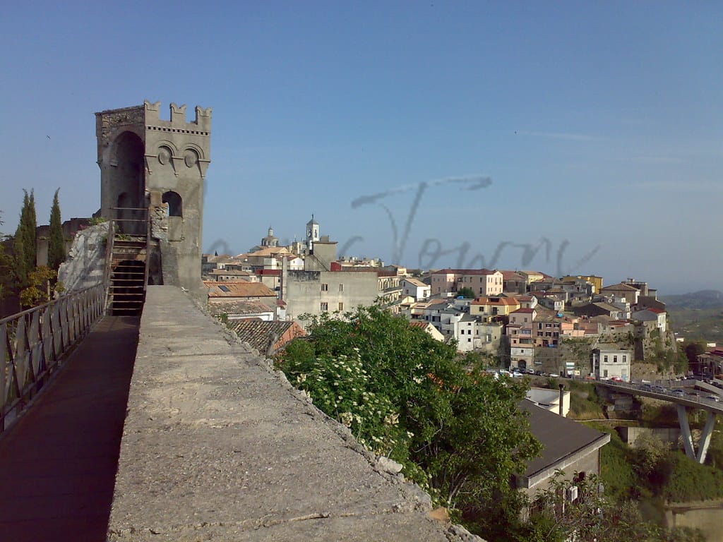
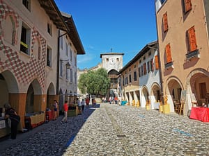
Lumezzane, situated in the Lombardy region of Italy, is an emerging locale for expatriates and retirees seeking a blend of serene living and cultural heritage. Nestled near the picturesque Valgobbia Valley and roughly 30 kilometers from the nearest beach, the town boasts a temperate climate and is characterized by its charming historical architecture, including the Santuario Madonna di Conche and various notable churches that exemplify the region’s rich religious traditions.
The local economy is strongly rooted in the manufacturing sector, particularly the production of high-quality metal products, contributing to a vibrant community spirit and employment opportunities. While Lumezzane offers many advantages, such as a favorable walk score and access to healthcare, it is less known compared to larger cities, which may present challenges in terms of amenities and international connectivity. Nonetheless, its authentic Italian atmosphere and ease of integration make it an appealing choice for those looking to embrace local culture in a tranquil setting.
✅ Pros
– High-quality healthcare services available in the region.
– Strong local economy with low unemployment rate.
– Pleasant climate with warm summers and mild winters.
– Rich cultural and historical heritage to explore.
– Opportunities for social integration within the community.
– Sufficient educational facilities for various age groups.
– Decent internet connectivity for remote work and leisure.
– Convenient transportation options for local and regional travel.
– Scenic surroundings with beautiful landscapes and outdoor activities.
– Friendly atmosphere fostering a sense of belonging.
❌ Cons
– Limited nightlife options for evening entertainment and socializing.
– Air quality could be better for sensitive individuals.
– Infrastructure improvements needed for smoother daily commuting.
– Fewer international amenities than larger cities might offer.
– Public transport might feel less frequent or convenient.
– Touristic attractions limited compared to more popular destinations.
– Language barrier can pose challenges for newcomers integrating.
– Smaller community may feel isolating for some expats.
– Weather may be too humid for some preferences.
Related Posts
No posts found for the town.
More questions about Lumezzane ? Ask Magic AI.
Our innovative AI assistant is eager to help. Try it out here: