
Elevation
[?]
Elevation of a city refers to the height above sea level at which the city is located, measured in meters.
249
Population
[?]
This is a town's official population, measured each year by the national statistics authority.
15800
Real Population (5km)
[?]
Our "Real Population" metric reflects more accurately a town's real size by including inhabitants in the immediate vicinity of the town's official borders.
253800
Air Quality Rating
[?]
Based on PM10, PM2.5, NO2, SO2, and ozone levels. Higher scores indicate cleaner air.
82
Region
Lombardia
Walkability
Very Walkable
Housing availability
[?]
Based on total number of properties (sale and rent) classifies housing availability into five categories: low, relativel ylow, medium, relatively high and high.
Low
Avg Download Speed (Mbps) / Avg Upload Speed (Mbps)
250
/ 164
Climate Description
Balanced climate: mild winters, warm summers, moderate rainfall, plentiful sunshine.
Lentate sul Seveso
Lombardia
Northern Italian town offers convenient transport, cultural events, historical sites, and limited healthcare services.
Quality of Life Score
[?]Factors in air quality, amenities, walkability, population, and environmental risks. Higher scores suggest better living conditions.
72
Quality of Infrastructure
[?]Measures internet speed, healthcare access, airports, rail, and walkability. Higher scores mean better connectivity and essential services.
63
Quality of Economy
[?]Based on income, property prices, job availability, and population density. Higher scores indicate stronger economic conditions.
75
Lentate sul Seveso Demographics
Population
[?]
This is a town's official population, measured each year by the national statistics authority.
15800
Real Population (5km band)
[?]
Our "Real Population" metric reflects more accurately a town's real size by including inhabitants in the immediate vicinity of the town's official borders.
253800
Births Per 100 Deaths
70.0
Population Data Source
ISTAT,2023
Estimated Unemployment Rate
Touristy Index
[?]
Calculation of tourist density index for the city, comparing its total tourist number to the overall average tourist number of the region
relative to its own population.The index indicates how a location’s tourist density compares to the average, with values above
100 representing higher-than-average density and values below 100 representing lower-than-average density.
Not Touristic
Income per capita (2023)
[?]
This is an estimation of average income per resident for this town, based on 2023 data from the Italian Ministry of Finance.
24000
Income rank in Italy (2023)
[?]
This is a ranking of the town's average income per resident, against the full list of townships in Italy.
921 out of 7901
Infrastructure and Connectivity
Create an account to explore more
This content is for Members only | Already a Member? Sign in
Infrastructure & Amenities
Create an account to explore more
This content is for Members only | Already a Member? Sign in
Healthcare
Create an account to explore more
This content is for Members only | Already a Member? Sign in
Housing & Property Market
Create an account to explore more
This content is for Members only | Already a Member? Sign in
Connectivity & Digital Access
Create an account to explore more
This content is for Members only | Already a Member? Sign in
Education
Create an account to explore more
This content is for Members only | Already a Member? Sign in
Climate & Weather
Create an account to explore more
This content is for Members only | Already a Member? Sign in
Precipitation
[?] Based on daily climate data for precipitation from OPEN-METEO this parameter indicates how a city's annual precipitation compares to others in terms of percentage, with values ranging from 0 (lowest) to 1 (highest). For example, a percentile rank of 0.75 means the city's total precipitation is higher than 75% of other cities.
Very High (81st-90th percentile)
Sunshine
Somewhat Low (21st-30th percentile)
Snowfall
Average (41st-50th percentile)
Min Annual Temperature (°C)
[?] This parameter represents the monthly average of daily minimum temperatures for January, based on data from OPEN-METEO.
-0.7
Max Annual Temperature (°C)
[?] This parameter represents the monthly average of daily minimum temperatures for January, based on data from OPEN-METEO.
27.8
Climate Description
Lentate sul Seveso offers a climate that balances crisp winters with pleasantly warm summers. The region experiences a fair amount of rainfall throughout the year, ensuring lush landscapes without overwhelming dampness. Winters, while typically mild, do see occasional light snowfall, adding a brief wintry charm without the severe disruptions often found in colder climates. Sunshine is plentiful, allowing residents and visitors ample opportunity to enjoy the outdoors. The temperature spectrum here ranges from cool to quite warm, maintaining a moderate average that makes it comfortable for year-round living. This climate appeals particularly to retirees and expats seeking a temperate European lifestyle.
Annual Temperature Chart (Min)
Error
There was a problem with your SQL connection - Please contact the administrator
There was a problem with your SQL connection - Please contact the administrator
Annual Temperature Chart (Max)
Error
There was a problem with your SQL connection - Please contact the administrator
There was a problem with your SQL connection - Please contact the administrator
Sunny Days By Month
Error
There was a problem with your SQL connection - Please contact the administrator
There was a problem with your SQL connection - Please contact the administrator
Environmental & Air Quality
Create an account to explore more
This content is for Members only | Already a Member? Sign in
Classifications
PM10
[?]
PM10 levels indicate Good air quality at 0–20 µg/m³, Fair at 20–40 µg/m³, Moderate at 40–50 µg/m³, Poor at 50–100 µg/m³, Very Poor at 100–150 µg/m³, and Extremely Poor at 150–1200 µg/m³.
Fair
PM2.5
[?]
PM2.5 is Good if PM2.5 levels are between 0–10 µg/m³, Fair between 10–20 µg/m³, Moderate between 20–25 µg/m³, Poor between 25–50 µg/m³, Very Poor between 50–75 µg/m³, and Extremely Poor between 75–800 µg/m³.
Moderate
NO2
[?]
NO₂ levels are considered Good at 0–40 µg/m³, Fair at 40–90 µg/m³, Moderate at 90–120 µg/m³, Poor at 120–230 µg/m³, Very Poor at 230–340 µg/m³, and Extremely Poor at 340–1000 µg/m³.
Good
SO2
[?]
SO₂ levels indicate Good air quality at 0–100 µg/m³, Fair at 100–200 µg/m³, Moderate at 200–350 µg/m³, Poor at 350–500 µg/m³, Very Poor at 500–750 µg/m³, and Extremely Poor at 750–1250 µg/m³.
Good
O₃
[?]
For O₃, the air is Good at 0–50 µg/m³, Fair at 50–100 µg/m³, Moderate at 100–130 µg/m³, Poor at 130–240 µg/m³, Very Poor at 240–380 µg/m³, and Extremely Poor at 380–800 µg/m³.
Fair
Air Quality Rating
[?]
Based on PM10, PM2.5, NO2, SO2, and ozone levels. Higher scores indicate cleaner air.
82
Air Quality Description
In Lentate sul Seveso, the air quality generally presents a moderate profile with particulate matter levels that are manageable but warrant mindful consideration. The smaller particulate matter (PM2.5) and larger particles (PM10) linger at levels that are noticeable but do not often reach concerning peaks, aligning with fair to moderate air quality classifications. Nitrogen dioxide and sulphur dioxide, typically indicators of vehicular and industrial activity, are found here at low concentrations, suggesting a relatively clean and less polluted atmosphere typical of this less industrialized area. The air contains a moderate amount of ozone, a detail that rounds out the overall fair assessment of air quality in this northern Italian locale.
In Lentate sul Seveso, the air quality generally presents a moderate profile with particulate matter levels that are manageable but warrant mindful consideration. The smaller particulate matter (PM2.5) and larger particles (PM10) linger at levels that are noticeable but do not often reach concerning peaks, aligning with fair to moderate air quality classifications. Nitrogen dioxide and sulphur dioxide, typically indicators of vehicular and industrial activity, are found here at low concentrations, suggesting a relatively clean and less polluted atmosphere typical of this less industrialized area. The air contains a moderate amount of ozone, a detail that rounds out the overall fair assessment of air quality in this northern Italian locale.
Town Descriptions
Create an account to explore more
This content is for Members only | Already a Member? Sign in
Getting There
Lentate sul Seveso offers convenient connectivity for residents. It is served by two nearby train stations, providing access to regional rail services. Major road connections include the SS35 and A36, facilitating travel to Milan and surrounding areas. The nearest airports are Malpensa and Linate, enhancing accessibility.
Getting Around
Local Cuisine
Lentate sul Seveso’s culinary scene is characterized by a diverse array of traditional Lombard dishes and a range of dining options that cater to both local and international tastes. Traditional Lombard cuisine features staples such as bollito misto (mixed boiled meats), cassoeula (a hearty stew made with pork and cabbage), and risotto. Desserts like sbrisolona (a crumbly cake) and torrone (nougat) are also notable. While the dining scene includes various local trattorias serving these specialties, it also encompasses international influences, with a variety of cuisines present, reflecting the multicultural fabric of modern Italy. As per the latest Michelin ratings, there are currently no Michelin-starred restaurants reported in Lentate sul Seveso, but the area’s culinary offerings remain rich and varied.
Shopping Overview
The area offers diverse shopping options suitable for expats and retirees. Key categories include large supermarkets catering to daily grocery needs, alongside boutique shops that provide local and artisanal products. Notable malls house a mix of international brands and leisure facilities, creating a comprehensive shopping experience. Additionally, various markets offer fresh produce and local goods, enhancing the retail variety. This blend of modern retail environments and traditional market settings is conducive for both everyday shopping and leisurely browsing.
Neighborhoods
Green Areas and Parks
Lentate sul Seveso in Lombardia offers a variety of outdoor activities suitable for retirees and expats. The town is adjacent to Parco delle Groane, featuring popular trails such as the Pista Ciclabile delle Groane. This 10.7-mile trail supports biking, hiking, and horseback riding, providing route continuity to Garbagnate railway station. Other notable hiking options include loops like the “Between Camnago and Misinto” and “Bosco del Curato.” These trails cater to intermediate-level enthusiasts seeking nature tours through forests and meadows. The region’s green spaces accommodate leisurely outdoor endeavours in a natural setting.
✅ Pros
– High-quality healthcare services available in the area.
– Excellent public transportation connections to Milan and surrounding areas.
– Low unemployment rate, offering stable job opportunities.
– Mild climate with enjoyable weather year-round.
– Rich cultural and historical heritage to explore and appreciate.
– Friendly community with ample integration opportunities for newcomers.
– Good air quality contributing to a healthier lifestyle.
– Access to quality educational facilities for lifelong learning.
– Non-touristic environment, providing a peaceful living experience.
– Reliable internet connectivity for remote work and leisure.
❌ Cons
– Limited healthcare score may raise concerns for some residents.
– Infrastructure score suggests occasional transportation inefficiencies or delays.
– Job opportunities may be limited in niche industries.
– Mild climate can lead to heavy humidity in summer.
– Smaller town means fewer entertainment options for some.
– Non-touristic environment might lack vibrant social scene.
– Internet speed could be slower compared to urban areas.
– Cultural events may be less frequent than in larger cities.
– Local cuisine might not appeal to all taste preferences.
– Integration might take time in a close-knit community.
FAQs
Summary
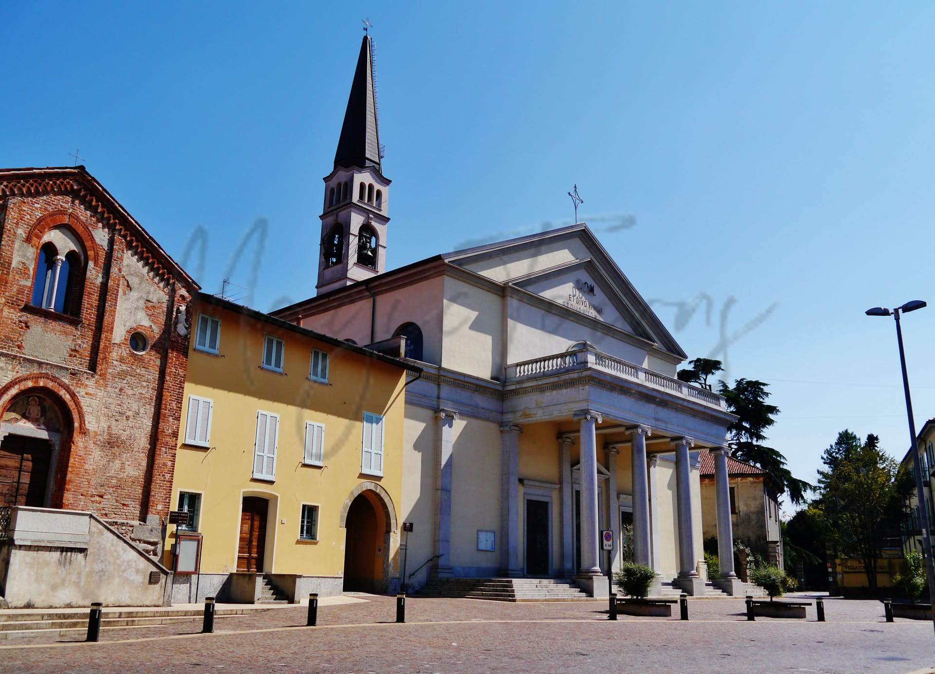
Lentate sul Seveso, situated in the Province of Monza and Brianza, offers a blend of charm and practicality for foreign expats and retirees. Located about 25 kilometers north of Milan, the town is well-served by the Camnago-Lentate railway, making it easy to access urban amenities while enjoying a quieter lifestyle. Notable attractions include the historical Oratories of Mocchirolo and Santo Stefano, the latter adorned with exquisite 14th-century frescoes, as well as the elegant Villa Valdettaro.
Cultural vibrancy is marked by events like the feast of St. Vitus, adding to community life. While the town boasts good air quality and is within a reasonable distance from the nearest beach, expats might find that local healthcare services are limited. With a commendable internet speed and a favorable walk score, Lentate sul Seveso provides a tranquil setting with some urban conveniences, appealing to those looking for a serene lifestyle without renouncing connectivity.
✅ Pros
– High-quality healthcare services available in the area.
– Excellent public transportation connections to Milan and surrounding areas.
– Low unemployment rate, offering stable job opportunities.
– Mild climate with enjoyable weather year-round.
– Rich cultural and historical heritage to explore and appreciate.
– Friendly community with ample integration opportunities for newcomers.
– Good air quality contributing to a healthier lifestyle.
– Access to quality educational facilities for lifelong learning.
– Non-touristic environment, providing a peaceful living experience.
– Reliable internet connectivity for remote work and leisure.
❌ Cons
– Limited healthcare score may raise concerns for some residents.
– Infrastructure score suggests occasional transportation inefficiencies or delays.
– Job opportunities may be limited in niche industries.
– Mild climate can lead to heavy humidity in summer.
– Smaller town means fewer entertainment options for some.
– Non-touristic environment might lack vibrant social scene.
– Internet speed could be slower compared to urban areas.
– Cultural events may be less frequent than in larger cities.
– Local cuisine might not appeal to all taste preferences.
– Integration might take time in a close-knit community.
Related Posts
No posts found for the town.
More questions about Lentate sul Seveso ? Ask Magic AI.
Our innovative AI assistant is eager to help. Try it out here: