
Elevation
[?]
Elevation of a city refers to the height above sea level at which the city is located, measured in meters.
276
Population
[?]
This is a town's official population, measured each year by the national statistics authority.
14300
Real Population (5km)
[?]
Our "Real Population" metric reflects more accurately a town's real size by including inhabitants in the immediate vicinity of the town's official borders.
106500
Air Quality Rating
[?]
Based on PM10, PM2.5, NO2, SO2, and ozone levels. Higher scores indicate cleaner air.
86
Region
Toscana
Walkability
Very Walkable
Housing availability
[?]
Based on total number of properties (sale and rent) classifies housing availability into five categories: low, relativel ylow, medium, relatively high and high.
Relatively Low
Avg Download Speed (Mbps) / Avg Upload Speed (Mbps)
107
/ 46
Climate Description
Mild winters, warm summers, even rainfall, abundant sunshine; overall temperate year-round.
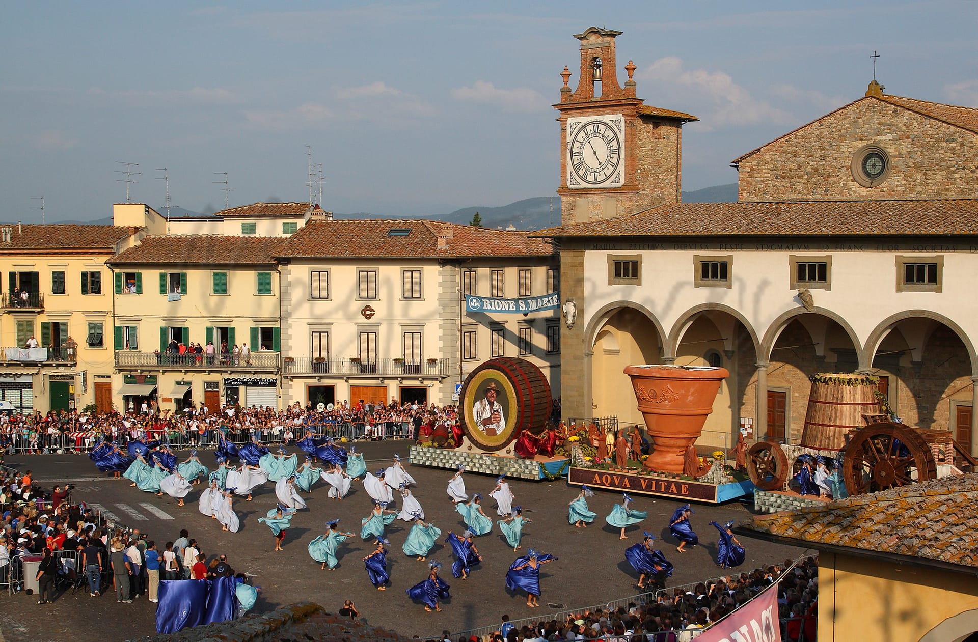
Impruneta
Toscana
Located in Tuscany, this town is known for terracotta pottery, agriculture, and proximity to Florence.
Quality of Life Score
[?]Factors in air quality, amenities, walkability, population, and environmental risks. Higher scores suggest better living conditions.
73
Quality of Infrastructure
[?]Measures internet speed, healthcare access, airports, rail, and walkability. Higher scores mean better connectivity and essential services.
61
Quality of Economy
[?]Based on income, property prices, job availability, and population density. Higher scores indicate stronger economic conditions.
77
Impruneta Demographics
Population
[?]
This is a town's official population, measured each year by the national statistics authority.
14300
Real Population (5km band)
[?]
Our "Real Population" metric reflects more accurately a town's real size by including inhabitants in the immediate vicinity of the town's official borders.
106500
Births Per 100 Deaths
50.0
Population Data Source
ISTAT,2023
Estimated Unemployment Rate
Touristy Index
[?]
Calculation of tourist density index for the city, comparing its total tourist number to the overall average tourist number of the region
relative to its own population.The index indicates how a location’s tourist density compares to the average, with values above
100 representing higher-than-average density and values below 100 representing lower-than-average density.
Some Tourism
Income per capita (2023)
[?]
This is an estimation of average income per resident for this town, based on 2023 data from the Italian Ministry of Finance.
24100
Income rank in Italy (2023)
[?]
This is a ranking of the town's average income per resident, against the full list of townships in Italy.
906 out of 7901
Infrastructure and Connectivity
Create an account to explore more
This content is for Members only | Already a Member? Sign in
Infrastructure & Amenities
Create an account to explore more
This content is for Members only | Already a Member? Sign in
Healthcare
Create an account to explore more
This content is for Members only | Already a Member? Sign in
Housing & Property Market
Create an account to explore more
This content is for Members only | Already a Member? Sign in
Connectivity & Digital Access
Create an account to explore more
This content is for Members only | Already a Member? Sign in
Education
Create an account to explore more
This content is for Members only | Already a Member? Sign in
Climate & Weather
Create an account to explore more
This content is for Members only | Already a Member? Sign in
Precipitation
[?] Based on daily climate data for precipitation from OPEN-METEO this parameter indicates how a city's annual precipitation compares to others in terms of percentage, with values ranging from 0 (lowest) to 1 (highest). For example, a percentile rank of 0.75 means the city's total precipitation is higher than 75% of other cities.
Somewhat Low (21st-30th percentile)
Sunshine
Somewhat High (61st-70th percentile)
Snowfall
Below Average (31st-40th percentile)
Min Annual Temperature (°C)
[?] This parameter represents the monthly average of daily minimum temperatures for January, based on data from OPEN-METEO.
0.7
Max Annual Temperature (°C)
[?] This parameter represents the monthly average of daily minimum temperatures for January, based on data from OPEN-METEO.
29.4
Climate Description
Impruneta offers a climate characterized by considerable sunshine, contributing to its appeal among expats and retirees. The region enjoys mild winters with rare snowfall, making it attractive for those seeking less severe winter conditions. Summers are comfortably warm without excessive heat, ensuring pleasant outdoor leisure activities. Rainfall is distributed evenly throughout the year, supporting the lush landscapes that surround this magical town. This balanced climate makes Impruneta an ideal location for those from climates both colder and hotter, offering a respite with its temperate weather year-round.
Annual Temperature Chart (Min)
Error
There was a problem with your SQL connection - Please contact the administrator
There was a problem with your SQL connection - Please contact the administrator
Annual Temperature Chart (Max)
Error
There was a problem with your SQL connection - Please contact the administrator
There was a problem with your SQL connection - Please contact the administrator
Sunny Days By Month
Error
There was a problem with your SQL connection - Please contact the administrator
There was a problem with your SQL connection - Please contact the administrator
Environmental & Air Quality
Create an account to explore more
This content is for Members only | Already a Member? Sign in
Classifications
PM10
[?]
PM10 levels indicate Good air quality at 0–20 µg/m³, Fair at 20–40 µg/m³, Moderate at 40–50 µg/m³, Poor at 50–100 µg/m³, Very Poor at 100–150 µg/m³, and Extremely Poor at 150–1200 µg/m³.
Good
PM2.5
[?]
PM2.5 is Good if PM2.5 levels are between 0–10 µg/m³, Fair between 10–20 µg/m³, Moderate between 20–25 µg/m³, Poor between 25–50 µg/m³, Very Poor between 50–75 µg/m³, and Extremely Poor between 75–800 µg/m³.
Fair
NO2
[?]
NO₂ levels are considered Good at 0–40 µg/m³, Fair at 40–90 µg/m³, Moderate at 90–120 µg/m³, Poor at 120–230 µg/m³, Very Poor at 230–340 µg/m³, and Extremely Poor at 340–1000 µg/m³.
Good
SO2
[?]
SO₂ levels indicate Good air quality at 0–100 µg/m³, Fair at 100–200 µg/m³, Moderate at 200–350 µg/m³, Poor at 350–500 µg/m³, Very Poor at 500–750 µg/m³, and Extremely Poor at 750–1250 µg/m³.
Good
O₃
[?]
For O₃, the air is Good at 0–50 µg/m³, Fair at 50–100 µg/m³, Moderate at 100–130 µg/m³, Poor at 130–240 µg/m³, Very Poor at 240–380 µg/m³, and Extremely Poor at 380–800 µg/m³.
Fair
Air Quality Rating
[?]
Based on PM10, PM2.5, NO2, SO2, and ozone levels. Higher scores indicate cleaner air.
86
Air Quality Description
Nestled in the Tuscan hills, Impruneta offers an atmospheric quality that supports a serene lifestyle, praised for its satisfactory air conditions. Fine particles are modest, ensuring that common pollutants pose minimal interference with daily activities. Particularly, the levels of nitrogen dioxide and sulphur dioxide are notably low, reflecting the town’s lesser industrial activity and higher environmental consciousness. However, while ozone levels occasionally rise to less substantial concentrations, they rarely disrupt the rustic charm and wellbeing of Impruneta’s residents. Such an environment proves beneficial for those seeking a healthier, laid-back retirement away from urban sprawl.
Nestled in the Tuscan hills, Impruneta offers an atmospheric quality that supports a serene lifestyle, praised for its satisfactory air conditions. Fine particles are modest, ensuring that common pollutants pose minimal interference with daily activities. Particularly, the levels of nitrogen dioxide and sulphur dioxide are notably low, reflecting the town’s lesser industrial activity and higher environmental consciousness. However, while ozone levels occasionally rise to less substantial concentrations, they rarely disrupt the rustic charm and wellbeing of Impruneta’s residents. Such an environment proves beneficial for those seeking a healthier, laid-back retirement away from urban sprawl.
Town Descriptions
Create an account to explore more
This content is for Members only | Already a Member? Sign in
Getting There
Impruneta is accessible via key regional roads, including the SR222, facilitating travel to Florence and other nearby towns. The nearest airport is Amerigo Vespucci in Florence, while Galileo Galilei in Pisa serves as a secondary option. Train stations within a short drive enhance connectivity to other Italian cities.
Getting Around
Local Cuisine
Impruneta’s culinary scene is deeply rooted in traditional Tuscan cuisine, with an emphasis on regional ingredients and classic recipes. Notable traditional dishes include Pappa al Pomodoro, a rustic soup made with stale bread and ripe tomatoes; Ribollita, a hearty vegetable and bread soup; Bistecca alla Fiorentina, a thick, grilled T-bone steak; Pici, a hand-rolled pasta typically served with rich ragù sauce; and Crispy Crostini di Fegatini, topped with creamy chicken liver pâté. In addition to these local delicacies, Impruneta features a variety of dining options that also reflect international flavors, accommodating diverse culinary preferences. It boasts a vibrant restaurant scene that ranges from rustic osterias to modern dining establishments. Notably, the region includes Michelin-starred restaurants that signify a high standard of culinary excellence. The mix of traditional Tuscan fare complemented by international influences and Michelin-star recognition makes Impruneta a distinctive culinary destination in Tuscany.
Shopping Overview
The area features a variety of shopping options, including small grocery stores providing local products and a distinctive Italian ambience. Notably, terracotta shops are prevalent, reflecting the region’s artisanal heritage. Additionally, there are pharmacies and petrol stations available. This mix makes for a practical and authentic shopping experience, catering to daily needs while also highlighting local craftsmanship.
Neighborhoods
Green Areas and Parks
Impruneta in Toscana offers several hiking routes suited for varying fitness levels, including the “View of Certosa – Park loop from Pozzolatico” and the “Hiking loop from Tavarnuzze.” The trails provide views of historical sites such as St. John’s Square and technical challenges like the “Tavernaccia – Via della Poggiona.” Outdoor enthusiasts can also explore mountain biking options in the Impruneta Trail Area. Additionally, the Circolo Golf Ugolino offers golfing opportunities, and the Piscina Zodiac provides swimming facilities, catering to diverse outdoor interests.
✅ Pros
– Rich cultural and historical backdrop for exploration and appreciation.
– Excellent air quality enhances overall well-being and comfort.
– Low unemployment rate indicates a stable local economy.
– Strong integration opportunities with friendly local community.
– Proximity to Florence for urban amenities and attractions.
– Quality healthcare services support residents’ medical needs effectively.
– Mild climate offers pleasant weather year-round for outdoor activities.
– Sufficient internet connectivity facilitates remote work and communication.
– Scenic landscapes provide tranquil living environment and recreational options.
❌ Cons
– Limited public transportation options for travel outside town.
– Healthcare score leaves room for improvement in services.
– Infrastructure may not be as developed as larger cities.
– Internet speed may not satisfy heavy data users.
– Tourism can lead to seasonal overcrowding and noise.
– Local amenities may be limited compared to larger towns.
– Language barrier can complicate daily interactions for newcomers.
– Limited educational facilities for families with school-aged children.
– Rural living might feel isolating for some expats.
– Weather can be too hot in summer for comfort.
FAQs
Summary
Impruneta, located in the scenic Tuscany region, offers a balanced lifestyle for expats and retirees, featuring a rich cultural heritage and modern amenities. This charming town is renowned for its high-quality terracotta pottery, a tradition that dates back centuries, alongside stunning views of the Tuscan hills. Impruneta’s population is engaged in local industries, with agriculture and artisanal crafts playing a significant role in community life. The town’s appealing transport links and proximity to Florence make it an attractive base for exploring the region.
While boasting excellent healthcare and a generally high quality of life, it does have a higher cost of living compared to other areas, which may be a consideration for those on a fixed income. However, with a walkable environment and active local community, Impruneta provides a conducive backdrop for a fulfilling expat experience, blending the tranquil countryside charm with accessibility to urban amenities.
✅ Pros
– Rich cultural and historical backdrop for exploration and appreciation.
– Excellent air quality enhances overall well-being and comfort.
– Low unemployment rate indicates a stable local economy.
– Strong integration opportunities with friendly local community.
– Proximity to Florence for urban amenities and attractions.
– Quality healthcare services support residents’ medical needs effectively.
– Mild climate offers pleasant weather year-round for outdoor activities.
– Sufficient internet connectivity facilitates remote work and communication.
– Scenic landscapes provide tranquil living environment and recreational options.
❌ Cons
– Limited public transportation options for travel outside town.
– Healthcare score leaves room for improvement in services.
– Infrastructure may not be as developed as larger cities.
– Internet speed may not satisfy heavy data users.
– Tourism can lead to seasonal overcrowding and noise.
– Local amenities may be limited compared to larger towns.
– Language barrier can complicate daily interactions for newcomers.
– Limited educational facilities for families with school-aged children.
– Rural living might feel isolating for some expats.
– Weather can be too hot in summer for comfort.
Related Posts
More questions about Impruneta ? Ask Magic AI.
Our innovative AI assistant is eager to help. Try it out here: