Elevation
[?]
Elevation of a city refers to the height above sea level at which the city is located, measured in meters.
359
Population
[?]
This is a town's official population, measured each year by the national statistics authority.
42300
Real Population (5km)
[?]
Our "Real Population" metric reflects more accurately a town's real size by including inhabitants in the immediate vicinity of the town's official borders.
45300
Air Quality Rating
[?]
Based on PM10, PM2.5, NO2, SO2, and ozone levels. Higher scores indicate cleaner air.
90
Region
Puglia
Walkability
Walker’s Paradise
Housing availability
[?]
Based on total number of properties (sale and rent) classifies housing availability into five categories: low, relativel ylow, medium, relatively high and high.
Low
Avg Download Speed (Mbps) / Avg Upload Speed (Mbps)
84
/ 34
Climate Description
Temperate climate with mild winters, warm summers, and evenly distributed rainfall.
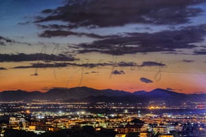
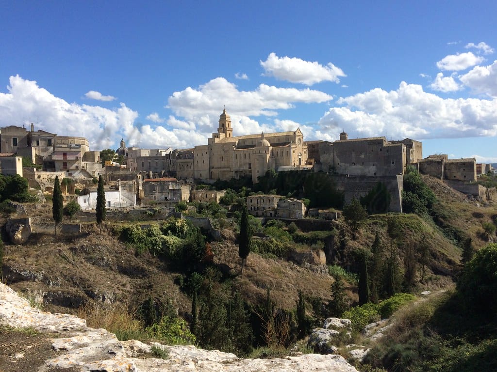
Gravina in Puglia
Puglia
This Apulian town features historical sites, Romanesque architecture, and high walkability, but limited beach access.
Quality of Life Score
[?]Factors in air quality, amenities, walkability, population, and environmental risks. Higher scores suggest better living conditions.
84
Quality of Infrastructure
[?]Measures internet speed, healthcare access, airports, rail, and walkability. Higher scores mean better connectivity and essential services.
63
Quality of Economy
[?]Based on income, property prices, job availability, and population density. Higher scores indicate stronger economic conditions.
63
Gravina in Puglia Demographics
Population
[?]
This is a town's official population, measured each year by the national statistics authority.
42300
Real Population (5km band)
[?]
Our "Real Population" metric reflects more accurately a town's real size by including inhabitants in the immediate vicinity of the town's official borders.
45300
Births Per 100 Deaths
80.0
Population Data Source
ISTAT,2023
Estimated Unemployment Rate
Touristy Index
[?]
Calculation of tourist density index for the city, comparing its total tourist number to the overall average tourist number of the region
relative to its own population.The index indicates how a location’s tourist density compares to the average, with values above
100 representing higher-than-average density and values below 100 representing lower-than-average density.
Not Touristic
Income per capita (2023)
[?]
This is an estimation of average income per resident for this town, based on 2023 data from the Italian Ministry of Finance.
17700
Income rank in Italy (2023)
[?]
This is a ranking of the town's average income per resident, against the full list of townships in Italy.
5609 out of 7901
Infrastructure and Connectivity
Create an account to explore more
This content is for Members only | Already a Member? Sign in
Infrastructure & Amenities
Create an account to explore more
This content is for Members only | Already a Member? Sign in
Healthcare
Create an account to explore more
This content is for Members only | Already a Member? Sign in
Housing & Property Market
Create an account to explore more
This content is for Members only | Already a Member? Sign in
Connectivity & Digital Access
Create an account to explore more
This content is for Members only | Already a Member? Sign in
Education
Create an account to explore more
This content is for Members only | Already a Member? Sign in
Climate & Weather
Create an account to explore more
This content is for Members only | Already a Member? Sign in
Precipitation
[?] Based on daily climate data for precipitation from OPEN-METEO this parameter indicates how a city's annual precipitation compares to others in terms of percentage, with values ranging from 0 (lowest) to 1 (highest). For example, a percentile rank of 0.75 means the city's total precipitation is higher than 75% of other cities.
Very Low (Bottom 10%)
Sunshine
Very High (81st-90th percentile)
Snowfall
Somewhat Low (21st-30th percentile)
Min Annual Temperature (°C)
[?] This parameter represents the monthly average of daily minimum temperatures for January, based on data from OPEN-METEO.
2.2
Max Annual Temperature (°C)
[?] This parameter represents the monthly average of daily minimum temperatures for January, based on data from OPEN-METEO.
32.1
Climate Description
Gravina in Puglia offers a climate that supports both leisurely retirement and active living. Winter brings brief and gentle snowfall, creating picturesque scenes without causing much disruption. Summers are warm, inviting residents and visitors alike to enjoy the abundant sunshine. The shoulder seasons are mild, ideal for outdoor pursuits and exploring the historic surroundings. With rainfall distributed fairly throughout the year, the landscape maintains its lushness, enhancing the town’s appeal for those seeking a tranquil yet vibrant environment. Gravina’s overall temperate weather allows for an engaging lifestyle, harmonizing with both the social and natural aspects of this charming Italian locale.
Annual Temperature Chart (Min)
Error
There was a problem with your SQL connection - Please contact the administrator
There was a problem with your SQL connection - Please contact the administrator
Annual Temperature Chart (Max)
Error
There was a problem with your SQL connection - Please contact the administrator
There was a problem with your SQL connection - Please contact the administrator
Sunny Days By Month
Error
There was a problem with your SQL connection - Please contact the administrator
There was a problem with your SQL connection - Please contact the administrator
Environmental & Air Quality
Create an account to explore more
This content is for Members only | Already a Member? Sign in
Classifications
PM10
[?]
PM10 levels indicate Good air quality at 0–20 µg/m³, Fair at 20–40 µg/m³, Moderate at 40–50 µg/m³, Poor at 50–100 µg/m³, Very Poor at 100–150 µg/m³, and Extremely Poor at 150–1200 µg/m³.
Good
PM2.5
[?]
PM2.5 is Good if PM2.5 levels are between 0–10 µg/m³, Fair between 10–20 µg/m³, Moderate between 20–25 µg/m³, Poor between 25–50 µg/m³, Very Poor between 50–75 µg/m³, and Extremely Poor between 75–800 µg/m³.
Good
NO2
[?]
NO₂ levels are considered Good at 0–40 µg/m³, Fair at 40–90 µg/m³, Moderate at 90–120 µg/m³, Poor at 120–230 µg/m³, Very Poor at 230–340 µg/m³, and Extremely Poor at 340–1000 µg/m³.
Good
SO2
[?]
SO₂ levels indicate Good air quality at 0–100 µg/m³, Fair at 100–200 µg/m³, Moderate at 200–350 µg/m³, Poor at 350–500 µg/m³, Very Poor at 500–750 µg/m³, and Extremely Poor at 750–1250 µg/m³.
Good
O₃
[?]
For O₃, the air is Good at 0–50 µg/m³, Fair at 50–100 µg/m³, Moderate at 100–130 µg/m³, Poor at 130–240 µg/m³, Very Poor at 240–380 µg/m³, and Extremely Poor at 380–800 µg/m³.
Fair
Air Quality Rating
[?]
Based on PM10, PM2.5, NO2, SO2, and ozone levels. Higher scores indicate cleaner air.
90
Air Quality Description
Gravina in Puglia, nestled among Italy’s picturesque southern vistas, offers residents enviable air quality. Dominant particulate matters such as PM10 and PM2.5 are considerably low, boding well for those concerned with respiratory health. Nitrogen and sulphur dioxide levels also fall comfortably within recommended health standards. While ozone presence hovers at moderate levels, the overall atmospheric conditions contribute to a setting that supports well-being. This balance of elements renders Gravina an appealing choice for retirees and expats seeking cleaner air without sacrificing the charm and cultural richness of Italian life.
Gravina in Puglia, nestled among Italy’s picturesque southern vistas, offers residents enviable air quality. Dominant particulate matters such as PM10 and PM2.5 are considerably low, boding well for those concerned with respiratory health. Nitrogen and sulphur dioxide levels also fall comfortably within recommended health standards. While ozone presence hovers at moderate levels, the overall atmospheric conditions contribute to a setting that supports well-being. This balance of elements renders Gravina an appealing choice for retirees and expats seeking cleaner air without sacrificing the charm and cultural richness of Italian life.
Town Descriptions
Create an account to explore more
This content is for Members only | Already a Member? Sign in
Getting There
Gravina in Puglia is accessible via the A14 and SS96 roads, connecting it to key cities in the region. The nearest airport is Bari, followed by Brindisi. Rail services are limited, with nearby train stations scoring 5 and 3 for connectivity, respectively, reflecting moderate transport options.
Getting Around
Local Cuisine
Gravina in Puglia boasts a rich culinary scene steeped in tradition, characterized by local dishes that are integral to Puglian culture. The region is known for its handmade pasta, particularly orecchiette, as well as hearty fare such as ciceri e tria, a combination of chickpeas and pasta. Other regional specialties include bombette pugliese (stuffed meat rolls), melanzane ripiene (stuffed eggplants), and the renowned burrata cheese. The town offers a variety of dining options, ranging from traditional trattorias to modern eateries featuring regional innovations. While the international dining influence is moderate, Italian cuisine dominates the landscape, with local restaurants occasionally incorporating elements from Mediterranean and global cuisines. Currently, there are no Michelin-starred restaurants in Gravina in Puglia, which means the dining experience, while authentic and diverse, remains rooted in local tradition rather than high-end gastronomy.
Shopping Overview
Shopping in the area is primarily centred around farmers’ markets, art galleries, and specialty shops offering unique gifts and local products. Fresh produce can be found at various outdoor markets, while boutiques feature artisanal goods and regional crafts. Additionally, there are opportunities to explore art through galleries that showcase local talent. This diverse range of options caters to both everyday needs and niche interests, providing a comprehensive shopping experience.
Neighborhoods
Green Areas and Parks
Gravina in Puglia offers a variety of outdoor activities, notable trails include Via Peuceta, Segment 6, a challenging 18.8-mile trek estimated to take 7 hours and 25 minutes. Serra Lamascesciola provides a moderate 5.7-mile hike, while Pulicchio di Gravina offers a simpler 2.3-mile route. The region is part of the Alta Murgia National Park, a renowned area for trekking and natural exploration. The park offers expansive landscapes for hiking enthusiasts.
✅ Pros
– Rich cultural and historical backdrop enhances daily life experience.
– Good air quality promotes health and outdoor activities.
– Opportunities for integration in a welcoming local community.
– Moderate healthcare quality with accessible local medical facilities.
– Reasonable infrastructure supports daily commuting and local travel.
– Non-touristic environment offers a peaceful living atmosphere.
– Mild climate suitable for year-round outdoor activities.
– Low unemployment rate encourages community engagement and stability.
– Internet connectivity supports remote work and digital engagement.
– Local cuisine and traditions enrich lifestyle and community experiences.
❌ Cons
– Limited healthcare quality may require travel for specialized services.
– Public transportation options are somewhat limited for long distances.
– Economic opportunities may be less diverse compared to larger cities.
– Average internet speeds may not support heavy data use.
– Local educational facilities may lack advanced programs and resources.
– Mild climate means occasional humidity, which can be uncomfortable.
– Non-touristic environment may feel isolated for some expats.
– Income rank indicates potential financial limitations for newcomers.
– Cultural experiences may feel repetitive without nearby urban diversity.
– Infrastructure improvements may be slower in rural settings.
FAQs
Summary
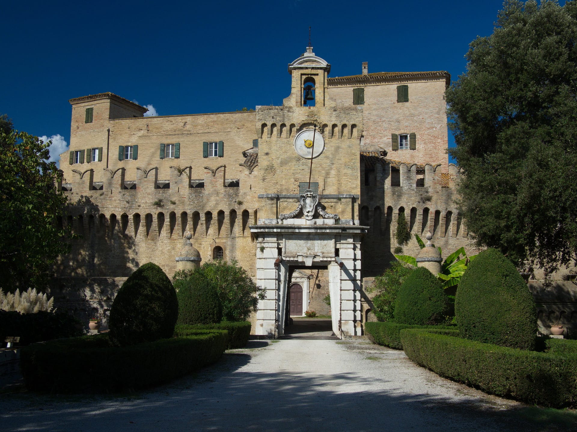
Gravina in Puglia, located in the Apulia region, offers a blend of history, culture, and local charm that appeals to foreign expats and retirees. Known for its impressive historical sites like the Gravina Sotterranea, an underground town with caves and ancient structures, and the Basilica Concattedrale di Santa Maria Assunta, the town showcases Apulian Romanesque architecture. The nearby Acquedotto Bridge, famous for featuring in notable films, highlights the area’s picturesque setting.
Despite its vibrant cultural backdrop, some challenges exist. Access to healthcare could be a concern with a lower quality percentile, and while the nearest beaches are around 60 km away, the limited proximity may deter beach enthusiasts. However, with a high walkability score, the town encourages exploration on foot, making it suitable for those who prefer an active lifestyle. Internet connectivity is also robust, ensuring good communication lines for expatriates.
✅ Pros
– Rich cultural and historical backdrop enhances daily life experience.
– Good air quality promotes health and outdoor activities.
– Opportunities for integration in a welcoming local community.
– Moderate healthcare quality with accessible local medical facilities.
– Reasonable infrastructure supports daily commuting and local travel.
– Non-touristic environment offers a peaceful living atmosphere.
– Mild climate suitable for year-round outdoor activities.
– Low unemployment rate encourages community engagement and stability.
– Internet connectivity supports remote work and digital engagement.
– Local cuisine and traditions enrich lifestyle and community experiences.
❌ Cons
– Limited healthcare quality may require travel for specialized services.
– Public transportation options are somewhat limited for long distances.
– Economic opportunities may be less diverse compared to larger cities.
– Average internet speeds may not support heavy data use.
– Local educational facilities may lack advanced programs and resources.
– Mild climate means occasional humidity, which can be uncomfortable.
– Non-touristic environment may feel isolated for some expats.
– Income rank indicates potential financial limitations for newcomers.
– Cultural experiences may feel repetitive without nearby urban diversity.
– Infrastructure improvements may be slower in rural settings.
Related Posts
No posts found for the town.
More questions about Gravina in Puglia ? Ask Magic AI.
Our innovative AI assistant is eager to help. Try it out here: