
Elevation
[?]
Elevation of a city refers to the height above sea level at which the city is located, measured in meters.
136
Population
[?]
This is a town's official population, measured each year by the national statistics authority.
21200
Real Population (5km)
[?]
Our "Real Population" metric reflects more accurately a town's real size by including inhabitants in the immediate vicinity of the town's official borders.
228600
Air Quality Rating
[?]
Based on PM10, PM2.5, NO2, SO2, and ozone levels. Higher scores indicate cleaner air.
82
Region
Lombardia
Walkability
Very Walkable
Housing availability
[?]
Based on total number of properties (sale and rent) classifies housing availability into five categories: low, relativel ylow, medium, relatively high and high.
Low
Avg Download Speed (Mbps) / Avg Upload Speed (Mbps)
145
/ 81
Climate Description
Balanced climate: mild winters, warm summers, moderate rainfall, and abundant sunshine.
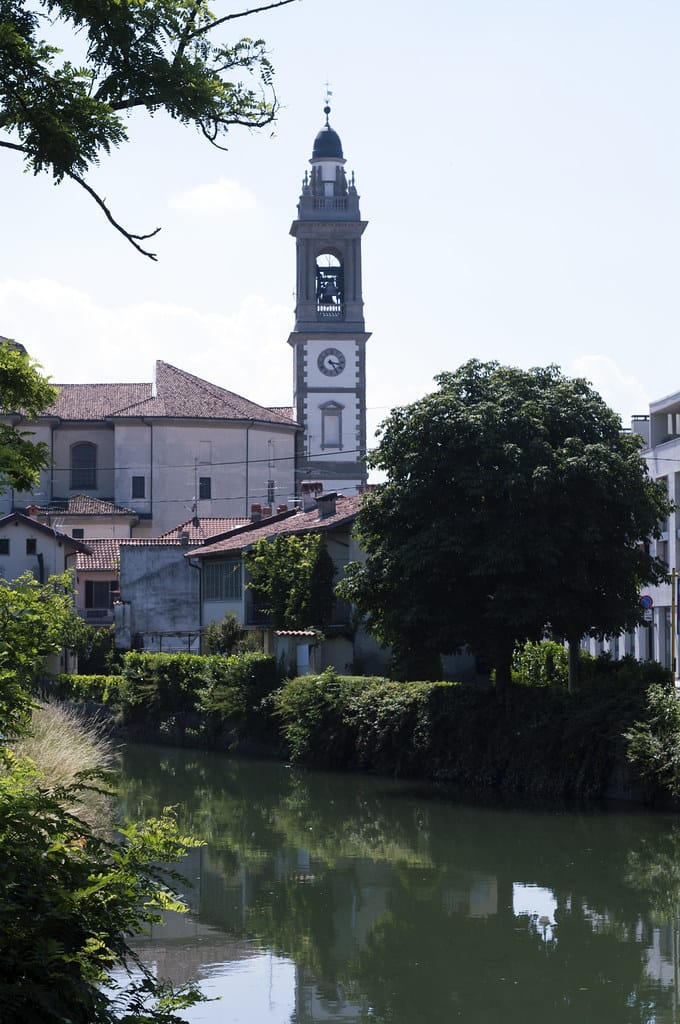
Gorgonzola
Lombardia
Compact town known for Gorgonzola cheese, pedestrian-friendly layout, and proximity to Milan.
Quality of Life Score
[?]Factors in air quality, amenities, walkability, population, and environmental risks. Higher scores suggest better living conditions.
79
Quality of Infrastructure
[?]Measures internet speed, healthcare access, airports, rail, and walkability. Higher scores mean better connectivity and essential services.
74
Quality of Economy
[?]Based on income, property prices, job availability, and population density. Higher scores indicate stronger economic conditions.
80
Gorgonzola Demographics
Population
[?]
This is a town's official population, measured each year by the national statistics authority.
21200
Real Population (5km band)
[?]
Our "Real Population" metric reflects more accurately a town's real size by including inhabitants in the immediate vicinity of the town's official borders.
228600
Births Per 100 Deaths
70.0
Population Data Source
ISTAT,2023
Estimated Unemployment Rate
Touristy Index
[?]
Calculation of tourist density index for the city, comparing its total tourist number to the overall average tourist number of the region
relative to its own population.The index indicates how a location’s tourist density compares to the average, with values above
100 representing higher-than-average density and values below 100 representing lower-than-average density.
Not Touristic
Income per capita (2023)
[?]
This is an estimation of average income per resident for this town, based on 2023 data from the Italian Ministry of Finance.
27100
Income rank in Italy (2023)
[?]
This is a ranking of the town's average income per resident, against the full list of townships in Italy.
60 out of 7901
Infrastructure and Connectivity
Create an account to explore more
This content is for Members only | Already a Member? Sign in
Closest Airport
Name
Linate (Milan)
Connectivity Score
[?]
Measures travel time and service quality of nearby airport stations. Higher scores mean better transport access.
7
Driving Time
18min(s)
Milan Linate Airport (LIN), situated in Segrate and Peschiera Borromeo in Lombardy, Italy, serves around 10.6 million passengers annually. It focuses on flights within Europe and the United Kingdom, serving as a hub for ITA Airways. The airport offers convenient connections to popular destinations such as Rome, Cagliari, and Paris, making it an accessible choice for travellers seeking direct European flights.
2nd Closest Airport
Name
Orio al Serio (Bergamo)
Connectivity Score
[?]
Measures travel time and service quality of nearby airport stations. Higher scores mean better transport access.
7
Driving Time
24min(s)
Orio al Serio International Airport, also known as Milan Bergamo Airport, is located just 5 km from Bergamo and about 45 km from Milan in Lombardy, Italy. It is the third busiest airport in Italy, serving over 13 million passengers annually and acting as a major hub for Ryanair. The airport connects to numerous European destinations including Copenhagen, Düsseldorf, as well as farther routes like Dubai and Cairo. Known for its budget-friendly flights primarily operated by Ryanair, Milan Bergamo Airport is a popular choice for travellers looking for affordable options to various international destinations.
3rd Closest Airport
Name
Malpensa (Milan)
Connectivity Score
[?]
Measures travel time and service quality of nearby airport stations. Higher scores mean better transport access.
10
Driving Time
41min(s)
Milan Malpensa Airport (MXP) is located near Milan, Italy, and is the second largest and busiest airport in the country. Handling 28.5 million passengers, the airport connects to around 195 destinations worldwide, serving as a major hub for EasyJet. Key routes include flights to New York, London, Dubai, and Istanbul, making it a significant international gateway. Notable for its effective connectivity with Milan’s city centre via the Malpensa Express, the airport caters extensively to travellers heading to diverse European, American, and Asian destinations.
Closest Rail
Name
Cascina Antonietta
Connectivity Score
[?]
Measures travel time and service quality of nearby rail stations. Higher scores mean better transport access.
5
Driving Time
4min(s)
Train service at Cascina Antonietta provides various rail connections primarily operated by Trenitalia. The station is served by regional train lines that connect users to significant destinations such as Milan, Gorgonzola, and further into the Lombardy region.
Key destinations connected by direct trains include:
– Milan Centrale
– Gorgonzola
– Abbiategrasso
Trenitalia operates the services, with departures typically every 20 to 30 minutes during peak hours, while off-peak hours may see less frequent schedules, offering a few trains per hour.
The services at Cascina Antonietta focus primarily on regional travel, with no direct high-speed trains stopping at this station, providing a mix of local connectivity predominately through regional lines.
2nd Closest Rail
Name
Stazione di Melzo
Connectivity Score
[?]
Measures travel time and service quality of nearby rail stations. Higher scores mean better transport access.
6
Driving Time
8min(s)
Train service at Stazione di Melzo provides a connection primarily to the Milan suburban railway network. The station is served by lines S5 and S6, both operated by Trenord. Key destinations accessible by direct trains from Melzo include Treviglio and Novara.
The frequency of train departures is approximately every 30 minutes, catering primarily to regional travel needs. The services predominantly feature regional trains, with no high-speed trains operating from this station.
In summary, Stazione di Melzo is a regional station linking its passengers to key urban centres within the surrounding Lombardy region, featuring efficient service intervals and vital connections to nearby destinations.
3rd Closest Rail
Name
Stazione di Vignate
Connectivity Score
[?]
Measures travel time and service quality of nearby rail stations. Higher scores mean better transport access.
7
Driving Time
10min(s)
Train service at Stazione di Vignate includes the following:
– **Rail lines that stop here:** The station is located on the Milan–Venice railway and serves the S5 and S6 lines of the Milan suburban railway network.
– **Key destinations connected by direct trains:**
– S5 towards Varese
– S5 towards Treviglio
– S6 towards Novara
– **Train operators:** The primary operator for trains at Vignate is Trenord.
– **Frequency of departures:** Specific frequencies are not stated, but services generally operate frequently during peak hours with several departures daily.
– **Type of trains:** The station caters primarily to regional services, with no high-speed services noted at this station.
Infrastructure & Amenities
Create an account to explore more
This content is for Members only | Already a Member? Sign in
Healthcare
Create an account to explore more
This content is for Members only | Already a Member? Sign in
Housing & Property Market
Create an account to explore more
This content is for Members only | Already a Member? Sign in
Connectivity & Digital Access
Create an account to explore more
This content is for Members only | Already a Member? Sign in
Education
Create an account to explore more
This content is for Members only | Already a Member? Sign in
Climate & Weather
Create an account to explore more
This content is for Members only | Already a Member? Sign in
Precipitation
[?] Based on daily climate data for precipitation from OPEN-METEO this parameter indicates how a city's annual precipitation compares to others in terms of percentage, with values ranging from 0 (lowest) to 1 (highest). For example, a percentile rank of 0.75 means the city's total precipitation is higher than 75% of other cities.
Somewhat High (61st-70th percentile)
Sunshine
Below Average (31st-40th percentile)
Snowfall
Above Average (51st-60th percentile)
Min Annual Temperature (°C)
[?] This parameter represents the monthly average of daily minimum temperatures for January, based on data from OPEN-METEO.
-1.1
Max Annual Temperature (°C)
[?] This parameter represents the monthly average of daily minimum temperatures for January, based on data from OPEN-METEO.
28.6
Climate Description
In Gorgonzola, Italy, the climate offers a balanced experience throughout the year. Winters, though chilly, seldom plummet into severe colds, keeping frost at bay but sprinkling the city with occasional snow. Summers, on the other hand, present a warm ambiance without the swelter of more southern locales. Notably well-lit by sunshine most days, Gorgonzola enjoys clear skies that contribute to a pleasant living environment, particularly appealing for those retreating from more extreme climates or seeking a serene retirement spot. Rainfall is moderate, occurring across seasons without significant extremity, maintaining the region’s lush landscapes and supporting local agriculture.
Annual Temperature Chart (Min)
Error
There was a problem with your SQL connection - Please contact the administrator
There was a problem with your SQL connection - Please contact the administrator
Annual Temperature Chart (Max)
Error
There was a problem with your SQL connection - Please contact the administrator
There was a problem with your SQL connection - Please contact the administrator
Sunny Days By Month
Error
There was a problem with your SQL connection - Please contact the administrator
There was a problem with your SQL connection - Please contact the administrator
Environmental & Air Quality
Create an account to explore more
This content is for Members only | Already a Member? Sign in
Classifications
PM10
[?]
PM10 levels indicate Good air quality at 0–20 µg/m³, Fair at 20–40 µg/m³, Moderate at 40–50 µg/m³, Poor at 50–100 µg/m³, Very Poor at 100–150 µg/m³, and Extremely Poor at 150–1200 µg/m³.
Fair
PM2.5
[?]
PM2.5 is Good if PM2.5 levels are between 0–10 µg/m³, Fair between 10–20 µg/m³, Moderate between 20–25 µg/m³, Poor between 25–50 µg/m³, Very Poor between 50–75 µg/m³, and Extremely Poor between 75–800 µg/m³.
Moderate
NO2
[?]
NO₂ levels are considered Good at 0–40 µg/m³, Fair at 40–90 µg/m³, Moderate at 90–120 µg/m³, Poor at 120–230 µg/m³, Very Poor at 230–340 µg/m³, and Extremely Poor at 340–1000 µg/m³.
Good
SO2
[?]
SO₂ levels indicate Good air quality at 0–100 µg/m³, Fair at 100–200 µg/m³, Moderate at 200–350 µg/m³, Poor at 350–500 µg/m³, Very Poor at 500–750 µg/m³, and Extremely Poor at 750–1250 µg/m³.
Good
O₃
[?]
For O₃, the air is Good at 0–50 µg/m³, Fair at 50–100 µg/m³, Moderate at 100–130 µg/m³, Poor at 130–240 µg/m³, Very Poor at 240–380 µg/m³, and Extremely Poor at 380–800 µg/m³.
Fair
Air Quality Rating
[?]
Based on PM10, PM2.5, NO2, SO2, and ozone levels. Higher scores indicate cleaner air.
82
Air Quality Description
In Gorgonzola, Italy, the air quality presents a mixed picture that is crucial for those considering relocation. The levels of nitrogen dioxide and sulphur dioxide are notably low, resting comfortably in a range that is regarded as good. This suggests a lesser likelihood of respiratory irritations often associated with urban settings. Particulate matter, on the other hand, specifically PM10 and PM2.5, hover at fair and moderate levels respectively, indicating a moderate presence of finer pollutants that could impact sensitive groups. Ozone levels, too, stand at a fair rating, signaling mid-range values that might warrant cautious optimism for outdoor activities in this quaint town.
In Gorgonzola, Italy, the air quality presents a mixed picture that is crucial for those considering relocation. The levels of nitrogen dioxide and sulphur dioxide are notably low, resting comfortably in a range that is regarded as good. This suggests a lesser likelihood of respiratory irritations often associated with urban settings. Particulate matter, on the other hand, specifically PM10 and PM2.5, hover at fair and moderate levels respectively, indicating a moderate presence of finer pollutants that could impact sensitive groups. Ozone levels, too, stand at a fair rating, signaling mid-range values that might warrant cautious optimism for outdoor activities in this quaint town.
Town Descriptions
Create an account to explore more
This content is for Members only | Already a Member? Sign in
Getting There
Gorgonzola enjoys accessible connectivity through major transport routes. The nearest airport is Linate, while Orio al Serio offers additional options. Local train stations provide reasonable access, albeit with moderate connectivity scores. The town’s infrastructure rating reflects its overall transport viability, supporting ease of movement.
Getting Around
Local Cuisine
Gorgonzola, part of Lombardia, boasts a rich culinary scene characterized by traditional Lombard dishes such as risotto, polenta, ossobuco, and the iconic Gorgonzola cheese itself. The dining options range from local trattorias offering rustic fare to more contemporary venues accentuated with international influences. Notably, while Gorgonzola features several well-rated restaurants known for their robust Italian cuisine, it currently does not have any Michelin-starred establishments. However, the adjacent areas in Lombardy are home to numerous Michelin-rated venues that highlight the broader gastronomic offerings of the region.
Shopping Overview
The shopping landscape includes supermarkets, boutique outlets, department stores, and specialty shops. Major retail centres feature various grocery stores, fashion boutiques, furniture outlets, and lifestyle shops, catering to diverse consumer needs. In addition, dedicated markets offer fresh produce and artisanal goods. Overall, this area provides a comprehensive shopping experience reflective of both traditional and modern retail environments, ensuring accessibility and variety for all residents and visitors.
Neighborhoods
Green Areas and Parks
Gorgonzola, in the Lombardy region, offers accessible outdoor options for those interested in green spaces and hiking. Parco Sola Cabiati is a notable park within the area, providing a serene setting for leisurely activities. Hiking enthusiasts can explore various trails such as the Gorgonzola – Santuario Madonna dell’Aiuto loop, a 3.43-mile route suitable for easy hikes. More challenging trails include the Cernusco sul Naviglio loop and Agriturismo – Gorgonzola loop, offering longer and intermediate routes. These venues cater to varying interests and physical abilities, supporting community engagement with nature.
✅ Pros
– Excellent transportation links to Milan and surrounding areas.
– Strong local economy with low unemployment rates.
– Good air quality for a healthier lifestyle.
– Rich cultural and historical backdrop to explore.
– Integration opportunities for expats and retirees.
– Reliable healthcare facilities available nearby.
– Favorable weather for outdoor activities year-round.
– Quality educational facilities for various age groups.
– Low tourist presence ensures a quieter living environment.
– Strong internet connectivity for remote work and leisure.
❌ Cons
– Limited healthcare facilities may lead to longer wait times.
– Air quality is good, but not perfect for sensitive individuals.
– Infrastructure improvements are needed in some areas of the town.
– Weather can be too hot in summer for some residents.
– Quiet lifestyle may feel isolating for some expats.
– Cultural activities may not be as vibrant as larger cities.
– Limited dining options compared to more touristy locations.
– Public transport frequency could be improved outside peak hours.
– Local shops may lack variety for specific international goods.
– Language barrier might complicate everyday interactions for newcomers.
FAQs
Summary
Gorgonzola, located northeast of Milan in Lombardia, is renowned for its namesake cheese, a staple of Italian cuisine with a rich history. The town boasts a compact layout with a Walk Score reflecting its pedestrian-friendly environment, making it accessible for expats and retirees. Residents can easily explore local attractions, which include charming squares and historic churches, as well as enjoy the vibrant atmosphere of nearby Milan. Gorgonzola’s local industries are primarily centered around agriculture and food production, particularly the famed Gorgonzola cheese, which exemplifies the region’s culinary tradition.
Though Gorgonzola offers a high quality of life with solid healthcare and good air quality, challenges include limited cultural activities compared to larger cities. For those seeking a quieter lifestyle with quick access to urban amenities, Gorgonzola can be an appealing choice. However, the expat community may find fewer options for entertainment and social engagement than in nearby Milan.
✅ Pros
– Excellent transportation links to Milan and surrounding areas.
– Strong local economy with low unemployment rates.
– Good air quality for a healthier lifestyle.
– Rich cultural and historical backdrop to explore.
– Integration opportunities for expats and retirees.
– Reliable healthcare facilities available nearby.
– Favorable weather for outdoor activities year-round.
– Quality educational facilities for various age groups.
– Low tourist presence ensures a quieter living environment.
– Strong internet connectivity for remote work and leisure.
❌ Cons
– Limited healthcare facilities may lead to longer wait times.
– Air quality is good, but not perfect for sensitive individuals.
– Infrastructure improvements are needed in some areas of the town.
– Weather can be too hot in summer for some residents.
– Quiet lifestyle may feel isolating for some expats.
– Cultural activities may not be as vibrant as larger cities.
– Limited dining options compared to more touristy locations.
– Public transport frequency could be improved outside peak hours.
– Local shops may lack variety for specific international goods.
– Language barrier might complicate everyday interactions for newcomers.
Related Posts
No posts found for the town.
More questions about Gorgonzola ? Ask Magic AI.
Our innovative AI assistant is eager to help. Try it out here: