
Elevation
[?]
Elevation of a city refers to the height above sea level at which the city is located, measured in meters.
17
Population
[?]
This is a town's official population, measured each year by the national statistics authority.
70900
Real Population (5km)
[?]
Our "Real Population" metric reflects more accurately a town's real size by including inhabitants in the immediate vicinity of the town's official borders.
108900
Air Quality Rating
[?]
Based on PM10, PM2.5, NO2, SO2, and ozone levels. Higher scores indicate cleaner air.
84
Region
Sicilia
Walkability
Very Walkable
Housing availability
[?]
Based on total number of properties (sale and rent) classifies housing availability into five categories: low, relativel ylow, medium, relatively high and high.
High
Avg Download Speed (Mbps) / Avg Upload Speed (Mbps)
366
/ 216
Climate Description
Sunny climate, mild winters, warm summers, no snow, moderate temperatures year-round.
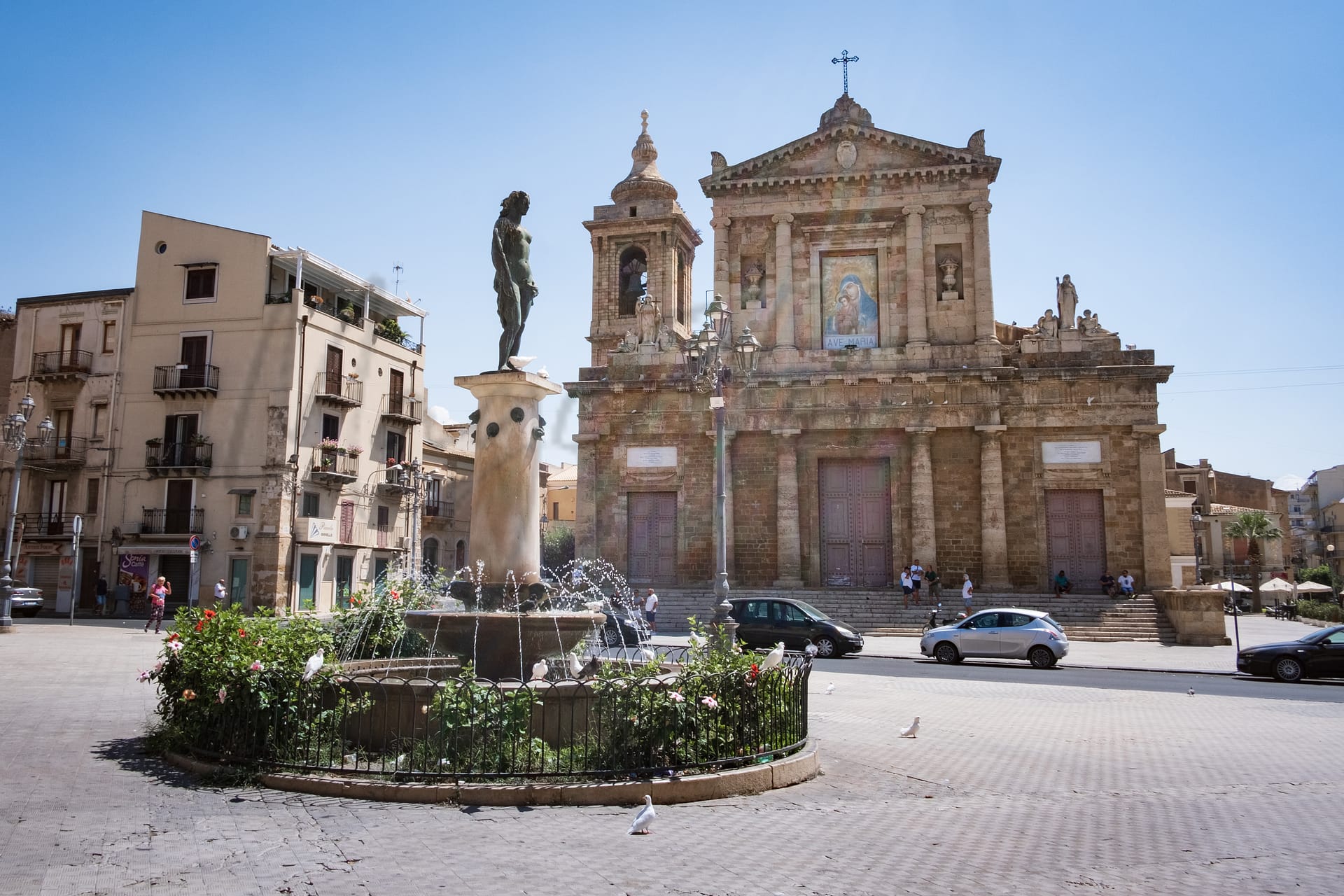
Gela
Sicilia
Coastal town known for archaeological sites, affordable living, decent healthcare, but limited public transport.
Quality of Life Score
[?]Factors in air quality, amenities, walkability, population, and environmental risks. Higher scores suggest better living conditions.
78
Quality of Infrastructure
[?]Measures internet speed, healthcare access, airports, rail, and walkability. Higher scores mean better connectivity and essential services.
61
Quality of Economy
[?]Based on income, property prices, job availability, and population density. Higher scores indicate stronger economic conditions.
73
Gela Demographics
Population
[?]
This is a town's official population, measured each year by the national statistics authority.
70900
Real Population (5km band)
[?]
Our "Real Population" metric reflects more accurately a town's real size by including inhabitants in the immediate vicinity of the town's official borders.
108900
Births Per 100 Deaths
80.0
Population Data Source
ISTAT,2023
Estimated Unemployment Rate
Touristy Index
[?]
Calculation of tourist density index for the city, comparing its total tourist number to the overall average tourist number of the region
relative to its own population.The index indicates how a location’s tourist density compares to the average, with values above
100 representing higher-than-average density and values below 100 representing lower-than-average density.
Not Touristic
Income per capita (2023)
[?]
This is an estimation of average income per resident for this town, based on 2023 data from the Italian Ministry of Finance.
18200
Income rank in Italy (2023)
[?]
This is a ranking of the town's average income per resident, against the full list of townships in Italy.
5308 out of 7901
Infrastructure and Connectivity
Create an account to explore more
This content is for Members only | Already a Member? Sign in
Infrastructure & Amenities
Create an account to explore more
This content is for Members only | Already a Member? Sign in
Healthcare
Create an account to explore more
This content is for Members only | Already a Member? Sign in
Housing & Property Market
Create an account to explore more
This content is for Members only | Already a Member? Sign in
Connectivity & Digital Access
Create an account to explore more
This content is for Members only | Already a Member? Sign in
Education
Create an account to explore more
This content is for Members only | Already a Member? Sign in
Climate & Weather
Create an account to explore more
This content is for Members only | Already a Member? Sign in
Precipitation
[?] Based on daily climate data for precipitation from OPEN-METEO this parameter indicates how a city's annual precipitation compares to others in terms of percentage, with values ranging from 0 (lowest) to 1 (highest). For example, a percentile rank of 0.75 means the city's total precipitation is higher than 75% of other cities.
Very Low (Bottom 10%)
Sunshine
Exceptional (Top 10%)
Snowfall
Very Low (Bottom 10%)
Min Annual Temperature (°C)
[?] This parameter represents the monthly average of daily minimum temperatures for January, based on data from OPEN-METEO.
7.7
Max Annual Temperature (°C)
[?] This parameter represents the monthly average of daily minimum temperatures for January, based on data from OPEN-METEO.
30.9
Climate Description
Gela, located in southern Italy, enjoys a predominantly sunny climate which bolsters its appeal as a destination for retirees and expats. The weather here is characterized by mild, pleasant winters and warm, sun-filled summers. Notably, the region virtually never experiences snow, making it an ideal choice for those seeking to escape colder climates. Temperature variations are moderate throughout the year, contributing to a comfortable living environment that encourages outdoor activities and leisure. This stable weather pattern not only enhances the daily quality of life but also simplifies year-round planning for both residents and visitors.
Annual Temperature Chart (Min)
Error
There was a problem with your SQL connection - Please contact the administrator
There was a problem with your SQL connection - Please contact the administrator
Annual Temperature Chart (Max)
Error
There was a problem with your SQL connection - Please contact the administrator
There was a problem with your SQL connection - Please contact the administrator
Sunny Days By Month
Error
There was a problem with your SQL connection - Please contact the administrator
There was a problem with your SQL connection - Please contact the administrator
Environmental & Air Quality
Create an account to explore more
This content is for Members only | Already a Member? Sign in
Classifications
PM10
[?]
PM10 levels indicate Good air quality at 0–20 µg/m³, Fair at 20–40 µg/m³, Moderate at 40–50 µg/m³, Poor at 50–100 µg/m³, Very Poor at 100–150 µg/m³, and Extremely Poor at 150–1200 µg/m³.
Good
PM2.5
[?]
PM2.5 is Good if PM2.5 levels are between 0–10 µg/m³, Fair between 10–20 µg/m³, Moderate between 20–25 µg/m³, Poor between 25–50 µg/m³, Very Poor between 50–75 µg/m³, and Extremely Poor between 75–800 µg/m³.
Good
NO2
[?]
NO₂ levels are considered Good at 0–40 µg/m³, Fair at 40–90 µg/m³, Moderate at 90–120 µg/m³, Poor at 120–230 µg/m³, Very Poor at 230–340 µg/m³, and Extremely Poor at 340–1000 µg/m³.
Good
SO2
[?]
SO₂ levels indicate Good air quality at 0–100 µg/m³, Fair at 100–200 µg/m³, Moderate at 200–350 µg/m³, Poor at 350–500 µg/m³, Very Poor at 500–750 µg/m³, and Extremely Poor at 750–1250 µg/m³.
Good
O₃
[?]
For O₃, the air is Good at 0–50 µg/m³, Fair at 50–100 µg/m³, Moderate at 100–130 µg/m³, Poor at 130–240 µg/m³, Very Poor at 240–380 µg/m³, and Extremely Poor at 380–800 µg/m³.
Fair
Air Quality Rating
[?]
Based on PM10, PM2.5, NO2, SO2, and ozone levels. Higher scores indicate cleaner air.
84
Air Quality Description
Gela, Italy presents a congenial atmosphere with commendable air quality throughout the year. Major pollutants such as particulate matter and nitrogen dioxide are consistently rated well within acceptable levels, providing a clean and safe environment. Ozone levels stand at a moderate rating, occasionally influenced by seasonal variations typical of southern climates but generally pose minimal bother. The town’s adherence to environmental standards ensures that its air remains predominantly fresh, benefiting everyone from young families to retirees looking for a healthy lifestyle. This positive aspect significantly enhances Gela’s appeal as a promising relocation choice for expatriates seeking both tranquility and vitality.
Gela, Italy presents a congenial atmosphere with commendable air quality throughout the year. Major pollutants such as particulate matter and nitrogen dioxide are consistently rated well within acceptable levels, providing a clean and safe environment. Ozone levels stand at a moderate rating, occasionally influenced by seasonal variations typical of southern climates but generally pose minimal bother. The town’s adherence to environmental standards ensures that its air remains predominantly fresh, benefiting everyone from young families to retirees looking for a healthy lifestyle. This positive aspect significantly enhances Gela’s appeal as a promising relocation choice for expatriates seeking both tranquility and vitality.
Town Descriptions
Create an account to explore more
This content is for Members only | Already a Member? Sign in
Getting There
Gela is connected via the A18 and A19 highways, facilitating road access to Catania and Palermo airports. Local train stations provide limited connectivity, with scores indicating moderate service levels. Overall, Gela’s infrastructure rating reflects potential challenges in transport connectivity.
Getting Around
Local Cuisine
Gela’s culinary scene is a vibrant tapestry woven from traditional Sicilian dishes and a variety of international influences. Traditional dishes such as grissini, granite di mandorle (almond granita), caponata (a signature sweet and sour aubergine stew), and rigatoni alla norma highlight the local gastronomy. The town offers a diverse array of dining establishments, where traditional Sicilian flavors coexist with modern culinary creativity. Restaurants serve fresh seafood, expertly crafted pizzas, and hearty pasta dishes, appealing to a wide range of palates. Among these, there are notable Michelin-starred restaurants, showcasing Gela’s commitment to high culinary standards. Overall, the dining landscape reflects both the rich heritage and contemporary evolution of Sicilian cuisine.
Shopping Overview
The shopping landscape features several supermarkets and shopping centres, with notable formats including large retail complexes and local boutiques. Expats and retirees can find diverse options such as modern malls, traditional markets, and specialty stores catering to various needs. Key venues typically offer a mix of grocery, clothing, and household goods, creating a comprehensive shopping experience suitable for everyday requirements and leisure. Additionally, local shopping areas provide cultural goods and artisan products, enriching the retail atmosphere.
Neighborhoods
Green Areas and Parks
In Gela, Sicily, outdoor enthusiasts can access various activities and trails. Notable trails include Periplo della Sicilia, Tappa 10 and Gela – Macchitella – Montelungo, which offer moderate difficulty for hiking, biking, and trail running. Gela features parks like Parco di Montelungo for biking and exploring nature. The Riserva Naturale Biviere is a regional natural reserve offering birdwatching opportunities. The local beaches such as Lungomare Federico II di Svevia provide areas for jogging and relaxation. These facilities cater to a range of skill levels and offer both historic and scenic exploration opportunities.
✅ Pros
– Rich cultural and historical backdrop to explore and enjoy.
– Pleasant Mediterranean climate with mild winters and warm summers.
– Opportunities for integration in a friendly, welcoming community.
– Good air quality for a healthier living environment.
– Access to basic healthcare facilities with local services available.
– Lower tourist presence allows for a more authentic experience.
– Reasonable transportation options connecting to major Sicilian cities.
– Diverse local cuisine showcasing traditional Sicilian flavors.
– Affordable cost of living compared to other Italian towns.
– Quaint coastal town with beautiful surrounding natural landscapes.
❌ Cons
– Healthcare quality may not meet higher standards expected abroad.
– Limited advanced medical facilities for serious health issues.
– Public transportation can be infrequent and unreliable at times.
– Job opportunities may be scarce for new arrivals.
– Internet speeds can be inconsistent, affecting connectivity.
– Educational facilities might not cater to international standards.
– Higher unemployment rate compared to national average.
– Infrastructure could use improvements for better living conditions.
– The economy may feel stagnant and less dynamic overall.
– Language barrier may complicate integration for non-Italian speakers.
FAQs
Summary
Gela, situated on Sicily’s southern coast, offers a compelling blend of history and modern living, making it of interest to expats and retirees. With its scenic locale overlooking the Mediterranean, Gela features ample opportunities for relaxation and recreation. The town is known for its rich archaeological heritage, including ancient ruins reflecting a storied past, while its excellent beaches attract those seeking coastal leisure. Furthermore, Gela boasts a low cost of living and decent healthcare facilities, enhancing its appeal for potential residents.
However, challenges exist; public transportation options may be lacking, and local educational services are not highly rated. The climate offers long, hot summers and mild winters, which can be a draw for many but may also prove uncomfortable during peak summer months. Overall, Gela presents a unique proposition for those wishing to embrace Sicilian rural life, balancing charm and modernity amid its potential drawbacks.
✅ Pros
– Rich cultural and historical backdrop to explore and enjoy.
– Pleasant Mediterranean climate with mild winters and warm summers.
– Opportunities for integration in a friendly, welcoming community.
– Good air quality for a healthier living environment.
– Access to basic healthcare facilities with local services available.
– Lower tourist presence allows for a more authentic experience.
– Reasonable transportation options connecting to major Sicilian cities.
– Diverse local cuisine showcasing traditional Sicilian flavors.
– Affordable cost of living compared to other Italian towns.
– Quaint coastal town with beautiful surrounding natural landscapes.
❌ Cons
– Healthcare quality may not meet higher standards expected abroad.
– Limited advanced medical facilities for serious health issues.
– Public transportation can be infrequent and unreliable at times.
– Job opportunities may be scarce for new arrivals.
– Internet speeds can be inconsistent, affecting connectivity.
– Educational facilities might not cater to international standards.
– Higher unemployment rate compared to national average.
– Infrastructure could use improvements for better living conditions.
– The economy may feel stagnant and less dynamic overall.
– Language barrier may complicate integration for non-Italian speakers.
Related Posts
No posts found for the town.
More questions about Gela ? Ask Magic AI.
Our innovative AI assistant is eager to help. Try it out here: