
Elevation
[?]
Elevation of a city refers to the height above sea level at which the city is located, measured in meters.
205
Population
[?]
This is a town's official population, measured each year by the national statistics authority.
12300
Real Population (5km)
[?]
Our "Real Population" metric reflects more accurately a town's real size by including inhabitants in the immediate vicinity of the town's official borders.
91800
Air Quality Rating
[?]
Based on PM10, PM2.5, NO2, SO2, and ozone levels. Higher scores indicate cleaner air.
82
Region
Lombardia
Walkability
Very Walkable
Housing availability
[?]
Based on total number of properties (sale and rent) classifies housing availability into five categories: low, relativel ylow, medium, relatively high and high.
Low
Avg Download Speed (Mbps) / Avg Upload Speed (Mbps)
198
/ 118
Climate Description
Temperate climate with mild winters, warm summers, ample sunshine, and well-distributed rain.
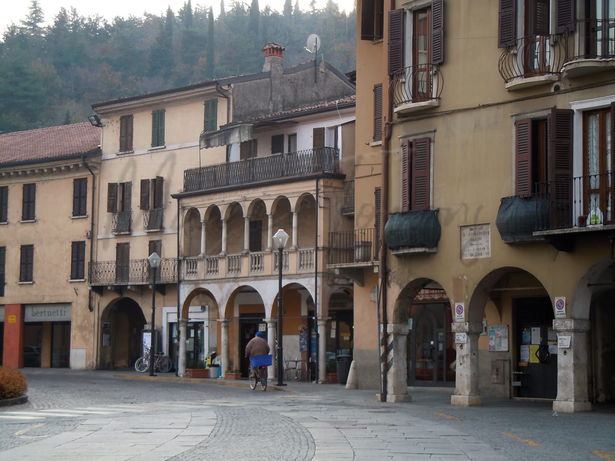
Gavardo
Lombardia
Small town near Lake Garda, known for wool production, history, and good air quality.
Quality of Life Score
[?]Factors in air quality, amenities, walkability, population, and environmental risks. Higher scores suggest better living conditions.
86
Quality of Infrastructure
[?]Measures internet speed, healthcare access, airports, rail, and walkability. Higher scores mean better connectivity and essential services.
59
Quality of Economy
[?]Based on income, property prices, job availability, and population density. Higher scores indicate stronger economic conditions.
71
Gavardo Demographics
Population
[?]
This is a town's official population, measured each year by the national statistics authority.
12300
Real Population (5km band)
[?]
Our "Real Population" metric reflects more accurately a town's real size by including inhabitants in the immediate vicinity of the town's official borders.
91800
Births Per 100 Deaths
60.0
Population Data Source
ISTAT,2023
Estimated Unemployment Rate
Touristy Index
[?]
Calculation of tourist density index for the city, comparing its total tourist number to the overall average tourist number of the region
relative to its own population.The index indicates how a location’s tourist density compares to the average, with values above
100 representing higher-than-average density and values below 100 representing lower-than-average density.
Not Touristic
Income per capita (2023)
[?]
This is an estimation of average income per resident for this town, based on 2023 data from the Italian Ministry of Finance.
22500
Income rank in Italy (2023)
[?]
This is a ranking of the town's average income per resident, against the full list of townships in Italy.
2172 out of 7901
Infrastructure and Connectivity
Create an account to explore more
This content is for Members only | Already a Member? Sign in
Closest Airport
Name
Montichiari (Brescia)
Connectivity Score
[?]
Measures travel time and service quality of nearby airport stations. Higher scores mean better transport access.
3
Driving Time
23min(s)
Montichiari Airport, officially known as Brescia “Gabriele D’Annunzio” Airport (IATA: VBS), is located in Montichiari, southeast of Brescia in Lombardy, Italy. Currently, it does not support scheduled passenger services and primarily operates as a cargo airport, notably for Poste Italiane, with Rome-Fiumicino being a key destination. The airport serves as a cargo hub for airlines like Poste Air Cargo, DHL, and Silk Way West Airlines.
2nd Closest Airport
Name
Orio al Serio (Bergamo)
Connectivity Score
[?]
Measures travel time and service quality of nearby airport stations. Higher scores mean better transport access.
7
Driving Time
43min(s)
Orio al Serio International Airport, also known as Milan Bergamo Airport, is located just 5 km from Bergamo and about 45 km from Milan in Lombardy, Italy. It is the third busiest airport in Italy, serving over 13 million passengers annually and acting as a major hub for Ryanair. The airport connects to numerous European destinations including Copenhagen, Düsseldorf, as well as farther routes like Dubai and Cairo. Known for its budget-friendly flights primarily operated by Ryanair, Milan Bergamo Airport is a popular choice for travellers looking for affordable options to various international destinations.
3rd Closest Airport
Name
Valerio Catullo (Verona)
Connectivity Score
[?]
Measures travel time and service quality of nearby airport stations. Higher scores mean better transport access.
7
Driving Time
44min(s)
Valerio Catullo Airport, also known as Verona Villafranca Airport, is situated 10 km southwest of Verona in Italy’s Veneto region. It is a significant regional hub, particularly for Air Dolomiti, Neos, and Volotea, handling nearly 3 million passengers in 2022. The airport offers connections to 80 destinations, ranging from European cities like Paris and Barcelona to long-haul routes in Africa and the Caribbean. Known for its accessibility via major motorways A4 and A22, it provides convenient options for travellers with features like a VIP lounge and fast track services.
Closest Rail
Name
Stazione di Lonato
Connectivity Score
[?]
Measures travel time and service quality of nearby rail stations. Higher scores mean better transport access.
5
Driving Time
27min(s)
Train service at Stazione di Lonato includes a selection of regional train services only, primarily operated by Trenitalia and Trenord. The station lies on the Milan–Venice railway line.
– **Rail Lines:** The key rail line that stops here is the Milan–Venice railway.
– **Key Destinations:** Direct trains connect Lonato with major destinations such as Brescia, Desenzano del Garda, Peschiera del Garda, and Verona. There are also infrequent services extending to Vicenza, Padua, and Venice (operating once per day).
– **Train Operators:** The primary operators at this station are Trenitalia and Trenord, focusing on regional services.
– **Frequency of Departures:** Departures tend to be hourly, with some trains operating less frequently, particularly those to further destinations.
– **High-Speed Services:** The station primarily offers regional services with no high-speed train options available.
2nd Closest Rail
Name
Stazione di Montirone
Connectivity Score
[?]
Measures travel time and service quality of nearby rail stations. Higher scores mean better transport access.
5
Driving Time
28min(s)
Train service at Stazione di Montirone includes the following key details:
– **Rail lines that stop here**: The station is served primarily by regional rail lines operated by Trenord, connecting Montirone with nearby cities.
– **Key destinations connected by direct trains**: Direct trains from Montirone typically connect to Brescia, a significant nearby city. Other regional destinations may include towns and cities within the Lombardy region.
– **Train operators**: Trenord is the main operator of train services at Stazione di Montirone, primarily focused on regional trains.
– **Frequency of departures**: Trains generally operate on an hourly basis from Montirone, with services depending on the specific day and time.
– **Type of trains**: The station primarily features regional trains, with no high-speed services stopping at this station.
3rd Closest Rail
Name
Stazione di San Zeno-Folzano
Connectivity Score
[?]
Measures travel time and service quality of nearby rail stations. Higher scores mean better transport access.
6
Driving Time
29min(s)
Train service at Stazione di San Zeno-Folzano includes a mix of regional and high-speed trains provided by Trenitalia and Italo. The rail lines that stop here connect to various destinations, with direct trains available to cities such as Brescia and Verona. Departures generally occur at an hourly frequency, although some times may see fewer services throughout the day. This station supports both regional routes and high-speed connections, making it a versatile stop for travellers in Italy.
Infrastructure & Amenities
Create an account to explore more
This content is for Members only | Already a Member? Sign in
Healthcare
Create an account to explore more
This content is for Members only | Already a Member? Sign in
Housing & Property Market
Create an account to explore more
This content is for Members only | Already a Member? Sign in
Connectivity & Digital Access
Create an account to explore more
This content is for Members only | Already a Member? Sign in
Education
Create an account to explore more
This content is for Members only | Already a Member? Sign in
Climate & Weather
Create an account to explore more
This content is for Members only | Already a Member? Sign in
Precipitation
[?] Based on daily climate data for precipitation from OPEN-METEO this parameter indicates how a city's annual precipitation compares to others in terms of percentage, with values ranging from 0 (lowest) to 1 (highest). For example, a percentile rank of 0.75 means the city's total precipitation is higher than 75% of other cities.
Above Average (51st-60th percentile)
Sunshine
Somewhat Low (21st-30th percentile)
Snowfall
Average (41st-50th percentile)
Min Annual Temperature (°C)
[?] This parameter represents the monthly average of daily minimum temperatures for January, based on data from OPEN-METEO.
0
Max Annual Temperature (°C)
[?] This parameter represents the monthly average of daily minimum temperatures for January, based on data from OPEN-METEO.
27.7
Climate Description
Gavardo enjoys a temperate climate, characterized by mild winters and warm summers. The area benefits from substantial sunshine throughout the year, ensuring that outdoor activities are seldom hindered by poor weather conditions. Precipitation is well-distributed across all seasons, providing a green and lush environment without being excessively rainy. Snow is rare and typically light, adding a brief wintry charm without causing significant disruptions. The region's temperatures range from cool to comfortably warm, making Gavardo an ideal locale for those seeking a stable and pleasant climate after retiring or for expatriates looking for a new home away from the extremes.
Annual Temperature Chart (Min)
Error
There was a problem with your SQL connection - Please contact the administrator
There was a problem with your SQL connection - Please contact the administrator
Annual Temperature Chart (Max)
Error
There was a problem with your SQL connection - Please contact the administrator
There was a problem with your SQL connection - Please contact the administrator
Sunny Days By Month
Error
There was a problem with your SQL connection - Please contact the administrator
There was a problem with your SQL connection - Please contact the administrator
Environmental & Air Quality
Create an account to explore more
This content is for Members only | Already a Member? Sign in
Classifications
PM10
[?]
PM10 levels indicate Good air quality at 0–20 µg/m³, Fair at 20–40 µg/m³, Moderate at 40–50 µg/m³, Poor at 50–100 µg/m³, Very Poor at 100–150 µg/m³, and Extremely Poor at 150–1200 µg/m³.
Fair
PM2.5
[?]
PM2.5 is Good if PM2.5 levels are between 0–10 µg/m³, Fair between 10–20 µg/m³, Moderate between 20–25 µg/m³, Poor between 25–50 µg/m³, Very Poor between 50–75 µg/m³, and Extremely Poor between 75–800 µg/m³.
Fair
NO2
[?]
NO₂ levels are considered Good at 0–40 µg/m³, Fair at 40–90 µg/m³, Moderate at 90–120 µg/m³, Poor at 120–230 µg/m³, Very Poor at 230–340 µg/m³, and Extremely Poor at 340–1000 µg/m³.
Good
SO2
[?]
SO₂ levels indicate Good air quality at 0–100 µg/m³, Fair at 100–200 µg/m³, Moderate at 200–350 µg/m³, Poor at 350–500 µg/m³, Very Poor at 500–750 µg/m³, and Extremely Poor at 750–1250 µg/m³.
Good
O₃
[?]
For O₃, the air is Good at 0–50 µg/m³, Fair at 50–100 µg/m³, Moderate at 100–130 µg/m³, Poor at 130–240 µg/m³, Very Poor at 240–380 µg/m³, and Extremely Poor at 380–800 µg/m³.
Fair
Air Quality Rating
[?]
Based on PM10, PM2.5, NO2, SO2, and ozone levels. Higher scores indicate cleaner air.
82
Air Quality Description
Gavardo, located in Italy, offers a mixed air quality profile. With ‘Fair’ levels of PM10 particulates at 25.14 μg/m3 and PM2.5 at 15.71 μg/m3, the town suggests a moderate burden of airborne dust and particles. Nitrogen dioxide and sulphur dioxide, important indicators of vehicular and industrial activity, sit at ‘Good’ levels, suggesting a healthier atmosphere concerning these gases. Meanwhile, ozone —a pollutant that can impact breathing comfort— is classified as ‘Fair’, largely influenced by both natural and human factors. This varied combination should be considered by those sensitive to air quality or with respiratory concerns.
Gavardo, located in Italy, offers a mixed air quality profile. With ‘Fair’ levels of PM10 particulates at 25.14 μg/m3 and PM2.5 at 15.71 μg/m3, the town suggests a moderate burden of airborne dust and particles. Nitrogen dioxide and sulphur dioxide, important indicators of vehicular and industrial activity, sit at ‘Good’ levels, suggesting a healthier atmosphere concerning these gases. Meanwhile, ozone —a pollutant that can impact breathing comfort— is classified as ‘Fair’, largely influenced by both natural and human factors. This varied combination should be considered by those sensitive to air quality or with respiratory concerns.
Town Descriptions
Create an account to explore more
This content is for Members only | Already a Member? Sign in
Getting There
Gavardo offers moderate connectivity, with the nearest airport in Montichiari and a second option in Orio al Serio. The town is serviced by two train stations, both providing reasonable train access, albeit with average connectivity scores. Key road connections enhance accessibility to surrounding regions.
Getting Around
Local Cuisine
Gavardo, located in the Lombardy region of Italy, boasts a rich culinary scene deeply rooted in regional traditions. The local cuisine is characterized by a variety of traditional dishes, including risotto, polenta, and braised meats, with risotto alla Milanese and cotoletta alla Milanese being particularly notable. The area is known for its use of quality ingredients such as butter, cheeses, and cured meats, reflecting the regional gastronomic heritage. Dining options in Gavardo feature a blend of rustic trattorias offering authentic Italian fare alongside international influences, catering to diverse palates. However, the town has no Michelin-starred restaurants, highlighting a gap in high-end dining relative to larger cities in the region, but still providing satisfactory local experiences.
Shopping Overview
Shopping options in the area include a range of supermarkets, boutique stores, and several notable shopping centres. Weekly markets offer fresh produce and local products. Major shopping centres feature clothing, accessories, electronics, and supermarkets. Popular venues include centres with both international and Italian brands, leisure facilities such as cinemas, and outlets for luxury goods. Residents can expect a diverse retail environment catering to various needs, contributing to a vibrant shopping experience suitable for expats and retirees.
Neighborhoods
Green Areas and Parks
Gavardo offers diverse outdoor activities, particularly for hiking enthusiasts. Notable trails in the area include the Strada degli Scarubbi Loop, a challenging 7.2-mile trail, and the Bocca di Selva Loop, a moderate 5-mile trail. For those appreciating scenic views, the Lago di Garda Loop via Busatte – Tempesta provides a moderate 5.5-mile hike with lake vistas. The Valle delle Sette offers additional opportunities for hiking and exploration. These trails highlight the region’s natural beauty and provide varied difficulty levels for retirees and expats seeking outdoor activities.
✅ Pros
– High-quality healthcare services available in the area.
– Favorable air quality for a healthier lifestyle.
– Low unemployment rate supports economic stability.
– Mild climate suitable for enjoyable outdoor activities.
– Rich cultural and historical heritage to explore.
– Opportunities for integration into the local community.
– Less touristy atmosphere for a peaceful living experience.
– Adequate transportation options for easy commuting.
– Diverse educational facilities catering to various needs.
– Reliable internet connectivity for remote work and leisure.
❌ Cons
– Limited nightlife options for those seeking vibrant social activities.
– Infrastructure improvements needed; some roads may be poorly maintained.
– Fewer international communities compared to larger cities in Italy.
– Limited shopping and dining variety outside traditional options.
– Healthcare facilities may occasionally face long waiting times.
– Limited language support for non-Italian speakers in some services.
– Seasonal temperature variations can be less predictable.
– Connectivity issues may arise during peak internet usage times.
– Cultural events may not occur frequently throughout the year.
– Commuting options may be less convenient during off-peak hours.
FAQs
Summary
Gavardo, nestled in the province of Brescia in Lombardy, is strategically located near Lake Garda, offering easy access for those pursuing leisure and activities by the water. This town, with its Celtic origins and rich historical tapestry, is recognized as a prominent center for wool production. Expats can appreciate the unique blend of local heritage and modern amenities, enhanced by a high walkability score and good air quality. Key attractions include a museum housing archaeological finds and historical sites like the Church of San Rocco, boasting Gothic architecture and notable frescoes. However, Gavardo’s relatively small size might challenge those seeking vibrant nightlife or extensive international amenities. Although healthcare and internet services are satisfactory, expats may sometimes feel limited in cultural diversity compared to larger regional hubs. Overall, Gavardo presents a serene lifestyle with a touch of Italian charm, ideal for retirees and those valuing tranquility over bustle.
✅ Pros
– High-quality healthcare services available in the area.
– Favorable air quality for a healthier lifestyle.
– Low unemployment rate supports economic stability.
– Mild climate suitable for enjoyable outdoor activities.
– Rich cultural and historical heritage to explore.
– Opportunities for integration into the local community.
– Less touristy atmosphere for a peaceful living experience.
– Adequate transportation options for easy commuting.
– Diverse educational facilities catering to various needs.
– Reliable internet connectivity for remote work and leisure.
❌ Cons
– Limited nightlife options for those seeking vibrant social activities.
– Infrastructure improvements needed; some roads may be poorly maintained.
– Fewer international communities compared to larger cities in Italy.
– Limited shopping and dining variety outside traditional options.
– Healthcare facilities may occasionally face long waiting times.
– Limited language support for non-Italian speakers in some services.
– Seasonal temperature variations can be less predictable.
– Connectivity issues may arise during peak internet usage times.
– Cultural events may not occur frequently throughout the year.
– Commuting options may be less convenient during off-peak hours.
Related Posts
No posts found for the town.
More questions about Gavardo ? Ask Magic AI.
Our innovative AI assistant is eager to help. Try it out here: