
Elevation
[?]
Elevation of a city refers to the height above sea level at which the city is located, measured in meters.
239
Population
[?]
This is a town's official population, measured each year by the national statistics authority.
53000
Real Population (5km)
[?]
Our "Real Population" metric reflects more accurately a town's real size by including inhabitants in the immediate vicinity of the town's official borders.
285000
Air Quality Rating
[?]
Based on PM10, PM2.5, NO2, SO2, and ozone levels. Higher scores indicate cleaner air.
82
Region
Lombardia
Walkability
Walker’s Paradise
Housing availability
[?]
Based on total number of properties (sale and rent) classifies housing availability into five categories: low, relativel ylow, medium, relatively high and high.
Medium
Avg Download Speed (Mbps) / Avg Upload Speed (Mbps)
257
/ 178
Climate Description
Seasonal range, abundant sun, balanced precipitation, brief snow, mild winters, not too hot.
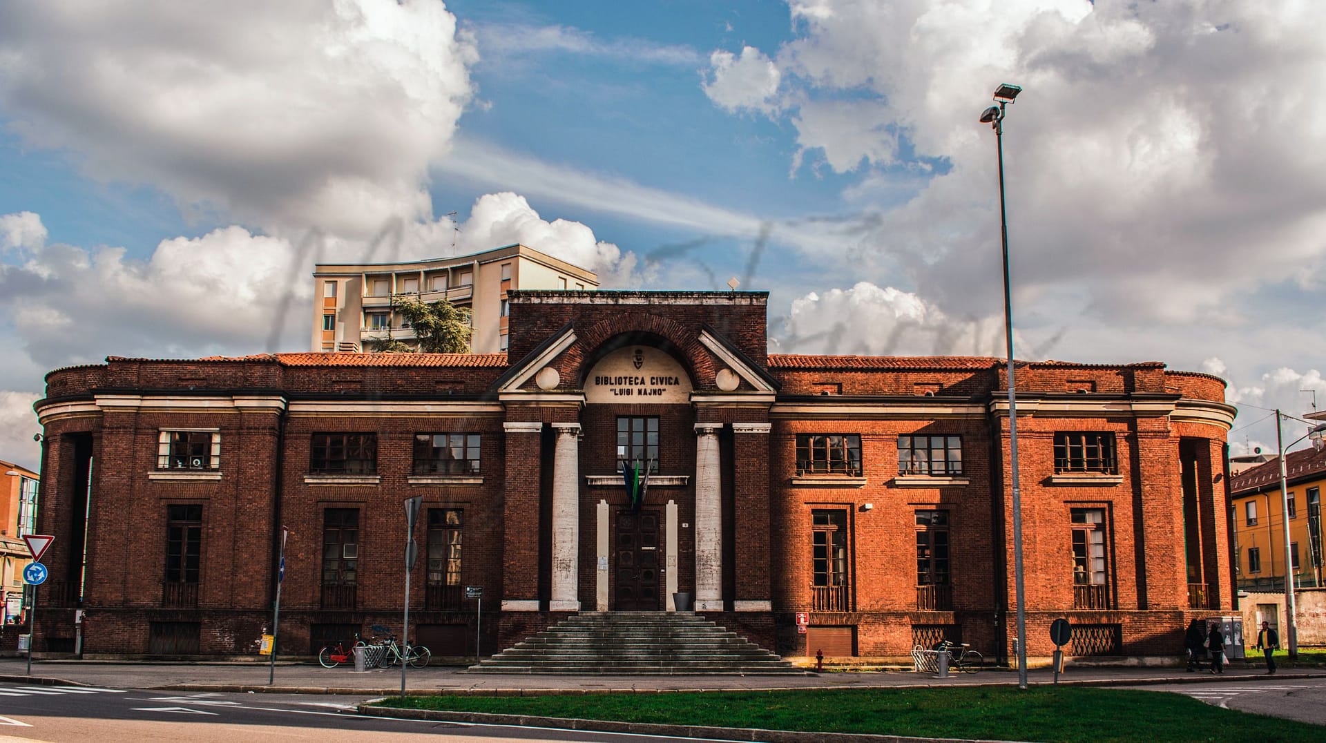
Gallarate
Lombardia
Historical town in Lombardy with notable landmarks, vibrant community life, and proximity to Milan.
Quality of Life Score
[?]Factors in air quality, amenities, walkability, population, and environmental risks. Higher scores suggest better living conditions.
78
Quality of Infrastructure
[?]Measures internet speed, healthcare access, airports, rail, and walkability. Higher scores mean better connectivity and essential services.
81
Quality of Economy
[?]Based on income, property prices, job availability, and population density. Higher scores indicate stronger economic conditions.
83
Gallarate Demographics
Population
[?]
This is a town's official population, measured each year by the national statistics authority.
53000
Real Population (5km band)
[?]
Our "Real Population" metric reflects more accurately a town's real size by including inhabitants in the immediate vicinity of the town's official borders.
285000
Births Per 100 Deaths
60.0
Population Data Source
ISTAT,2023
Estimated Unemployment Rate
Touristy Index
[?]
Calculation of tourist density index for the city, comparing its total tourist number to the overall average tourist number of the region
relative to its own population.The index indicates how a location’s tourist density compares to the average, with values above
100 representing higher-than-average density and values below 100 representing lower-than-average density.
Not Touristic
Income per capita (2023)
[?]
This is an estimation of average income per resident for this town, based on 2023 data from the Italian Ministry of Finance.
24600
Income rank in Italy (2023)
[?]
This is a ranking of the town's average income per resident, against the full list of townships in Italy.
635 out of 7901
Infrastructure and Connectivity
Create an account to explore more
This content is for Members only | Already a Member? Sign in
Infrastructure & Amenities
Create an account to explore more
This content is for Members only | Already a Member? Sign in
Healthcare
Create an account to explore more
This content is for Members only | Already a Member? Sign in
Housing & Property Market
Create an account to explore more
This content is for Members only | Already a Member? Sign in
Connectivity & Digital Access
Create an account to explore more
This content is for Members only | Already a Member? Sign in
Education
Create an account to explore more
This content is for Members only | Already a Member? Sign in
Climate & Weather
Create an account to explore more
This content is for Members only | Already a Member? Sign in
Precipitation
[?] Based on daily climate data for precipitation from OPEN-METEO this parameter indicates how a city's annual precipitation compares to others in terms of percentage, with values ranging from 0 (lowest) to 1 (highest). For example, a percentile rank of 0.75 means the city's total precipitation is higher than 75% of other cities.
Exceptional (Top 10%)
Sunshine
Somewhat Low (21st-30th percentile)
Snowfall
Above Average (51st-60th percentile)
Min Annual Temperature (°C)
[?] This parameter represents the monthly average of daily minimum temperatures for January, based on data from OPEN-METEO.
-0.3
Max Annual Temperature (°C)
[?] This parameter represents the monthly average of daily minimum temperatures for January, based on data from OPEN-METEO.
27.7
Climate Description
Gallarate, nestled in Italy, boasts a climate with a notable range between its coldest and warmest months, catering well to those who appreciate a true experience of seasons. The town enjoys abundant sunshine, that assures activities under clear blue skies for much of the year. Precipitation is well-spread throughout the year, refreshing the lush scenery without overwhelming residents or visitors. Winters softly blanket the city in occasional snow, painting picturesque landscapes that are as brief as they are beautiful. Overall, Gallarate's climate offers a comfortable balance, neither too harsh in winter nor excessively hot in summer, ideal for retirees and expats seeking a temperate European lifestyle.
Annual Temperature Chart (Min)
Error
There was a problem with your SQL connection - Please contact the administrator
There was a problem with your SQL connection - Please contact the administrator
Annual Temperature Chart (Max)
Error
There was a problem with your SQL connection - Please contact the administrator
There was a problem with your SQL connection - Please contact the administrator
Sunny Days By Month
Error
There was a problem with your SQL connection - Please contact the administrator
There was a problem with your SQL connection - Please contact the administrator
Environmental & Air Quality
Create an account to explore more
This content is for Members only | Already a Member? Sign in
Classifications
PM10
[?]
PM10 levels indicate Good air quality at 0–20 µg/m³, Fair at 20–40 µg/m³, Moderate at 40–50 µg/m³, Poor at 50–100 µg/m³, Very Poor at 100–150 µg/m³, and Extremely Poor at 150–1200 µg/m³.
Fair
PM2.5
[?]
PM2.5 is Good if PM2.5 levels are between 0–10 µg/m³, Fair between 10–20 µg/m³, Moderate between 20–25 µg/m³, Poor between 25–50 µg/m³, Very Poor between 50–75 µg/m³, and Extremely Poor between 75–800 µg/m³.
Moderate
NO2
[?]
NO₂ levels are considered Good at 0–40 µg/m³, Fair at 40–90 µg/m³, Moderate at 90–120 µg/m³, Poor at 120–230 µg/m³, Very Poor at 230–340 µg/m³, and Extremely Poor at 340–1000 µg/m³.
Good
SO2
[?]
SO₂ levels indicate Good air quality at 0–100 µg/m³, Fair at 100–200 µg/m³, Moderate at 200–350 µg/m³, Poor at 350–500 µg/m³, Very Poor at 500–750 µg/m³, and Extremely Poor at 750–1250 µg/m³.
Good
O₃
[?]
For O₃, the air is Good at 0–50 µg/m³, Fair at 50–100 µg/m³, Moderate at 100–130 µg/m³, Poor at 130–240 µg/m³, Very Poor at 240–380 µg/m³, and Extremely Poor at 380–800 µg/m³.
Fair
Air Quality Rating
[?]
Based on PM10, PM2.5, NO2, SO2, and ozone levels. Higher scores indicate cleaner air.
82
Air Quality Description
Gallarate, nestled in the Lombardy region of Italy, offers a relatively stable air quality environment that is conducive for retirees and expats seeking a balanced lifestyle. While particulate matter, both PM10 and PM2.5, hover around fair to moderate levels, they seldom disrupt daily activities. The town benefits from commendable levels of nitrogen dioxide and sulphur dioxide, maintaining a fresh ambiance conducive to outdoor pursuits. However, the presence of ozone at fair levels suggests a degree of caution during high-exposure activities. Overall, Gallarate’s air supports a healthy living but advises a mindful approach toward environmental changes.
Gallarate, nestled in the Lombardy region of Italy, offers a relatively stable air quality environment that is conducive for retirees and expats seeking a balanced lifestyle. While particulate matter, both PM10 and PM2.5, hover around fair to moderate levels, they seldom disrupt daily activities. The town benefits from commendable levels of nitrogen dioxide and sulphur dioxide, maintaining a fresh ambiance conducive to outdoor pursuits. However, the presence of ozone at fair levels suggests a degree of caution during high-exposure activities. Overall, Gallarate’s air supports a healthy living but advises a mindful approach toward environmental changes.
Town Descriptions
Create an account to explore more
This content is for Members only | Already a Member? Sign in
Getting There
Gallarate enjoys robust connectivity, with Malpensa Airport just minutes away, enhancing regional and international access. The town is served by two nearby train stations, both providing moderate rail connectivity. Key road connections include the A8 motorway, facilitating ease of travel to Milan and surrounding areas.
Getting Around
Local Cuisine
Gallarate’s culinary scene reflects the rich traditions of Lombardy, featuring local specialties such as risotto, polenta, and panettone that showcase the region’s agricultural bounty. The town boasts a variety of dining options, from traditional trattorias to modern bistros, providing both authentic Italian dishes and an array of international cuisines. Notably, Gallarate is home to Michelin-starred restaurants, including Ilario Vinciguerra and Radici Osteria Contemporanea, which elevate local dining experiences with their innovative approaches to Lombard cuisine.
Shopping Overview
The city offers a diverse range of shopping options, including shopping malls and specialty boutiques. Supermarkets cater to everyday needs, while local markets provide fresh produce and artisanal products. Shopping centres often feature a mix of international brands and niche retailers, creating a vibrant shopping experience. Art galleries and gift shops also enhance the retail landscape, appealing to those interested in unique and handcrafted items. Overall, the area presents a well-rounded selection, suitable for expatriates and retirees.
Neighborhoods
Green Areas and Parks
Gallarate offers various outdoor activities suitable for all ages. Key highlights include hiking trails such as the Crenna – Monte Belvedere and Crenna – Monte Capro routes, which provide moderate to easy options for hikers. The area also hosts the Area Verde La Boschina di Crenna, a 24-hour accessible park with trails running through fields and woods, ideal for leisurely walks or bird-watching. Parco Bassetti is another prominent green space providing ample opportunities for outdoor relaxation and exploration.
✅ Pros
– Quality healthcare services available for residents and expats.
– Efficient public transportation connects to major cities and airports.
– Favorable unemployment rate compared to national average.
– Pleasant climate with warm summers and mild winters.
– Rich cultural and historical heritage to explore and enjoy.
– Low tourist traffic enhances local living experience.
– Strong infrastructure supports daily living needs effectively.
– Good integration opportunities within the local community.
– Reliable internet connectivity for remote work and communication.
– Affordable cost of living relative to nearby metropolitan areas.
❌ Cons
– Healthcare services may not meet expectations for all individuals.
– Air quality can be suboptimal during certain times of year.
– Limited educational facilities for families with school-aged children.
– Local dining options might lack diversity for adventurous eaters.
– Mild winters can still feel damp and chilly at times.
– Proximity to major cities means potential noise and congestion.
– Cultural events may not be as frequent or large-scale.
– Limited shopping options compared to metropolitan areas nearby.
– Integration opportunities may depend on language proficiency.
– Remote work may require flexibility due to local infrastructure.
FAQs
Summary
Gallarate, situated in the Lombardy region of Italy, is an attractive destination for expats and retirees seeking a blend of historical charm and modern convenience. This town, with its Roman roots, is characterized by notable landmarks such as the Basilica di Santa Maria Assunta and the Museo MAGA, showcasing a rich cultural tapestry. Gallarate’s vibrant community life is mirrored in its bustling piazzas, where social gatherings and outdoor dining are commonplace, reflecting the Italian love for family and community. Proximity to Milan and the scenic Italian lakes enhances its appeal, offering both cosmopolitan culture and natural beauty.
However, potential residents should consider the local industrial backdrop, which, while providing employment opportunities, may not offer the same diversity found in larger cities. Additionally, while the healthcare system is accessible, expats might find it beneficial to familiarize themselves with local services. Overall, Gallarate is a welcoming town that balances tradition with modern living.
✅ Pros
– Quality healthcare services available for residents and expats.
– Efficient public transportation connects to major cities and airports.
– Favorable unemployment rate compared to national average.
– Pleasant climate with warm summers and mild winters.
– Rich cultural and historical heritage to explore and enjoy.
– Low tourist traffic enhances local living experience.
– Strong infrastructure supports daily living needs effectively.
– Good integration opportunities within the local community.
– Reliable internet connectivity for remote work and communication.
– Affordable cost of living relative to nearby metropolitan areas.
❌ Cons
– Healthcare services may not meet expectations for all individuals.
– Air quality can be suboptimal during certain times of year.
– Limited educational facilities for families with school-aged children.
– Local dining options might lack diversity for adventurous eaters.
– Mild winters can still feel damp and chilly at times.
– Proximity to major cities means potential noise and congestion.
– Cultural events may not be as frequent or large-scale.
– Limited shopping options compared to metropolitan areas nearby.
– Integration opportunities may depend on language proficiency.
– Remote work may require flexibility due to local infrastructure.
Related Posts
No posts found for the town.
More questions about Gallarate ? Ask Magic AI.
Our innovative AI assistant is eager to help. Try it out here: