
Elevation
[?]
Elevation of a city refers to the height above sea level at which the city is located, measured in meters.
7
Population
[?]
This is a town's official population, measured each year by the national statistics authority.
129400
Real Population (5km)
[?]
Our "Real Population" metric reflects more accurately a town's real size by including inhabitants in the immediate vicinity of the town's official borders.
209100
Air Quality Rating
[?]
Based on PM10, PM2.5, NO2, SO2, and ozone levels. Higher scores indicate cleaner air.
88
Region
Emilia-Romagna
Walkability
Walker’s Paradise
Housing availability
[?]
Based on total number of properties (sale and rent) classifies housing availability into five categories: low, relativel ylow, medium, relatively high and high.
High
Avg Download Speed (Mbps) / Avg Upload Speed (Mbps)
286
/ 175
Climate Description
Temperate climate with mild winters, warm summers, moderate rainfall; no extreme weather.
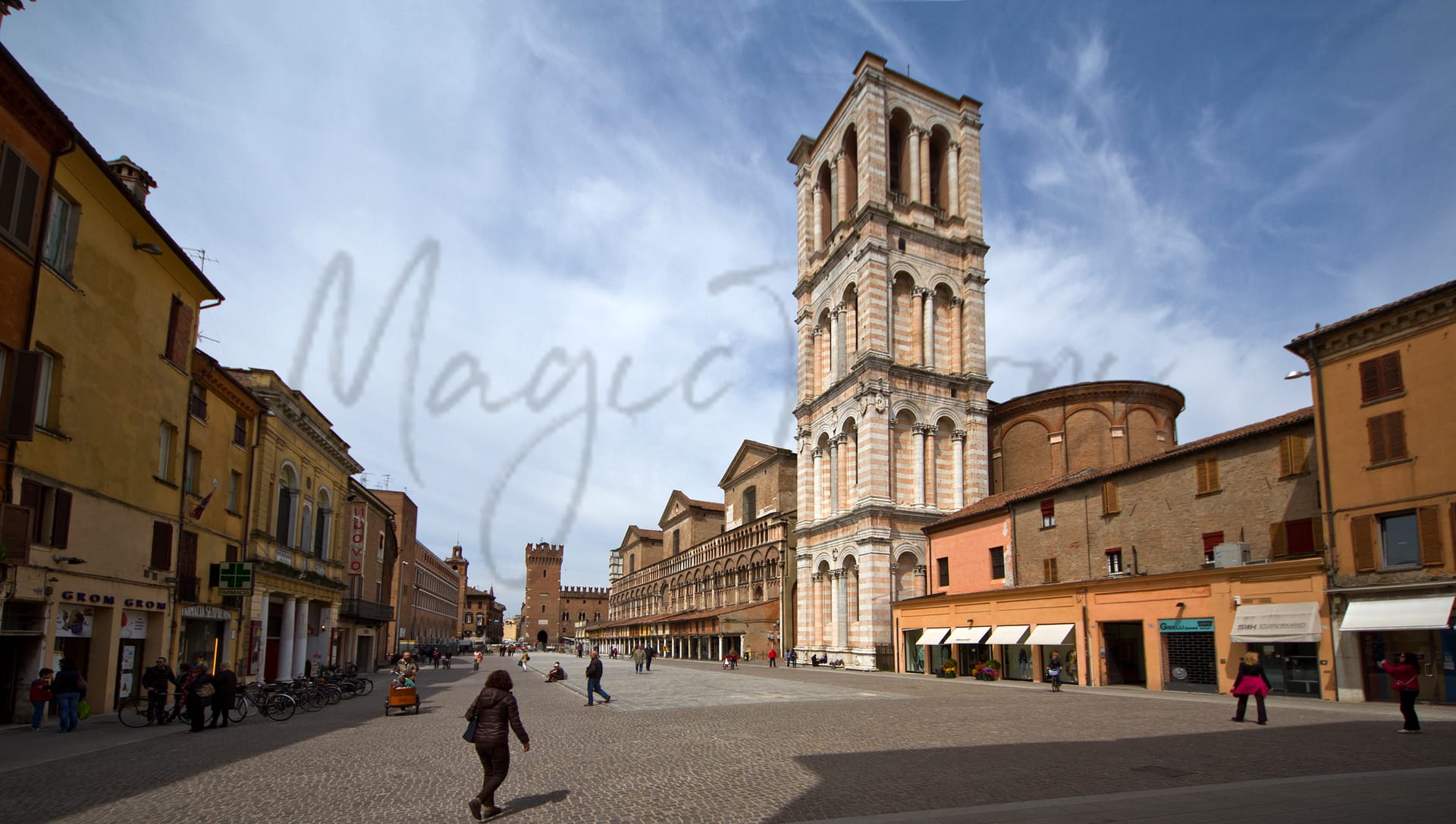
Ferrara
Emilia-Romagna
Historic UNESCO site with Renaissance architecture, high living standards, and strong community engagement.
Quality of Life Score
[?]Factors in air quality, amenities, walkability, population, and environmental risks. Higher scores suggest better living conditions.
89
Quality of Infrastructure
[?]Measures internet speed, healthcare access, airports, rail, and walkability. Higher scores mean better connectivity and essential services.
72
Quality of Economy
[?]Based on income, property prices, job availability, and population density. Higher scores indicate stronger economic conditions.
85
Ferrara Demographics
Population
[?]
This is a town's official population, measured each year by the national statistics authority.
129400
Real Population (5km band)
[?]
Our "Real Population" metric reflects more accurately a town's real size by including inhabitants in the immediate vicinity of the town's official borders.
209100
Births Per 100 Deaths
40.0
Population Data Source
ISTAT,2023
Estimated Unemployment Rate
Touristy Index
[?]
Calculation of tourist density index for the city, comparing its total tourist number to the overall average tourist number of the region
relative to its own population.The index indicates how a location’s tourist density compares to the average, with values above
100 representing higher-than-average density and values below 100 representing lower-than-average density.
Some Tourism
Income per capita (2023)
[?]
This is an estimation of average income per resident for this town, based on 2023 data from the Italian Ministry of Finance.
24800
Income rank in Italy (2023)
[?]
This is a ranking of the town's average income per resident, against the full list of townships in Italy.
545 out of 7901
Infrastructure and Connectivity
Create an account to explore more
This content is for Members only | Already a Member? Sign in
Infrastructure & Amenities
Create an account to explore more
This content is for Members only | Already a Member? Sign in
Healthcare
Create an account to explore more
This content is for Members only | Already a Member? Sign in
Housing & Property Market
Create an account to explore more
This content is for Members only | Already a Member? Sign in
Connectivity & Digital Access
Create an account to explore more
This content is for Members only | Already a Member? Sign in
Education
Create an account to explore more
This content is for Members only | Already a Member? Sign in
Climate & Weather
Create an account to explore more
This content is for Members only | Already a Member? Sign in
Precipitation
[?] Based on daily climate data for precipitation from OPEN-METEO this parameter indicates how a city's annual precipitation compares to others in terms of percentage, with values ranging from 0 (lowest) to 1 (highest). For example, a percentile rank of 0.75 means the city's total precipitation is higher than 75% of other cities.
Low (11th-20th percentile)
Sunshine
Above Average (51st-60th percentile)
Snowfall
Below Average (31st-40th percentile)
Min Annual Temperature (°C)
[?] This parameter represents the monthly average of daily minimum temperatures for January, based on data from OPEN-METEO.
0.5
Max Annual Temperature (°C)
[?] This parameter represents the monthly average of daily minimum temperatures for January, based on data from OPEN-METEO.
31.4
Climate Description
Ferrara, Italy boasts a climate marked by fairly balanced seasons, making it suitable for retirees and expats seeking a predictable environment. Winters are gently crisp with occasional frosty mornings hinting at brief snowfalls, though stark cold is rare, allowing for comfortable year-end festivities. Conversely, summers present with warmth sufficient for outdoor leisure yet resist oppressive heat, facilitating enjoyment of the abundant sunshine that bathes the city. Rainfall is moderate throughout the year, maintaining the lushness of the local flora without excessive wet periods. Overall, Ferrara offers a temperate climate where extremes are smoothed, ideally complementing its historical charm and relaxed lifestyle.
Annual Temperature Chart (Min)
Error
There was a problem with your SQL connection - Please contact the administrator
There was a problem with your SQL connection - Please contact the administrator
Annual Temperature Chart (Max)
Error
There was a problem with your SQL connection - Please contact the administrator
There was a problem with your SQL connection - Please contact the administrator
Sunny Days By Month
Error
There was a problem with your SQL connection - Please contact the administrator
There was a problem with your SQL connection - Please contact the administrator
Environmental & Air Quality
Create an account to explore more
This content is for Members only | Already a Member? Sign in
Classifications
PM10
[?]
PM10 levels indicate Good air quality at 0–20 µg/m³, Fair at 20–40 µg/m³, Moderate at 40–50 µg/m³, Poor at 50–100 µg/m³, Very Poor at 100–150 µg/m³, and Extremely Poor at 150–1200 µg/m³.
Fair
PM2.5
[?]
PM2.5 is Good if PM2.5 levels are between 0–10 µg/m³, Fair between 10–20 µg/m³, Moderate between 20–25 µg/m³, Poor between 25–50 µg/m³, Very Poor between 50–75 µg/m³, and Extremely Poor between 75–800 µg/m³.
Fair
NO2
[?]
NO₂ levels are considered Good at 0–40 µg/m³, Fair at 40–90 µg/m³, Moderate at 90–120 µg/m³, Poor at 120–230 µg/m³, Very Poor at 230–340 µg/m³, and Extremely Poor at 340–1000 µg/m³.
Good
SO2
[?]
SO₂ levels indicate Good air quality at 0–100 µg/m³, Fair at 100–200 µg/m³, Moderate at 200–350 µg/m³, Poor at 350–500 µg/m³, Very Poor at 500–750 µg/m³, and Extremely Poor at 750–1250 µg/m³.
Good
O₃
[?]
For O₃, the air is Good at 0–50 µg/m³, Fair at 50–100 µg/m³, Moderate at 100–130 µg/m³, Poor at 130–240 µg/m³, Very Poor at 240–380 µg/m³, and Extremely Poor at 380–800 µg/m³.
Fair
Air Quality Rating
[?]
Based on PM10, PM2.5, NO2, SO2, and ozone levels. Higher scores indicate cleaner air.
88
Air Quality Description
In Ferrara, Italy, the air quality generally holds a satisfactory mark, making it a fitting environment for those considering a move or retirement in this historic town. The particulate matter (PM10 and PM2.5 levels) oscillates around fair conditions, providing a decent breathability for outdoor activities and daily excursions. The nitrogen and sulfur dioxide levels are commendably low, classified as good and reflecting lesser industrial pollutants compared to more urbanized locales. Ozone presence, while moderate, does not overly detract from Ferrara’s ambient air quality, ensuring residents can enjoy this culturally rich and serene setting with relative ease.
In Ferrara, Italy, the air quality generally holds a satisfactory mark, making it a fitting environment for those considering a move or retirement in this historic town. The particulate matter (PM10 and PM2.5 levels) oscillates around fair conditions, providing a decent breathability for outdoor activities and daily excursions. The nitrogen and sulfur dioxide levels are commendably low, classified as good and reflecting lesser industrial pollutants compared to more urbanized locales. Ozone presence, while moderate, does not overly detract from Ferrara’s ambient air quality, ensuring residents can enjoy this culturally rich and serene setting with relative ease.
Town Descriptions
Create an account to explore more
This content is for Members only | Already a Member? Sign in
Getting There
Ferrara benefits from good connectivity, with the nearest major airport, Guglielmo Marconi Airport in Bologna, approximately 30 minutes away. The town is accessible via the A13 and A16 motorways. Additionally, two train stations offer regional connections, enhancing travel options for residents and visitors alike.
Getting Around
Local Cuisine
Ferrara’s culinary scene is deeply rooted in rich traditions that reflect its storied history within Emilia-Romagna. The region is known for distinct local specialties such as ‘pasticcio di maccheroni’ (a macaroni pie with meat filling), ‘salama da sugo’ (a traditional sausage), and ‘pampapato di Ferrara’ (a chocolate dessert). Other notable dishes include ‘torta tenerina’ and ‘pinzini Ferraresi’. The city’s dining landscape features a variety of options ranging from rustic trattorias to modern bistros, showcasing local ingredients and flavors. Michelin-starred establishments such as ‘Da Noemi’, ‘Cucina Bacilieri’, and ‘Quel Fantastico Giovedì’ exemplify the high culinary standards in Ferrara, offering innovative interpretations of traditional cuisine. Furthermore, international influences are evident, with restaurants like ‘L’Oca Giuliva’ incorporating fresh seafood and unique antipasti into their menus, demonstrating a versatile dining scene that appeals to diverse palates while honoring Ferrara’s culinary heritage.
Shopping Overview
Shopping in the area caters to diverse preferences, featuring a mix of modern shopping malls and traditional street markets. Notable formats include large commercial centres, such as those housing supermarkets and boutiques, alongside vibrant local markets. A variety of street markets and local fairs are available, providing unique culinary and artisanal products. Additionally, designated shopping districts showcase a blend of luxury retailers and charming niche boutiques, making the area suitable for both everyday needs and upscale shopping experiences.
Neighborhoods
Green Areas and Parks
Ferrara, located in Emilia-Romagna, offers a range of green spaces and outdoor activities suitable for expats and retirees. Notable outdoor options include the “Il Grande Anello d’Acqua del Burana,” a highly-rated circular hiking trail. The area also supports biking enthusiasts with trails like those accessible from Ferrara – Lido Nazioni. Additionally, the nearby Agriturismo Due Laghi facilitates scuba diving and swimming activities. For those interested in exploring local waterways, boat tours are available, such as the “Alla scoperta dell’antico Po di Primaro”. These outdoor amenities reflect the city’s commitment to recreational activities.
✅ Pros
– High-quality healthcare with excellent facilities and services.
– Pleasant climate with mild winters and warm summers.
– Rich cultural and historical heritage to explore.
– Affordable cost of living compared to larger cities.
– Low unemployment rate fostering economic stability and opportunities.
– Good integration opportunities for expats and retirees.
– Adequate transportation network for easy mobility.
– Clean air quality promoting a healthy lifestyle.
– Vibrant local community with various social activities.
– Reliable internet connectivity for remote work and leisure.
❌ Cons
– Limited nightlife options can leave you longing for excitement.
– Fewer international amenities compared to larger Italian cities.
– Winter months may feel a bit too quiet and dull.
– Some local bureaucracy can drive you a little crazy.
– Public transport may not be as frequent as desired.
– Language barrier might make local integration more challenging.
– Limited job opportunities outside specific sectors for expats.
– Cultural events may not be as frequent as in cities.
– Seasonal tourism can disrupt local tranquility during peak times.
– Smaller expat community means less shared experience and support.
FAQs
Summary
Ferrara, nestled in the Emilia-Romagna region, is renowned for its rich historical tapestry and exceptional quality of life. A UNESCO World Heritage Site, the city boasts an impressive array of Renaissance architecture, including the imposing Este Castle and the stunning Cathedral of Saint George. With a population of approximately 340,000, Ferrara offers expats a compact and walkable urban environment, ideal for cycling enthusiasts. The local healthcare system ensures high standards, contributing to an overall favorable living experience. While Ferrara excels in cultural offerings and community engagement, it does present some challenges, notably in terms of nightlife and public transportation frequency, which may not cater to those seeking vibrant metropolitan amenities. Nonetheless, the region’s culinary traditions and local festivals provide ample opportunity for social interaction, making it an appealing choice for retirees and foreign professionals alike.
✅ Pros
– High-quality healthcare with excellent facilities and services.
– Pleasant climate with mild winters and warm summers.
– Rich cultural and historical heritage to explore.
– Affordable cost of living compared to larger cities.
– Low unemployment rate fostering economic stability and opportunities.
– Good integration opportunities for expats and retirees.
– Adequate transportation network for easy mobility.
– Clean air quality promoting a healthy lifestyle.
– Vibrant local community with various social activities.
– Reliable internet connectivity for remote work and leisure.
❌ Cons
– Limited nightlife options can leave you longing for excitement.
– Fewer international amenities compared to larger Italian cities.
– Winter months may feel a bit too quiet and dull.
– Some local bureaucracy can drive you a little crazy.
– Public transport may not be as frequent as desired.
– Language barrier might make local integration more challenging.
– Limited job opportunities outside specific sectors for expats.
– Cultural events may not be as frequent as in cities.
– Seasonal tourism can disrupt local tranquility during peak times.
– Smaller expat community means less shared experience and support.
Related Posts
More questions about Ferrara ? Ask Magic AI.
Our innovative AI assistant is eager to help. Try it out here: