
Elevation
[?]
Elevation of a city refers to the height above sea level at which the city is located, measured in meters.
285
Population
[?]
This is a town's official population, measured each year by the national statistics authority.
16200
Real Population (5km)
[?]
Our "Real Population" metric reflects more accurately a town's real size by including inhabitants in the immediate vicinity of the town's official borders.
104800
Air Quality Rating
[?]
Based on PM10, PM2.5, NO2, SO2, and ozone levels. Higher scores indicate cleaner air.
86
Region
Lombardia
Walkability
Walker’s Paradise
Housing availability
[?]
Based on total number of properties (sale and rent) classifies housing availability into five categories: low, relativel ylow, medium, relatively high and high.
Low
Avg Download Speed (Mbps) / Avg Upload Speed (Mbps)
207
/ 118
Climate Description
Mild climate with plentiful sunshine, modest winter snow, warm summers, and adequate rainfall.
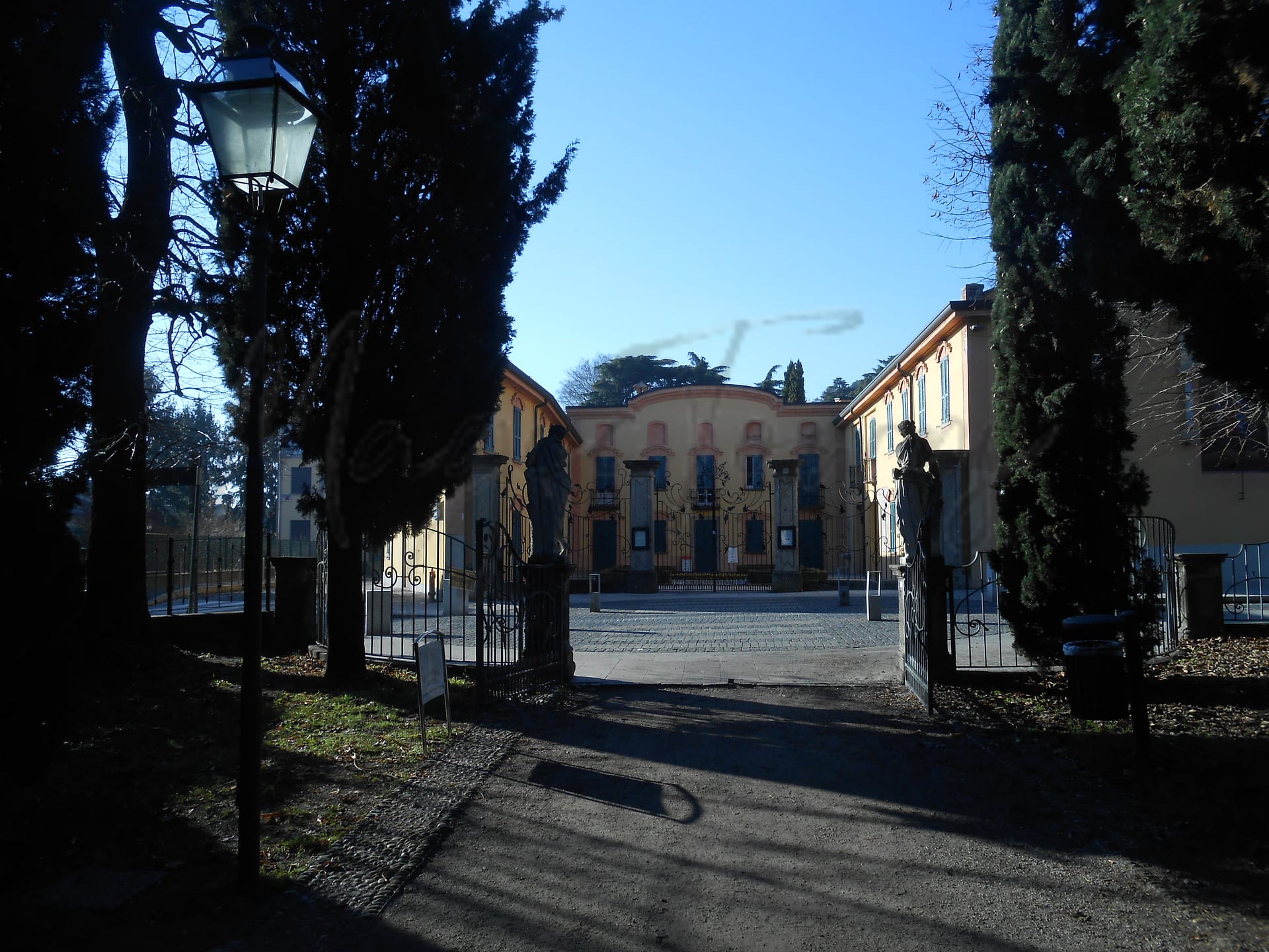
Erba
Lombardia
Small town in Lombardy, offering historical sites, modern amenities, and proximity to Milan.
Quality of Life Score
[?]Factors in air quality, amenities, walkability, population, and environmental risks. Higher scores suggest better living conditions.
78
Quality of Infrastructure
[?]Measures internet speed, healthcare access, airports, rail, and walkability. Higher scores mean better connectivity and essential services.
72
Quality of Economy
[?]Based on income, property prices, job availability, and population density. Higher scores indicate stronger economic conditions.
76
Erba Demographics
Population
[?]
This is a town's official population, measured each year by the national statistics authority.
16200
Real Population (5km band)
[?]
Our "Real Population" metric reflects more accurately a town's real size by including inhabitants in the immediate vicinity of the town's official borders.
104800
Births Per 100 Deaths
50.0
Population Data Source
ISTAT,2023
Estimated Unemployment Rate
Touristy Index
[?]
Calculation of tourist density index for the city, comparing its total tourist number to the overall average tourist number of the region
relative to its own population.The index indicates how a location’s tourist density compares to the average, with values above
100 representing higher-than-average density and values below 100 representing lower-than-average density.
Not Touristic
Income per capita (2023)
[?]
This is an estimation of average income per resident for this town, based on 2023 data from the Italian Ministry of Finance.
24600
Income rank in Italy (2023)
[?]
This is a ranking of the town's average income per resident, against the full list of townships in Italy.
628 out of 7901
Infrastructure and Connectivity
Create an account to explore more
This content is for Members only | Already a Member? Sign in
Infrastructure & Amenities
Create an account to explore more
This content is for Members only | Already a Member? Sign in
Healthcare
Create an account to explore more
This content is for Members only | Already a Member? Sign in
Housing & Property Market
Create an account to explore more
This content is for Members only | Already a Member? Sign in
Connectivity & Digital Access
Create an account to explore more
This content is for Members only | Already a Member? Sign in
Education
Create an account to explore more
This content is for Members only | Already a Member? Sign in
Climate & Weather
Create an account to explore more
This content is for Members only | Already a Member? Sign in
Precipitation
[?] Based on daily climate data for precipitation from OPEN-METEO this parameter indicates how a city's annual precipitation compares to others in terms of percentage, with values ranging from 0 (lowest) to 1 (highest). For example, a percentile rank of 0.75 means the city's total precipitation is higher than 75% of other cities.
Exceptional (Top 10%)
Sunshine
Below Average (31st-40th percentile)
Snowfall
Somewhat High (61st-70th percentile)
Min Annual Temperature (°C)
[?] This parameter represents the monthly average of daily minimum temperatures for January, based on data from OPEN-METEO.
-0.8
Max Annual Temperature (°C)
[?] This parameter represents the monthly average of daily minimum temperatures for January, based on data from OPEN-METEO.
27.3
Climate Description
Erba, Italy offers a climate that supports a comfortable year-round lifestyle, ideal for magic towns readers and those seeking a serene retirement destination. The town experiences a diverse range of weather patterns. Winter brings modest snowfall, encapsulating the landscape in a gentle white blanket, briefly transforming the town into a picturesque winter scene. The summers are pleasantly warm but rarely reach extremes, facilitating outdoor activities and explorations without discomfort. Sunshine is plentiful, gracing Erba with ample light for most of the year, contributing to vibrant local flora. Overall, the climate is mild with adequate rainfall to sustain lush greenery and maintain the natural beauty of the area.
Annual Temperature Chart (Min)
Error
There was a problem with your SQL connection - Please contact the administrator
There was a problem with your SQL connection - Please contact the administrator
Annual Temperature Chart (Max)
Error
There was a problem with your SQL connection - Please contact the administrator
There was a problem with your SQL connection - Please contact the administrator
Sunny Days By Month
Error
There was a problem with your SQL connection - Please contact the administrator
There was a problem with your SQL connection - Please contact the administrator
Environmental & Air Quality
Create an account to explore more
This content is for Members only | Already a Member? Sign in
Classifications
PM10
[?]
PM10 levels indicate Good air quality at 0–20 µg/m³, Fair at 20–40 µg/m³, Moderate at 40–50 µg/m³, Poor at 50–100 µg/m³, Very Poor at 100–150 µg/m³, and Extremely Poor at 150–1200 µg/m³.
Fair
PM2.5
[?]
PM2.5 is Good if PM2.5 levels are between 0–10 µg/m³, Fair between 10–20 µg/m³, Moderate between 20–25 µg/m³, Poor between 25–50 µg/m³, Very Poor between 50–75 µg/m³, and Extremely Poor between 75–800 µg/m³.
Fair
NO2
[?]
NO₂ levels are considered Good at 0–40 µg/m³, Fair at 40–90 µg/m³, Moderate at 90–120 µg/m³, Poor at 120–230 µg/m³, Very Poor at 230–340 µg/m³, and Extremely Poor at 340–1000 µg/m³.
Good
SO2
[?]
SO₂ levels indicate Good air quality at 0–100 µg/m³, Fair at 100–200 µg/m³, Moderate at 200–350 µg/m³, Poor at 350–500 µg/m³, Very Poor at 500–750 µg/m³, and Extremely Poor at 750–1250 µg/m³.
Good
O₃
[?]
For O₃, the air is Good at 0–50 µg/m³, Fair at 50–100 µg/m³, Moderate at 100–130 µg/m³, Poor at 130–240 µg/m³, Very Poor at 240–380 µg/m³, and Extremely Poor at 380–800 µg/m³.
Fair
Air Quality Rating
[?]
Based on PM10, PM2.5, NO2, SO2, and ozone levels. Higher scores indicate cleaner air.
86
Air Quality Description
Erba, Italy, offers a respectable air quality environment for expats and retirees considering a move. The small Italian town experiences fairly moderate levels of particulate matter, with both PM10 and PM2.5 hovering around fair classifications. Additionally, the presence of nitrogen and sulfur dioxide is minimal, placing these gases in the good category. Ozone levels also maintain a fair rating. Overall, residents of Erba can generally expect an air atmosphere that supports daily outdoor activities without significant concern for pollution-related health effects, making it a suitable choice for those valuing a balance between urban amenities and cleaner living conditions.
Erba, Italy, offers a respectable air quality environment for expats and retirees considering a move. The small Italian town experiences fairly moderate levels of particulate matter, with both PM10 and PM2.5 hovering around fair classifications. Additionally, the presence of nitrogen and sulfur dioxide is minimal, placing these gases in the good category. Ozone levels also maintain a fair rating. Overall, residents of Erba can generally expect an air atmosphere that supports daily outdoor activities without significant concern for pollution-related health effects, making it a suitable choice for those valuing a balance between urban amenities and cleaner living conditions.
Town Descriptions
Create an account to explore more
This content is for Members only | Already a Member? Sign in
Getting There
Erba, located in Lombardia, benefits from robust connectivity. It is situated near key roadways, including the SS342 and A36, facilitating access to nearby cities. Malpensa and Linate airports are approximately equidistant, enhancing travel options. Local train stations provide reasonable connectivity, supporting commuter travel.
Getting Around
Local Cuisine
Erba, a town in the Lombardia region of Italy, boasts a diverse culinary scene that is deeply rooted in Lombard traditions. Key traditional dishes include ‘bollito misto’ (mixed meats stew), ‘cassoeula’ (pork and cabbage stew), ‘risotto’, and ‘pizzoccheri’ (buckwheat pasta). The hospitality sector reflects these influences, with several local restaurants emphasizing regional ingredients and traditional cooking methods. International dining options are available, contributing to a varied gastronomic landscape. Notably, Erba is home to a Michelin-starred restaurant, which enhances its reputation as a destination for culinary excellence. The town’s emphasis on quality, authenticity, and local produce is a hallmark of its vibrant dining culture.
Shopping Overview
The shopping landscape includes factory outlets, shopping malls, and specialty shops. Various supermarkets cater to everyday needs, while farmers markets provide fresh local produce. The presence of gift shops enhances the variety available. Overall, shopping facilities are well-equipped to serve both daily and occasional retail demands, making it a practical choice for residents.
Neighborhoods
Green Areas and Parks
Erba, located in the province of Como, offers a variety of outdoor activities for enthusiasts. Key sites include the Alpe del Vicerè Park, which serves as a gateway to several hiking trails such as the Rifugio Capanna Mara – Monte Bollettone, a moderate 4.4-mile hike, and the challenging 6.2-mile Monte Palanzone route. These trails provide extensive opportunities for hiking within the scenic Lombardy region. Additionally, the proximity to larger natural reserves and parks enhances the outdoor experience, appealing to those interested in extensive hiking and nature exploration.
✅ Pros
– Excellent air quality for a healthier living environment.
– Low unemployment rate provides stable job opportunities.
– Well-developed infrastructure for convenient transportation options.
– Mild climate with pleasant seasonal variations year-round.
– Rich cultural and historical backdrop to explore and enjoy.
– Integration opportunities with friendly local community.
– Quality healthcare services available nearby for residents.
– Peaceful, non-touristic setting for relaxed living experience.
– Access to educational facilities for families and lifelong learners.
– Strong internet connectivity supports remote work and communication.
❌ Cons
– Healthcare services rated low; options may be limited.
– Limited nightlife; evening entertainment can be scarce.
– Less cultural diversity than larger cities; fewer international influences.
– Public transport options might not always be frequent.
– Local cuisine may not cater to all tastes.
– Smaller shopping selection compared to metropolitan areas.
– Language barrier could pose challenges for newcomers.
– Weather can be humid; summers might feel stifling.
– Limited job market for niche professions; opportunities may vary.
– Quiet lifestyle may not suit those seeking excitement.
FAQs
Summary
Erba, located in the rolling hills of Lombardy, offers a blend of historical richness and modern convenience for expatriates and retirees. With a pleasant climate characterized by long summers and cold winters, the town is ideally situated just a short drive from Milan, ensuring easy access to urban amenities while maintaining a charming, small-town atmosphere. Notable attractions include the Romanesque church of Saint Euphemia and the Licinium Theatre, a structure reminiscent of classical antiquity that hosts summer performances. Historically, Erba flourished as a holiday destination for the Italian aristocracy, evidenced by its elegant patrician villas. The local economy has roots in textile manufacturing, though it now emphasizes services and tourism, reflecting broader trends in the region.
While Erba boasts a favorable walkability score and good healthcare, it faces challenges typical of small towns, such as limited nightlife options and potential isolation. Nevertheless, its strong community spirit and picturesque surroundings make it a compelling choice for those seeking a respite in Italy.
✅ Pros
– Excellent air quality for a healthier living environment.
– Low unemployment rate provides stable job opportunities.
– Well-developed infrastructure for convenient transportation options.
– Mild climate with pleasant seasonal variations year-round.
– Rich cultural and historical backdrop to explore and enjoy.
– Integration opportunities with friendly local community.
– Quality healthcare services available nearby for residents.
– Peaceful, non-touristic setting for relaxed living experience.
– Access to educational facilities for families and lifelong learners.
– Strong internet connectivity supports remote work and communication.
❌ Cons
– Healthcare services rated low; options may be limited.
– Limited nightlife; evening entertainment can be scarce.
– Less cultural diversity than larger cities; fewer international influences.
– Public transport options might not always be frequent.
– Local cuisine may not cater to all tastes.
– Smaller shopping selection compared to metropolitan areas.
– Language barrier could pose challenges for newcomers.
– Weather can be humid; summers might feel stifling.
– Limited job market for niche professions; opportunities may vary.
– Quiet lifestyle may not suit those seeking excitement.
Related Posts
More questions about Erba ? Ask Magic AI.
Our innovative AI assistant is eager to help. Try it out here: