
Elevation
[?]
Elevation of a city refers to the height above sea level at which the city is located, measured in meters.
278
Population
[?]
This is a town's official population, measured each year by the national statistics authority.
17700
Real Population (5km)
[?]
Our "Real Population" metric reflects more accurately a town's real size by including inhabitants in the immediate vicinity of the town's official borders.
39300
Air Quality Rating
[?]
Based on PM10, PM2.5, NO2, SO2, and ozone levels. Higher scores indicate cleaner air.
86
Region
Piemonte
Walkability
Walker’s Paradise
Housing availability
[?]
Based on total number of properties (sale and rent) classifies housing availability into five categories: low, relativel ylow, medium, relatively high and high.
Low
Avg Download Speed (Mbps) / Avg Upload Speed (Mbps)
143
/ 63
Climate Description
Temperate climate with moderate warmth, year-round rainfall, mild snowfall, and abundant sunshine.
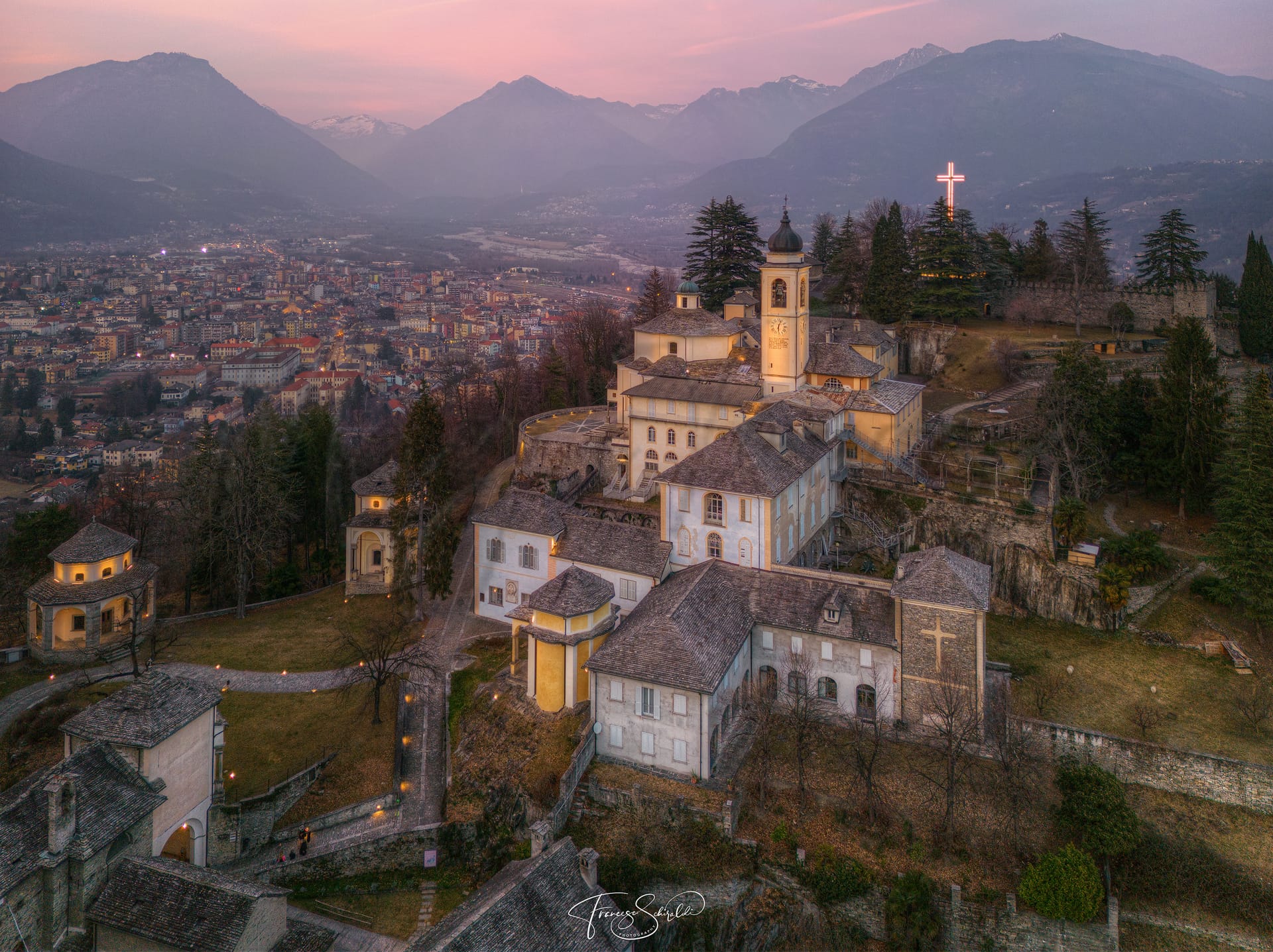
Domodossola
Piemonte
An appealing northern Italian town offering outdoor activities, rich heritage, and notable local cuisine.
Quality of Life Score
[?]Factors in air quality, amenities, walkability, population, and environmental risks. Higher scores suggest better living conditions.
72
Quality of Infrastructure
[?]Measures internet speed, healthcare access, airports, rail, and walkability. Higher scores mean better connectivity and essential services.
64
Quality of Economy
[?]Based on income, property prices, job availability, and population density. Higher scores indicate stronger economic conditions.
70
Domodossola Demographics
Population
[?]
This is a town's official population, measured each year by the national statistics authority.
17700
Real Population (5km band)
[?]
Our "Real Population" metric reflects more accurately a town's real size by including inhabitants in the immediate vicinity of the town's official borders.
39300
Births Per 100 Deaths
40.0
Population Data Source
ISTAT,2023
Estimated Unemployment Rate
Touristy Index
[?]
Calculation of tourist density index for the city, comparing its total tourist number to the overall average tourist number of the region
relative to its own population.The index indicates how a location’s tourist density compares to the average, with values above
100 representing higher-than-average density and values below 100 representing lower-than-average density.
Some Tourism
Income per capita (2023)
[?]
This is an estimation of average income per resident for this town, based on 2023 data from the Italian Ministry of Finance.
22000
Income rank in Italy (2023)
[?]
This is a ranking of the town's average income per resident, against the full list of townships in Italy.
2604 out of 7901
Infrastructure and Connectivity
Create an account to explore more
This content is for Members only | Already a Member? Sign in
Infrastructure & Amenities
Create an account to explore more
This content is for Members only | Already a Member? Sign in
Healthcare
Create an account to explore more
This content is for Members only | Already a Member? Sign in
Housing & Property Market
Create an account to explore more
This content is for Members only | Already a Member? Sign in
Connectivity & Digital Access
Create an account to explore more
This content is for Members only | Already a Member? Sign in
Education
Create an account to explore more
This content is for Members only | Already a Member? Sign in
Climate & Weather
Create an account to explore more
This content is for Members only | Already a Member? Sign in
Precipitation
[?] Based on daily climate data for precipitation from OPEN-METEO this parameter indicates how a city's annual precipitation compares to others in terms of percentage, with values ranging from 0 (lowest) to 1 (highest). For example, a percentile rank of 0.75 means the city's total precipitation is higher than 75% of other cities.
Exceptional (Top 10%)
Sunshine
Low (11th-20th percentile)
Snowfall
Exceptional (Top 10%)
Min Annual Temperature (°C)
[?] This parameter represents the monthly average of daily minimum temperatures for January, based on data from OPEN-METEO.
-0.5
Max Annual Temperature (°C)
[?] This parameter represents the monthly average of daily minimum temperatures for January, based on data from OPEN-METEO.
26.3
Climate Description
Domodossola enjoys a temperate climate, characterized by moderate warmth during its sunniest months. The town experiences a considerable amount of rainfall throughout the year, ensuring lush greenery in its surrounding landscapes. Winters are marked by mild snowfall, creating picturesque scenes without severe disruptions typical of harsher climates. Temperatures vary widely across the seasons, from cool to moderately warm, supporting a rich variety of flora and fauna. Overall, the climate in Domodossola is balanced, with abundant sunshine helping to maintain pleasant weather for the better part of the year, making it an attractive destination for those seeking tranquility and natural beauty.
Annual Temperature Chart (Min)
Error
There was a problem with your SQL connection - Please contact the administrator
There was a problem with your SQL connection - Please contact the administrator
Annual Temperature Chart (Max)
Error
There was a problem with your SQL connection - Please contact the administrator
There was a problem with your SQL connection - Please contact the administrator
Sunny Days By Month
Error
There was a problem with your SQL connection - Please contact the administrator
There was a problem with your SQL connection - Please contact the administrator
Environmental & Air Quality
Create an account to explore more
This content is for Members only | Already a Member? Sign in
Classifications
PM10
[?]
PM10 levels indicate Good air quality at 0–20 µg/m³, Fair at 20–40 µg/m³, Moderate at 40–50 µg/m³, Poor at 50–100 µg/m³, Very Poor at 100–150 µg/m³, and Extremely Poor at 150–1200 µg/m³.
Good
PM2.5
[?]
PM2.5 is Good if PM2.5 levels are between 0–10 µg/m³, Fair between 10–20 µg/m³, Moderate between 20–25 µg/m³, Poor between 25–50 µg/m³, Very Poor between 50–75 µg/m³, and Extremely Poor between 75–800 µg/m³.
Fair
NO2
[?]
NO₂ levels are considered Good at 0–40 µg/m³, Fair at 40–90 µg/m³, Moderate at 90–120 µg/m³, Poor at 120–230 µg/m³, Very Poor at 230–340 µg/m³, and Extremely Poor at 340–1000 µg/m³.
Good
SO2
[?]
SO₂ levels indicate Good air quality at 0–100 µg/m³, Fair at 100–200 µg/m³, Moderate at 200–350 µg/m³, Poor at 350–500 µg/m³, Very Poor at 500–750 µg/m³, and Extremely Poor at 750–1250 µg/m³.
Good
O₃
[?]
For O₃, the air is Good at 0–50 µg/m³, Fair at 50–100 µg/m³, Moderate at 100–130 µg/m³, Poor at 130–240 µg/m³, Very Poor at 240–380 µg/m³, and Extremely Poor at 380–800 µg/m³.
Fair
Air Quality Rating
[?]
Based on PM10, PM2.5, NO2, SO2, and ozone levels. Higher scores indicate cleaner air.
86
Air Quality Description
In the picturesque town of Domodossola, Italy, the air quality generally aligns positively with the expectations of those prioritizing a cleaner living environment. The surroundings are marked by acceptable levels of particulate matter; larger particles are well under control, contributing to an air quality deemed ‘Good’. Smaller particles are at a higher concentration yet classified as ‘Fair’, reflecting a moderate impact on the clarity of the air. Nitrogen and sulfur dioxide levels are commendably low, earning a ‘Good’ rating and indicating minimal industrial pollutants. Ozone levels, while slightly elevated, remain within a ‘Fair’ range, suggesting occasional fluctuations that are typical in varied climatic conditions.
In the picturesque town of Domodossola, Italy, the air quality generally aligns positively with the expectations of those prioritizing a cleaner living environment. The surroundings are marked by acceptable levels of particulate matter; larger particles are well under control, contributing to an air quality deemed ‘Good’. Smaller particles are at a higher concentration yet classified as ‘Fair’, reflecting a moderate impact on the clarity of the air. Nitrogen and sulfur dioxide levels are commendably low, earning a ‘Good’ rating and indicating minimal industrial pollutants. Ozone levels, while slightly elevated, remain within a ‘Fair’ range, suggesting occasional fluctuations that are typical in varied climatic conditions.
Town Descriptions
Create an account to explore more
This content is for Members only | Already a Member? Sign in
Getting There
Domodossola enjoys reasonable connectivity, situated on the A26 motorway that links to Milan and the Aosta Valley. The nearest airports are Malpensa and Linate, both offering national and international flights. The town’s train stations provide access to regional and national rail services, contributing to its moderate infrastructure rating.
Getting Around
Local Cuisine
Domodossola, located in the Piemonte region, boasts a rich culinary scene that reflects both its local traditions and broader influences. Traditional dishes include agnolotti, pasta parcels filled with a variety of meats or vegetables, and local cured meats, alongside game, polenta, and cheeses unique to the Ossola Valley. The region is also renowned for its use of fresh and natural ingredients, as demonstrated in its wide range of gastronomic offerings, from appetizers to desserts. The dining landscape features a diverse array of restaurants ranging from rustic trattorias to contemporary bistros. Notably, Domodossola is home to at least one Michelin-starred restaurant, Atelier, which exhibits high-quality culinary craftsmanship.
Shopping Overview
The city centre hosts a variety of traditional shops, boutiques, and craft stores alongside small businesses, offering a diverse shopping experience. A prominent weekly market features local products, including gastronomic items and handicrafts. Defined by a focus on “zero-mile shopping,” visitors can explore artisanal goods crafted from local materials like wood and stone. Dedicated shopping venues include a regionally recognised centre catering to various budgets and tastes, enhancing the overall shopping landscape.
Neighborhoods
Green Areas and Parks
Domodossola, located in Piemonte, offers a variety of outdoor activities and green spaces. Notable trails include the moderate Monte Calvario – Villadossola route, spanning 7.2 miles with an estimated duration of four hours, and the Passeggiata Domodossola via Fiume Toce, 4.9 miles long. The challenging Domodossola – Villadossola – Alpe della Colma trail extends for 19.7 miles, suitable for multi-day trekking. These trails provide opportunities for hiking amidst the region’s natural landscapes, catering to both casual walkers and experienced hikers. The area’s trails are accompanied by scenic views and access to historical sites such as Sacro Monte Calvario.
✅ Pros
– Rich cultural and historical backdrop for exploration.
– Access to quality healthcare services within the region.
– Excellent air quality for a healthier lifestyle.
– Low unemployment rate supports economic stability.
– Beautiful alpine climate with four distinct seasons.
– Integration opportunities with welcoming local community.
– Well-connected transportation options for easy travel.
– Sufficient educational facilities for various age groups.
– Moderate tourism, offering charm without overcrowding.
– Good internet connectivity for remote work and leisure.
❌ Cons
– Limited healthcare quality can lead to long wait times.
– Public transportation options may not always be reliable.
– Alpine weather can be harsh during long winter months.
– Limited shopping choices for those seeking variety.
– Local dialects can make communication challenging initially.
– Cultural events may not appeal to all expats.
– Job opportunities are scarce outside tourism and hospitality.
– Internet speeds may not meet all remote work needs.
– Limited nightlife options for younger retirees.
– Small-town life may feel too quiet for some.
FAQs
Summary
Domodossola, nestled in the stunning Piemonte region of northern Italy, offers a captivating blend of natural beauty and rich cultural heritage, making it an appealing destination for expats and retirees. Situated in the Ossola Valley, this town is renowned for its picturesque landscapes, rolling hills, and proximity to various outdoor activities, including hiking, skiing, and cycling. Key attractions include historic churches and nearby castles, which reflect the region’s storied past. The local cuisine, characterized by hearty dishes and renowned wines, adds to the culinary charm of the area.
While Domodossola boasts a vibrant expat community and ample recreational opportunities, potential drawbacks include healthcare access, which can be limited in rural areas, and occasional bureaucratic challenges in navigating local services. The lifestyle is generally tranquil and relaxed, ideal for those seeking a peaceful retirement in Italy’s breathtaking countryside.
✅ Pros
– Rich cultural and historical backdrop for exploration.
– Access to quality healthcare services within the region.
– Excellent air quality for a healthier lifestyle.
– Low unemployment rate supports economic stability.
– Beautiful alpine climate with four distinct seasons.
– Integration opportunities with welcoming local community.
– Well-connected transportation options for easy travel.
– Sufficient educational facilities for various age groups.
– Moderate tourism, offering charm without overcrowding.
– Good internet connectivity for remote work and leisure.
❌ Cons
– Limited healthcare quality can lead to long wait times.
– Public transportation options may not always be reliable.
– Alpine weather can be harsh during long winter months.
– Limited shopping choices for those seeking variety.
– Local dialects can make communication challenging initially.
– Cultural events may not appeal to all expats.
– Job opportunities are scarce outside tourism and hospitality.
– Internet speeds may not meet all remote work needs.
– Limited nightlife options for younger retirees.
– Small-town life may feel too quiet for some.
Related Posts
More questions about Domodossola ? Ask Magic AI.
Our innovative AI assistant is eager to help. Try it out here: