
Elevation
[?]
Elevation of a city refers to the height above sea level at which the city is located, measured in meters.
28
Population
[?]
This is a town's official population, measured each year by the national statistics authority.
14700
Real Population (5km)
[?]
Our "Real Population" metric reflects more accurately a town's real size by including inhabitants in the immediate vicinity of the town's official borders.
83200
Air Quality Rating
[?]
Based on PM10, PM2.5, NO2, SO2, and ozone levels. Higher scores indicate cleaner air.
82
Region
Lombardia
Walkability
Car-Dependent
Housing availability
[?]
Based on total number of properties (sale and rent) classifies housing availability into five categories: low, relativel ylow, medium, relatively high and high.
Medium
Avg Download Speed (Mbps) / Avg Upload Speed (Mbps)
62
/ 13
Climate Description
Temperate climate with mild winters, warm summers, and moderate rainfall year-round.
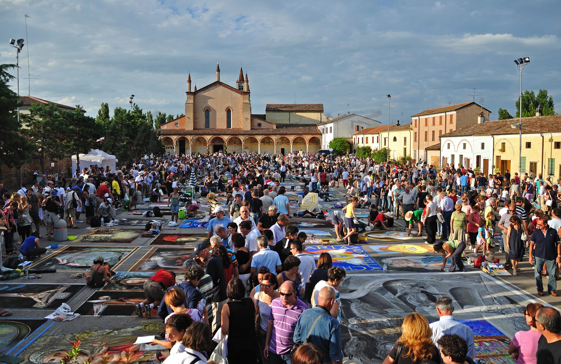
Curtatone
Lombardia
Historical architecture, low crime rate, moderate healthcare, proximity to Mantua, and tranquil lifestyle.
Quality of Life Score
[?]Factors in air quality, amenities, walkability, population, and environmental risks. Higher scores suggest better living conditions.
71
Quality of Infrastructure
[?]Measures internet speed, healthcare access, airports, rail, and walkability. Higher scores mean better connectivity and essential services.
50
Quality of Economy
[?]Based on income, property prices, job availability, and population density. Higher scores indicate stronger economic conditions.
90
Curtatone Demographics
Population
[?]
This is a town's official population, measured each year by the national statistics authority.
14700
Real Population (5km band)
[?]
Our "Real Population" metric reflects more accurately a town's real size by including inhabitants in the immediate vicinity of the town's official borders.
83200
Births Per 100 Deaths
60.0
Population Data Source
ISTAT,2023
Estimated Unemployment Rate
Touristy Index
[?]
Calculation of tourist density index for the city, comparing its total tourist number to the overall average tourist number of the region
relative to its own population.The index indicates how a location’s tourist density compares to the average, with values above
100 representing higher-than-average density and values below 100 representing lower-than-average density.
Not Touristic
Income per capita (2023)
[?]
This is an estimation of average income per resident for this town, based on 2023 data from the Italian Ministry of Finance.
25000
Income rank in Italy (2023)
[?]
This is a ranking of the town's average income per resident, against the full list of townships in Italy.
444 out of 7901
Infrastructure and Connectivity
Create an account to explore more
This content is for Members only | Already a Member? Sign in
Closest Airport
Name
Valerio Catullo (Verona)
Connectivity Score
[?]
Measures travel time and service quality of nearby airport stations. Higher scores mean better transport access.
7
Driving Time
36min(s)
Valerio Catullo Airport, also known as Verona Villafranca Airport, is situated 10 km southwest of Verona in Italy’s Veneto region. It is a significant regional hub, particularly for Air Dolomiti, Neos, and Volotea, handling nearly 3 million passengers in 2022. The airport offers connections to 80 destinations, ranging from European cities like Paris and Barcelona to long-haul routes in Africa and the Caribbean. Known for its accessibility via major motorways A4 and A22, it provides convenient options for travellers with features like a VIP lounge and fast track services.
2nd Closest Airport
Name
Reggio Emilia Airport (Reggio nell'Emilia)
Connectivity Score
[?]
Measures travel time and service quality of nearby airport stations. Higher scores mean better transport access.
1
Driving Time
51min(s)
Reggio Emilia Airport (Aeroporto di Reggio Emilia) primarily serves general aviation and doesn’t handle regular commercial passenger flights. Travellers to the region typically use nearby larger airports such as Bologna Guglielmo Marconi Airport, Milan Linate, and Parma Airport for international travel. The airport does not have significant passenger volume or notable airline hubs and destinations.
3rd Closest Airport
Name
Montichiari (Brescia)
Connectivity Score
[?]
Measures travel time and service quality of nearby airport stations. Higher scores mean better transport access.
3
Driving Time
51min(s)
Montichiari Airport, officially known as Brescia “Gabriele D’Annunzio” Airport (IATA: VBS), is located in Montichiari, southeast of Brescia in Lombardy, Italy. Currently, it does not support scheduled passenger services and primarily operates as a cargo airport, notably for Poste Italiane, with Rome-Fiumicino being a key destination. The airport serves as a cargo hub for airlines like Poste Air Cargo, DHL, and Silk Way West Airlines.
Closest Rail
Name
Stazione di Mantova
Connectivity Score
[?]
Measures travel time and service quality of nearby rail stations. Higher scores mean better transport access.
8
Driving Time
10min(s)
Train service at Stazione di Mantova provides connectivity through three main rail lines: the Verona-Modena Railway, the Milan-Mantua Railway, and the Mantua-Monselice Railway, which connects to Padua. Direct train services are available to prominent destinations including Milan, Verona, and Modena, with Trenitalia being the primary operator of the train services, supplemented by other regional services, notably one from Ferrovie Emilia. The frequency of train departures varies; high-frequency trains run around every 30 minutes to major cities, while some regional options may run less frequently, approximately every hour or a few times per day. The station accommodates a mix of train types, featuring high-speed trains alongside regional services. Overall, Stazione di Mantova serves as a vital transport hub, facilitating both rapid and local travel options for passengers.
2nd Closest Rail
Name
Stazione di Castellucchio
Connectivity Score
[?]
Measures travel time and service quality of nearby rail stations. Higher scores mean better transport access.
4
Driving Time
13min(s)
Train service at Stazione di Castellucchio provides a variety of regional connections primarily operated by Trenitalia and Italo. The station services regional rail lines, and passengers can travel directly to key destinations such as Mantova and Moneglia.
– **Rail lines that stop here:** Regional lines serving local and nearby areas.
– **Key destinations connected by direct trains:** Notable direct routes include Mantova, which is approximately 17 minutes away with around 20 departures daily, and Moneglia, taking about 5 hours with around 22 departures per day.
– **Train operators:** The main operators include Trenitalia and Italo.
– **Frequency of departures:** Trains to Mantova depart approximately every 30 minutes during peak hours and hourly or more frequently throughout the day; Moneglia has a few direct trains per day.
– **Type of trains:** The service primarily includes regional trains with no high-speed options available at this station.
3rd Closest Rail
Name
Stazione di Mantova Frassine
Connectivity Score
[?]
Measures travel time and service quality of nearby rail stations. Higher scores mean better transport access.
6
Driving Time
16min(s)
Train service at Stazione di Mantova Frassine provides connectivity along several rail lines, including the Verona-Modena Railway, which primarily services regional routes. Key destinations connected by direct trains from Mantova Frassine encompass major cities such as Verona, Modena, and Mantua itself. The main train operator serving this station is Trenitalia, known for its extensive regional coverage. Departures generally occur less frequently compared to larger hubs, typically on an hourly basis, although this may vary during off-peak times. Stazione di Mantova Frassine primarily serves regional trains, without direct high-speed services available.
Infrastructure & Amenities
Create an account to explore more
This content is for Members only | Already a Member? Sign in
Healthcare
Create an account to explore more
This content is for Members only | Already a Member? Sign in
Housing & Property Market
Create an account to explore more
This content is for Members only | Already a Member? Sign in
Connectivity & Digital Access
Create an account to explore more
This content is for Members only | Already a Member? Sign in
Education
Create an account to explore more
This content is for Members only | Already a Member? Sign in
Climate & Weather
Create an account to explore more
This content is for Members only | Already a Member? Sign in
Precipitation
[?] Based on daily climate data for precipitation from OPEN-METEO this parameter indicates how a city's annual precipitation compares to others in terms of percentage, with values ranging from 0 (lowest) to 1 (highest). For example, a percentile rank of 0.75 means the city's total precipitation is higher than 75% of other cities.
Below Average (31st-40th percentile)
Sunshine
Average (41st-50th percentile)
Snowfall
Below Average (31st-40th percentile)
Min Annual Temperature (°C)
[?] This parameter represents the monthly average of daily minimum temperatures for January, based on data from OPEN-METEO.
0.3
Max Annual Temperature (°C)
[?] This parameter represents the monthly average of daily minimum temperatures for January, based on data from OPEN-METEO.
30
Climate Description
Curtatone experiences a temperate climate, marked by a distinct variation in seasonal temperatures. Winters here are mild, though frost is not uncommon, aligning well with the occasional snowfall that the region receives, adding a brief wintry charm. Summers in Curtatone are comfortably warm, making it an appealing destination for expats and retirees seeking to enjoy outdoor activities under the abundant sunshine. The area receives moderate rainfall throughout the year, ensuring lush landscapes without the discomfort of excessive wetness. Overall, Curtatone's climate offers a balanced environment, suitable for those looking to enjoy a steady, pleasant weather pattern year-round.
Annual Temperature Chart (Min)
Error
There was a problem with your SQL connection - Please contact the administrator
There was a problem with your SQL connection - Please contact the administrator
Annual Temperature Chart (Max)
Error
There was a problem with your SQL connection - Please contact the administrator
There was a problem with your SQL connection - Please contact the administrator
Sunny Days By Month
Error
There was a problem with your SQL connection - Please contact the administrator
There was a problem with your SQL connection - Please contact the administrator
Environmental & Air Quality
Create an account to explore more
This content is for Members only | Already a Member? Sign in
Classifications
PM10
[?]
PM10 levels indicate Good air quality at 0–20 µg/m³, Fair at 20–40 µg/m³, Moderate at 40–50 µg/m³, Poor at 50–100 µg/m³, Very Poor at 100–150 µg/m³, and Extremely Poor at 150–1200 µg/m³.
Fair
PM2.5
[?]
PM2.5 is Good if PM2.5 levels are between 0–10 µg/m³, Fair between 10–20 µg/m³, Moderate between 20–25 µg/m³, Poor between 25–50 µg/m³, Very Poor between 50–75 µg/m³, and Extremely Poor between 75–800 µg/m³.
Fair
NO2
[?]
NO₂ levels are considered Good at 0–40 µg/m³, Fair at 40–90 µg/m³, Moderate at 90–120 µg/m³, Poor at 120–230 µg/m³, Very Poor at 230–340 µg/m³, and Extremely Poor at 340–1000 µg/m³.
Good
SO2
[?]
SO₂ levels indicate Good air quality at 0–100 µg/m³, Fair at 100–200 µg/m³, Moderate at 200–350 µg/m³, Poor at 350–500 µg/m³, Very Poor at 500–750 µg/m³, and Extremely Poor at 750–1250 µg/m³.
Good
O₃
[?]
For O₃, the air is Good at 0–50 µg/m³, Fair at 50–100 µg/m³, Moderate at 100–130 µg/m³, Poor at 130–240 µg/m³, Very Poor at 240–380 µg/m³, and Extremely Poor at 380–800 µg/m³.
Fair
Air Quality Rating
[?]
Based on PM10, PM2.5, NO2, SO2, and ozone levels. Higher scores indicate cleaner air.
82
Air Quality Description
Curtatone, a charming town in Italy, offers a reasonably satisfactory air quality environment, vital for retirees contemplating relocation. The particulate matter typically found here (PM10 and PM2.5) rests within fair classifications, suggesting a decent level of breathable air. Similarly, levels of nitrogen dioxide and sulphur dioxide are commendably low, categorized as good, underpinning the town’s suitability for those particularly sensitive to atmospheric pollutants. Additionally, ozone levels are moderate. This balanced profile allows residents to enjoy outdoor activities with reduced concern about the impacts of pollution on health and well-being.
Curtatone, a charming town in Italy, offers a reasonably satisfactory air quality environment, vital for retirees contemplating relocation. The particulate matter typically found here (PM10 and PM2.5) rests within fair classifications, suggesting a decent level of breathable air. Similarly, levels of nitrogen dioxide and sulphur dioxide are commendably low, categorized as good, underpinning the town’s suitability for those particularly sensitive to atmospheric pollutants. Additionally, ozone levels are moderate. This balanced profile allows residents to enjoy outdoor activities with reduced concern about the impacts of pollution on health and well-being.
Town Descriptions
Create an account to explore more
This content is for Members only | Already a Member? Sign in
Getting There
Curtatone’s connectivity is facilitated by the nearby Valerio Catullo Airport in Verona and Reggio Emilia Airport. The town is served by two train stations, with a notable difference in connectivity scores. Key road connections include the A22 motorway, providing access to regional transportation networks.
Getting Around
Local Cuisine
Curtatone, located in the Lombardy region, boasts a rich culinary scene characterized by traditional dishes such as Risotto alla Milanese, Cotoletta alla Milanese, Buseca (tripe and beans), and Cassoeula (cabbage and pork parts soup). The dining landscape features a mix of local specialties, including Casoncelli alla Bergamasca and pumpkin tortelli, alongside international influences like sushi and other global cuisines. Notably, the town is home to ‘Locanda delle Grazie’, recognized for its Mantuan seasonal cuisine and a Bib Gourmand rating in the Michelin Guide, indicating good quality and value. This blend of authentic local flavors and diverse dining options paints a complete picture of Curtatone’s culinary diversity.
Shopping Overview
The city offers diverse shopping options, including modern shopping malls featuring various retailers and dining establishments. Specialty shops and antique stores provide unique items, while local farmers’ markets and flea markets enhance the shopping experience with fresh produce and eclectic finds. This array supports a vibrant shopping culture suitable for various needs and preferences.
Neighborhoods
Green Areas and Parks
Curtatone, located in Lombardia, offers various outdoor activities for nature enthusiasts. The Riserva Naturale Valli del Mincio provides opportunities for wildlife observation in its protected area. For hiking aficionados, the Bocca di Selva Loop via SP14 is a notable 5-mile hiking trail situated in the nearby Parco naturale regionale della Lessinia. Additionally, the broader region features various moderate and difficult trails ranging from 5 to almost 19 miles, allowing for diverse hiking experiences.
✅ Pros
– High-quality healthcare services available in nearby cities.
– Favorable air quality enhances overall well-being and health.
– Low unemployment rate ensures economic stability and job opportunities.
– Non-touristic atmosphere promotes peaceful, local living experience.
– Rich cultural and historical backdrop for exploration and enjoyment.
– Good integration opportunities with friendly local community.
– Moderate climate for year-round outdoor activities and enjoyment.
– Well-connected transportation options facilitate easy travel to larger cities.
– Adequate educational facilities for families with children.
– Internet connectivity supports remote work and modern communication.
❌ Cons
– Healthcare services in town rated below average for local needs.
– Air quality not optimal compared to better-rated nearby areas.
– Infrastructure improvements are necessary for enhanced daily living.
– Limited local job opportunities compared to larger cities.
– Moderate climate may not suit everyone’s preferences year-round.
– Lack of tourist activities may feel dull for some residents.
– Internet speeds could be faster for digital nomads.
– Educational facilities may lack advanced programs or resources.
– Integration can be challenging for those not speaking Italian.
– Overall, limited entertainment options for weekend adventures.
FAQs
Summary
Curtatone, located in the province of Mantua, Lombardy, offers a charming environment for expats and retirees seeking an authentic Italian experience. Known for its historical architecture and proximity to the natural beauty of the Po River, the town provides a tranquil lifestyle with easy access to cultural attractions in nearby Mantua. The town is characterized by a peaceful atmosphere, moderate healthcare facilities, and a low crime rate, making it suitable for families and seniors alike.
However, expats may find challenges adjusting to the limited nightlife and recreational options, as well as a relatively low walkability score. While air quality is commendable, the distance to beaches and the need for a car to navigate the region may be inconvenient. Despite these factors, high-speed internet and a slow pace of life can appeal to those looking for balance and tranquility amid the vibrant Italian landscape.
✅ Pros
– High-quality healthcare services available in nearby cities.
– Favorable air quality enhances overall well-being and health.
– Low unemployment rate ensures economic stability and job opportunities.
– Non-touristic atmosphere promotes peaceful, local living experience.
– Rich cultural and historical backdrop for exploration and enjoyment.
– Good integration opportunities with friendly local community.
– Moderate climate for year-round outdoor activities and enjoyment.
– Well-connected transportation options facilitate easy travel to larger cities.
– Adequate educational facilities for families with children.
– Internet connectivity supports remote work and modern communication.
❌ Cons
– Healthcare services in town rated below average for local needs.
– Air quality not optimal compared to better-rated nearby areas.
– Infrastructure improvements are necessary for enhanced daily living.
– Limited local job opportunities compared to larger cities.
– Moderate climate may not suit everyone’s preferences year-round.
– Lack of tourist activities may feel dull for some residents.
– Internet speeds could be faster for digital nomads.
– Educational facilities may lack advanced programs or resources.
– Integration can be challenging for those not speaking Italian.
– Overall, limited entertainment options for weekend adventures.
Related Posts
No posts found for the town.
More questions about Curtatone ? Ask Magic AI.
Our innovative AI assistant is eager to help. Try it out here: