
Elevation
[?]
Elevation of a city refers to the height above sea level at which the city is located, measured in meters.
17
Population
[?]
This is a town's official population, measured each year by the national statistics authority.
35400
Real Population (5km)
[?]
Our "Real Population" metric reflects more accurately a town's real size by including inhabitants in the immediate vicinity of the town's official borders.
77000
Air Quality Rating
[?]
Based on PM10, PM2.5, NO2, SO2, and ozone levels. Higher scores indicate cleaner air.
82
Region
Emilia-Romagna
Walkability
Walker’s Paradise
Housing availability
[?]
Based on total number of properties (sale and rent) classifies housing availability into five categories: low, relativel ylow, medium, relatively high and high.
Medium
Avg Download Speed (Mbps) / Avg Upload Speed (Mbps)
280
/ 212
Climate Description
Temperate climate: warm summers, mild winters, moderate rainfall in spring and autumn.
Cento
Emilia-Romagna
Historic town with vibrant architecture, notable art, a famous Carnival, and culinary focus.
Quality of Life Score
[?]Factors in air quality, amenities, walkability, population, and environmental risks. Higher scores suggest better living conditions.
86
Quality of Infrastructure
[?]Measures internet speed, healthcare access, airports, rail, and walkability. Higher scores mean better connectivity and essential services.
66
Quality of Economy
[?]Based on income, property prices, job availability, and population density. Higher scores indicate stronger economic conditions.
82
Cento Demographics
Population
[?]
This is a town's official population, measured each year by the national statistics authority.
35400
Real Population (5km band)
[?]
Our "Real Population" metric reflects more accurately a town's real size by including inhabitants in the immediate vicinity of the town's official borders.
77000
Births Per 100 Deaths
70.0
Population Data Source
ISTAT,2023
Estimated Unemployment Rate
Touristy Index
[?]
Calculation of tourist density index for the city, comparing its total tourist number to the overall average tourist number of the region
relative to its own population.The index indicates how a location’s tourist density compares to the average, with values above
100 representing higher-than-average density and values below 100 representing lower-than-average density.
Not Touristic
Income per capita (2023)
[?]
This is an estimation of average income per resident for this town, based on 2023 data from the Italian Ministry of Finance.
24100
Income rank in Italy (2023)
[?]
This is a ranking of the town's average income per resident, against the full list of townships in Italy.
867 out of 7901
Infrastructure and Connectivity
Create an account to explore more
This content is for Members only | Already a Member? Sign in
Closest Airport
Name
Guglielmo Marconi (Bologna)
Connectivity Score
[?]
Measures travel time and service quality of nearby airport stations. Higher scores mean better transport access.
7
Driving Time
36min(s)
Guglielmo Marconi Airport, located in Bologna, Italy, approximately 6 km from the city centre, serves as a vital transport hub in the Emilia-Romagna region. With nearly 10 million passengers in 2023, it ranks among Italy’s busier airports, connecting travellers to over 100 destinations, including major cities like Amsterdam, Frankfurt, and Dubai. Key routes facilitated by airlines such as Ryanair and Wizz Air include domestic flights to Catania and international connections to Tirana and Madrid, with the longest direct route being to Dubai. The airport’s connectivity is enhanced by a monorail to Bologna Central Station, making it easily accessible for both domestic and international travellers.
2nd Closest Airport
Name
Reggio Emilia Airport (Reggio nell'Emilia)
Connectivity Score
[?]
Measures travel time and service quality of nearby airport stations. Higher scores mean better transport access.
1
Driving Time
59min(s)
Reggio Emilia Airport (Aeroporto di Reggio Emilia) primarily serves general aviation and doesn’t handle regular commercial passenger flights. Travellers to the region typically use nearby larger airports such as Bologna Guglielmo Marconi Airport, Milan Linate, and Parma Airport for international travel. The airport does not have significant passenger volume or notable airline hubs and destinations.
3rd Closest Airport
Name
Giuseppe Verdi (Parma)
Connectivity Score
[?]
Measures travel time and service quality of nearby airport stations. Higher scores mean better transport access.
3
Driving Time
71min(s)
Giuseppe Verdi Airport, also known as Parma Airport (PMF), is situated just northwest of Parma in Italy’s Emilia-Romagna region. It is a smaller regional airport with annual passenger numbers of around 116,720 as of 2022. Main destinations include Comiso, Trapani, and Chișinău, serviced primarily by carriers like Aeroitalia and FlyOne, with Ryanair offering seasonal flights to destinations like Palermo. The airport is noted for its convenience for travellers seeking access to this part of Northern Italy.
Closest Rail
Name
Stazione di Galliera
Connectivity Score
[?]
Measures travel time and service quality of nearby rail stations. Higher scores mean better transport access.
6
Driving Time
18min(s)
Train service at Stazione di Galliera provides access primarily to regional rail lines, with the S4 A line being a key service operating there. This line connects users directly to major destinations such as Bologna Centrale and Ferrara. The primary train operator serving this station is Trenitalia, known for comprehensive regional services throughout Italy. Departures from Stazione di Galliera occur at relatively frequent intervals, typically every 30 minutes to an hour, depending on the time of day. The station offers regional-only train services and does not feature high-speed trains. Overall, the service is convenient for local commuters and those travelling to nearby cities.
2nd Closest Rail
Name
Stazione di Camposanto
Connectivity Score
[?]
Measures travel time and service quality of nearby rail stations. Higher scores mean better transport access.
5
Driving Time
19min(s)
Train service at Stazione di Camposanto includes a variety of regional services operating primarily on local lines. The main rail lines that stop at this station are those connecting to Bologna, San Felice sul Panaro, Carpi, Crevalcore, and Verona Porta Nuova.
Key destinations connected by direct trains are:
– Bologna Centrale (approximately 36 minutes travel time, frequency of 4 times daily)
– Crevalcore (approximately 5 minutes travel time, frequency of 4 times daily)
– San Felice sul Panaro (approximately 5 minutes travel time, frequency of 4 times daily)
– Verona Porta Nuova (approximately 1 hour and 5 minutes travel time, frequency of 6 times daily)
– Carpi (only 1 train per day, taking 13 hours and 46 minutes)
The main train operator providing service at Camposanto is Trenitalia.
The frequency of departures is consistent throughout the day, with most routes operating approximately every 30 to 90 minutes, specifically between early morning and late evening.
Stazione di Camposanto primarily offers regional train services with no high-speed trains available at this station; thus, it is a regional-only service.
Overall, the train services at Stazione di Camposanto cater largely to regional destinations with multiple daily departures, ensuring convenient travel to nearby cities.
3rd Closest Rail
Name
Stazione di Crevalcore
Connectivity Score
[?]
Measures travel time and service quality of nearby rail stations. Higher scores mean better transport access.
6
Driving Time
20min(s)
Train service at Stazione di Crevalcore provides a variety of connections primarily through the following:
– **Rail Lines**: Trenitalia operates services from Crevalcore, predominantly featuring regional rail lines.
– **Key Destinations**:
– Bologna: Approximately 27 minutes, with about 12 trains per day.
– Venice: Roughly 2 hours and 3 minutes, with around 32 trains per day.
– Poggio Rusco: About 21 minutes, providing 11 trains per day.
– Verona Porta Nuova: Approximately 1 hour and 2 minutes, with 15 connections per day.
– Camposanto: Only 5 minutes away, serviced by 4 trains per day.
– **Train Operators**: The primary operators are Trenitalia and Italo, which manage local and regional routes.
– **Frequency of Departures**: Services vary by route; for instance, trains to Bologna and Bologna Centrale run approximately every 30 minutes throughout the day, while other routes have differing frequencies ranging from multiple daily connections to specific time slots.
– **Service Type**: The station caters to regional train services primarily, with no high-speed trains available at this station.
Infrastructure & Amenities
Create an account to explore more
This content is for Members only | Already a Member? Sign in
Healthcare
Create an account to explore more
This content is for Members only | Already a Member? Sign in
Housing & Property Market
Create an account to explore more
This content is for Members only | Already a Member? Sign in
Connectivity & Digital Access
Create an account to explore more
This content is for Members only | Already a Member? Sign in
Education
Create an account to explore more
This content is for Members only | Already a Member? Sign in
Climate & Weather
Create an account to explore more
This content is for Members only | Already a Member? Sign in
Precipitation
[?] Based on daily climate data for precipitation from OPEN-METEO this parameter indicates how a city's annual precipitation compares to others in terms of percentage, with values ranging from 0 (lowest) to 1 (highest). For example, a percentile rank of 0.75 means the city's total precipitation is higher than 75% of other cities.
Low (11th-20th percentile)
Sunshine
Above Average (51st-60th percentile)
Snowfall
Average (41st-50th percentile)
Min Annual Temperature (°C)
[?] This parameter represents the monthly average of daily minimum temperatures for January, based on data from OPEN-METEO.
0.3
Max Annual Temperature (°C)
[?] This parameter represents the monthly average of daily minimum temperatures for January, based on data from OPEN-METEO.
31.5
Climate Description
Cento enjoys a temperate climate that is conducive to year-round residence, appealing to expats and retirees alike. Summers in Cento are warm, often reaching the higher temperatures, but balanced by a notable amount of sunshine that brightens most days of the year. Winters are typically mild, with rare instances of snow that delicately dusts the landscape rather than disrupts. The spring and autumn months present a pleasant mildness, with moderate rainfall that maintains the lushness of the local vegetation without excessive wetness. This balance of warmth and light makes Cento an inviting place for those pursuing relaxed yet vibrant living conditions.
Annual Temperature Chart (Min)
Error
There was a problem with your SQL connection - Please contact the administrator
There was a problem with your SQL connection - Please contact the administrator
Annual Temperature Chart (Max)
Error
There was a problem with your SQL connection - Please contact the administrator
There was a problem with your SQL connection - Please contact the administrator
Sunny Days By Month
Error
There was a problem with your SQL connection - Please contact the administrator
There was a problem with your SQL connection - Please contact the administrator
Environmental & Air Quality
Create an account to explore more
This content is for Members only | Already a Member? Sign in
Classifications
PM10
[?]
PM10 levels indicate Good air quality at 0–20 µg/m³, Fair at 20–40 µg/m³, Moderate at 40–50 µg/m³, Poor at 50–100 µg/m³, Very Poor at 100–150 µg/m³, and Extremely Poor at 150–1200 µg/m³.
Fair
PM2.5
[?]
PM2.5 is Good if PM2.5 levels are between 0–10 µg/m³, Fair between 10–20 µg/m³, Moderate between 20–25 µg/m³, Poor between 25–50 µg/m³, Very Poor between 50–75 µg/m³, and Extremely Poor between 75–800 µg/m³.
Fair
NO2
[?]
NO₂ levels are considered Good at 0–40 µg/m³, Fair at 40–90 µg/m³, Moderate at 90–120 µg/m³, Poor at 120–230 µg/m³, Very Poor at 230–340 µg/m³, and Extremely Poor at 340–1000 µg/m³.
Good
SO2
[?]
SO₂ levels indicate Good air quality at 0–100 µg/m³, Fair at 100–200 µg/m³, Moderate at 200–350 µg/m³, Poor at 350–500 µg/m³, Very Poor at 500–750 µg/m³, and Extremely Poor at 750–1250 µg/m³.
Good
O₃
[?]
For O₃, the air is Good at 0–50 µg/m³, Fair at 50–100 µg/m³, Moderate at 100–130 µg/m³, Poor at 130–240 µg/m³, Very Poor at 240–380 µg/m³, and Extremely Poor at 380–800 µg/m³.
Fair
Air Quality Rating
[?]
Based on PM10, PM2.5, NO2, SO2, and ozone levels. Higher scores indicate cleaner air.
82
Air Quality Description
In Cento, Italy, the air quality presents a generally positive picture for those concerned with environmental conditions. The particulate matter typically found in urban settings—both PM10 and PM2.5—registers within a fair range, indicating a moderate presence that aligns closely with many other small European towns. The levels of nitrogen and sulfur dioxide are notably low, classified as good, reflecting effective local measures for controlling these pollutants. Ozone levels, while slightly higher, also fall into the fair category. This profile suggests that Cento’s air is quite accommodating for both expats and retirees seeking a new home with a reasonable environmental backdrop.
In Cento, Italy, the air quality presents a generally positive picture for those concerned with environmental conditions. The particulate matter typically found in urban settings—both PM10 and PM2.5—registers within a fair range, indicating a moderate presence that aligns closely with many other small European towns. The levels of nitrogen and sulfur dioxide are notably low, classified as good, reflecting effective local measures for controlling these pollutants. Ozone levels, while slightly higher, also fall into the fair category. This profile suggests that Cento’s air is quite accommodating for both expats and retirees seeking a new home with a reasonable environmental backdrop.
Town Descriptions
Create an account to explore more
This content is for Members only | Already a Member? Sign in
Getting There
Cento is accessible via the A13 and A14 motorways, linking to larger cities in Emilia-Romagna. Guglielmo Marconi Airport in Bologna and Reggio Emilia Airport offer the nearest air connections. Nearby train stations provide moderate connectivity, with infrastructure rated 66 out of 100.
Getting Around
Local Cuisine
Cento, located in the Emilia-Romagna region, embraces a rich culinary heritage characterized by its traditional dishes and a variety of dining options. The local cuisine features renowned dishes such as cappelletti and tortellini, which are stuffed pasta typically served in broth or with various fillings. Other notable dishes include gnocco fritto, a fried dough served with cheese and cured meats, and braised pork loin known as maiale al latte. The region is also famous for its production of Parmigiano Reggiano, Prosciutto di Parma, and traditional balsamic vinegar. Dining in Cento includes a blend of local trattorias as well as international influences, allowing a wide array of culinary experiences. Noteworthy is the Michelin-starred restaurant in nearby Pieve di Cento, Buriani dal 1967, representing the high cuisine available in the area. Overall, Cento’s culinary scene is a celebration of rich flavors and traditional Italian cooking, with options that cater to both local and international palates.
Shopping Overview
The shopping landscape in this area features a diverse mix of retail formats. Residents have access to large shopping centres that house numerous retail outlets, catering to a variety of needs from groceries to fashion. Supermarkets are prevalent, offering both local and international products. Additionally, smaller boutiques and artisan shops can be found, particularly in historic districts, enriching the shopping experience. Traditional markets also present opportunities to purchase fresh produce and local delicacies, appealing to those seeking a more authentic shopping approach.
Neighborhoods
Green Areas and Parks
Cento offers a range of outdoor activities tailored for those seeking recreational and nature-bound experiences. Notable hiking trails include the Colonia Elioterapica Loop from Pieve di Cento and the Lake Claudia Loop from Corporeno, providing intermediate and easy routes, respectively. Additionally, Green Park S.n.c. serves as a local recreational space ideal for leisurely activities. The area’s network of parks and trails caters to diverse outdoor interests, fostering an active lifestyle amidst its natural settings.
✅ Pros
– High-quality healthcare system ensures excellent medical services.
– Mild climate with warm summers and mild winters.
– Strong community support for expatriates and retirees.
– Accessible transportation options for regional travel.
– Affordable cost of living compared to larger cities.
– Low unemployment rate fosters economic stability.
– Rich cultural and historical heritage to explore.
– Air quality is generally good for outdoor activities.
– Opportunities for language and cultural integration available.
– Quiet, non-touristic environment for peaceful living.
❌ Cons
– Limited nightlife options may leave you craving excitement.
– Smaller town means fewer shopping and dining choices available.
– Infrastructure improvements needed for optimal connectivity and convenience.
– Language barrier could challenge daily interactions and services.
– Internet speeds may frustrate heavy users or remote workers.
– Cultural activities may not be as frequent or diverse.
– Public services could be less efficient than in larger cities.
– Seasonal tourism can disrupt the peaceful environment occasionally.
– Limited healthcare specialists compared to larger urban areas.
– Weather can be too hot for those sensitive to heat.
FAQs
Summary
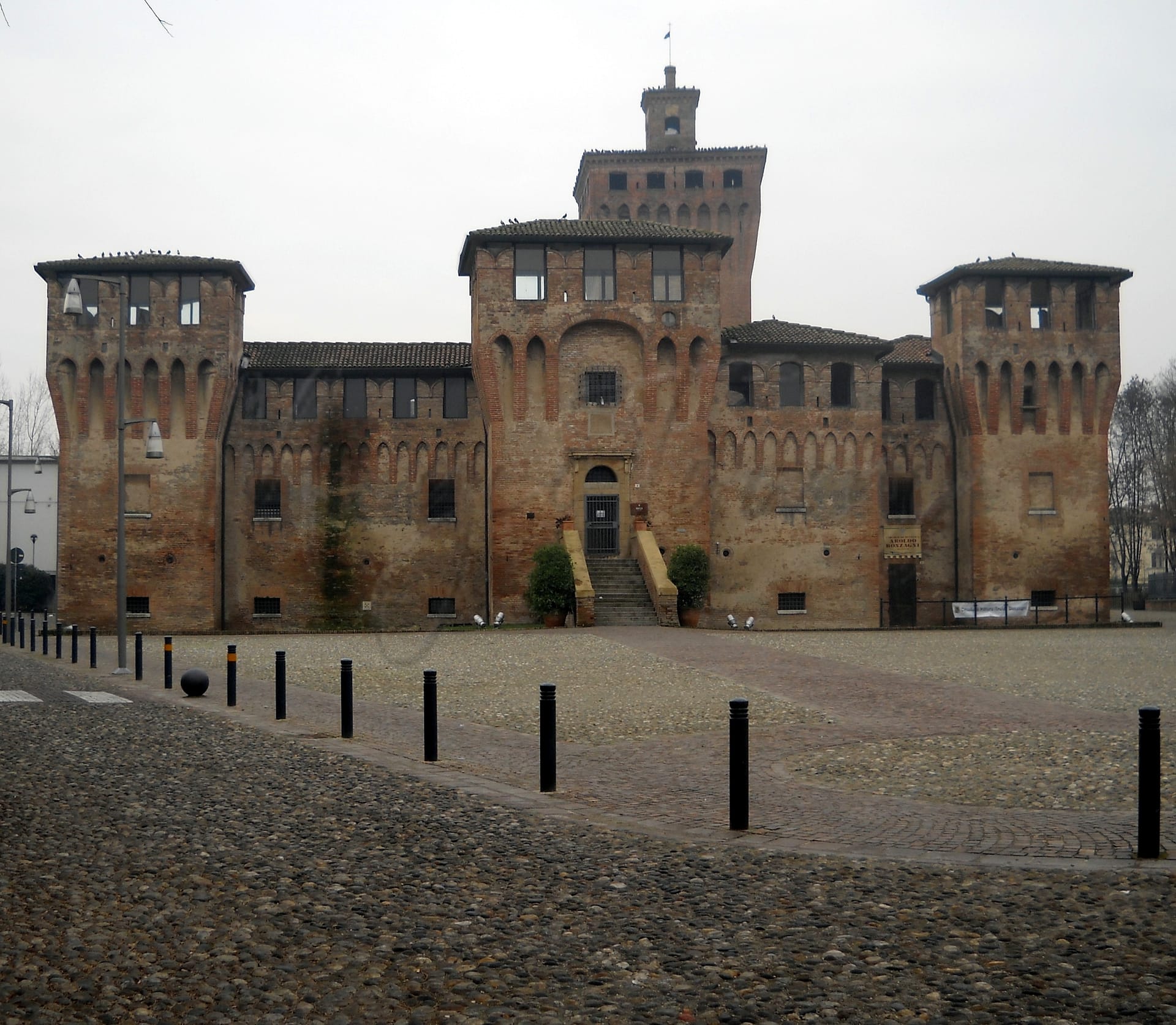
Cento, located in the Emilia-Romagna region of Italy, is a charming town known for its rich artistic and cultural heritage. Often called ‘Little Bologna,’ it boasts a historical center characterized by beautiful arcaded streets and vibrant architecture. Key attractions include the Piazza del Guercino, dedicated to the renowned painter, and the San Lorenzo Art Gallery, which showcases his works. The town is also home to the historic Jewish ghetto and the Rocca castle, a remnant from the 14th century.
Cento’s renowned Carnival, twinned with Rio de Janeiro’s, draws visitors with its colorful floats and lively atmosphere. Economic activities are centered around the culinary arts, with local delicacies like PGI Salama da Sugo. While healthcare and air quality in Cento are commendable, expats should note that the nearest major beach is some distance away. The town offers an appealing lifestyle but may lack some amenities of larger urban centers.
✅ Pros
– High-quality healthcare system ensures excellent medical services.
– Mild climate with warm summers and mild winters.
– Strong community support for expatriates and retirees.
– Accessible transportation options for regional travel.
– Affordable cost of living compared to larger cities.
– Low unemployment rate fosters economic stability.
– Rich cultural and historical heritage to explore.
– Air quality is generally good for outdoor activities.
– Opportunities for language and cultural integration available.
– Quiet, non-touristic environment for peaceful living.
❌ Cons
– Limited nightlife options may leave you craving excitement.
– Smaller town means fewer shopping and dining choices available.
– Infrastructure improvements needed for optimal connectivity and convenience.
– Language barrier could challenge daily interactions and services.
– Internet speeds may frustrate heavy users or remote workers.
– Cultural activities may not be as frequent or diverse.
– Public services could be less efficient than in larger cities.
– Seasonal tourism can disrupt the peaceful environment occasionally.
– Limited healthcare specialists compared to larger urban areas.
– Weather can be too hot for those sensitive to heat.
Related Posts
No posts found for the town.
More questions about Cento ? Ask Magic AI.
Our innovative AI assistant is eager to help. Try it out here: