Elevation
[?]
Elevation of a city refers to the height above sea level at which the city is located, measured in meters.
27
Population
[?]
This is a town's official population, measured each year by the national statistics authority.
15100
Real Population (5km)
[?]
Our "Real Population" metric reflects more accurately a town's real size by including inhabitants in the immediate vicinity of the town's official borders.
58400
Air Quality Rating
[?]
Based on PM10, PM2.5, NO2, SO2, and ozone levels. Higher scores indicate cleaner air.
72
Region
Lombardia
Walkability
Very Walkable
Housing availability
[?]
Based on total number of properties (sale and rent) classifies housing availability into five categories: low, relativel ylow, medium, relatively high and high.
Medium
Avg Download Speed (Mbps) / Avg Upload Speed (Mbps)
51
/ 16
Climate Description
Warm summers, mild winters, ample sunshine, breezy, occasional snow, balanced precipitation.
Casalmaggiore
Lombardia
Historic town in Lombardia with neoclassical architecture, local festivals, and scenic river access.
Quality of Life Score
[?]Factors in air quality, amenities, walkability, population, and environmental risks. Higher scores suggest better living conditions.
78
Quality of Infrastructure
[?]Measures internet speed, healthcare access, airports, rail, and walkability. Higher scores mean better connectivity and essential services.
50
Quality of Economy
[?]Based on income, property prices, job availability, and population density. Higher scores indicate stronger economic conditions.
81
Casalmaggiore Demographics
Population
[?]
This is a town's official population, measured each year by the national statistics authority.
15100
Real Population (5km band)
[?]
Our "Real Population" metric reflects more accurately a town's real size by including inhabitants in the immediate vicinity of the town's official borders.
58400
Births Per 100 Deaths
70.0
Population Data Source
ISTAT,2023
Estimated Unemployment Rate
Touristy Index
[?]
Calculation of tourist density index for the city, comparing its total tourist number to the overall average tourist number of the region
relative to its own population.The index indicates how a location’s tourist density compares to the average, with values above
100 representing higher-than-average density and values below 100 representing lower-than-average density.
Some Tourism
Income per capita (2023)
[?]
This is an estimation of average income per resident for this town, based on 2023 data from the Italian Ministry of Finance.
23200
Income rank in Italy (2023)
[?]
This is a ranking of the town's average income per resident, against the full list of townships in Italy.
1598 out of 7901
Infrastructure and Connectivity
Create an account to explore more
This content is for Members only | Already a Member? Sign in
Infrastructure & Amenities
Create an account to explore more
This content is for Members only | Already a Member? Sign in
Healthcare
Create an account to explore more
This content is for Members only | Already a Member? Sign in
Housing & Property Market
Create an account to explore more
This content is for Members only | Already a Member? Sign in
Connectivity & Digital Access
Create an account to explore more
This content is for Members only | Already a Member? Sign in
Education
Create an account to explore more
This content is for Members only | Already a Member? Sign in
Climate & Weather
Create an account to explore more
This content is for Members only | Already a Member? Sign in
Precipitation
[?] Based on daily climate data for precipitation from OPEN-METEO this parameter indicates how a city's annual precipitation compares to others in terms of percentage, with values ranging from 0 (lowest) to 1 (highest). For example, a percentile rank of 0.75 means the city's total precipitation is higher than 75% of other cities.
Somewhat Low (21st-30th percentile)
Sunshine
Above Average (51st-60th percentile)
Snowfall
Average (41st-50th percentile)
Min Annual Temperature (°C)
[?] This parameter represents the monthly average of daily minimum temperatures for January, based on data from OPEN-METEO.
-0.1
Max Annual Temperature (°C)
[?] This parameter represents the monthly average of daily minimum temperatures for January, based on data from OPEN-METEO.
30.6
Climate Description
Casalmaggiore, located in Italy, offers a climate that balances warm summers and mild winters attractively. The town is graced with ample sunshine, making it ideal for outdoor activities almost all year round. Winters are gentle here, rarely seeing harsh temperatures, while the summer heat is typically moderated by breezy conditions. Precipitation is fairly distributed throughout the year, ensuring lush, green landscapes without the burden of excessive rainfalls. Occasional snowfall might dust the town, creating picturesque scenes but never enough to disrupt daily life significantly. This balanced climate appeals greatly to retirees and expats seeking a comfortable environment.
Annual Temperature Chart (Min)
Error
There was a problem with your SQL connection - Please contact the administrator
There was a problem with your SQL connection - Please contact the administrator
Annual Temperature Chart (Max)
Error
There was a problem with your SQL connection - Please contact the administrator
There was a problem with your SQL connection - Please contact the administrator
Sunny Days By Month
Error
There was a problem with your SQL connection - Please contact the administrator
There was a problem with your SQL connection - Please contact the administrator
Environmental & Air Quality
Create an account to explore more
This content is for Members only | Already a Member? Sign in
Classifications
PM10
[?]
PM10 levels indicate Good air quality at 0–20 µg/m³, Fair at 20–40 µg/m³, Moderate at 40–50 µg/m³, Poor at 50–100 µg/m³, Very Poor at 100–150 µg/m³, and Extremely Poor at 150–1200 µg/m³.
Fair
PM2.5
[?]
PM2.5 is Good if PM2.5 levels are between 0–10 µg/m³, Fair between 10–20 µg/m³, Moderate between 20–25 µg/m³, Poor between 25–50 µg/m³, Very Poor between 50–75 µg/m³, and Extremely Poor between 75–800 µg/m³.
Fair
NO2
[?]
NO₂ levels are considered Good at 0–40 µg/m³, Fair at 40–90 µg/m³, Moderate at 90–120 µg/m³, Poor at 120–230 µg/m³, Very Poor at 230–340 µg/m³, and Extremely Poor at 340–1000 µg/m³.
Good
SO2
[?]
SO₂ levels indicate Good air quality at 0–100 µg/m³, Fair at 100–200 µg/m³, Moderate at 200–350 µg/m³, Poor at 350–500 µg/m³, Very Poor at 500–750 µg/m³, and Extremely Poor at 750–1250 µg/m³.
Good
O₃
[?]
For O₃, the air is Good at 0–50 µg/m³, Fair at 50–100 µg/m³, Moderate at 100–130 µg/m³, Poor at 130–240 µg/m³, Very Poor at 240–380 µg/m³, and Extremely Poor at 380–800 µg/m³.
Fair
Air Quality Rating
[?]
Based on PM10, PM2.5, NO2, SO2, and ozone levels. Higher scores indicate cleaner air.
72
Air Quality Description
In Casalmaggiore, the air quality generally presents a balanced profile conducive to comfortable living. The particulate matter, both PM10 and PM2.5, albeit slightly elevated, poses marginal concerns and is classified as fair. This indicates a reasonable level of pollutants that should not typically impair daily activities or enjoyment of the local ambiance. Nitrogen dioxide and sulphur dioxide levels are commendably low, achieving a ‘good’ rating and suggesting minimal interference from these gases in everyday life. Ozone levels are moderate, fitting within a fair classification as well. Collectively, these metrics suggest an environment where air quality supports an active, outdoor lifestyle.
In Casalmaggiore, the air quality generally presents a balanced profile conducive to comfortable living. The particulate matter, both PM10 and PM2.5, albeit slightly elevated, poses marginal concerns and is classified as fair. This indicates a reasonable level of pollutants that should not typically impair daily activities or enjoyment of the local ambiance. Nitrogen dioxide and sulphur dioxide levels are commendably low, achieving a ‘good’ rating and suggesting minimal interference from these gases in everyday life. Ozone levels are moderate, fitting within a fair classification as well. Collectively, these metrics suggest an environment where air quality supports an active, outdoor lifestyle.
Town Descriptions
Create an account to explore more
This content is for Members only | Already a Member? Sign in
Getting There
Casalmaggiore is accessible via the A21 motorway, facilitating regional travel. The nearest major airports are Giuseppe Verdi Airport in Parma and Reggio Emilia Airport. The town has regular train services, with proximity to two local stations that offer moderate connectivity scores.
Getting Around
Local Cuisine
Casalmaggiore, situated in the Lombardy region of Italy, exemplifies a culinary scene that is both traditional and reflective of contemporary Italian dining trends. The local cuisine is characterized by staples such as risotto, polenta, and renowned meat dishes like brasaola, which is aged, lean beef. Traditional recipes such as ‘pulenta pastissada,’ a hearty dish made with beef and butter, can be found alongside comforting soups like minestrone. The region’s cheeses, including Gorgonzola and Taleggio, further enrich the local palette. Dining options in Casalmaggiore vary widely, from rustic osterias serving authentic Lombard dishes to modern eateries that embrace international influences. There is a notable presence of cuisine that has been shaped not only by local ingredients but by global culinary trends, ensuring an eclectic dining experience. Additionally, the town is home to a Michelin-starred restaurant, providing a gourmet experience to those seeking high-end dining. Overall, Casalmaggiore’s culinary scene emphasizes a blend of age-old traditions with a welcoming attitude toward contemporary flavors, making it a unique destination for food enthusiasts.
Shopping Overview
Shopping facilities in the area include a range of supermarkets offering daily essentials, alongside specialised boutiques focusing on local goods. Expats and retirees can access larger shopping centres, which feature a mix of international retail chains and local stores. Markets showcasing regional products are commonplace, enhancing the shopping experience with a cultural touch. This variety ensures a comprehensive retail environment catering to diverse interests and needs.
Neighborhoods
Green Areas and Parks
Casalmaggiore, located in Lombardia, offers various outdoor activities ideal for expats and retirees. The “Window on the Po” loop is a notable hiking trail taking approximately 2.5 hours over nearly 6 miles, providing an engaging outdoor experience. Other tools such as the “Sabbioneta loop” offer a longer hiking option of around 11 miles. These well-marked trails cater to intermediate skill levels, ensuring accessibility for walkers looking to explore the scenic landscapes of the region. Local parks and trails provide a structured environment for recreational walking and hiking excursions.
✅ Pros
– Good healthcare services available for residents and expats.
– Efficient public transportation connects to nearby cities and towns.
– Mild climate with enjoyable seasons, suitable for outdoor activities.
– Rich cultural heritage with historical sites and local traditions.
– Low unemployment rate compared to national average fosters stability.
– Opportunities for social integration within the local community.
– Sufficient educational facilities for families and lifelong learners.
– Some tourism presence enhances local amenities and services.
– Reasonable cost of living compared to larger Italian cities.
– Adequate internet connectivity for remote work and communication.
❌ Cons
– Healthcare quality could use some improvement for residents’ peace.
– Air quality may not be optimal for sensitive individuals.
– Infrastructure development may feel outdated compared to larger cities.
– Limited tourist presence may restrict local cultural experiences.
– Income ranking suggests limited economic opportunities for residents.
– Average internet speeds might frustrate heavy remote workers.
– Community events may not be frequent or diverse enough.
– Limited shopping and dining options compared to bigger towns.
– Mild climate might mean occasional flooding from seasonal rains.
– Integration with locals can be challenging for newcomers.
FAQs
Summary
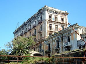
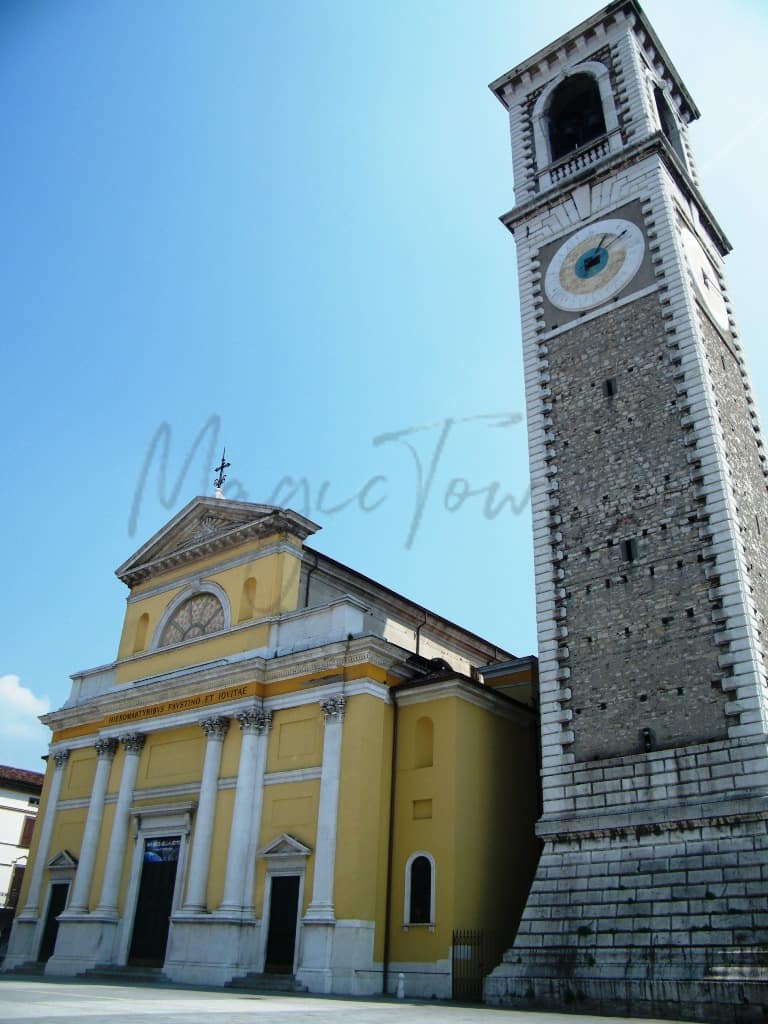
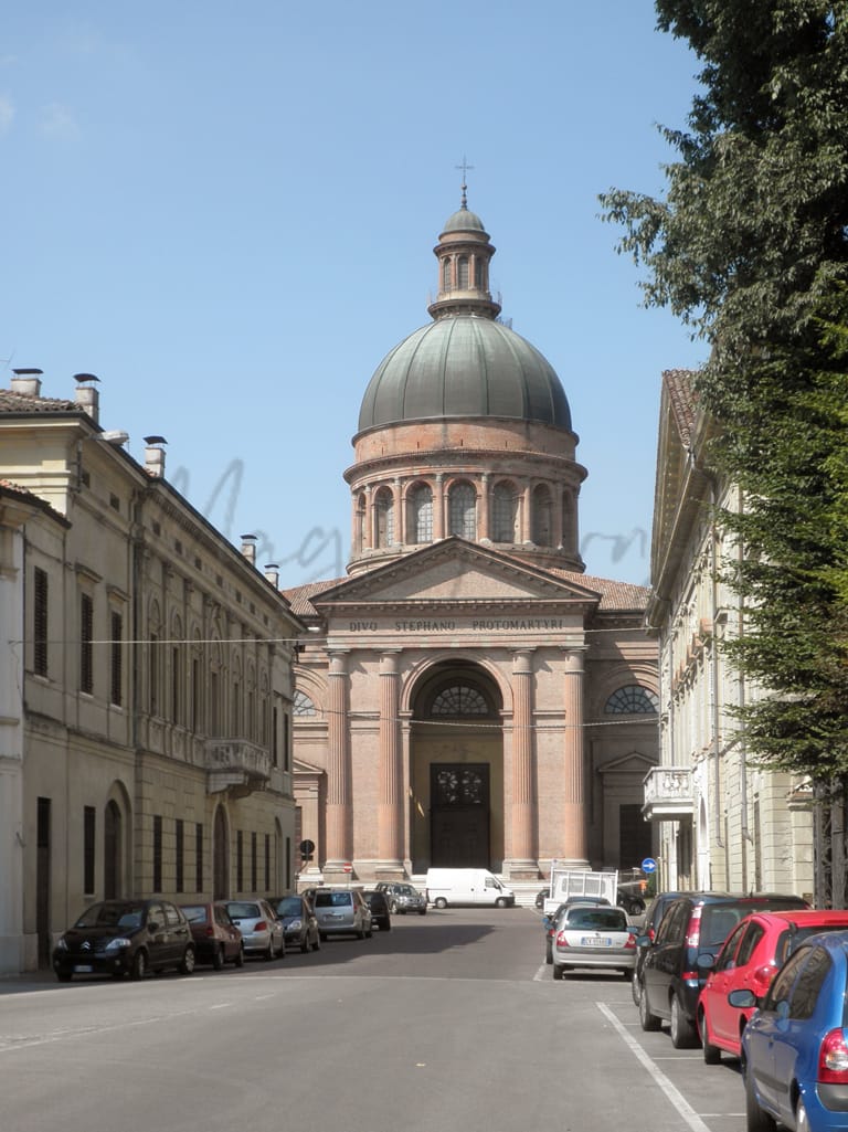
Casalmaggiore, nestled in Lombardia, offers a charming blend of history and modernity, appealing to foreign expats and retirees. Its historic center showcases neoclassical architecture, with highlights including the Duomo and the Bijou Museum, which houses exquisite costume jewelry from the early 1900s. The town’s vibrant culture is alive through local festivals and the bustling Piazza Garibaldi, a hub for markets and traditional events. Its strategic location along the Po river enhances its appeal, providing both scenic beauty and opportunities for outdoor activities.
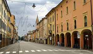
However, while there are several cultural attractions, some may find Casalmaggiore lacking in certain urban amenities compared to larger cities. The nearest beach is accessible yet a fair distance away, potentially limiting coastal leisure options. Despite these challenges, the inviting walkable streets, coupled with a community-oriented atmosphere, make it a cozy choice for those seeking a quieter lifestyle in Italy.
✅ Pros
– Good healthcare services available for residents and expats.
– Efficient public transportation connects to nearby cities and towns.
– Mild climate with enjoyable seasons, suitable for outdoor activities.
– Rich cultural heritage with historical sites and local traditions.
– Low unemployment rate compared to national average fosters stability.
– Opportunities for social integration within the local community.
– Sufficient educational facilities for families and lifelong learners.
– Some tourism presence enhances local amenities and services.
– Reasonable cost of living compared to larger Italian cities.
– Adequate internet connectivity for remote work and communication.
❌ Cons
– Healthcare quality could use some improvement for residents’ peace.
– Air quality may not be optimal for sensitive individuals.
– Infrastructure development may feel outdated compared to larger cities.
– Limited tourist presence may restrict local cultural experiences.
– Income ranking suggests limited economic opportunities for residents.
– Average internet speeds might frustrate heavy remote workers.
– Community events may not be frequent or diverse enough.
– Limited shopping and dining options compared to bigger towns.
– Mild climate might mean occasional flooding from seasonal rains.
– Integration with locals can be challenging for newcomers.
Related Posts
No posts found for the town.
More questions about Casalmaggiore ? Ask Magic AI.
Our innovative AI assistant is eager to help. Try it out here: