
Elevation
[?]
Elevation of a city refers to the height above sea level at which the city is located, measured in meters.
188
Population
[?]
This is a town's official population, measured each year by the national statistics authority.
14600
Real Population (5km)
[?]
Our "Real Population" metric reflects more accurately a town's real size by including inhabitants in the immediate vicinity of the town's official borders.
116700
Air Quality Rating
[?]
Based on PM10, PM2.5, NO2, SO2, and ozone levels. Higher scores indicate cleaner air.
96
Region
Toscana
Walkability
Somewhat Walkable
Housing availability
[?]
Based on total number of properties (sale and rent) classifies housing availability into five categories: low, relativel ylow, medium, relatively high and high.
Relatively High
Avg Download Speed (Mbps) / Avg Upload Speed (Mbps)
83
/ 40
Climate Description
Mild winters, warm summers, moderate rainfall; ideal Mediterranean climate for serene living.
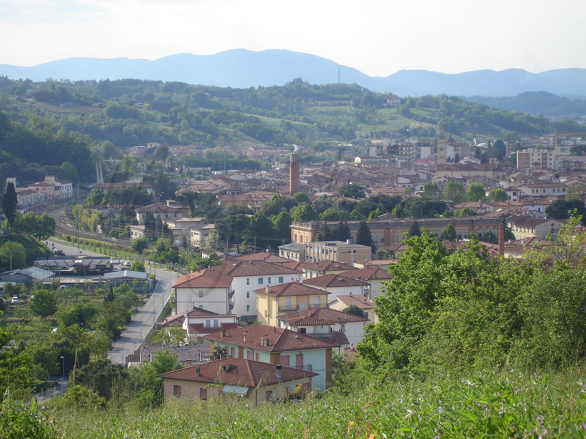
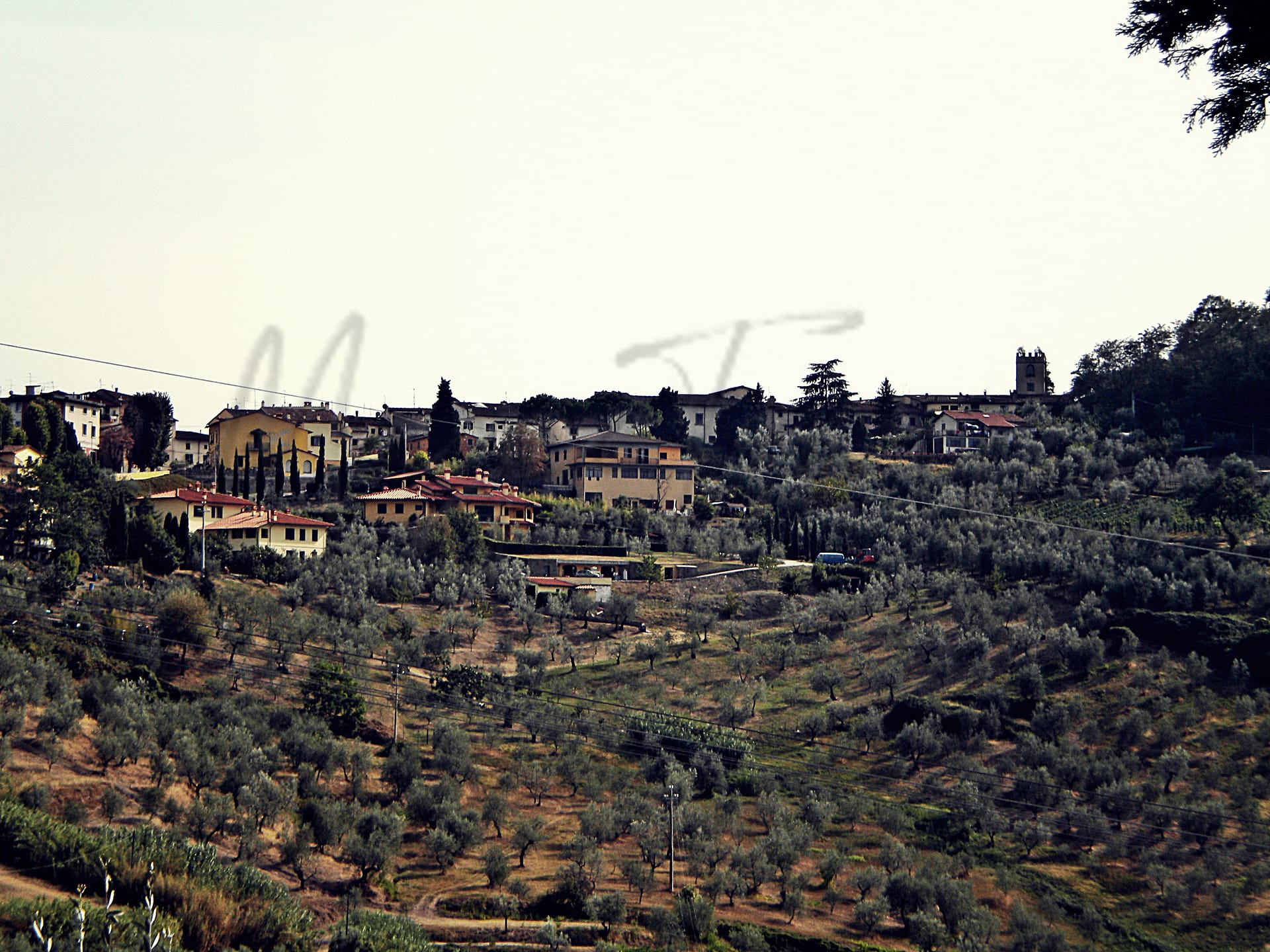
Carmignano
Toscana
Small Tuscan town known for wine production, Etruscan heritage, medieval sites, and UNESCO-listed villa.
Quality of Life Score
[?]Factors in air quality, amenities, walkability, population, and environmental risks. Higher scores suggest better living conditions.
76
Quality of Infrastructure
[?]Measures internet speed, healthcare access, airports, rail, and walkability. Higher scores mean better connectivity and essential services.
61
Quality of Economy
[?]Based on income, property prices, job availability, and population density. Higher scores indicate stronger economic conditions.
80
Carmignano Demographics
Population
[?]
This is a town's official population, measured each year by the national statistics authority.
14600
Real Population (5km band)
[?]
Our "Real Population" metric reflects more accurately a town's real size by including inhabitants in the immediate vicinity of the town's official borders.
116700
Births Per 100 Deaths
50.0
Population Data Source
ISTAT,2023
Estimated Unemployment Rate
Touristy Index
[?]
Calculation of tourist density index for the city, comparing its total tourist number to the overall average tourist number of the region
relative to its own population.The index indicates how a location’s tourist density compares to the average, with values above
100 representing higher-than-average density and values below 100 representing lower-than-average density.
Some Tourism
Income per capita (2023)
[?]
This is an estimation of average income per resident for this town, based on 2023 data from the Italian Ministry of Finance.
22300
Income rank in Italy (2023)
[?]
This is a ranking of the town's average income per resident, against the full list of townships in Italy.
2406 out of 7901
Infrastructure and Connectivity
Create an account to explore more
This content is for Members only | Already a Member? Sign in
Infrastructure & Amenities
Create an account to explore more
This content is for Members only | Already a Member? Sign in
Healthcare
Create an account to explore more
This content is for Members only | Already a Member? Sign in
Housing & Property Market
Create an account to explore more
This content is for Members only | Already a Member? Sign in
Connectivity & Digital Access
Create an account to explore more
This content is for Members only | Already a Member? Sign in
Education
Create an account to explore more
This content is for Members only | Already a Member? Sign in
Climate & Weather
Create an account to explore more
This content is for Members only | Already a Member? Sign in
Precipitation
[?] Based on daily climate data for precipitation from OPEN-METEO this parameter indicates how a city's annual precipitation compares to others in terms of percentage, with values ranging from 0 (lowest) to 1 (highest). For example, a percentile rank of 0.75 means the city's total precipitation is higher than 75% of other cities.
Below Average (31st-40th percentile)
Sunshine
Above Average (51st-60th percentile)
Snowfall
Below Average (31st-40th percentile)
Min Annual Temperature (°C)
[?] This parameter represents the monthly average of daily minimum temperatures for January, based on data from OPEN-METEO.
1.1
Max Annual Temperature (°C)
[?] This parameter represents the monthly average of daily minimum temperatures for January, based on data from OPEN-METEO.
29.3
Climate Description
Carmignano's climate offers a balanced Mediterranean appeal, suitable for those accustomed to a variety of weather patterns. Winters here are mild with the rare delight of light snowfall that briefly dusts the vine-covered hills. Bright, sunlit days dominate the year, supporting both an outdoor lifestyle and the local vineyards that produce esteemed wines. Summers extend warm offerings without succumbing to unbearable peaks, reinforcing Carmignano as an ideal relocation spot for retirees and expats seeking serenity without extreme temperatures. The moderate rainfall nurtures the green Tuscan landscape, maintaining its lush allure throughout the seasons and making it a picturesque magic town of Italy.
Annual Temperature Chart (Min)
Error
There was a problem with your SQL connection - Please contact the administrator
There was a problem with your SQL connection - Please contact the administrator
Annual Temperature Chart (Max)
Error
There was a problem with your SQL connection - Please contact the administrator
There was a problem with your SQL connection - Please contact the administrator
Sunny Days By Month
Error
There was a problem with your SQL connection - Please contact the administrator
There was a problem with your SQL connection - Please contact the administrator
Environmental & Air Quality
Create an account to explore more
This content is for Members only | Already a Member? Sign in
Classifications
PM10
[?]
PM10 levels indicate Good air quality at 0–20 µg/m³, Fair at 20–40 µg/m³, Moderate at 40–50 µg/m³, Poor at 50–100 µg/m³, Very Poor at 100–150 µg/m³, and Extremely Poor at 150–1200 µg/m³.
Good
PM2.5
[?]
PM2.5 is Good if PM2.5 levels are between 0–10 µg/m³, Fair between 10–20 µg/m³, Moderate between 20–25 µg/m³, Poor between 25–50 µg/m³, Very Poor between 50–75 µg/m³, and Extremely Poor between 75–800 µg/m³.
Good
NO2
[?]
NO₂ levels are considered Good at 0–40 µg/m³, Fair at 40–90 µg/m³, Moderate at 90–120 µg/m³, Poor at 120–230 µg/m³, Very Poor at 230–340 µg/m³, and Extremely Poor at 340–1000 µg/m³.
Good
SO2
[?]
SO₂ levels indicate Good air quality at 0–100 µg/m³, Fair at 100–200 µg/m³, Moderate at 200–350 µg/m³, Poor at 350–500 µg/m³, Very Poor at 500–750 µg/m³, and Extremely Poor at 750–1250 µg/m³.
Good
O₃
[?]
For O₃, the air is Good at 0–50 µg/m³, Fair at 50–100 µg/m³, Moderate at 100–130 µg/m³, Poor at 130–240 µg/m³, Very Poor at 240–380 µg/m³, and Extremely Poor at 380–800 µg/m³.
Fair
Air Quality Rating
[?]
Based on PM10, PM2.5, NO2, SO2, and ozone levels. Higher scores indicate cleaner air.
96
Air Quality Description
In Carmignano, Italy, the air quality largely contributes to the charm and allure of this Tuscan town. Residents and visitors breathe air that meets ‘Good’ quality standards across most pollutants, including particulate matter and nitrogen dioxide – elements primarily responsible for respiratory discomfort. The slight exception lies in the ozone levels, deemed ‘Fair,’ which reflects typical fluctuations due to climatic conditions prevalent in the region. This profile allows Carmignano’s outdoor lifestyle to thrive, featuring unhindered enjoyment of its rolling vineyards and historical sites without significant air quality concerns. The setting is ideal for retirees and expats seeking a serene health-conscious relocation.
In Carmignano, Italy, the air quality largely contributes to the charm and allure of this Tuscan town. Residents and visitors breathe air that meets ‘Good’ quality standards across most pollutants, including particulate matter and nitrogen dioxide – elements primarily responsible for respiratory discomfort. The slight exception lies in the ozone levels, deemed ‘Fair,’ which reflects typical fluctuations due to climatic conditions prevalent in the region. This profile allows Carmignano’s outdoor lifestyle to thrive, featuring unhindered enjoyment of its rolling vineyards and historical sites without significant air quality concerns. The setting is ideal for retirees and expats seeking a serene health-conscious relocation.
Town Descriptions
Create an account to explore more
This content is for Members only | Already a Member? Sign in
Getting There
Carmignano is accessible via the A11 motorway, connecting to major Tuscan cities. The nearest airports, Amerigo Vespucci and Galileo Galilei, provide national and international flights. Train stations nearby offer decent connectivity, scoring 7 out of 10, facilitating travel within the region and beyond.
Getting Around
Local Cuisine
The culinary scene in Carmignano, nestled in Tuscany, is characterized by its rich heritage and array of traditional dishes, notably featuring the unique dried figs of the region, also recognized for their Slow Food status. The local cuisine highlights rustic staples such as cured meats, cheeses, and handmade pastas, often paired with exceptional wines and olive oils produced in the area. Notably, food festivals celebrate local specialties including chestnuts, Porcini mushrooms, and wild boar. The dining options range from authentic Tuscan eateries offering traditional fare to modern establishments that reinterpret classic recipes. While the town has a variety of restaurants, it is home to at least one Michelin-starred venue, elevating its culinary reputation. Overall, Carmignano’s food culture reflects both local culinary traditions and an openness to international influences, making it a delightful destination for gastronomy lovers.
Shopping Overview
The area features various shopping options encompassing supermarkets, specialty shops, and boutiques. Regular farmers’ markets offer local produce and artisanal goods, while shopping centres provide a more extensive retail experience, including diverse dining options. Retail formats include both open-air markets and enclosed shopping venues, catering to daily necessities as well as unique local products, making it accessible for residents and visitors alike.
Neighborhoods
Green Areas and Parks
Carmignano offers various outdoor activities, prominently featuring several well-established hiking trails. Among the trails, the Artimino-Firenze via Ciclabile dei Renai stands out as a moderate 28.4-mile route, estimated to take over 10 hours. The Bacchereto-Torre Sant’Alluccio-Santa Cristina trail, known for its difficulty and elevation gain of 2,618 feet, is popular and demanding. The Verghereto-Artimino-Poggio alla Malva provides a moderate 8.4-mile excursion, while the shorter Poggio alla Malva-Fiume Arno trail offers an easy 2.4-mile hike. These trails provide both seasoned hikers and casual walkers numerous options to explore the scenic Tuscan landscape.
✅ Pros
– Charming historical backdrop with rich cultural heritage.
– Excellent air quality makes for a healthy environment.
– Low unemployment rate ensures economic stability and job opportunities.
– Good healthcare services available for residents and expats.
– Integration opportunities with friendly local community.
– Convenient transportation links to nearby cities and attractions.
– Mild climate ideal for outdoor activities year-round.
– Access to quality educational facilities for families.
– Moderate tourism enhances local economy without overcrowding.
– Reliable internet connectivity for remote work and communication.
❌ Cons
– Healthcare score indicates room for improvement in services.
– Limited nightlife options may lead to quiet evenings at home.
– Small-town charm might feel isolating for some expats.
– Seasons can be unpredictable; rain may surprise outdoor plans.
– Public transport may lack frequency for spontaneous day trips.
– Some local customs might take time to fully understand.
– Limited shopping options for high-end or specialty items.
– Connectivity can falter in rural areas outside town center.
– Local dialect may pose a challenge for new residents.
– Seasonal tourist influx can lead to crowded attractions.
FAQs
Summary
Carmignano, nestled in the rolling hills of Tuscany, is a small town that offers a blend of rich culture, history, and beautiful landscapes. Its strategic location provides easy access to both Florence and Pistoia, enhancing its appeal for international retirees and expats. The area is renowned for its wine production, with the Carmignano Vine and Wine Museum highlighting local viticulture, while archaeological sites such as the Tumulo di Montefortini speak to its Etruscan heritage. Key attractions include the medieval fortress, the Church of Saints Michael and Francis, and the Villa Medicea La Ferdinanda, a UNESCO World Heritage Site.
Despite its charm, challenges exist; some may find the pace of life in Carmignano slower than expected, coupled with limited healthcare options relative to larger cities. Nevertheless, its pristine air quality, picturesque surroundings, and rich local traditions, including vibrant festivals, contribute to an engaging lifestyle for those looking to immerse themselves in the Italian way of life.
✅ Pros
– Charming historical backdrop with rich cultural heritage.
– Excellent air quality makes for a healthy environment.
– Low unemployment rate ensures economic stability and job opportunities.
– Good healthcare services available for residents and expats.
– Integration opportunities with friendly local community.
– Convenient transportation links to nearby cities and attractions.
– Mild climate ideal for outdoor activities year-round.
– Access to quality educational facilities for families.
– Moderate tourism enhances local economy without overcrowding.
– Reliable internet connectivity for remote work and communication.
❌ Cons
– Healthcare score indicates room for improvement in services.
– Limited nightlife options may lead to quiet evenings at home.
– Small-town charm might feel isolating for some expats.
– Seasons can be unpredictable; rain may surprise outdoor plans.
– Public transport may lack frequency for spontaneous day trips.
– Some local customs might take time to fully understand.
– Limited shopping options for high-end or specialty items.
– Connectivity can falter in rural areas outside town center.
– Local dialect may pose a challenge for new residents.
– Seasonal tourist influx can lead to crowded attractions.
Related Posts
No posts found for the town.
More questions about Carmignano ? Ask Magic AI.
Our innovative AI assistant is eager to help. Try it out here: