
Elevation
[?]
Elevation of a city refers to the height above sea level at which the city is located, measured in meters.
39
Population
[?]
This is a town's official population, measured each year by the national statistics authority.
8000
Real Population (5km)
[?]
Our "Real Population" metric reflects more accurately a town's real size by including inhabitants in the immediate vicinity of the town's official borders.
51700
Air Quality Rating
[?]
Based on PM10, PM2.5, NO2, SO2, and ozone levels. Higher scores indicate cleaner air.
82
Region
Veneto
Walkability
Somewhat Walkable
Housing availability
[?]
Based on total number of properties (sale and rent) classifies housing availability into five categories: low, relativel ylow, medium, relatively high and high.
Relatively Low
Avg Download Speed (Mbps) / Avg Upload Speed (Mbps)
58
/ 15
Climate Description
Balmy climate, adequate rainfall, and scarce snowfall; benefits from abundant sunshine.
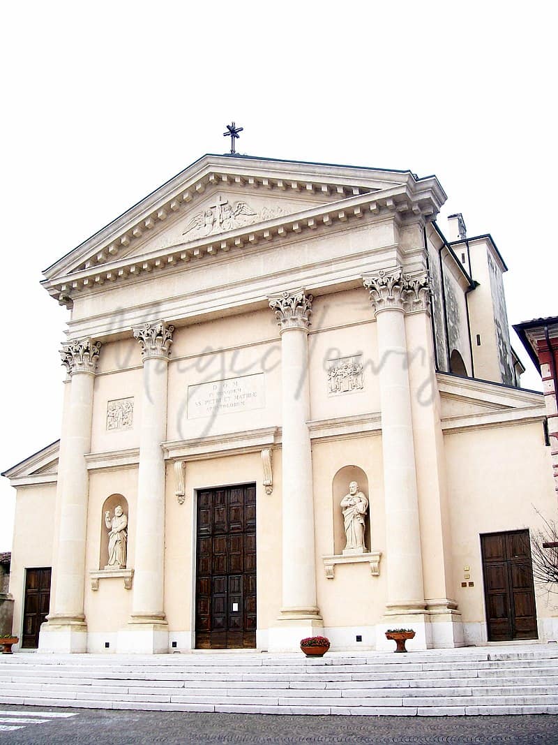
Caldiero
Veneto
Charming town known for historic thermal springs, offering a serene lifestyle with easy urban access and a robust local economy driven by tourism and viticulture.
Quality of Life Score
[?]Factors in air quality, amenities, walkability, population, and environmental risks. Higher scores suggest better living conditions.
83
Quality of Infrastructure
[?]Measures internet speed, healthcare access, airports, rail, and walkability. Higher scores mean better connectivity and essential services.
57
Quality of Economy
[?]Based on income, property prices, job availability, and population density. Higher scores indicate stronger economic conditions.
71
Caldiero Demographics
Population
[?]
This is a town's official population, measured each year by the national statistics authority.
8000
Real Population (5km band)
[?]
Our "Real Population" metric reflects more accurately a town's real size by including inhabitants in the immediate vicinity of the town's official borders.
51700
Births Per 100 Deaths
150.0
Population Data Source
ISTAT,2023
Estimated Unemployment Rate
Touristy Index
[?]
Calculation of tourist density index for the city, comparing its total tourist number to the overall average tourist number of the region
relative to its own population.The index indicates how a location’s tourist density compares to the average, with values above
100 representing higher-than-average density and values below 100 representing lower-than-average density.
Some Tourism
Income per capita (2023)
[?]
This is an estimation of average income per resident for this town, based on 2023 data from the Italian Ministry of Finance.
22100
Income rank in Italy (2023)
[?]
This is a ranking of the town's average income per resident, against the full list of townships in Italy.
2559 out of 7901
Infrastructure and Connectivity
Create an account to explore more
This content is for Members only | Already a Member? Sign in
Infrastructure & Amenities
Create an account to explore more
This content is for Members only | Already a Member? Sign in
Within 10km
Auto Repair Shops
166
Bars
170
Cafes
64
Cinemas
3
Dentists
21
Golf Courses
2
Gyms
35
Health Clinics
30
Hiking Trails
6
Historical Sites
102
Libraries
7
Museums
5
Parks
21
Pharmacies
24
Restaurants
120
Shopping Centres
10
Supermarkets
49
Spas
116
Beach
Name
Driving Distance
Water Quality Rating
Mountain Resort
Name
Monte Baldo - Malcesine/Prà Alpesina
Driving Distance
65.0mins
Healthcare
Create an account to explore more
This content is for Members only | Already a Member? Sign in
Healthcare Score
[?]
Evaluates hospital/clinic access, drive time to care, and regional quality rankings. Higher scores mean better healthcare.
55.0
Nearest Hospital Name
Girolamo Fracastoro-Pronto Soc
Drive Time to Nearest Hospital
13 minutes
Hospitals and Clinics Within 10km
6
Healthcare Quality Description
In this area of Veneto, healthcare services exhibit moderate efficiency, with average overall indicators by national standards. Local hospital care ranks low, suggesting limitations in immediate services. Emergency cardiac care is relatively efficient, yet breast cancer treatments often bypass minimally invasive methods. Orthopaedic concerns are resolved promptly, with most bone fractures managed swiftly. Patient outcomes post-surgery are favourable, indicating effective short-stay recoveries. However, readmissions following a heart attack are somewhat frequent, as are the instances post-heart failure. Prospective residents may find varying levels of care quality, necessitating consideration of specific medical needs prior to relocation.
Local Public Healthcare Provider
AZIENDA ULSS N. 9 SCALIGERA
Safety
Seismic Zone (risk of earthquakes)
[?]
Official seismic zones classify areas based on earthquake risk.
Moderate Earthquake Risk
Road Accidents Rate per 10k Inhabitants
[?]
Calculation of road accidents per 10,000 people based on the number of deaths and injuries registered in roads for year 2022 for the city.
31
Percentage of Population at Landslide Risk
[?] Percentage of the population in high or moderate landslide risk zones. Higher values indicate greater environmental risk.
Percentage of Population at Flood Risk
[?] Percentage of the population in high or moderate flood risk zones. Higher values indicate greater environmental risk.
Car Insurance Price Index
[?]
The car insurance price index is a measure of how a city's average car insurance premium compares to the national average,
expressed as a percentage. A value of 100 indicates that the city's premium is equal to the national average.
Values above 100 show higher premiums, while values below 100 show lower premiums.
96.851
Housing & Property Market
Create an account to explore more
This content is for Members only | Already a Member? Sign in
Housing availability
[?]
Based on total number of properties (sale and rent) classifies housing availability into five categories: low, relativel ylow, medium, relatively high and high.
Relatively Low
Property Prices per m²
[?]
Calculation of property sale prices per square meter for apartments, houses in the city.
Median (50th Percentile): The midpoint price, where half the values are above and half below.
First Quartile (25th Percentile): The price below which 25% of properties fall.
Third Quartile (75th Percentile): The price below which 75% of properties fall.
First Quartile
1633
Median
1907
Third Quartile
2380
Connectivity & Digital Access
Create an account to explore more
This content is for Members only | Already a Member? Sign in
Walkability Description
Somewhat Walkable
Avg Download Speed (Mbps)
58
Fast Download Speed (Mbps)
73
Slow Download Speed (Mbps)
41
Education
Create an account to explore more
This content is for Members only | Already a Member? Sign in
Avg Schools Ranking (All Criteria)
[?]
This ranking shows in which decile the town's public schools fall while looking at all the indicators provided by the Italian Ministry of Education for the most recent available year. Note that figures are only provided by the ministry at the school catchment area level, and therefore several schools may be grouped together.
Bottom 30%
Avg Schools Ranking (Standardised Tests)
[?]
This ranking shows in which decile the town's public schools fall while looking the students' results in national standardised tests. The data is provided by the Italian Ministry of Education for the most recent available year.
Top 40%
Counts of School
Error
There was a problem with your SQL connection - Please contact the administrator
There was a problem with your SQL connection - Please contact the administrator
Climate & Weather
Create an account to explore more
This content is for Members only | Already a Member? Sign in
Precipitation
[?] Based on daily climate data for precipitation from OPEN-METEO this parameter indicates how a city's annual precipitation compares to others in terms of percentage, with values ranging from 0 (lowest) to 1 (highest). For example, a percentile rank of 0.75 means the city's total precipitation is higher than 75% of other cities.
Below Average (31st-40th percentile)
Sunshine
Above Average (51st-60th percentile)
Snowfall
Somewhat Low (21st-30th percentile)
Min Annual Temperature (°C)
[?] This parameter represents the monthly average of daily minimum temperatures for January, based on data from OPEN-METEO.
-0.6
Max Annual Temperature (°C)
[?] This parameter represents the monthly average of daily minimum temperatures for January, based on data from OPEN-METEO.
29.6
Climate Description
Caldiero, Italy, presents a climate profile amenable to those seeking mild, comfortable living conditions throughout much of the year. Seasons are distinctly recognizable, with warm summers and moderately cold winters. The characterictic warmth of summer reaches its peak without becoming oppressive, which might appeal to retirees and expats from cooler climates looking for a sunnier disposition. Winters hint at brief cool spells, often just brushing past the freezing point, close to idyllic for those who appreciate a brief, scenic snowfall without the burden of harsh winter conditions. Annual weather trends lean towards generous sunshine, affording residents plenty of opportunity to explore outdoor leisure in this quaint locale.
Annual Temperature Chart (Min)
Error
There was a problem with your SQL connection - Please contact the administrator
There was a problem with your SQL connection - Please contact the administrator
Annual Temperature Chart (Max)
Error
There was a problem with your SQL connection - Please contact the administrator
There was a problem with your SQL connection - Please contact the administrator
Sunny Days By Month
Error
There was a problem with your SQL connection - Please contact the administrator
There was a problem with your SQL connection - Please contact the administrator
Environmental & Air Quality
Create an account to explore more
This content is for Members only | Already a Member? Sign in
Classifications
PM10
[?]
PM10 levels indicate Good air quality at 0–20 µg/m³, Fair at 20–40 µg/m³, Moderate at 40–50 µg/m³, Poor at 50–100 µg/m³, Very Poor at 100–150 µg/m³, and Extremely Poor at 150–1200 µg/m³.
Fair
PM2.5
[?]
PM2.5 is Good if PM2.5 levels are between 0–10 µg/m³, Fair between 10–20 µg/m³, Moderate between 20–25 µg/m³, Poor between 25–50 µg/m³, Very Poor between 50–75 µg/m³, and Extremely Poor between 75–800 µg/m³.
Fair
NO2
[?]
NO₂ levels are considered Good at 0–40 µg/m³, Fair at 40–90 µg/m³, Moderate at 90–120 µg/m³, Poor at 120–230 µg/m³, Very Poor at 230–340 µg/m³, and Extremely Poor at 340–1000 µg/m³.
Good
SO2
[?]
SO₂ levels indicate Good air quality at 0–100 µg/m³, Fair at 100–200 µg/m³, Moderate at 200–350 µg/m³, Poor at 350–500 µg/m³, Very Poor at 500–750 µg/m³, and Extremely Poor at 750–1250 µg/m³.
Good
O₃
[?]
For O₃, the air is Good at 0–50 µg/m³, Fair at 50–100 µg/m³, Moderate at 100–130 µg/m³, Poor at 130–240 µg/m³, Very Poor at 240–380 µg/m³, and Extremely Poor at 380–800 µg/m³.
Fair
Air Quality Rating
[?]
Based on PM10, PM2.5, NO2, SO2, and ozone levels. Higher scores indicate cleaner air.
82
Air Quality Description
In Caldiero, Italy, the air quality encapsulates a fair balance, fitting for those looking to settle away from more industrial atmospheres. The small particulates in the air, which can penetrate the respiratory system more deeply, are present at moderate levels. Similarly, larger particulate matter also maintains a fair presence, hovering around moderate concentrations. Nitrogen and sulfur dioxide levels are commendably low in this region, suggesting minimal influence from heavy traffic or industrial outputs. The ozone quantity straddles the median, indicating seasonal variances typical of many Italian localities. Overall, Caldiero offers an atmosphere conducive to relaxed daily living and outdoor activities.
In Caldiero, Italy, the air quality encapsulates a fair balance, fitting for those looking to settle away from more industrial atmospheres. The small particulates in the air, which can penetrate the respiratory system more deeply, are present at moderate levels. Similarly, larger particulate matter also maintains a fair presence, hovering around moderate concentrations. Nitrogen and sulfur dioxide levels are commendably low in this region, suggesting minimal influence from heavy traffic or industrial outputs. The ozone quantity straddles the median, indicating seasonal variances typical of many Italian localities. Overall, Caldiero offers an atmosphere conducive to relaxed daily living and outdoor activities.
Town Descriptions
Create an account to explore more
This content is for Members only | Already a Member? Sign in
Getting There
Getting Around
Caldiero’s connectivity is efficient, primarily serviced by regional buses and a local train station linking it to Verona. Most amenities within the town are easily accessible on foot, ideal for quick commutes and leisurely strolls alike.
Local Cuisine
Caldiero, situated in Veneto, reflects a culinary scene that is deeply rooted in traditional local dishes while also offering a blend of international influences. The cuisine of the region is characterized by staple ingredients such as polenta, risotto, rice, and a variety of meats and seafood sourced from the nearby Adriatic coast and the Venetian lagoon. Signature dishes include ‘Risotto all’amarone’, ‘Baccalà alla vicentina’, and ‘Brasato all’amarone’, showcasing the rich agricultural and maritime heritage of Veneto. Notably, seasonal vegetables such as Radicchio Rosso and white asparagus are also celebrated in local cooking.
The dining landscape in Caldiero features a range of establishments from casual eateries to more refined dining experiences, reflecting international flavors alongside traditional Italian cuisine. While the town hosts various culinary options, including notable restaurants that serve Indian, Chinese, and Japanese cuisines, it does not currently feature any Michelin-starred restaurants. Nevertheless, the area’s proximity to Verona, which is known for its rich culinary offerings including Michelin-starred venues, enhances the gastronomic appeal of Caldiero to both locals and visitors alike.
Shopping Overview
Caldiero offers a diverse range of shopping experiences. The area includes several shopping centres providing a mix of men’s, women’s, and children’s fashion outlets. Boutiques and fashion stores are prevalent, catering to varying tastes. Grocery options are available for day-to-day essentials, with additional shopping facilities in nearby towns such as Verona. Shopping centres like Centro Commerciale Verona Est and Le Corti Venete are prominent in the region, while outlet stores provide discounted brands. This mixture of supermarkets, boutiques, and shopping malls ensures accessibility and variety for fresh settlers.
Neighborhoods
Green Areas and Parks
Caldiero offers diverse opportunities for outdoor enthusiasts. Prominent hiking trails include the challenging Via Postumia, Segment 14 from Vicenza to Lonigo, which covers 31.4 km with an elevation gain of 923 meters, and the multi-day Via Postumia MTB, Segment 5, stretching 62.9 km from Vicenza to Zevio. For moderate hiking, the Monte Granza to Monte del Prete trail offers a 42.2 km route with 982 meters of elevation change. Additionally, Caldiero features thermal baths at Juno, providing a unique blend of nature and relaxation in its verdant settings.
✅ Pros
– Mild climate with warm summers and mild winters.
– Rich cultural and historical heritage to explore.
– Affordable cost of living compared to larger cities.
– Strong community integration opportunities for newcomers.
– Accessible healthcare facilities with decent quality.
– Low unemployment rate, enhancing economic stability.
– Good air quality for a healthier lifestyle.
– Basic infrastructure supporting daily living needs.
– Proximity to major cities for convenience and exploration.
– Some tourism, creating a welcoming atmosphere.
❌ Cons
– Limited entertainment options for those seeking vibrant nightlife.
– Healthcare facilities rated average; not top-tier for specialized care.
– Infrastructure may feel outdated and lacking in modern amenities.
– Internet speed could frustrate tech-savvy residents and remote workers.
– Public transportation options are limited outside town center.
– Seasonal tourism can lead to overcrowding during peak times.
– Local shops may have limited variety compared to larger cities.
– Cultural events may not be as frequent as in big cities.
– Educational facilities may lack options for advanced studies.
– Language barrier may pose challenges for non-Italian speakers.
FAQs
Summary
Situated in the northeastern Italian region of Veneto, Caldiero is a charming municipality within the province of Verona. Known primarily for its therapeutic hot springs, which have been in use since Roman times, the town offers a blend of historical allure and modern amenities. Caldiero enjoys a strategic location, allowing easy access to Verona’s rich cultural scene while providing a peaceful, small-town atmosphere. The local economy benefits from both tourism and agriculture, with vineyards playing a significant role in the regional wine production. Accessibility is further enhanced by its proximity to major roads and railways connecting it efficiently with larger cities and attractions in the area. This makes Caldiero an appealing option for those seeking a tranquil lifestyle with the convenance of urban connectivity.
✅ Pros
– Mild climate with warm summers and mild winters.
– Rich cultural and historical heritage to explore.
– Affordable cost of living compared to larger cities.
– Strong community integration opportunities for newcomers.
– Accessible healthcare facilities with decent quality.
– Low unemployment rate, enhancing economic stability.
– Good air quality for a healthier lifestyle.
– Basic infrastructure supporting daily living needs.
– Proximity to major cities for convenience and exploration.
– Some tourism, creating a welcoming atmosphere.
❌ Cons
– Limited entertainment options for those seeking vibrant nightlife.
– Healthcare facilities rated average; not top-tier for specialized care.
– Infrastructure may feel outdated and lacking in modern amenities.
– Internet speed could frustrate tech-savvy residents and remote workers.
– Public transportation options are limited outside town center.
– Seasonal tourism can lead to overcrowding during peak times.
– Local shops may have limited variety compared to larger cities.
– Cultural events may not be as frequent as in big cities.
– Educational facilities may lack options for advanced studies.
– Language barrier may pose challenges for non-Italian speakers.
Related Posts
No posts found for the town.
More questions about Caldiero ? Ask Magic AI.
Our innovative AI assistant is eager to help. Try it out here: