
Elevation
[?]
Elevation of a city refers to the height above sea level at which the city is located, measured in meters.
180
Population
[?]
This is a town's official population, measured each year by the national statistics authority.
14000
Real Population (5km)
[?]
Our "Real Population" metric reflects more accurately a town's real size by including inhabitants in the immediate vicinity of the town's official borders.
215700
Air Quality Rating
[?]
Based on PM10, PM2.5, NO2, SO2, and ozone levels. Higher scores indicate cleaner air.
82
Region
Lombardia
Walkability
Very Walkable
Housing availability
[?]
Based on total number of properties (sale and rent) classifies housing availability into five categories: low, relativel ylow, medium, relatively high and high.
Low
Avg Download Speed (Mbps) / Avg Upload Speed (Mbps)
226
/ 144
Climate Description
Pleasant climate with brisk winters, warm summers, ample sun, and mild average temperatures.
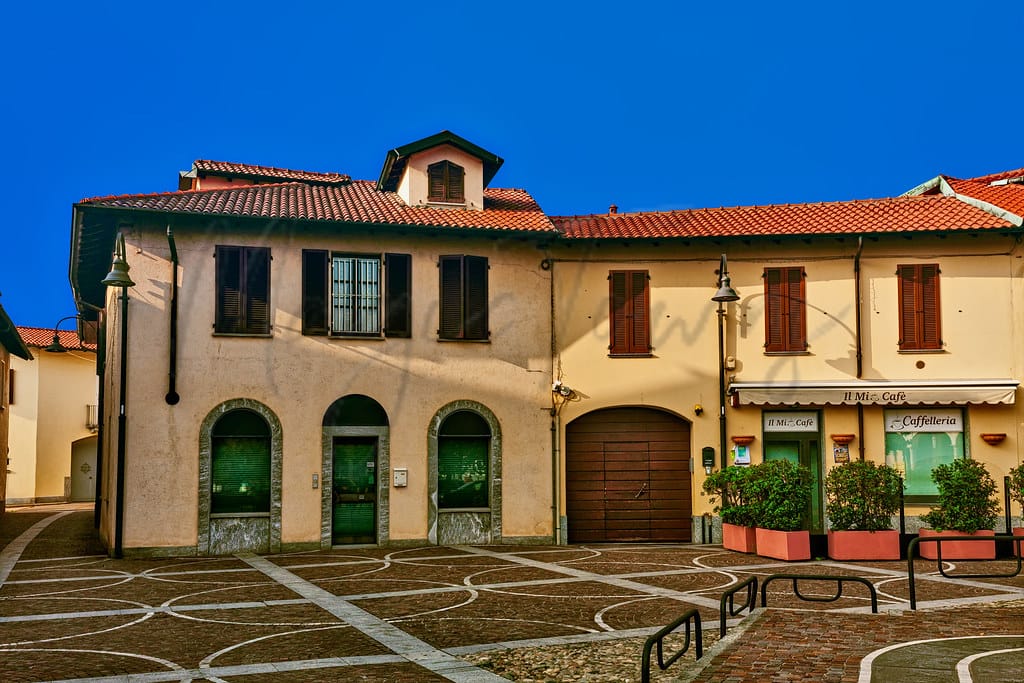
Busto Garolfo
Lombardia
Lombard town with historical architecture, small businesses, community spirit, and proximity to Milan.
Quality of Life Score
[?]Factors in air quality, amenities, walkability, population, and environmental risks. Higher scores suggest better living conditions.
77
Quality of Infrastructure
[?]Measures internet speed, healthcare access, airports, rail, and walkability. Higher scores mean better connectivity and essential services.
68
Quality of Economy
[?]Based on income, property prices, job availability, and population density. Higher scores indicate stronger economic conditions.
73
Busto Garolfo Demographics
Population
[?]
This is a town's official population, measured each year by the national statistics authority.
14000
Real Population (5km band)
[?]
Our "Real Population" metric reflects more accurately a town's real size by including inhabitants in the immediate vicinity of the town's official borders.
215700
Births Per 100 Deaths
60.0
Population Data Source
ISTAT,2023
Estimated Unemployment Rate
Touristy Index
[?]
Calculation of tourist density index for the city, comparing its total tourist number to the overall average tourist number of the region
relative to its own population.The index indicates how a location’s tourist density compares to the average, with values above
100 representing higher-than-average density and values below 100 representing lower-than-average density.
No Data
Income per capita (2023)
[?]
This is an estimation of average income per resident for this town, based on 2023 data from the Italian Ministry of Finance.
24700
Income rank in Italy (2023)
[?]
This is a ranking of the town's average income per resident, against the full list of townships in Italy.
594 out of 7901
Infrastructure and Connectivity
Create an account to explore more
This content is for Members only | Already a Member? Sign in
Infrastructure & Amenities
Create an account to explore more
This content is for Members only | Already a Member? Sign in
Healthcare
Create an account to explore more
This content is for Members only | Already a Member? Sign in
Housing & Property Market
Create an account to explore more
This content is for Members only | Already a Member? Sign in
Connectivity & Digital Access
Create an account to explore more
This content is for Members only | Already a Member? Sign in
Education
Create an account to explore more
This content is for Members only | Already a Member? Sign in
Climate & Weather
Create an account to explore more
This content is for Members only | Already a Member? Sign in
Precipitation
[?] Based on daily climate data for precipitation from OPEN-METEO this parameter indicates how a city's annual precipitation compares to others in terms of percentage, with values ranging from 0 (lowest) to 1 (highest). For example, a percentile rank of 0.75 means the city's total precipitation is higher than 75% of other cities.
Very High (81st-90th percentile)
Sunshine
Somewhat Low (21st-30th percentile)
Snowfall
Above Average (51st-60th percentile)
Min Annual Temperature (°C)
[?] This parameter represents the monthly average of daily minimum temperatures for January, based on data from OPEN-METEO.
-0.9
Max Annual Temperature (°C)
[?] This parameter represents the monthly average of daily minimum temperatures for January, based on data from OPEN-METEO.
28.8
Climate Description
Busto Garolfo, located in Italy, ensures a pleasant climate that accommodates both brisk winters and warm summers. Thanks to generous sunshine throughout the year, residents enjoy ample opportunities to explore the outdoor charms of the region. The winter season briefly welcomes a light snowfall, adding a picturesque layer to the town's scenic vistas without causing significant disruptions. Summers in Busto Garolfo are notably warm, providing an ideal setting for evening strolls and local gatherings. Transitioning through the seasons, the average temperature maintains a mild character, suitable for those who might favor temperate weather. Such a climate supports a comfortable lifestyle for expats and retirees seeking a tranquil environment.
Annual Temperature Chart (Min)
Error
There was a problem with your SQL connection - Please contact the administrator
There was a problem with your SQL connection - Please contact the administrator
Annual Temperature Chart (Max)
Error
There was a problem with your SQL connection - Please contact the administrator
There was a problem with your SQL connection - Please contact the administrator
Sunny Days By Month
Error
There was a problem with your SQL connection - Please contact the administrator
There was a problem with your SQL connection - Please contact the administrator
Environmental & Air Quality
Create an account to explore more
This content is for Members only | Already a Member? Sign in
Classifications
PM10
[?]
PM10 levels indicate Good air quality at 0–20 µg/m³, Fair at 20–40 µg/m³, Moderate at 40–50 µg/m³, Poor at 50–100 µg/m³, Very Poor at 100–150 µg/m³, and Extremely Poor at 150–1200 µg/m³.
Fair
PM2.5
[?]
PM2.5 is Good if PM2.5 levels are between 0–10 µg/m³, Fair between 10–20 µg/m³, Moderate between 20–25 µg/m³, Poor between 25–50 µg/m³, Very Poor between 50–75 µg/m³, and Extremely Poor between 75–800 µg/m³.
Moderate
NO2
[?]
NO₂ levels are considered Good at 0–40 µg/m³, Fair at 40–90 µg/m³, Moderate at 90–120 µg/m³, Poor at 120–230 µg/m³, Very Poor at 230–340 µg/m³, and Extremely Poor at 340–1000 µg/m³.
Good
SO2
[?]
SO₂ levels indicate Good air quality at 0–100 µg/m³, Fair at 100–200 µg/m³, Moderate at 200–350 µg/m³, Poor at 350–500 µg/m³, Very Poor at 500–750 µg/m³, and Extremely Poor at 750–1250 µg/m³.
Good
O₃
[?]
For O₃, the air is Good at 0–50 µg/m³, Fair at 50–100 µg/m³, Moderate at 100–130 µg/m³, Poor at 130–240 µg/m³, Very Poor at 240–380 µg/m³, and Extremely Poor at 380–800 µg/m³.
Fair
Air Quality Rating
[?]
Based on PM10, PM2.5, NO2, SO2, and ozone levels. Higher scores indicate cleaner air.
82
Air Quality Description
Nestled in northern Italy, Busto Garolfo offers a blend of continental climate impacts and modern living influences on air quality. While the locale maintains a fair rating for particulate matter of 10 micrometers or less, and ozone levels, there’s a sustained moderate concern for finer particulate matter. Fortunately, levels of nitrogen and sulfur dioxide remain commendably low, reflecting good management of these pollutants. The atmospheric conditions in Busto Garolfo thus present a largely agreeable environment for those considering relocation, particularly expats and retirees seeking a balance between quaint Italian charm and the requisites of health-conscious living.
Nestled in northern Italy, Busto Garolfo offers a blend of continental climate impacts and modern living influences on air quality. While the locale maintains a fair rating for particulate matter of 10 micrometers or less, and ozone levels, there’s a sustained moderate concern for finer particulate matter. Fortunately, levels of nitrogen and sulfur dioxide remain commendably low, reflecting good management of these pollutants. The atmospheric conditions in Busto Garolfo thus present a largely agreeable environment for those considering relocation, particularly expats and retirees seeking a balance between quaint Italian charm and the requisites of health-conscious living.
Town Descriptions
Create an account to explore more
This content is for Members only | Already a Member? Sign in
Getting There
Busto Garolfo is well-connected via road, with proximity to the A8 highway facilitating access to Milan and Varese. The Malpensa International Airport is approximately 20 minutes away, while Linate Airport is 36 minutes distant. Nearby train stations enhance connectivity, offering regular services to surrounding regions.
Getting Around
Local Cuisine
Busto Garolfo, located in Lombardy, embodies the culinary richness of the region with a variety of traditional dishes and dining options. The local cuisine highlights staples such as risotto—due to the area’s extensive rice paddies—and polenta, which has been a fundamental part of the diet for centuries. Notable dishes include osso buco, a braised veal shank dish, and tortelli di zucca, which features pumpkin-stuffed pasta, showcasing the region’s focus on hearty, flavorful food.
The dining scene in Busto Garolfo is characterized by a mix of traditional Italian trattorias and contemporary eateries that often reflect international influences. Although there aren’t many Michelin-starred establishments within the town itself, nearby Busto Arsizio offers Michelin-rated dining experiences, which include innovative interpretations of regional classics. Overall, Busto Garolfo’s culinary landscape is a blend of local tradition and modern dining, offering residents and visitors alike a rich and diverse culinary experience.
Shopping Overview
The area offers a diverse array of shopping options including supermarkets, boutiques, and shopping centres. Larger shopping venues such as regional malls feature a mix of brand outlets and department stores. Supermarkets provide essential groceries and household goods, while smaller specialty shops cater to niche markets and local crafts. Nearby shopping centres often include dining options, enhancing the shopping experience. The overall environment is accommodating for both expats and retirees, providing accessible amenities for daily needs and leisure shopping.
Neighborhoods
Green Areas and Parks
Busto Garolfo offers several appealing outdoor activities for residents and visitors. Notable nearby green spaces include Parco del Roccolo and Parco Alto Milanese, both offering opportunities for hiking and biking. The Parco delle Groane is another attractive destination for those interested in exploring the regional flora. Hiking enthusiasts can embark on trails like Parco Nazionale Valgrande via Ponte della Buia, a challenging route of 17.4 miles, while easier options include the 1.5-mile trek around Area Vul via E1. These areas provide substantial opportunities for outdoor recreation within a short distance of the town.
✅ Pros
– Proximity to Milan for cultural and economic opportunities.
– Good healthcare facilities ensuring quality medical services available.
– Favorable air quality for a healthier living environment.
– Efficient transportation links for easy travel within Lombardy.
– Low unemployment rate promoting economic stability and job opportunities.
– Pleasant climate for year-round outdoor activities and enjoyment.
– Rich cultural and historical backdrop to explore and appreciate.
– Integration opportunities with locals fostering community connections.
– Accessible educational facilities for families and lifelong learning.
– Reliable internet connectivity enhancing remote work options.
❌ Cons
– Healthcare quality could be better; not the highest ratings.
– Air quality is decent, but not pristine everywhere.
– Limited tourist presence means fewer cultural events and activities.
– Local infrastructure may need improvements in certain areas.
– Small-town vibe may feel isolating for some expats.
– Weather can be unpredictable; pack for all seasons.
– Integration challenges for non-Italian speakers may arise.
– Average internet speed might frustrate heavy users.
– Educational facilities may lack advanced specialized programs.
– Limited nightlife options for those seeking vibrant evenings.
FAQs
Summary
Busto Garolfo, situated in the Metropolitan City of Milan, blends local charm with accessibility, making it appealing for expats and retirees. This Lombard town is characterized by its historical architecture, notably the church of San Salvatore, and a modest yet vibrant community of around 14,000 residents. The local economy, primarily influenced by a history of weaving, has evolved to accommodate small and medium enterprises, contributing to a balanced lifestyle.
Culturally, Busto Garolfo offers a glimpse into traditional Lombard life, with festivals and local markets enhancing its community spirit. However, while the town boasts a high walkability score and is within a 20-minute drive to the airport, expats may find limited healthcare options compared to larger urban centers. Nonetheless, its proximity to Milan, along with good air quality and a serene environment, presents a noteworthy option for those looking for a quieter yet connected lifestyle in Italy.
✅ Pros
– Proximity to Milan for cultural and economic opportunities.
– Good healthcare facilities ensuring quality medical services available.
– Favorable air quality for a healthier living environment.
– Efficient transportation links for easy travel within Lombardy.
– Low unemployment rate promoting economic stability and job opportunities.
– Pleasant climate for year-round outdoor activities and enjoyment.
– Rich cultural and historical backdrop to explore and appreciate.
– Integration opportunities with locals fostering community connections.
– Accessible educational facilities for families and lifelong learning.
– Reliable internet connectivity enhancing remote work options.
❌ Cons
– Healthcare quality could be better; not the highest ratings.
– Air quality is decent, but not pristine everywhere.
– Limited tourist presence means fewer cultural events and activities.
– Local infrastructure may need improvements in certain areas.
– Small-town vibe may feel isolating for some expats.
– Weather can be unpredictable; pack for all seasons.
– Integration challenges for non-Italian speakers may arise.
– Average internet speed might frustrate heavy users.
– Educational facilities may lack advanced specialized programs.
– Limited nightlife options for those seeking vibrant evenings.
Related Posts
No posts found for the town.
More questions about Busto Garolfo ? Ask Magic AI.
Our innovative AI assistant is eager to help. Try it out here: