
Elevation
[?]
Elevation of a city refers to the height above sea level at which the city is located, measured in meters.
410
Population
[?]
This is a town's official population, measured each year by the national statistics authority.
10200
Real Population (5km)
[?]
Our "Real Population" metric reflects more accurately a town's real size by including inhabitants in the immediate vicinity of the town's official borders.
11000
Air Quality Rating
[?]
Based on PM10, PM2.5, NO2, SO2, and ozone levels. Higher scores indicate cleaner air.
84
Region
Puglia
Walkability
Very Walkable
Housing availability
[?]
Based on total number of properties (sale and rent) classifies housing availability into five categories: low, relativel ylow, medium, relatively high and high.
Low
Avg Download Speed (Mbps) / Avg Upload Speed (Mbps)
Climate Description
Warm summers, mild winters, abundant sunshine, light snowfall, temperate and comfortable climate.
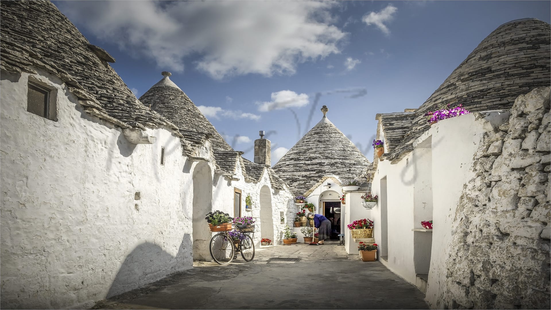
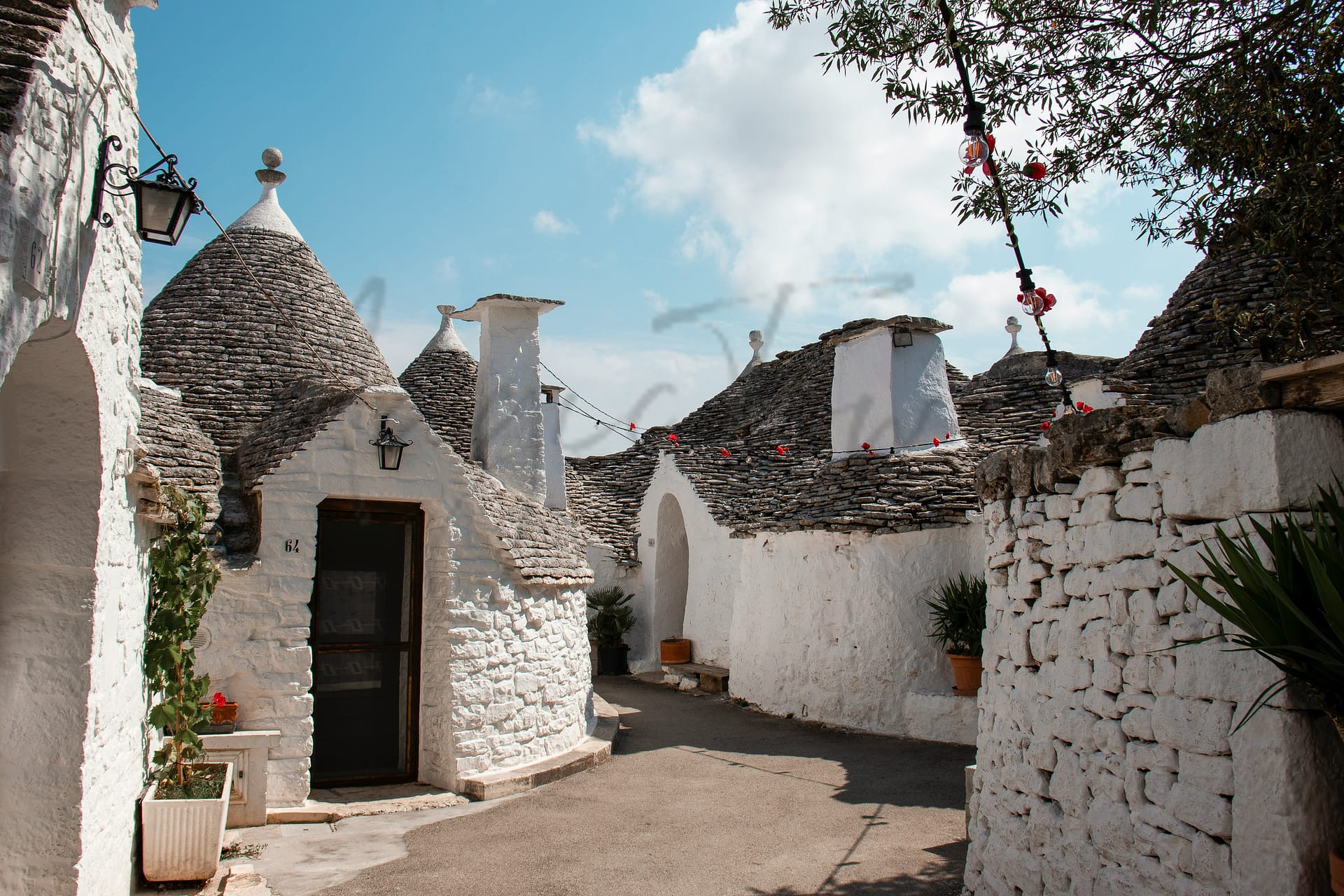
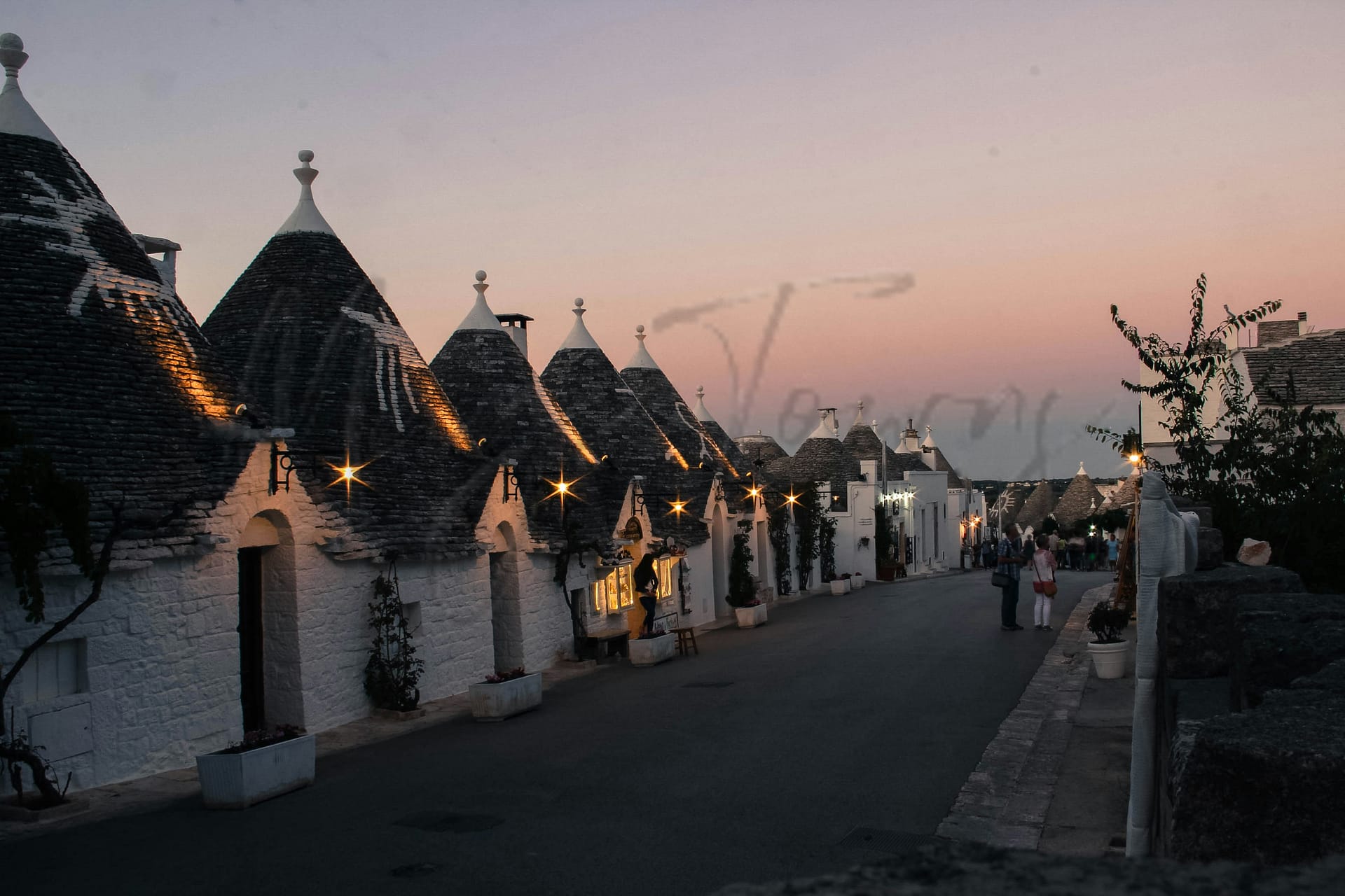
Alberobello
Puglia
Known for its UNESCO-listed trulli, this Puglia town has limited job opportunities and healthcare accessibility.
Quality of Life Score
[?]Factors in air quality, amenities, walkability, population, and environmental risks. Higher scores suggest better living conditions.
70
Quality of Infrastructure
[?]Measures internet speed, healthcare access, airports, rail, and walkability. Higher scores mean better connectivity and essential services.
43
Quality of Economy
[?]Based on income, property prices, job availability, and population density. Higher scores indicate stronger economic conditions.
61
Alberobello Demographics
Population
[?]
This is a town's official population, measured each year by the national statistics authority.
10200
Real Population (5km band)
[?]
Our "Real Population" metric reflects more accurately a town's real size by including inhabitants in the immediate vicinity of the town's official borders.
11000
Births Per 100 Deaths
60.0
Population Data Source
ISTAT,2023
Estimated Unemployment Rate
Touristy Index
[?]
Calculation of tourist density index for the city, comparing its total tourist number to the overall average tourist number of the region
relative to its own population.The index indicates how a location’s tourist density compares to the average, with values above
100 representing higher-than-average density and values below 100 representing lower-than-average density.
Moderate Tourism
Income per capita (2023)
[?]
This is an estimation of average income per resident for this town, based on 2023 data from the Italian Ministry of Finance.
18600
Income rank in Italy (2023)
[?]
This is a ranking of the town's average income per resident, against the full list of townships in Italy.
5041 out of 7901
Infrastructure and Connectivity
Create an account to explore more
This content is for Members only | Already a Member? Sign in
Closest Airport
Name
Papola Casale (Brindisi)
Connectivity Score
[?]
Measures travel time and service quality of nearby airport stations. Higher scores mean better transport access.
4
Driving Time
43min(s)
Papola Casale (Brindisi) Airport is located approximately 6 kilometres from Brindisi’s city centre in southern Italy. In 2023, it served over 3 million passengers, acting as a focus city for Ryanair with regular and seasonal flights connecting to destinations such as London, Milan, and Rome. Known for its dual role as a civilian airport and strategic military facility, it provides essential humanitarian services and supports regional travel, making it both an important transport hub and a vital strategic location.
2nd Closest Airport
Name
Karol Wojtyla (Bari)
Connectivity Score
[?]
Measures travel time and service quality of nearby airport stations. Higher scores mean better transport access.
7
Driving Time
48min(s)
Bari Karol Wojtyła Airport is located approximately 8 kilometres northwest of Bari, Italy, and serves as a significant hub in the Puglia region. It handled over 6 million passengers in 2023, largely acting as a focus city for low-cost carriers like Ryanair and Volotea. The airport connects to numerous European cities, with main routes including destinations such as London, Paris, Milan, and Istanbul, and benefits from seasonal services to cities like New York and Vienna, marking it as a convenient base for both domestic and international travel.
3rd Closest Airport
Name
Capodichino (Naples)
Connectivity Score
[?]
Measures travel time and service quality of nearby airport stations. Higher scores mean better transport access.
9
Driving Time
149min(s)
Capodichino Airport, officially known as Naples International Airport, is located in Capodichino, Naples, Campania, Italy, approximately 5.9 km north-northeast of Naples city centre. It is the largest airport in Southern Italy, handling over 12 million passengers annually, and serves as a base for airlines such as easyJet, Ryanair, Volotea, and Wizz Air. The airport offers connections to major domestic destinations like Milan and Turin, as well as international routes to cities including Barcelona, London, Munich, Frankfurt, and New York City, making it a key hub for travellers in the Mediterranean region.
Closest Rail
Name
Stazione di Alberobello
Connectivity Score
[?]
Measures travel time and service quality of nearby rail stations. Higher scores mean better transport access.
5
Driving Time
3min(s)
Train service at Stazione di Alberobello includes local train services on the Bari–Martina Franca–Taranto railway. The primary operator for these services is Ferrovie del Sud Est. Key destinations connected by direct trains include Bari, Conversano, Putignano, and Martina Franca. Departure frequency varies, but generally, trains run several times a day. The station does not serve high-speed trains; it primarily offers regional services only.
2nd Closest Rail
Name
Stazione di Locorotondo
Connectivity Score
[?]
Measures travel time and service quality of nearby rail stations. Higher scores mean better transport access.
4
Driving Time
11min(s)
Train service at Stazione di Locorotondo includes regional train services that primarily operate on the Bari–Martina Franca–Taranto railway. The key destinations connected by direct trains are Bari, Conversano, Putignano, and Martina Franca. The main train operator at this station is Ferrovie del Sud Est, which focuses on regional services. Departures typically occur every two hours, with services running primarily throughout the day from Monday to Saturday. This station does not accommodate high-speed trains; it only serves regional trains, catering to local transit needs.
3rd Closest Rail
Name
Stazione di Noci
Connectivity Score
[?]
Measures travel time and service quality of nearby rail stations. Higher scores mean better transport access.
5
Driving Time
12min(s)
Train service at Stazione di Noci provides a range of connections and services for passengers. The rail lines that stop here include regional trains on the Bari – Conversano – Putignano – Martina Franca route. Key destinations connected by direct trains include Bari, Conversano, Putignano, and Martina Franca. The primary train operator servicing this station is Trenitalia, focusing on regional routes. Frequency of departures is approximately six times per day for various destinations, primarily on weekdays. This station mainly offers regional trains, with no high-speed services operating at this location, making it a gateway for local travel in the region rather than long-distance high-speed travel.
Infrastructure & Amenities
Create an account to explore more
This content is for Members only | Already a Member? Sign in
Healthcare
Create an account to explore more
This content is for Members only | Already a Member? Sign in
Housing & Property Market
Create an account to explore more
This content is for Members only | Already a Member? Sign in
Connectivity & Digital Access
Create an account to explore more
This content is for Members only | Already a Member? Sign in
Education
Create an account to explore more
This content is for Members only | Already a Member? Sign in
Climate & Weather
Create an account to explore more
This content is for Members only | Already a Member? Sign in
Precipitation
[?] Based on daily climate data for precipitation from OPEN-METEO this parameter indicates how a city's annual precipitation compares to others in terms of percentage, with values ranging from 0 (lowest) to 1 (highest). For example, a percentile rank of 0.75 means the city's total precipitation is higher than 75% of other cities.
Very Low (Bottom 10%)
Sunshine
Very High (81st-90th percentile)
Snowfall
Low (11th-20th percentile)
Min Annual Temperature (°C)
[?] This parameter represents the monthly average of daily minimum temperatures for January, based on data from OPEN-METEO.
4
Max Annual Temperature (°C)
[?] This parameter represents the monthly average of daily minimum temperatures for January, based on data from OPEN-METEO.
29.8
Climate Description
Alberobello, with its iconic trulli houses, offers a climate well-suited for those seeking a balance of warm summers and mild winters. The town is graced with abundant sunshine throughout the year, facilitating outdoor activities and leisure for retirees and expats alike. Winters see a light touch of snowfall, adding a whimsical aspect to the landscape without causing significant disruptions. Summers are pleasantly warm, encouraging exploration of the local vineyards and olive groves. Overall, the climate in Alberobello supports a comfortable lifestyle, with temperatures rarely experiencing extremes, making it an ideal locale for those enchanted by temperate weather and historic charm.
Annual Temperature Chart (Min)
Error
There was a problem with your SQL connection - Please contact the administrator
There was a problem with your SQL connection - Please contact the administrator
Annual Temperature Chart (Max)
Error
There was a problem with your SQL connection - Please contact the administrator
There was a problem with your SQL connection - Please contact the administrator
Sunny Days By Month
Error
There was a problem with your SQL connection - Please contact the administrator
There was a problem with your SQL connection - Please contact the administrator
Environmental & Air Quality
Create an account to explore more
This content is for Members only | Already a Member? Sign in
Classifications
PM10
[?]
PM10 levels indicate Good air quality at 0–20 µg/m³, Fair at 20–40 µg/m³, Moderate at 40–50 µg/m³, Poor at 50–100 µg/m³, Very Poor at 100–150 µg/m³, and Extremely Poor at 150–1200 µg/m³.
Good
PM2.5
[?]
PM2.5 is Good if PM2.5 levels are between 0–10 µg/m³, Fair between 10–20 µg/m³, Moderate between 20–25 µg/m³, Poor between 25–50 µg/m³, Very Poor between 50–75 µg/m³, and Extremely Poor between 75–800 µg/m³.
Good
NO2
[?]
NO₂ levels are considered Good at 0–40 µg/m³, Fair at 40–90 µg/m³, Moderate at 90–120 µg/m³, Poor at 120–230 µg/m³, Very Poor at 230–340 µg/m³, and Extremely Poor at 340–1000 µg/m³.
Good
SO2
[?]
SO₂ levels indicate Good air quality at 0–100 µg/m³, Fair at 100–200 µg/m³, Moderate at 200–350 µg/m³, Poor at 350–500 µg/m³, Very Poor at 500–750 µg/m³, and Extremely Poor at 750–1250 µg/m³.
Good
O₃
[?]
For O₃, the air is Good at 0–50 µg/m³, Fair at 50–100 µg/m³, Moderate at 100–130 µg/m³, Poor at 130–240 µg/m³, Very Poor at 240–380 µg/m³, and Extremely Poor at 380–800 µg/m³.
Fair
Air Quality Rating
[?]
Based on PM10, PM2.5, NO2, SO2, and ozone levels. Higher scores indicate cleaner air.
84
Air Quality Description
In Alberobello, Italy, the air quality generally presents a favorable environment for those concerned with respiratory health and overall well-being. The particulate matter levels, both PM10 and PM2.5, consistently measure well within acceptable standards, indicating a lower presence of these small particles that can penetrate the lungs and affect human health. Nitrogen dioxide and sulphur dioxide, often indicators of vehicular and industrial activity, are also found in minimal concentrations, further underscoring the town’s clean air profile. However, ozone levels are moderate, suggesting occasional peaks which may warrant caution during certain times of the year.
In Alberobello, Italy, the air quality generally presents a favorable environment for those concerned with respiratory health and overall well-being. The particulate matter levels, both PM10 and PM2.5, consistently measure well within acceptable standards, indicating a lower presence of these small particles that can penetrate the lungs and affect human health. Nitrogen dioxide and sulphur dioxide, often indicators of vehicular and industrial activity, are also found in minimal concentrations, further underscoring the town’s clean air profile. However, ozone levels are moderate, suggesting occasional peaks which may warrant caution during certain times of the year.
Town Descriptions
Create an account to explore more
This content is for Members only | Already a Member? Sign in
Getting There
Alberobello is accessible via the SS 172 and SS 100 roads, enhancing its connectivity within the region. The nearest airports are Brindisi and Bari, both within a short drive. Local train stations provide limited service, with moderate connectivity scores, reflecting a mixed transport infrastructure.
Getting Around
Local Cuisine
Alberobello’s culinary scene is deeply rooted in traditional Puglian cuisine, emphasizing local ingredients and time-honored recipes. Key dishes include orecchiette pasta, focaccia Barese, bombette di Alberobello—pork rolls with caciocavallo cheese—and cartellate, sweet fried pastries. The focus on ‘cucina povera’ showcases simple, hearty meals prepared with fresh produce, local dairy, and seafood from the Adriatic. While predominantly featuring Italian cuisine, the dining landscape in Alberobello also reflects some international influences. Options range from casual eateries to fine dining establishments. Notably, Alberobello is home to Evo Ristorante, which holds a Michelin star, highlighting the area’s capability to deliver refined, creative dining experiences. This juxtaposition of traditional and modern culinary approaches contributes to a vibrant gastronomic offering in the region.
Shopping Overview
The area offers diverse shopping options catering to varied needs. Key categories include supermarkets for groceries, local markets featuring fresh produce and artisanal food products, and boutiques selling crafted items, souvenirs, and clothing. A significant weekly market occurs on Thursdays, showcasing local delicacies like olive oil and cheeses. Craftsmanship thrives, with artisans producing leather, wood, and textile goods. The shopping experience is enriched by charming streets lined with shops, reflecting a blend of traditional and contemporary merchandise.
Neighborhoods
Green Areas and Parks
Alberobello offers diverse outdoor trails in scenic Puglia. Notable walks include the Passeggiata Alberobello, an easy 1.2-mile path, and the moderate Via Ellenica, Tappa 7, stretching 11.1 miles towards Martina Franca. The Route of the Two Seas extends 12.6 miles to Locorotondo. Additional hikes include Locorotondo – Bosco Selva and Sentiero Italia, R04, to Noci, measuring 9.2 miles. The Giro Alberobello provides a short 1.7-mile circuit. These routes vary in difficulty and explore the region’s distinctive landscapes, suitable for retirees seeking leisurely outdoor excursions.
✅ Pros
– Rich cultural and historical backdrop to explore daily.
– Mild climate with warm summers and mild winters.
– Opportunities for integration within a welcoming local community.
– Moderate tourism enhances local economy and vibrancy.
– Access to healthcare services, though with room for improvement.
– Good air quality contributes to a healthier lifestyle.
– Affordable cost of living compared to larger Italian cities.
– Limited but functional transportation options within and outside town.
– Unique trulli architecture creates a charming living environment.
– Local markets provide fresh produce and authentic flavors.
❌ Cons
– Healthcare services may lack quality and efficiency at times.
– Limited transportation options can hinder mobility and accessibility.
– Internet connectivity is poor, with slow download speeds.
– Educational facilities may not meet all expatriate expectations.
– Economic opportunities are limited, especially for high-income jobs.
– Local unemployment slightly exceeds the national average.
– Infrastructure development is lacking and can be frustrating.
– Seasonal tourism influx can disrupt daily life and routines.
– Weather can be hot and humid during summer months.
– Limited recreational activities outside of cultural exploration.
FAQs
Summary
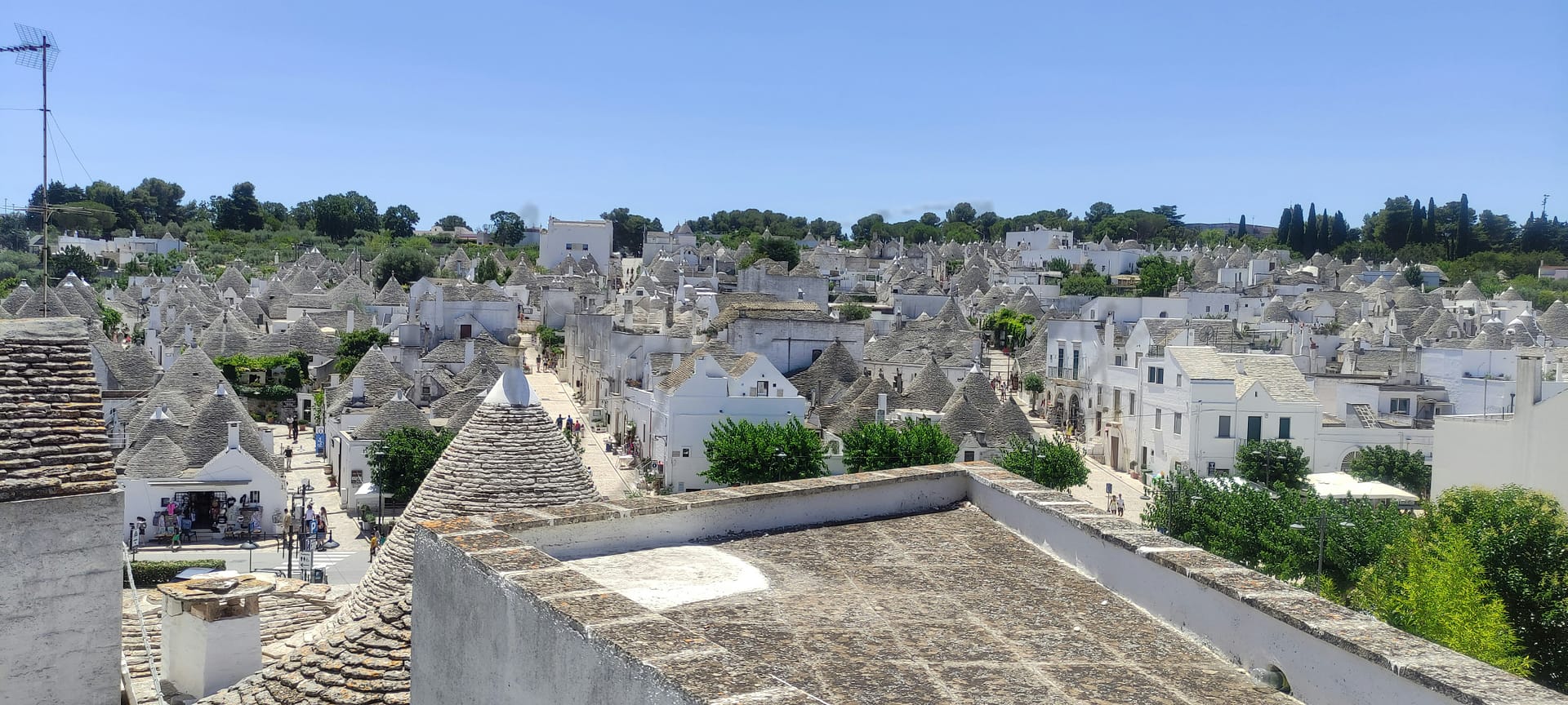
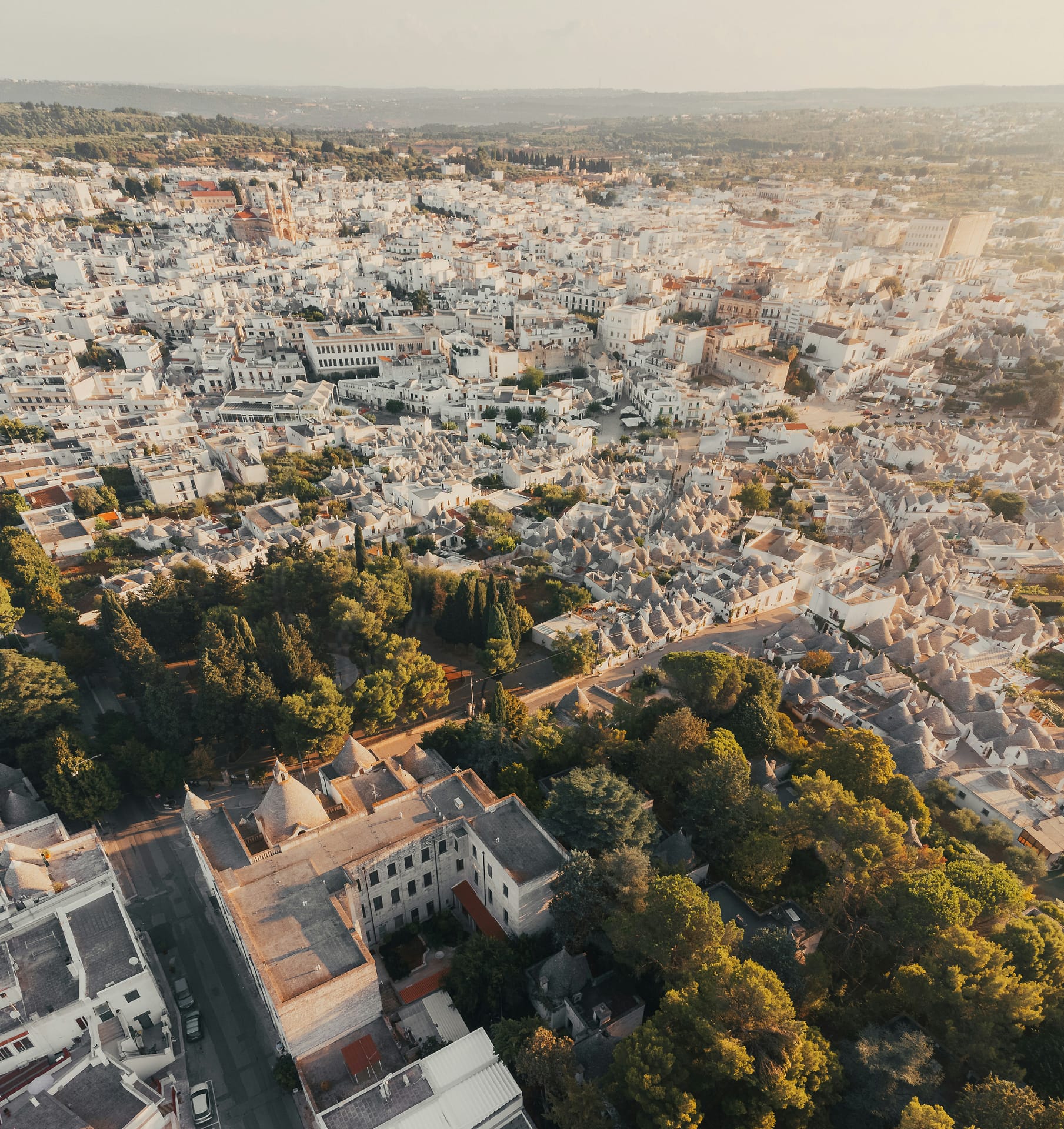
Alberobello, a town in the heart of Puglia, is famed for its distinctive trulli—cone-shaped stone dwellings recognized as a UNESCO World Heritage site. With a population of approximately 10,200, it boasts over 1,500 of these structures, primarily concentrated in the Rione Monti and Aia Piccola districts. Key attractions include the two-storey Sovereign Trullo and the Museo del Territorio, which showcases local history. The town supports a vibrant culture with local festivals celebrating traditional traditions, including culinary highlights like orecchiette and bombette.
However, expats may encounter challenges such as limited job opportunities and a slow-paced lifestyle, compounded by the region’s relative isolation. While healthcare options exist, they rank lower in accessibility and quality. Additionally, the language barrier can hinder integration into the community, and older homes may require renovations. Accessibility to amenities can be inconvenient due to less robust public transport options.
✅ Pros
– Rich cultural and historical backdrop to explore daily.
– Mild climate with warm summers and mild winters.
– Opportunities for integration within a welcoming local community.
– Moderate tourism enhances local economy and vibrancy.
– Access to healthcare services, though with room for improvement.
– Good air quality contributes to a healthier lifestyle.
– Affordable cost of living compared to larger Italian cities.
– Limited but functional transportation options within and outside town.
– Unique trulli architecture creates a charming living environment.
– Local markets provide fresh produce and authentic flavors.
❌ Cons
– Healthcare services may lack quality and efficiency at times.
– Limited transportation options can hinder mobility and accessibility.
– Internet connectivity is poor, with slow download speeds.
– Educational facilities may not meet all expatriate expectations.
– Economic opportunities are limited, especially for high-income jobs.
– Local unemployment slightly exceeds the national average.
– Infrastructure development is lacking and can be frustrating.
– Seasonal tourism influx can disrupt daily life and routines.
– Weather can be hot and humid during summer months.
– Limited recreational activities outside of cultural exploration.
Related Posts
More questions about Alberobello ? Ask Magic AI.
Our innovative AI assistant is eager to help. Try it out here: