Elevation
[?]
Elevation of a city refers to the height above sea level at which the city is located, measured in meters.
553
Population
[?]
This is a town's official population, measured each year by the national statistics authority.
33800
Real Population (5km)
[?]
Our "Real Population" metric reflects more accurately a town's real size by including inhabitants in the immediate vicinity of the town's official borders.
59700
Air Quality Rating
[?]
Based on PM10, PM2.5, NO2, SO2, and ozone levels. Higher scores indicate cleaner air.
84
Region
Sicilia
Walkability
Walker’s Paradise
Housing availability
[?]
Based on total number of properties (sale and rent) classifies housing availability into five categories: low, relativel ylow, medium, relatively high and high.
Low
Avg Download Speed (Mbps) / Avg Upload Speed (Mbps)
131
/ 62
Climate Description
Mild winters, warm summers, moderate rain, rare snow, abundant sunshine; balanced, fair climate.
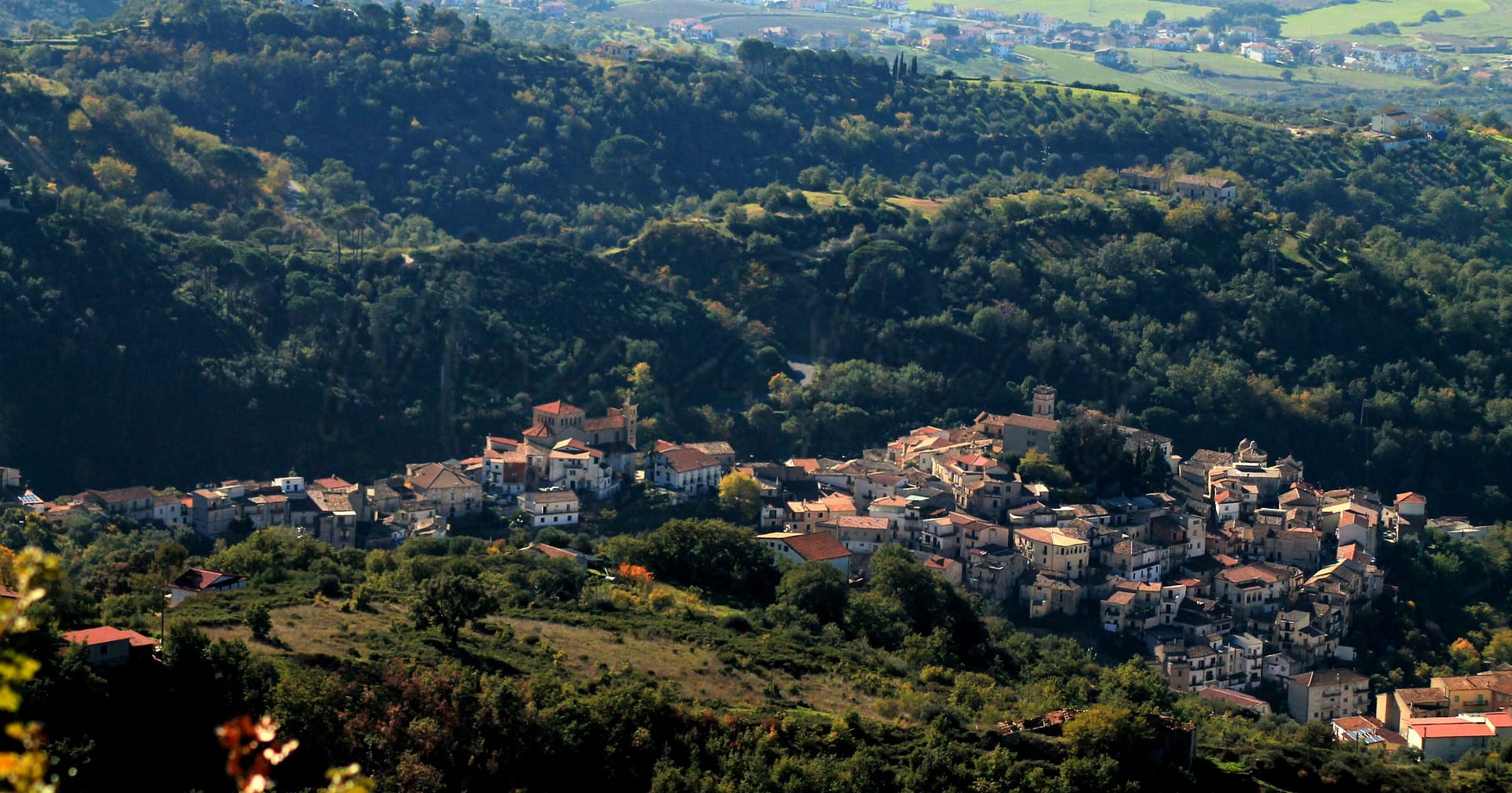
Adrano
Sicilia
Historic town near Mount Etna, featuring archaeological sites, agriculture, and local festivals.
Quality of Life Score
[?]Factors in air quality, amenities, walkability, population, and environmental risks. Higher scores suggest better living conditions.
85
Quality of Infrastructure
[?]Measures internet speed, healthcare access, airports, rail, and walkability. Higher scores mean better connectivity and essential services.
69
Quality of Economy
[?]Based on income, property prices, job availability, and population density. Higher scores indicate stronger economic conditions.
56
Adrano Demographics
Population
[?]
This is a town's official population, measured each year by the national statistics authority.
33800
Real Population (5km band)
[?]
Our "Real Population" metric reflects more accurately a town's real size by including inhabitants in the immediate vicinity of the town's official borders.
59700
Births Per 100 Deaths
100.0
Population Data Source
ISTAT,2023
Estimated Unemployment Rate
Touristy Index
[?]
Calculation of tourist density index for the city, comparing its total tourist number to the overall average tourist number of the region
relative to its own population.The index indicates how a location’s tourist density compares to the average, with values above
100 representing higher-than-average density and values below 100 representing lower-than-average density.
Not Touristic
Income per capita (2023)
[?]
This is an estimation of average income per resident for this town, based on 2023 data from the Italian Ministry of Finance.
13900
Income rank in Italy (2023)
[?]
This is a ranking of the town's average income per resident, against the full list of townships in Italy.
7506 out of 7901
Infrastructure and Connectivity
Create an account to explore more
This content is for Members only | Already a Member? Sign in
Infrastructure & Amenities
Create an account to explore more
This content is for Members only | Already a Member? Sign in
Healthcare
Create an account to explore more
This content is for Members only | Already a Member? Sign in
Housing & Property Market
Create an account to explore more
This content is for Members only | Already a Member? Sign in
Connectivity & Digital Access
Create an account to explore more
This content is for Members only | Already a Member? Sign in
Education
Create an account to explore more
This content is for Members only | Already a Member? Sign in
Climate & Weather
Create an account to explore more
This content is for Members only | Already a Member? Sign in
Precipitation
[?] Based on daily climate data for precipitation from OPEN-METEO this parameter indicates how a city's annual precipitation compares to others in terms of percentage, with values ranging from 0 (lowest) to 1 (highest). For example, a percentile rank of 0.75 means the city's total precipitation is higher than 75% of other cities.
Very Low (Bottom 10%)
Sunshine
Exceptional (Top 10%)
Snowfall
Low (11th-20th percentile)
Min Annual Temperature (°C)
[?] This parameter represents the monthly average of daily minimum temperatures for January, based on data from OPEN-METEO.
3.3
Max Annual Temperature (°C)
[?] This parameter represents the monthly average of daily minimum temperatures for January, based on data from OPEN-METEO.
31.4
Climate Description
Adrano, Italy, offers a climate marked by mild winters and warm summers, suitable for expatriates and retirees seeking comfort throughout the year. The region sees a modest amount of precipitation annually, ensuring that both sunny days and occasional rain enrich the local ambiance without extreme weather disruptions. Winters are soft with rare snowfall, making it an easy adjustment for those not accustomed to harsh cold climates. Sunshine is plentiful, providing ample opportunity to enjoy outdoor activities and explore Adrano's historical sites. Overall, Adrano exhibits a balanced climate that supports a relaxed lifestyle with the joy of consistent fair weather year-round.
Annual Temperature Chart (Min)
Error
There was a problem with your SQL connection - Please contact the administrator
There was a problem with your SQL connection - Please contact the administrator
Annual Temperature Chart (Max)
Error
There was a problem with your SQL connection - Please contact the administrator
There was a problem with your SQL connection - Please contact the administrator
Sunny Days By Month
Error
There was a problem with your SQL connection - Please contact the administrator
There was a problem with your SQL connection - Please contact the administrator
Environmental & Air Quality
Create an account to explore more
This content is for Members only | Already a Member? Sign in
Classifications
PM10
[?]
PM10 levels indicate Good air quality at 0–20 µg/m³, Fair at 20–40 µg/m³, Moderate at 40–50 µg/m³, Poor at 50–100 µg/m³, Very Poor at 100–150 µg/m³, and Extremely Poor at 150–1200 µg/m³.
Good
PM2.5
[?]
PM2.5 is Good if PM2.5 levels are between 0–10 µg/m³, Fair between 10–20 µg/m³, Moderate between 20–25 µg/m³, Poor between 25–50 µg/m³, Very Poor between 50–75 µg/m³, and Extremely Poor between 75–800 µg/m³.
Good
NO2
[?]
NO₂ levels are considered Good at 0–40 µg/m³, Fair at 40–90 µg/m³, Moderate at 90–120 µg/m³, Poor at 120–230 µg/m³, Very Poor at 230–340 µg/m³, and Extremely Poor at 340–1000 µg/m³.
Good
SO2
[?]
SO₂ levels indicate Good air quality at 0–100 µg/m³, Fair at 100–200 µg/m³, Moderate at 200–350 µg/m³, Poor at 350–500 µg/m³, Very Poor at 500–750 µg/m³, and Extremely Poor at 750–1250 µg/m³.
Good
O₃
[?]
For O₃, the air is Good at 0–50 µg/m³, Fair at 50–100 µg/m³, Moderate at 100–130 µg/m³, Poor at 130–240 µg/m³, Very Poor at 240–380 µg/m³, and Extremely Poor at 380–800 µg/m³.
Fair
Air Quality Rating
[?]
Based on PM10, PM2.5, NO2, SO2, and ozone levels. Higher scores indicate cleaner air.
84
Air Quality Description
Living in Adrano affords residents the luxury of experiencing mostly good air quality, with key pollutants well-managed within desirable benchmarks. This Italian town presents everyday air composed of moderately low concentrations of particles and gases that are known to affect human health. Levels of PM10 and PM2.5, minute particles that can penetrate the lungs and affect cardiovascular health, consistently register in the good category, indicating a lower risk of pollution-related health issues. Nitrogen and sulfur dioxide figures stand similarly favorable, enhancing the area’s appeal for those considering relocation for health and environmental reasons. Meanwhile, ozone levels, though slightly elevated, predominantly pose minor concerns, completing a largely reassuring overall air quality profile for Adrano.
Living in Adrano affords residents the luxury of experiencing mostly good air quality, with key pollutants well-managed within desirable benchmarks. This Italian town presents everyday air composed of moderately low concentrations of particles and gases that are known to affect human health. Levels of PM10 and PM2.5, minute particles that can penetrate the lungs and affect cardiovascular health, consistently register in the good category, indicating a lower risk of pollution-related health issues. Nitrogen and sulfur dioxide figures stand similarly favorable, enhancing the area’s appeal for those considering relocation for health and environmental reasons. Meanwhile, ozone levels, though slightly elevated, predominantly pose minor concerns, completing a largely reassuring overall air quality profile for Adrano.
Town Descriptions
Create an account to explore more
This content is for Members only | Already a Member? Sign in
Getting There
Adrano is accessible via the A19 motorway connecting Catania and Palermo, facilitating regional travel. The nearest airports are Catania Fontanarossa and Tito Minniti airports, with local train stations providing limited connectivity. The town’s infrastructure rating suggests a moderate level of transport services and facilities.
Getting Around
Local Cuisine
Adrano’s culinary scene is a reflection of its Sicilian heritage, characterized by traditional dishes such as scacciata, caponata, pasta alla norma, arancini, and locally produced cannoli. The town offers a variety of dining options, from local trattorias that highlight homemade meals with fresh ingredients from nearby farms to international cuisine that caters to diverse palates. Adrano supports its vibrant food culture with markets and community gatherings that emphasize authentic flavors and traditional cooking methods. However, as of now, there are no Michelin-starred restaurants based in Adrano.
Shopping Overview
The area offers diverse shopping options, featuring supermarkets for everyday essentials, local markets for fresh produce, and various boutiques showcasing artisan goods. Large supermarkets provide a broad range of groceries, while smaller specialty shops cater to niche markets. Additionally, the presence of open-air markets contributes to a vibrant shopping atmosphere. Expats and retirees will find both traditional shopping venues and modern conveniences, enhancing their retail experience. Overall, the shopping landscape is characterised by a blend of local charm and accessibility to everyday necessities.
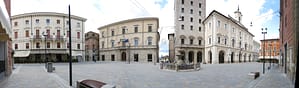
Neighborhoods
Green Areas and Parks
Adrano provides various outdoor activities in the Parco dell’Etna, a significant feature of its landscape. Popular hikes include the Piano Fiera-Rifugio Galvarina trail, stretching 6.6 miles with moderate difficulty. Another notable hike, the Grotta Nonna Syria-Monte Minardo, covers 8.5 miles and offers challenging terrain. Cycling enthusiasts can explore the 77.4-mile Etna Park bike tour. The area’s natural beauty and diverse trails cater to hikers and cyclists with varying expertise, offering opportunities to explore Sicily’s distinctive volcanic landscapes.
✅ Pros
– Rich cultural and historical backdrop to explore and enjoy.
– Healthcare quality is decent with accessible medical facilities.
– Affordable cost of living compared to major Italian cities.
– Mild Mediterranean climate with warm summers and mild winters.
– Opportunities for local integration and community participation.
– Non-touristy environment offering peaceful daily life.
– Reasonable air quality contributing to a healthier lifestyle.
– Sufficient transportation options for local and regional travel.
– Developing infrastructure supporting daily needs and services.
– Scenic landscapes and proximity to natural attractions.
❌ Cons
– Limited job opportunities may challenge financial stability for expats.
– Higher unemployment rate compared to the national average.
– Healthcare system shows room for improvement in various aspects.
– Internet speeds may frustrate avid streamers and remote workers.
– Infrastructure development is still catching up with urban standards.
– Local amenities may be less diverse than in larger cities.
– Language barrier can complicate daily interactions for newcomers.
– Public transportation may not always be timely or reliable.
– Limited educational facilities for families with school-age children.
– Cultural activities may be scarce outside major tourist seasons.
FAQs
Summary
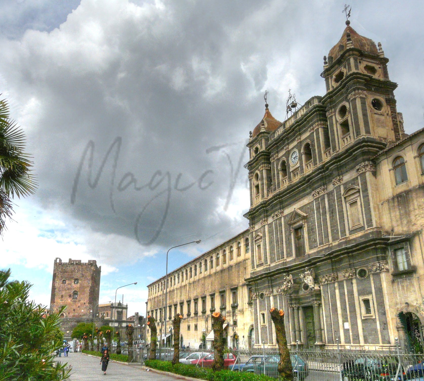
Adrano, a comune in the heart of Sicily, offers a blend of rich history and local culture for expats and retirees. Positioned near Mount Etna, the town boasts significant archaeological sites, including remnants of its ancient Greek and Roman roots. Notable attractions include a Norman castle from the 11th century and the Chiesa Madre, famed for its 16th-century artwork. The local economy thrives on agriculture, specializing in olives and citrus fruits, reflecting traditional Sicilian practices.
While Adrano enjoys a temperate climate with abundant sunny days, it faces certain challenges. The healthcare system is adequate, but infrastructure may be less developed compared to larger cities. Public services can vary, and crime rates, while manageable, warrant attention. Nevertheless, the high walkability and vibrant local festivals, such as the annual Carnival, foster a strong sense of community, making Adrano an intriguing option for those seeking an authentic Sicilian lifestyle.
✅ Pros
– Rich cultural and historical backdrop to explore and enjoy.
– Healthcare quality is decent with accessible medical facilities.
– Affordable cost of living compared to major Italian cities.
– Mild Mediterranean climate with warm summers and mild winters.
– Opportunities for local integration and community participation.
– Non-touristy environment offering peaceful daily life.
– Reasonable air quality contributing to a healthier lifestyle.
– Sufficient transportation options for local and regional travel.
– Developing infrastructure supporting daily needs and services.
– Scenic landscapes and proximity to natural attractions.
❌ Cons
– Limited job opportunities may challenge financial stability for expats.
– Higher unemployment rate compared to the national average.
– Healthcare system shows room for improvement in various aspects.
– Internet speeds may frustrate avid streamers and remote workers.
– Infrastructure development is still catching up with urban standards.
– Local amenities may be less diverse than in larger cities.
– Language barrier can complicate daily interactions for newcomers.
– Public transportation may not always be timely or reliable.
– Limited educational facilities for families with school-age children.
– Cultural activities may be scarce outside major tourist seasons.
Related Posts
No posts found for the town.
More questions about Adrano ? Ask Magic AI.
Our innovative AI assistant is eager to help. Try it out here: